 North Beach Tailor Alteration Shop Finder: Inherited Suits
Neighborhood Guides
Mission Neighborhood Historical Walking Tour: 1776 to Murals
A free Mission District history walk runs from the 1776 Mission Dolores to Clarion Alley and 24th Street's murals; it is self-guided and needs no booking.
The oldest intact building in San Francisco is a whitewashed adobe chapel at 16th and Dolores Streets, finished in 1791 and still standing after the 1906 earthquake that leveled much of the city. That chapel anchors this neighborhood historical walking tour of the Mission District, a free, self-guided route of about two and a half miles that runs from Spanish colonial roots through Victorian blocks spared by the fire to the mural alleys of the Latino Mission.
Mission Dolores, the City's Founding Address
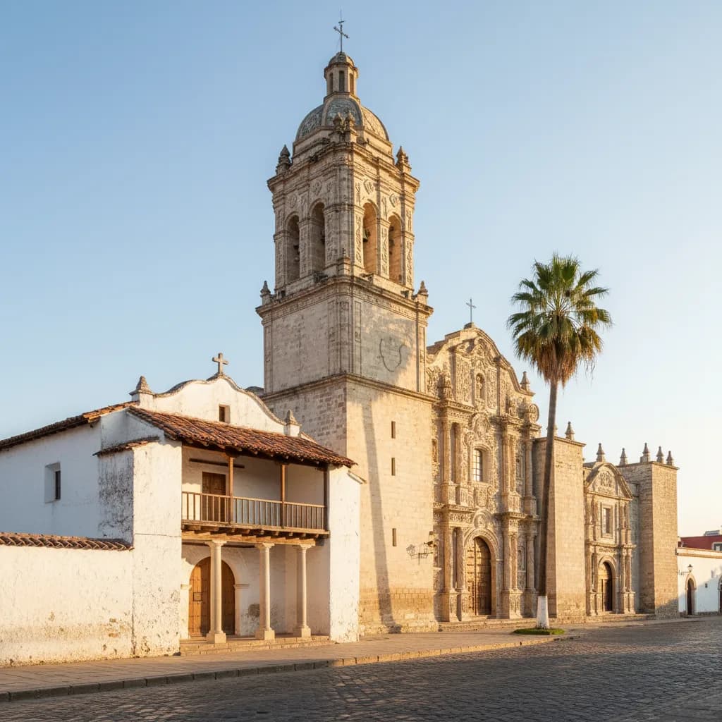
Mission San Francisco de Asis was founded in 1776, and locals have always called it Mission Dolores after a nearby creek named for Our Lady of Sorrows. Stand across Dolores Street to see the contrast that defines the site: the low adobe chapel with its four simple columns and tile roof on the left, and the ornate twentieth-century basilica towering beside it. The chapel walls are about four feet thick, which is part of why they survived the shaking of 1906.
The small cemetery beside the chapel is one of the few left inside city limits, holding graves of early Californio families and a memorial to the thousands of Ohlone people who lived, worked and died at the mission. The Ramaytush Ohlone were here long before 1776, and their story is the honest starting point for any history of this valley. Entry to the mission interior is ticketed and has set visiting hours, so if you are walking early, the exterior and street view still tell the story.
Dolores Park and the Golden Hydrant
Walk south on Dolores to Mission Dolores Park, between 18th and 20th Streets. The slope looks timeless, but it was two Jewish cemeteries until the burials were moved to Colma, and the city bought the land in 1905. A year later it became a refugee camp, with families living in tents and earthquake shacks after their homes burned. Today the upper southwest corner has the classic downtown skyline view; that is the spot photographers aim for.
From the park's southwest corner, climb to 20th and Church Streets and look for a fire hydrant painted gold. When the mains failed in April 1906, this was one of the few hydrants still pressurized, and firefighters used it to hold the line at 20th Street. Every April 18, residents repaint it before dawn in a small ceremony. It is easy to walk past, so look for it at the curb on the park side of the intersection, just below the playground.
Liberty Hill's Surviving Victorians
Because the fire stopped at 20th, the blocks south of it kept their nineteenth-century houses. Wander the Liberty Hill area between 20th and 22nd Streets, roughly from Dolores east to Valencia, and you will see Italianate flats, Stick-style bay windows and Queen Anne towers that predate the earthquake. The area is a city-designated historic district. Fair warning: the hill on 20th is steep, and the shortcut via Guerrero is gentler on the knees if you are carrying a camera bag.
Valencia Street, one block east, shows the commercial side of the same era. Many of the two-story storefronts with flats above were built when the Mission was a mostly Irish and German working-class district, long before the Latino community made it home after the Second World War. Look above the modern shop signs for cornices and pressed-metal bays. The sidewalk cafes are tempting, but for history, the upper floors are where the original facades survive.
Clarion Alley and the Women's Building
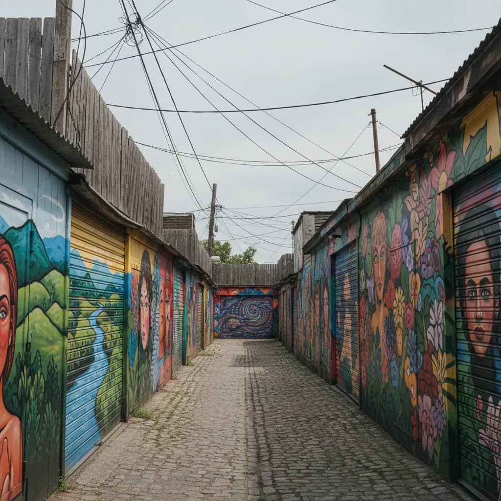
Head north on Valencia to 17th Street and turn into Clarion Alley, the narrow lane between Mission and Valencia that a group of artists began painting in 1992. Walls and garage doors here are repainted often, so what you see changes from visit to visit, and many works address housing, policing and displacement in the neighborhood. Walk the length of the alley slowly and look at both sides; the best pieces are often on the low doors rather than the tall walls.
Two blocks south at 3543 18th Street, the Women's Building wears the MaestraPeace mural, painted in 1994 by seven women artists across two facades of the building. It is visible from the sidewalk, and the 18th Street side is the clearer view. Skip trying to photograph it from directly underneath; step back across the street, where the whole composition fits in one frame and you are out of the way of people entering the building.
24th Street, Calle 24 and Balmy Alley
Ride or walk south to 24th Street, the heart of the Calle 24 Latino Cultural District that the city recognized in 2014. Between Mission and Potrero, the street has panaderias, taquerias and shops that have served families for decades. Turn south into Balmy Alley, between Treat and Harrison, where murals have covered fences and garage doors since the 1970s, many responding to the wars in Central America during the 1980s. The alley is a residential lane, so keep voices down.
If you want a guide for this stretch, Precita Eyes Mural Arts Center at 2981 24th Street has run community mural walks for decades, and their guides know which artists painted which wall. On your own, the alley takes about fifteen minutes at a slow pace. The regulars you will see here are muralists touching up their work, neighbors taking out bins and small school groups with sketchbooks, so treat it as someone's back lane rather than an outdoor gallery.
Getting There, Pacing and a Foggy-Day Backup
16th Street Mission BART puts you a few blocks from Mission Dolores, and 24th Street Mission BART is right at the end of the route, so you can walk one way and ride back. The Muni J Church line runs along the edge of Dolores Park if your legs give out on the hill. The Mission is usually one of the sunniest parts of the city, which makes it a good pick on days when fog sits over the western neighborhoods.
If it rains, cut the route to Mission Dolores, Clarion Alley and the Women's Building, all within a short loop from 16th Street BART, and save Balmy Alley for a dry afternoon when the colors read better. Ask Karpo APP to order the stops around your start time or add a lunch break on 24th Street, and it will suggest a sequence you can follow on foot. Every stop here is a public street, park or building exterior.
Ask Karpo for more information.
Keep reading
- North Beach Tailor Alteration Shop Finder: Inherited Suits
 Hayes Valley Tailor Alteration Shop Finder for Boutique Buys
 Pac Heights Tailor Alteration Shop Finder for Heirloom Gowns