 North Beach Tailor Alteration Shop Finder: Inherited Suits
Neighborhood Guides
SF Historic Walking Route: 3 Ways to Read Mission
A Mission historic walking route can focus on housing, public art, or changing streets. Choose one lens and keep other layers visible without conflating them.
The Mission is too layered for a historic walking route that treats every facade, mural, and street corner as one continuous story. Choose a lens before choosing your stops: housing and architecture, public art and community expression, or the changing public street. Each produces a different walk. The same block may matter to all three, but that does not make their evidence interchangeable. A mural cannot establish a building's construction date, and a picturesque row of houses cannot stand in for the neighborhood's social history. The useful route begins with a question specific enough to keep those distinctions visible.
Housing: compare the block, not just the prettiest house
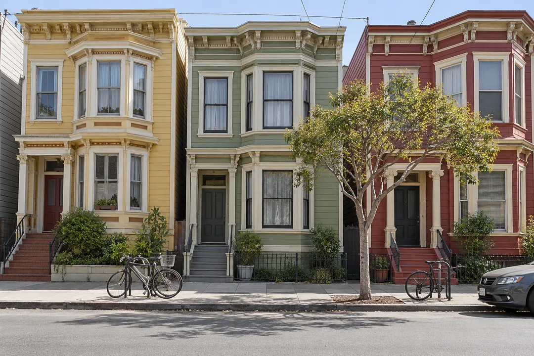
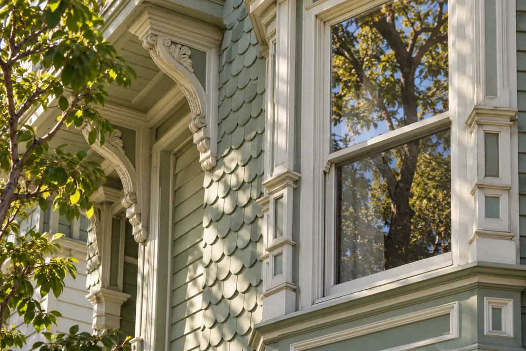
If housing is your subject, choose a small residential area where you can compare whole streetscapes. Notice how buildings meet the pavement, how entrances are arranged, and how upper floors repeat or break a pattern. San Francisco Planning's Mission historical context material gives background for investigating the neighborhood's built environment. Use it to prepare questions, not to attach an assumed date to every bay window. A single ornate facade can be absorbing, but a comparison between several buildings may tell you more about the form of a block than one isolated architectural portrait.
Make the observation task precise. Ask each walker to choose a detail that changes along the street: the height of a ground floor, the treatment of a corner, or the distance between a doorway and the pavement. Describe that difference before discussing what it might mean. A change in form could have several explanations, and guessing the most dramatic one does not improve the walk. Record a street-level observation in plain language, then connect it to documentary research later. That gives people without architectural training a useful way to participate without pretending expertise.
Keep residential privacy central to the route. Stay on public pavement, avoid lingering directly outside an occupied window, and do not step onto a stoop to improve the camera angle. A building's historical interest does not make its entrance a public viewing platform. If a group photograph would block someone's access, move to another location. These boundaries can be agreed before the walk so nobody has to interrupt the conversation to negotiate them. The aim is to look carefully at a place where people live, not to temporarily take possession of it.
Public art: follow authorship rather than a color trail
If murals are your main interest, organize the outing around the relationship between an artwork, its creator, and its setting. Color alone is a weak reason to combine works into a historical narrative. Read any attribution that is actually present and distinguish the artist's words from your own interpretation. Do not assume that every image expresses the same political position or belongs to the same period. A mural can be visually legible while its references remain unfamiliar. That is a reason to research the work, not to invent a meaning that fits the rest of the itinerary.
A public-art walk also needs a different photography rhythm from a housing walk. Give each work enough distance to be seen within its surroundings before making a detail image. Avoid placing a companion in front of an artwork if doing so blocks a passage or interferes with someone else's use of the street. If the work is difficult to view without obstruction, move on. Your route does not need to claim a complete inventory. A few works approached with attention to authorship offer more than a long sequence reduced to colorful backgrounds for portraits.
Streets: observe how the neighborhood connects
For a walk about public space, the subject is the link between destinations. The Mission Area Plan discusses pedestrian comfort, street connections, and open space as planning questions. Use those ideas to look at the present street without assuming every proposal has been implemented. Notice where your group can walk together, where a crossing interrupts conversation, and where there is room to pause. Those observations can reveal how a route feels to different people. They do not require declaring an entire neighborhood accessible or inaccessible on the basis of one short outing.
Try a comparison between a busier commercial street and a nearby residential block. The purpose is not to rank one as more authentic than the other. Ask how traffic, entrances, and available space alter the way you move. Someone who enjoys browsing may favor the commercial stretch, while a companion who wants conversation may prefer the quieter block. Put that difference into the planning decision. A route is not universally good because its destinations are interesting. It also has to connect those destinations in a way that suits the people actually walking it.
Combine lenses only at a clear junction
You can connect housing, art, and public space, but make the transition explicit. For example, a street corner can become the point where you stop comparing facades and begin thinking about circulation. Tell your companions that the question has changed. Otherwise the route risks presenting architecture as social history and public art as decoration without investigating either. Give each lens enough room to produce an observation. If time or energy is limited, finish one question well and leave the other two for another outing. There is no prize for compressing the whole district into an afternoon.
Avoid describing a simple walk as a complete account of the Mission's communities. The planning documents themselves distinguish historical resources and ongoing cultural questions. A visitor's route should be equally careful about scope. You can learn from the area without speaking on behalf of everyone who lives there. The most useful conclusion may be that a building pattern, an artwork, and a busy street led to three different questions. That is a coherent result. It does not need to be converted into a grand narrative that erases the differences you went out to notice.
Practical Notes
Select the walking area only after choosing the lens. Keep a refreshment or seated-rest stop outside the core sequence, so the route still works if you decide to continue without entering a business. Use a current navigation map for connections, and treat historical maps and planning diagrams as background documents. They may explain an idea without describing today's usable path. Consider each crossing and slope in relation to your group. Avoid giving a blanket step-free promise. This is a public-street observation plan, with no assumed admission, guided interpretation, or access to private interiors.
A clear request to the Karpo APP might describe a Mission history walk focused on residential form, with public art saved for a separate visit. Another might prioritize mural research and reduce the number of buildings. Evaluate suggestions according to that chosen lens rather than accepting the longest list. Put the selected stops into your navigation map and remove any detour that contributes no new observation. Finish by sharing one detail each person noticed and one question that needs further research. The walk succeeds when your understanding becomes more precise, even if the distance you covered stays modest.
Ask Karpo for more information.
Keep reading
- North Beach Tailor Alteration Shop Finder: Inherited Suits
 Hayes Valley Tailor Alteration Shop Finder for Boutique Buys
 Pac Heights Tailor Alteration Shop Finder for Heirloom Gowns