 North Beach Tailor Alteration Shop Finder: Inherited Suits
Neighborhood Guides
Hayes Valley Historic Architecture Walking Route: 5 Stops
Trace a Hayes Valley historic architecture walking route from 1915 Beaux-Arts domes on Van Ness Avenue to Julia Morgan's 1922 courtyard and Steiner Street.
Few San Francisco neighborhoods illustrate the interplay between disaster, urban repair, and architectural preservation as clearly as Hayes Valley. In April 1906, soldiers and firefighters halted the westward march of the Great Fire along Van Ness Avenue and Franklin Street, sparing the Victorian redwood blocks climbing westward toward Alamo Square while clearing the eastern flats for one of America's grandest Beaux-Arts civic ensembles. More than eighty years later, after the 1989 Loma Prieta earthquake crippled the double-deck Central Freeway that had sliced across Hayes Street, residents voted to tear down the concrete viaduct and stitch the historic street grid back together. Walking a Hayes Valley historic architecture walking route from Van Ness Avenue up to Steiner Street lets you experience all three chapters on foot.
Beaux-Arts Grandeur along the 1906 Van Ness Avenue Fireline
Start at the eastern gateway of the neighborhood where Grove Street and Hayes Street meet Van Ness Avenue. Looking east across the plaza stands San Francisco City Hall, designed by Paris-trained architects Arthur Brown and John Bakewell and opened in 1915 in time for the Panama-Pacific International Exposition. Built of Sierra granite around a steel skeleton, its French Baroque dome rises more than three hundred feet above the pavement, accented with gilded lead ribs and lanterns that anchor the eastward view down Fulton and Grove Streets.
Directly on the western side of Van Ness Avenue between Grove Street and McAllister Street stand the twin limestone-and-granite facades of the War Memorial Opera House and the War Memorial Veterans Building, completed in 1932 by Arthur Brown with G. Albert Lansburgh. Their rusticated ground-floor arcades, paired Corinthian columns, and mansard roofs deliberately echo the 1915 City Hall across the avenue, creating a unified Classical Revival courtyard where delegates gathered in 1945 to draft and sign the Charter of the United Nations.
From Freeway Scars to Patricia's Green and Linden Street Alleys
Walk two blocks west along Grove Street or Hayes Street to Octavia Street, where Patricia's Green opens into a lively neighborhood promenade between Hayes Street and Fell Street. For four decades after the 1950s, a roaring two-level concrete highway ramp shadowed these blocks and isolated the commercial storefronts of Hayes Street from the residential rows to the east. Following the 1989 earthquake and the final demolition of the elevated ramp, landscape architect Walter Hood and city planners completed Octavia Boulevard in 2005, restoring local access lanes and a central linear park.
Before crossing Octavia Street, duck one half-block north or south into Linden Street and Hickory Street, two narrow nineteenth-century mid-block carriage alleys that originally housed stables and tradesmen's cottages behind the grander townhouses on Hayes, Fell, and Oak Streets. Because the lots fronting Linden Street are half the depth of standard city parcels, contemporary architects and preservationists have adapted two-story wooden carriage houses and narrow infill plots into human-scaled storefronts with cedar louvers, steel casement windows, and pocket courtyards.
Julia Morgan's 1922 Brickwork and Stick-Eastlake Rows on Page and Laguna
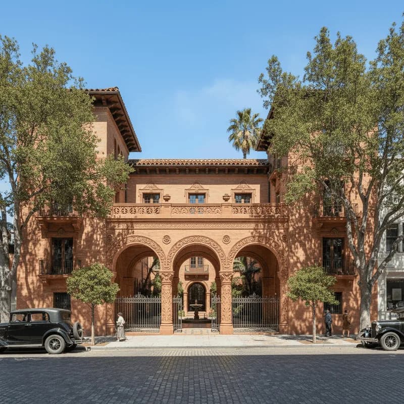
Cross Octavia Street and head one block south and west to the intersection of Page Street and Laguna Street. Anchoring the northwest corner is the San Francisco Zen Center building, commissioned in 1921 as the Emanuel Sisterhood Residence for Jewish working women and completed in 1922 by pioneering California architect Julia Morgan. Trained at the École des Beaux-Arts in Paris, Morgan wrapped this three-story reinforced-concrete structure in warm patterned red tapestry brick, Mediterranean tiled eaves, and cast-terra-cotta colonnettes around a sheltered interior garden court that faces south toward the sun.
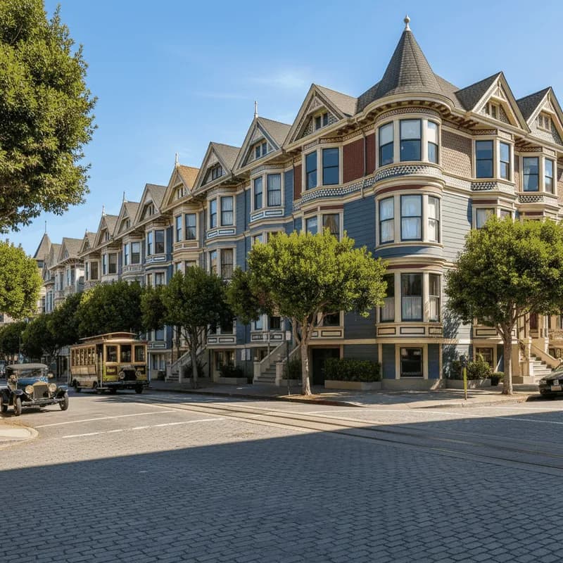
Continuing west along Page Street, Haight Street, and Waller Street between Laguna Street and Webster Street puts you inside intact rows of pre-1906 redwood architecture. Here you can compare 1880s Stick-Eastlake townhouses—recognizable by their squared three-window bays, vertical framing strips, and machine-carved wooden friezes—with 1890s Queen Anne residences sporting turreted corner bays, fish-scale shingles, and leaded stained-glass transoms. Notice how the steep hillside grade forced nineteenth-century builders to set each house atop a tall brick or rusticated wood basement story accessed by wide wooden stoops.
Pay special attention to the intersection corners along Laguna Street, Buchanan Street, and Waller Street, where nineteenth-century zoning naturally blended neighborhood commerce with upstairs family flats. Classic San Francisco corner buildings from the 1880s and 1890s feature chamfered forty-five-degree corner entrances with cast-iron columns at street level and projecting polygonal turrets directly overhead, designed to catch cross-breezes and diagonal sunlight from two streets at once. Just south at the junction of Octavia Street and Waller Street, the 1910 First Baptist Church anchors the southern end of Octavia Boulevard with Classical Revival columns and stained-glass clerestories rebuilt immediately after the 1906 tremor.
Climbing to Steiner Street Queen Annes, What to Skip, and Your Plan B
Finish your route by climbing four blocks west along Hayes Street or Grove Street to Steiner Street on the eastern edge of Alamo Square Park. Along the east side of Steiner Street between Hayes Street and Grove Street stand the six contiguous Queen Anne houses built between 1892 and 1896 by carpenter-developer Matthew Kavanaugh, who lived in the corner mansion at Hayes and Steiner Streets. Climb onto the grassy crest of Alamo Square inside the park to see how Kavanaugh's asymmetrical gables, spindlework porches, and polychrome paint schemes frame the distant 1915 dome of City Hall down the valley.
For optimal photography, time the lower Hayes Valley and Page Street blocks for morning light between nine-thirty and noon, and save the west-facing Steiner Street row at Alamo Square for mid-to-late afternoon when golden light illuminates the six Victorian facades without backlighting. Skip walking the noisy multi-lane traffic corridor of Market Street and Gough Street south of Haight Street if you want a peaceful architectural stroll, and skip driving a car along Hayes Street on weekend afternoons when dining parklets and boutique browsers slow traffic to a crawl. When Pacific fog or wind sweeps over the exposed crest of Alamo Square, trigger your Plan B by dropping two blocks down the leeward eastern slope to Page Street—which operates as a calm slow street—or pausing along the sheltered arcades of Van Ness Avenue near Grove Street. Use the Karpo APP to connect these five Hayes Valley architecture stops with nearby espresso bars and sunny park benches.
Ask Karpo for more information.
Keep reading
- North Beach Tailor Alteration Shop Finder: Inherited Suits
 Hayes Valley Tailor Alteration Shop Finder for Boutique Buys
 Pac Heights Tailor Alteration Shop Finder for Heirloom Gowns