 North Beach Tailor Alteration Shop Finder: Inherited Suits
Neighborhood Guides
Heritage Historic District SF: 3 Dogpatch Scale Clues
Read Dogpatch from public sidewalks through narrow house lots, residential rows and industrial buildings, using three scales to shape a focused SF walk.
Dogpatch puts small houses beside the history of industrial work. San Francisco's Central Waterfront plan identifies Victorian and Edwardian workers' dwellings concentrated on Minnesota and Tennessee Streets, with Twenty-second Street as a neighborhood commercial heart. For a heritage historic district walk in SF, those relationships are more revealing than a list of spectacular buildings. Use three scales as your subject: the individual lot, the residential row and the larger industrial block. This suggested walk stays on public sidewalks and asks you to compare built forms, rather than seek entry to homes or workshops.
Begin with the width of a house
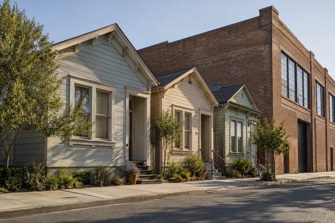
On a residential stretch of Tennessee Street, let your eye travel horizontally before looking up. Pick a short group of houses and notice where each frontage begins and ends. The city plan describes the district's fine grain and its twenty-five-foot lots. That planning language becomes easier to understand when you compare the width of an entrance, a window bay and the adjoining frontage. You are looking at the rhythm of separate properties, rather than one uninterrupted development.
A useful drawing exercise needs only a scrap of paper. Mark a vertical line whenever a building frontage changes, then add a small rectangle for each visible entrance. The resulting sketch need not be accurate enough to measure anything. Its value is the distinction between a narrow dwelling frontage and a building that occupies a broader portion of the block. Record what you can actually see. A large doorway does not establish what machinery once passed through it, and a painted facade does not establish a construction year.
Minnesota and Tennessee are the residential comparison
The Central Waterfront plan connects the area's housing to industrial workers and dates the concentrated Victorian and Edwardian dwellings to the period between 1870 and 1910. That is documented district context, rather than a date assigned here to every house. Carry that distinction into the walk. A building can belong to an older residential pattern while its windows, cladding or entrance have changed. You do not need to decide which pieces are original in order to recognize the scale of the row.
Choose one blockfront on Tennessee and a second on Minnesota, using the city's district map to keep the comparison within the designated area. On the first, concentrate on the relationship between the doorstep and the pavement. On the second, concentrate on upper floors and roof edges. Dividing attention this way makes the two passages different. It also avoids the familiar sightseeing habit of taking the same angled photograph of every attractive facade and learning little from the collection afterward.
Read a working neighborhood without staging its past
The official Dogpatch public realm plan describes a mixture of workers' cottages, factories, warehouses and public buildings, with historic resources constructed between 1860 and 1945. It also identifies Dogpatch as a neighborhood that survived the 1906 earthquake and fire. Those are reasons to notice more than houses. They are not permission to imagine a particular worker's family, a shipyard conversation or the interior of an unidentified building. The architecture supplies enough material without invented human scenes.
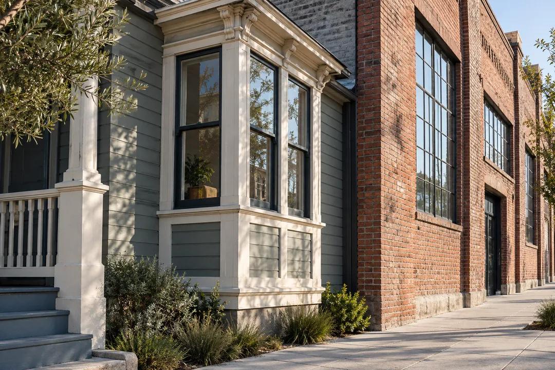
At a point where a small residential frontage and a larger building can be seen together, compare the frequency of their openings. Ask how often the street offers a door, a window or an uninterrupted wall. This is a visual question, not a claim that an industrial facade had a single purpose. Several small doors can make a block feel very different from one long wall, even when the two buildings rise to a similar height. Write down the difference in ordinary language before reaching for a style label.
Make Twenty-second Street the hinge
Twenty-second Street offers a useful change of subject because the city plan describes its role as the local commercial center, with mixed-use buildings defining the street. Treat that documented role as a connection between the residential comparison and the wider district. Look at how the ground floor meets the corner and how the upper floor relates to it. This article makes no claims about which businesses are trading, what they sell or whether their interiors are open to visitors.
For a short outing, choose a continuous path between your two residential examples and a crossing of Twenty-second Street. Make your own route length depend on your arrival and departure points. There is no reward for reaching every boundary. Skip a long detour undertaken only to photograph an industrial-looking wall: without a documented identity or a clear comparison, it adds distance rather than understanding. A modest circuit can produce a stronger account of Dogpatch than a sprawling waterfront itinerary.
Keep the district separate from the waterfront
Dogpatch, the Central Waterfront planning area and the Pier 70 historic district are related geographical subjects, but they are not interchangeable labels. The public realm plan discusses Dogpatch and Pier 70 as distinct historic resources. Use the current city district map for the area under discussion rather than extending the historic district to every nearby building with a maritime appearance. This matters particularly when a photograph frames old and new construction in the same view.
If you continue toward the waterfront after the residential walk, mark that as a separate extension in your notes. Do not imply that every connecting lot is a public passage or that an appealing gate is an entrance. For this walk, the public sidewalk is the observation position. A closed view remains closed. There is still plenty to notice in building height, frontage width and street alignment without following a resident through a doorway or stepping into a working yard.
Photograph the relationship, then the detail
Make your first image a comparison: a short run of smaller buildings with enough surrounding street to show their scale. For the second, choose a detail that explains the first image, such as the way a bay projects or a stair meets the frontage. Avoid placing the camera against a window or lingering at a door. Let somebody leaving a house pass before stopping again. A residential street is a place where people are conducting their day, not a backdrop arranged for a visitor.
The images accompanying this article are AI-generated architectural illustrations of the forms being discussed. They are not documentary photographs of named Dogpatch properties and should not be used to identify a house, date an alteration or prove a building's condition. Make your own observations on the street, then compare them with the city material if you want to investigate further. Keeping an illustration separate from evidence makes the account more useful, especially when sharing it with someone who has never visited.
Practical Notes
Bring the SF Planning district map and a compact notebook. Choose footwear for a city sidewalk walk and a route that fits the least mobile person in your group. This article has not audited curb ramps, gradients or a step-free circuit. If rain makes careful looking uncomfortable, shorten the residential comparison rather than assuming a workshop or residential doorway offers shelter. With children, use the frontage sketch as a shared activity and keep the group clear of entrances.
Use Karpo APP as your next place to explore city ideas after the walk. The architectural exercise itself needs no live tracking, automatic route optimization or claim of access to private property. Before leaving, write three observations in your own words: what the narrow lot does, how a residential row differs from a broad building, and what changes at Twenty-second Street. Those notes give the outing a clear purpose while leaving the neighborhood's present life room to continue around you.
Ask Karpo for more information.
Keep reading
- North Beach Tailor Alteration Shop Finder: Inherited Suits
 Hayes Valley Tailor Alteration Shop Finder for Boutique Buys
 Pac Heights Tailor Alteration Shop Finder for Heirloom Gowns