 North Beach Tailor Alteration Shop Finder: Inherited Suits
Neighborhood Guides
Hayes Valley Art Walk Route Planner: Free Octavia Loop
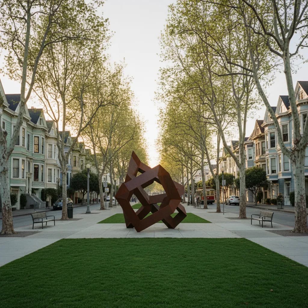
Start at free Patricia's Green on Octavia Boulevard, browse Linden Street studios, and walk past SFJAZZ Center at Fell and Franklin Streets before dusk.
Where a noisy double-decker concrete freeway once cast permanent shadow across central San Francisco, a sunlit median of sycamore trees, public sculptures, and timber-framed design storefronts now anchors the city's most walkable creative district. Using a dedicated Hayes Valley art walk route planner lets you link the rotating open-air installations at Patricia's Green on Octavia Boulevard with intimate pedestrian studio alleys and the glass-walled cultural institutions bordering Franklin Street. Because the entire neighborhood sits on a gentle, level valley floor between Civic Center and Alamo Square, you can cover every outdoor sculpture, architectural pocket park, and storefront vitrine in ninety unhurried minutes without climbing a single steep hill.
Starting at Patricia's Green Where the Central Freeway Stood
Begin your loop at the intersection of Hayes and Octavia Streets on the northern edge of Patricia's Green, the linear park that opened in 2005 after the city demolished the elevated Central Freeway structure damaged during the 1989 Loma Prieta earthquake. Named in memory of neighborhood activist Patricia Walkup, who campaigned for years to replace overhead highway ramps with a tree-lined boulevard, this grassy commons serves as Hayes Valley's outdoor sculpture rotunda. Admission is completely free at all hours, and morning light between ten and noon illuminates the center lawn before afternoon shadows fall from surrounding buildings.
Through a long-standing partnership between the San Francisco Arts Commission and civic arts organizations including Burning Man Project, the central pad of Patricia's Green hosts monumental rotating sculptures crafted from weathered steel, perforated aluminum, and reclaimed timber. Walk a full three-hundred-sixty-degree circuit around the centerpiece installation to see how the sightlines frame the painted wooden bay windows along Octavia Boulevard to the west and the distant gilded dome of San Francisco City Hall to the east. Along the perimeter path, curved mosaic benches and low stone ledges invite walkers to sketch or compare the neighborhood's mix of contemporary infill housing and late-nineteenth-century rowhouses.
Pay close attention to the narrow parcels immediately bordering Octavia Boulevard between Fell and Lily Streets. When the freeway ramps came down, urban planners preserved the unusual skinny lot dimensions left behind by the former highway columns, prompting local architects to design slender, light-filled contemporary facades with floor-to-ceiling studio glass on the ground level. That urban repair experiment explains why Hayes Valley feels so distinct from older commercial strips elsewhere in San Francisco: nearly every corner pairs a public plaza or pocket garden with street-level craft and design spaces.
Turning into Linden Street's Shared Pedestrian Living Alley
From the southern end of Patricia's Green at Fell Street, double back half a block north and turn east into Linden Street between Octavia and Gough Streets. Completed in 2010 as the city's prototype Living Alley, this narrow mid-block service lane was redesigned by neighborhood residents and landscape architects into a curbless pedestrian sanctuary paved with permeable stone pavers. Delivery trucks yield to walkers, and tall clusters of clumping bamboo, drought-tolerant ferns, and built-in cedar benches line the sunny northern wall.
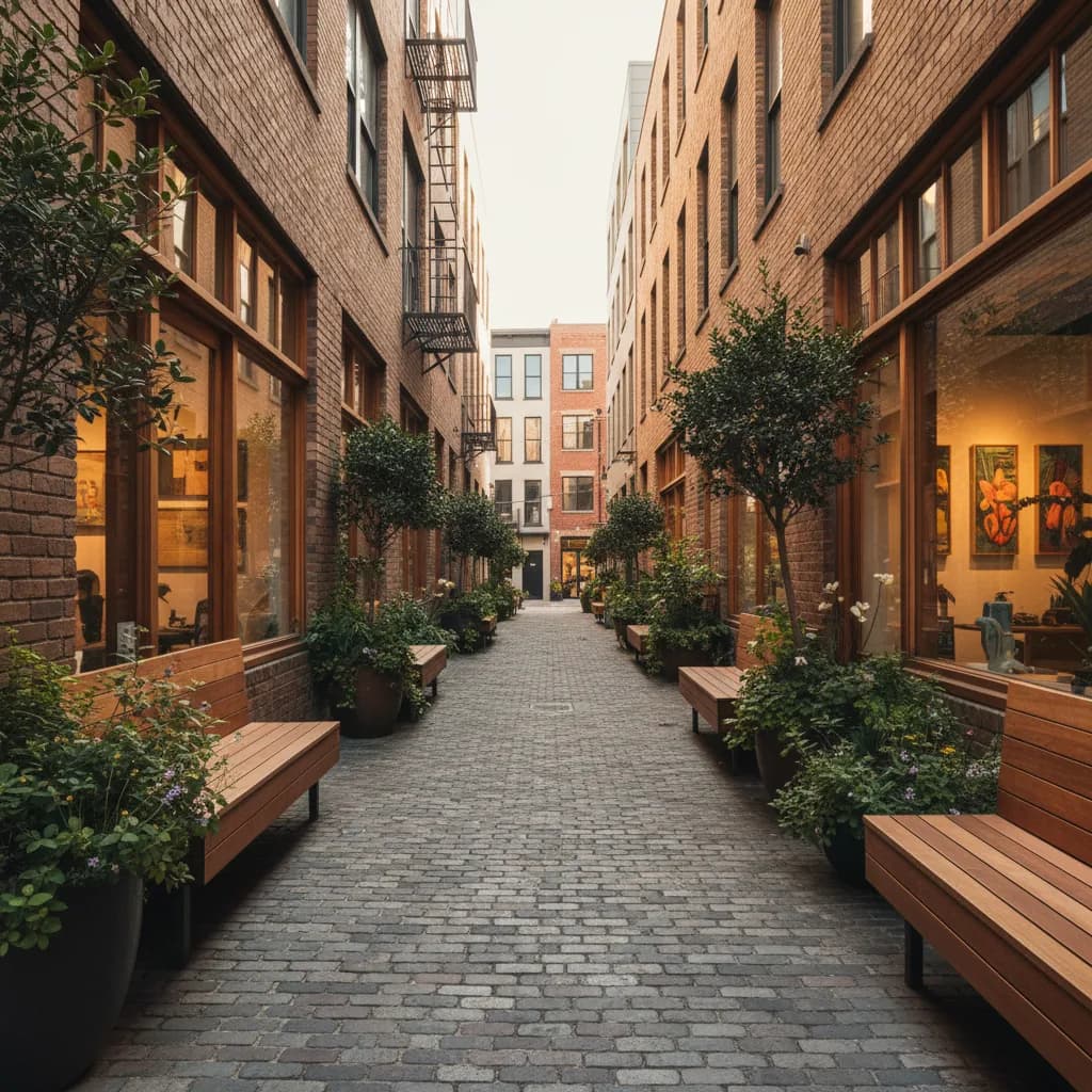
Mid-block alleys in nineteenth-century San Francisco were originally laid out to house stables, blacksmiths, and carriage workshops behind the grander street-facing residences on Hayes and Fell Streets. Today Linden Street keeps that workshop scale alive: former garage bays and timber-beamed ground floors open directly onto the brick paving, allowing passersby to peer into architectural model rooms, small-batch ceramic and eyewear displays, and minimalist espresso windows. Pausing here mid-morning lets you study how reclaimed redwood siding, blackened steel planters, and historic wood-frame siding converse across a lane barely twenty-five feet wide.
Continue east to Gough Street and turn north one short block back toward Hayes Street, where independent print sellers, art book displays, and sculptural home-object showrooms occupy ground-floor Victorian storefronts. Unlike high-traffic museum corridors where visitors rush past velvet ropes, the two blocks of Hayes Street between Gough and Laguna encourage slow window curation. Look up above the modern awning line to spot intact 1890s dentil cornices, carved brackets, and bay-window millwork that survived the April 1906 earthquake and fire.
Reading the 1906 Fire Line Along Franklin and Van Ness
Walking east along Hayes or Grove Street toward Franklin Street and Van Ness Avenue reveals one of the sharpest architectural boundaries in American urban history. During the April 1906 conflagration that followed the great earthquake, firefighters and soldiers finally halted the westward march of flames along the wide boulevard of Van Ness Avenue and the adjoining blocks of Franklin Street. Everything east of that firebreak burned to ashes and was later reconstructed in monumental Beaux-Arts granite, limestone, and terra-cotta, while the blocks west into Hayes Valley retained their wooden Victorian and Edwardian streetscape.
Cross Franklin Street at Fell Street to examine the transparent glass-and-concrete facade of the SFJAZZ Center, which opened in January 2013 as the first standalone building in the United States designed from the ground up specifically for jazz performance and education. Architect Mark Cavagnero designed the ground-floor lobby and corner perimeter with expansive clear glazing so the building's interior cultural life, photography displays, and ceramic mural tributes connect directly with pedestrians on the Franklin and Fell sidewalks rather than hiding behind blank masonry walls.
From the corner of Franklin and Grove Streets, look two blocks east into the Civic Center Historic District, where the 1932 War Memorial Opera House and the 1915 San Francisco City Hall dome designed by Arthur Brown Jr. anchor the classical axis, complemented by the curving glass facade of Louise M. Davies Symphony Hall, completed in 1980. Pairing the intimate, wood-framed scale of Hayes Valley's alleys with this grand civic panorama gives your walk a dramatic contrast in scale within a ten-minute radius.
Looping West Along Page and Laguna Victorian Blocks
To complete the circuit without retracing your exact footsteps, head west along Fulton or Grove Street to Laguna Street and turn south toward Page Street. The intersection of Laguna, Rose, and Page Streets preserves tranquil rows of Italianate and Queen Anne residences with ornate cast-iron gateposts, stained-glass transoms, and pocket sidewalk gardens. Because Page Street operates as a calm slow-street corridor prioritized for walkers and cyclists, you can stand safely near the curb to photograph the layered bay windows rising westward toward the Alamo Square ridge.
If you time your walk for Thursday or Friday afternoon between two and five o'clock, the western sun angles directly down the east-west streets from Alamo Square, lighting up the polychrome paint schemes on Laguna Street and the steel sculptures back at Patricia's Green. If you want to compare which neighborhood design showrooms, nearby gallery spaces, or outdoor patio tables fit your afternoon schedule, open the Karpo APP and ask in plain language to filter Hayes Valley stops by vibe or time window.
Transit Approaches, Wind Layering, and Practical Route Notes
Reaching the starting point at Patricia's Green requires zero car parking hassle. Exit at Civic Center/UN Plaza station on BART or Muni Metro and walk ten minutes west along Grove or Hayes Street past City Hall, or ride the Muni 21-Hayes bus directly to the Hayes and Octavia stop. Cyclists can roll along the protected bike lanes on Page Street or Polk Street and lock up at the public racks bordering Patricia's Green at Hayes and Octavia Streets.
Even on bright autumn and spring afternoons, cool marine air from the Golden Gate funnels briskly down the Fell and Oak Street panhandle corridor around three-thirty in the afternoon, so pack a windproof outer layer alongside comfortable flat walking shoes. Public restrooms and drinking water fountains are available near Civic Center Plaza and inside public transit concourses, and you can use the Karpo APP whenever you are ready to pivot from your outdoor sculpture loop to a quiet espresso counter or early dinner spot along Gough or Hayes Street.
Ask Karpo for more information.
Keep reading
- North Beach Tailor Alteration Shop Finder: Inherited Suits
 Hayes Valley Tailor Alteration Shop Finder for Boutique Buys
 Pac Heights Tailor Alteration Shop Finder for Heirloom Gowns