 Brickell Tailor Alteration Shop Finder: First Work Suit Fit
Neighborhood Guides
Brickell Neighborhood Historical Walking Tour to Vizcaya
A free Brickell walk south from the river bridge to Vizcaya: Tequesta sculpture, the Atlantis sky court, Villa Serena, Simpson Park hammock and The Underline.
Brickell is usually described as a forest of glass towers, yet a straight line down Brickell Avenue passes through more than a century of Miami history, from Native sculpture and Gilded Age winter homes to the 1980s condos that defined the city on television. This neighborhood historical walking tour starts at the Miami River and heads south toward the bay, ending at the gates of Vizcaya. It is free, almost entirely flat and about three miles one way, with an easy return by Metrorail.
Start at the Brickell Avenue Bridge
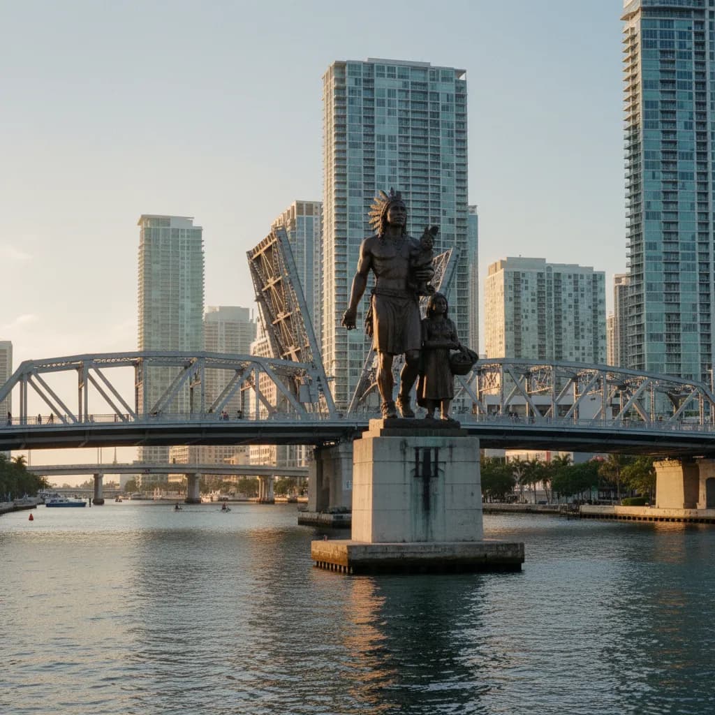
Stand on the Brickell Avenue Bridge over the Miami River. The current bascule bridge opened in the mid-1990s, and rising from its center is the Tequesta Family, a bronze by Miami sculptor Manny Carbonell showing a Tequesta warrior with his wife and child. The figure is a reminder that the mouth of this river was a major Tequesta village site long before any Spanish or American settlers arrived.
From the bridge you can see both banks of the river, which was the commercial heart of early Miami. William and Mary Brickell arrived on the south bank in 1871 and ran a trading post that dealt with Seminole families who paddled down from the Everglades. Their name stuck to the avenue and the neighborhood, although nothing of their original store survives. Lean on the railing for a moment and imagine canoes instead of yachts.
Brickell Avenue Before the Towers
Walk south along the avenue. In the early twentieth century this was a road of large winter estates facing Biscayne Bay, and locals nicknamed it Millionaire's Row. Almost all of those houses were demolished from the 1960s onward as banks and condo developers bought the waterfront lots. A few churches and lower buildings survive between the towers, and they help you picture the earlier scale of the street.
Keep an eye on the side streets that run toward the water. Several end at small public access points or pocket parks where you can see the bay. These are worth the short detour, because the main avenue is lined with gates and driveways and it is easy to forget how close the water is.
A useful habit on this stretch is to read each block by its age rather than its height. Low walls of coral rock, mature banyans in a front lawn or a church set back from the curb usually mark a lot that escaped redevelopment. When you spot one, pause and look at the towers beside it, then try to picture the whole frontage at that older scale. That small exercise turns a commute corridor into a readable timeline.
The Atlantis and Miami's 1980s Moment
Continue to the stretch of Brickell Avenue south of the Rickenbacker Causeway turnoff. Here you will find the Atlantis, a condominium completed in 1982 by the Miami firm Arquitectonica. The building is famous for a square hole punched through its upper floors, holding a palm tree, a hot tub and a red spiral staircase. Its image appeared in the opening credits of Miami Vice, and for many people it became shorthand for the city itself.
Arquitectonica designed several other bold residential towers along this part of the avenue in the same years, with bright colors, grids and cut-outs that broke with the plain slabs of the 1960s. They are private residences, so the best viewing spots are across the street or from the median. Bring a lens that can capture height, and visit in the morning when the sun lights the eastern façades.
Villa Serena and William Jennings Bryan
Farther south, look for Villa Serena, the Mission-style house that William Jennings Bryan built as a winter home around 1913. Bryan was a three-time presidential candidate and Secretary of State under Woodrow Wilson, and later spent a great deal of time in Florida promoting real estate. The house is private and partly hidden by trees and walls, but its tile roof and arched details are visible from the sidewalk.
It is one of the few surviving reminders of the estate era on the avenue. Treat it as a sidewalk stop rather than a site visit, and keep moving. The contrast between this low house and the towers on either side is the clearest lesson of the walk about how quickly Brickell changed.
Simpson Park and a Surviving Hammock
Turn inland toward Simpson Park, a city park that protects a remnant of tropical hardwood hammock, the dense native forest that once covered much of the coastal ridge. The park is named for Charles Torrey Simpson, a naturalist who campaigned to save these forests in the early twentieth century. Walking under the canopy of gumbo limbo, strangler fig and live oak gives you a sense of what the earliest settlers had to clear.
Stay on marked paths, carry insect repellent and check the city parks page for current access before you go, as opening arrangements can change. Even a short stroll here drops the temperature noticeably compared with the open avenue.
The Underline and the End at Vizcaya
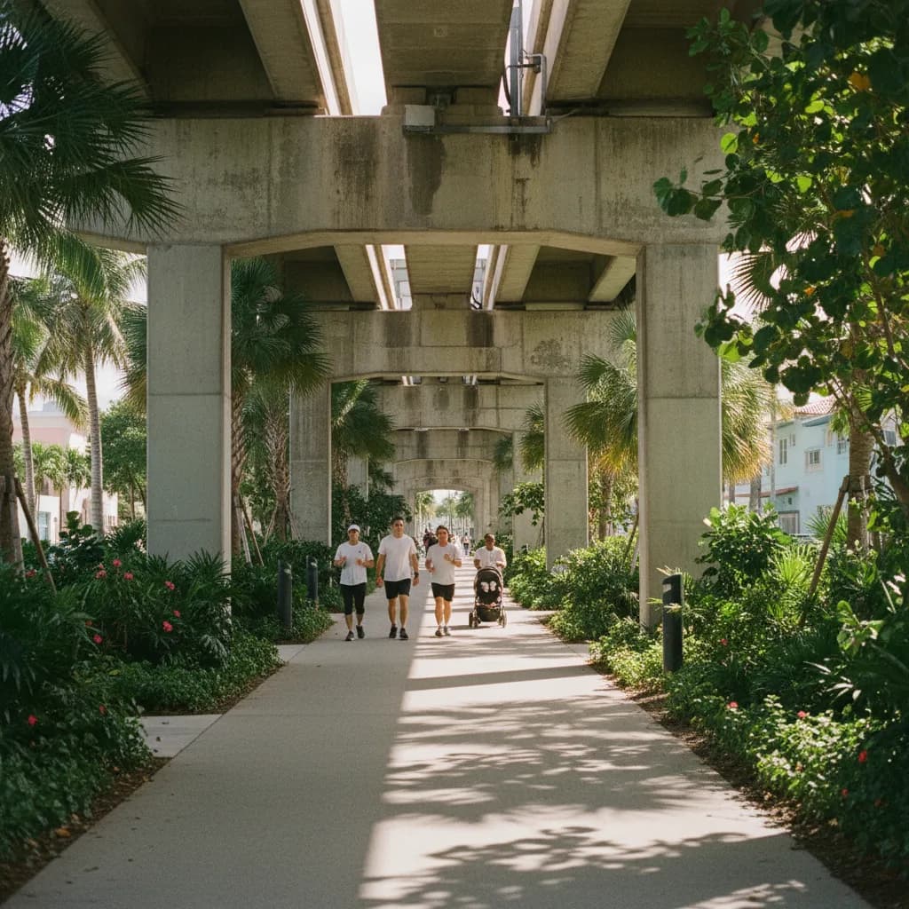
Cut west to The Underline, a linear park built beneath the elevated Metrorail line. Its first section, in Brickell, opened in 2021 with native plantings, shaded seating and walking paths. Walking here shows how the city is reusing transport corridors for public space, which is a newer chapter in Brickell's history.
From The Underline, head south and east toward Vizcaya Museum and Gardens, the Italian Renaissance-style estate completed in 1916 for industrialist James Deering. Entry to the house and gardens requires a timed ticket, so check the official website for current days and booking if you want to go inside. Even from the entrance drive, the scale of the estate gives you a final look at the kind of bayfront wealth that once lined the whole avenue.
Practical Planning Notes
Walk in the early morning to avoid heat and traffic noise. Sidewalks are wide along most of the avenue, but crossings at the causeway approach can be busy. The Brickell and Vizcaya Metrorail stations make it easy to walk one way and ride back. For a shorter version, do the bridge, the Atlantis viewpoint and Simpson Park in about ninety minutes. Ask Karpo APP to set the stops in an order that fits your start time and walking pace. All the stops on this route are public streets, sidewalks and parks, except the Vizcaya interior.
Ask Karpo for more information.
Keep reading
- Brickell Tailor Alteration Shop Finder: First Work Suit Fit
 Coconut Grove Tailor Alteration Shop Finder: Heat-Proof Fits
 Little Havana Tailor Alteration Shop Finder: Guayabera Fits