 Brickell Tailor Alteration Shop Finder: First Work Suit Fit
Neighborhood Guides
Miami Historic Walking Route: See Grove Beyond Mansions
A West Grove historic walking route reads porches and residential boundaries from public sidewalks, linking a careful sketch to Bahamian heritage sources.
A West Coconut Grove historic walking route can begin with a change in what you consider worth noticing: the relationship between modest homes, porches and the street, rather than a hunt for grand houses. Use Charles Avenue as the historical focus and choose a small public-sidewalk section on a map. The aim is to understand how a neighborhood’s built form can prompt questions about community history. You will leave with a carefully described frontage and a reading question, without treating anyone’s home as a visitor attraction.
Give the residential street its own scale
The City of Miami’s planning guidance describes Village Island West through the contributions and heritage of Black Bahamians who came to South Florida. The Coconut Grove business district’s historical introduction also acknowledges Bahamian influence. These sources provide a starting context for the West Grove. They do not establish the age or ownership history of every house you pass. A small timber building can invite a useful architectural question while its specific story remains something to research through a proper record.
Before the walk, write a purpose that does not depend on entering a house. You might want to see how a porch creates a transition between indoor space and the street, or how a setback changes the way a dwelling sits among its neighbors. Keep that purpose in plain language. The route does not require you to identify a resident, infer a household’s income or photograph private activity. It asks you to notice an arrangement of space while recognizing that the arrangement remains part of somebody’s daily life.
A useful first sketch is a simple section from pavement to wall. Include only what is visible without leaving public space: the sidewalk edge, planting, a front boundary if present, a porch and the enclosed room beyond. Do not draw an imaginary interior. You are recording a sequence of thresholds, not making a real-estate plan. If the view is blocked, draw the obstruction as part of the section. A hedge or fence can tell you where your observation ends without becoming an inconvenience to overcome.
The porch is a relationship, not a stage

Choose one frontage where the porch is visible and describe its depth relative to the rest of the facade. Look at the roof edge, supports and the separation from the street. Then describe what you cannot tell from your position. You may see a raised floor without knowing when it was built or why that height was chosen. Record the visible relationship first. A confident explanation about ventilation, storms or a family’s habits needs evidence beyond the appearance of a single house.
Use a second frontage only if it offers a genuinely different relationship. Perhaps the entrance is nearer the pavement, or perhaps planting makes the transition less direct. Avoid turning differences into a ranking of authenticity. A later alteration can be important to a household even if it complicates a visitor’s preferred picture of the past. The purpose of comparison is to sharpen your description. It is not to decide which resident has maintained the most photogenic version of a historical narrative.
Do not wait outside for someone to appear on a porch. Do not frame a person through a window, photograph a child or make a doorway the background for a group portrait. A neighbor who offers a greeting has not agreed to an interview. Respond naturally, keep moving when appropriate and ask permission before recording a conversation. If you want oral history, seek an identified public program or published account in which the contributor has chosen how their experience will be shared.
Put the tree canopy in the drawing carefully
A canopy can dominate your impression of the Grove, but a tree’s size is not a reliable construction date for the house behind it. In your drawing, mark where foliage hides the roofline and where its shadow changes the reading of a wall. That makes the observation more precise than describing everything as timeless or untouched. A residential street contains growth, maintenance and alteration. You can acknowledge those processes without inventing a chronology from the color of wood or the thickness of a trunk.
For a companion who prefers photographs, agree on one public-view image of the spatial relationship rather than a series of house portraits. The photograph should help explain the section sketch: how the sidewalk, planting and porch sit together. Review it before moving on. Remove it if it includes private activity you did not notice at the time. A smaller set of images with a clear purpose is easier to use responsibly than a camera roll full of residences whose occupants never became part of the plan.
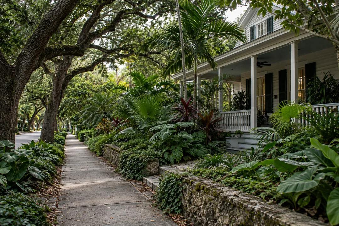
The illustrations in this article are newly generated contemporary scenes of a shaded residential street and a porch detail. They do not identify a Charles Avenue property or reproduce a historic photograph. The woodwork and planting are visual prompts for noticing thresholds, not a claim about the construction of any named home. Keep that distinction when discussing the outing with someone else. The reliable historical context comes from attributed writing, while the details of your own walk come from the street you actually observed.
Follow one name into the record
After the visual exercise, return to the city’s background material and choose one named place or historical figure for further reading. Keep the spelling exactly as the source gives it, and record what kind of document you are using. A planning guideline, a business district introduction and an archival record answer different questions. The first can explain conservation priorities, the second can orient a visitor, and a relevant archival record may support a more specific historical claim. Do not quietly treat their purposes as interchangeable.
Write a question connecting the source to your observation. You could ask how a documented building’s relationship to the street has been described across different records. You could also ask what a conservation document values about the neighborhood’s scale. These questions are more productive than asking whether every porch is original. They give you a reason to revisit the material and a way to recognize an answer, rather than using historical language simply to decorate a pleasant afternoon walk.
Practical Notes on keeping the walk modest
Select the exact start and return point before leaving, using a street map and the public sidewalk network. This article does not provide a measured route, promise an accessible surface or include house admission. Keep bags and companions out of driveways, and pass a frontage when stopping would block somebody’s approach. Water and sun protection belong in the plan. If conditions make sketching uncomfortable, reduce the exercise to one careful view and continue the reading elsewhere instead of extending the residential walk to fill time.
Karpo APP can be used to discover ideas around a Grove cultural outing. Ask for neighborhood history interests or a separate place to continue reading afterward, then make your own short walking sequence. The next useful action is to match a question with a source, not to collect more house names. Background sources: the City of Miami’s Village Island West guidance, https://archive.miamigov.com/planning/docs/guidelines/GrandAveVisionPlan.pdf , and the Coconut Grove history introduction, https://coconutgrove.com/about/coconut-grove-history/ . Neither source turns a private porch into a public stop.
Ask Karpo for more information.
Keep reading
- Brickell Tailor Alteration Shop Finder: First Work Suit Fit
 Coconut Grove Tailor Alteration Shop Finder: Heat-Proof Fits
 Little Havana Tailor Alteration Shop Finder: Guayabera Fits