 Brickell Tailor Alteration Shop Finder: First Work Suit Fit
Neighborhood Guides

Miami Historic Walking Route: Read Gables Beyond Roofs
A Coral Gables historic walking route compares civic views with pedestrian approaches, using City Hall as the anchor for a compact planning diagram.
A Coral Gables historic walking route can use the space between buildings as its main subject. Choose a compact civic section around City Hall and the adjoining streets, then compare how an entrance, a street view and an open space work together. This Miami-area outing is for someone who wants to read city planning without making a tour of private homes. The result is a small diagram of relationships: what draws your eye, what directs your feet and where those two instructions differ.
Start with the city's account of its design
The City of Coral Gables describes its development as a planned city with Mediterranean architecture, bringing residential and commercial areas into a larger composition of gateways, monuments and open spaces. Use that official account as the background question for the walk. Can you recognize an attempt to organize a sequence of views rather than simply decorate separate buildings? The question does not assume every present feature belongs to the original plan. It asks you to compare a planning idea with a contemporary piece of city.
The city’s historical-landmarks page identifies City Hall as a Mediterranean Revival building designed by Phineas Paist and Denman Fink. That is an attributed fact about a particular building. Keep it separate from your own impression of the surrounding streets. An attractive row of arches nearby does not automatically share the same architects or construction history. Write the official attribution next to the building name in your notes, and use plain descriptive language for the spaces whose individual histories you have not researched.
Before choosing the walking section, make a diagram with three symbols: a rectangle for a building face, an arrow for a view and a dot for a place to pause. You do not need a detailed street plan yet. The symbols describe the relationships you hope to examine. Later, use an ordinary map to select the real public approaches and crossings. This order prevents a long list of landmarks from taking over an outing whose purpose is to understand composition rather than maximize coverage.
Walk toward an entrance without entering it
Pick a public approach from which City Hall’s exterior is visible. Notice when the entrance first becomes legible. Is it apparent from a distance, or do you identify it only after other features catch your attention? Draw the line of your view. Then draw the route your feet actually follow using the public pavement and crossings. Those lines may not match. The distinction between a strong visual axis and an ordinary pedestrian approach can be the most useful thing you record all day.
At the next suitable stopping place, turn back toward where you started. A view that felt formal in one direction can be less organized in reverse. Photograph or sketch both directions only if there is room to do so without interrupting movement. Keep parked vehicles, trees and street furniture in the description. They are part of the present experience. You are studying a city being used, so an image stripped of every contemporary element would answer a different question about architectural presentation.
Do not use the exercise as a reason to enter an administrative building. Exterior observation is enough, and a civic function does not make every doorway an invitation to visitors. If indoor history is your main interest, choose an actual public interpretive offering separately. For this walk, the useful threshold is the one you can read from outside: where an approach narrows, a facade becomes deeper, or an entrance announces itself through scale. None of those observations requires a claim about interior access.
Distinguish an arch from a route
An arcade can make a sequence of openings feel continuous. Look at the repeating supports, the depth behind them and the point where the rhythm ends. Then ask whether the apparent passage is part of the route available to you. A visually inviting arch may belong to a private approach, while a less theatrical sidewalk provides the actual connection. Record both. This keeps the architectural reading attached to the practical business of moving through the city instead of treating every framed view as a public corridor.
Choose one open space that you encounter within the small section already selected. Describe its edges before describing its atmosphere. Which building face, planting strip or roadway defines each side? Is the space an endpoint, a pause between destinations or merely something you pass alongside? These are interpretations you can test against the diagram. Avoid calling it part of Merrick’s original design unless an appropriate record establishes that connection. Present-day relationships can be worth discussing without attaching an unsupported founder story to each one.
If your companion sees a ceremonial route where you see an awkward crossing, preserve both accounts on the page. The visual and physical experiences can diverge without either observer being wrong. Ask what information each drawing leaves out. A wide photograph may explain the architectural hierarchy while hiding the experience of finding a crossing. A close diagram of the pavement may explain movement while losing the larger view. The combination is more revealing than arguing for a single flattering description of the place.
Read the roof after the ground
Only now add rooflines, material changes and ornamental details to the diagram. This reverses the usual tendency to begin and end with tiled roofs. Ask how the details strengthen the sequence you have already noticed. A tower might provide a visual marker from several positions, while a recessed opening may matter only nearby. Write these as observations of your selected view. Their relationship to design intent, later restoration or the wider history of Mediterranean Revival needs the city’s documentation or another identified architectural source.
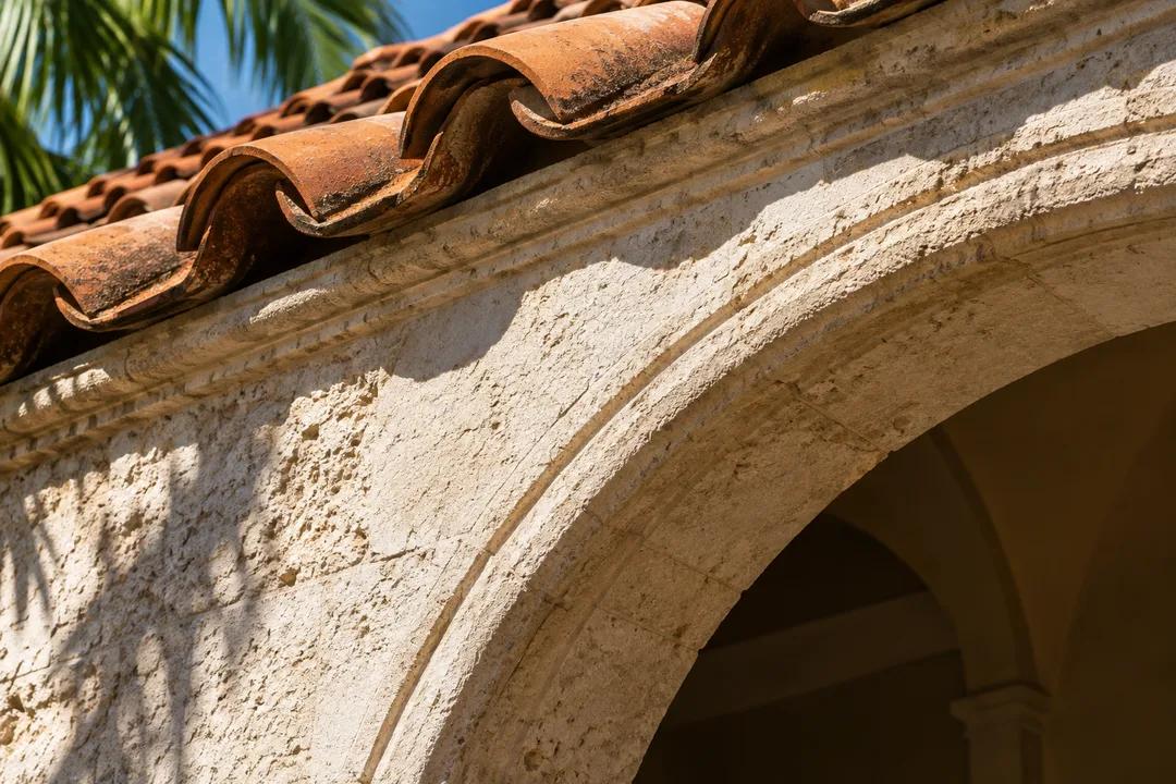
The generated photographs accompanying this article offer an imagined civic arcade and a close material study. They are contemporary illustrations, not photographs of City Hall or proof of its fabric. Their purpose is to suggest how a wide relationship and a close detail answer different questions. Use the actual street for your diagram, and the city’s landmark record for attribution. Keeping those sources distinct makes the comparison more useful than silently replacing a building you could not see clearly with an idealized picture.
Practical Notes for a compact civic comparison
Keep the City Hall area as the anchor instead of adding the scattered themed residential villages to the same walk. That would turn a small spatial exercise into a different trip with more transfers and private-property boundaries. Carry a pencil, water and a page large enough for two arrows that do not overlap. In strong sun, prioritize a comfortable observation point over the most symmetrical angle. If the chosen view is obstructed, describe the obstruction or choose a shorter comparison rather than crossing somewhere unsuitable for a photograph.
For city discovery, Karpo APP can be an entry point to ideas around a Coral Gables architecture outing. Describe the interest in civic spaces and a compact exterior walk, then keep the diagram and street directions in your own tools. Historical attribution: https://www.coralgables.com/department/historical-resources-cultural-arts/historical-landmarks . Planning background: the city’s Community Recreation Master Plan. Finish by labeling one difference between where a composition directs the eye and where the public route directs the walker. That specific observation is the deliverable this walk is designed to produce.
Ask Karpo for more information.
Keep reading
- Brickell Tailor Alteration Shop Finder: First Work Suit Fit
 Coconut Grove Tailor Alteration Shop Finder: Heat-Proof Fits
 Little Havana Tailor Alteration Shop Finder: Guayabera Fits