 Brickell Tailor Alteration Shop Finder: First Work Suit Fit
Neighborhood Guides

Miami Historic Walking Route: Read Circle Evidence First
A Miami Circle historic walking route compares the archaeological record with the riverfront today, separating sourced findings from surface impressions.
A Miami Circle historic walking route works as a comparison between an archaeological record and the contemporary riverfront, rather than a search for a dramatic ruin. Begin with the Florida Department of State’s short site description, then plan a small public-space outing around Brickell Point and the mouth of the Miami River. Your task is to distinguish a documented discovery from what you can see at the surface. A photograph of today’s skyline and a careful note about the evidence can belong together without pretending they show the same moment.
Take one archaeological statement with you
Florida’s Division of Historical Resources says the Miami Circle was discovered during archaeological salvage excavations in 1998 and describes holes and basins cut into shallow limestone. Those are specific claims from an identified agency. Read them before arriving, then write them in your notebook with the source link. Resist expanding the account into an imagined ceremony or a confident explanation of how a structure was used. A concise official description gives you a sound starting point without providing a script for every aspect of ancient life.
The National Park Service’s 2007 Special Resource Study describes research suggesting that the circular pattern represents the footprint of a prehistoric structure. Notice the wording: the inference is tied to research. You should not remove that qualification when retelling it. The report also examined different future management options. Its discussion is historical documentation of possibilities, rather than evidence that a proposed observation platform, museum or shelter exists today. Keeping the date and purpose of a document visible is part of reading a site accurately.
Make two cards before leaving. Put the documented description on one, including the agency and date of the report when relevant. Leave the second card blank for a description of the present setting. The cards keep the outing focused, especially if you are visiting with someone who expects every historical place to offer exposed ruins. You are not promising a view into an excavation. You are arranging a comparison between a researched account of a place and the ordinary experience of standing in its urban surroundings.
Let the riverfront establish the setting
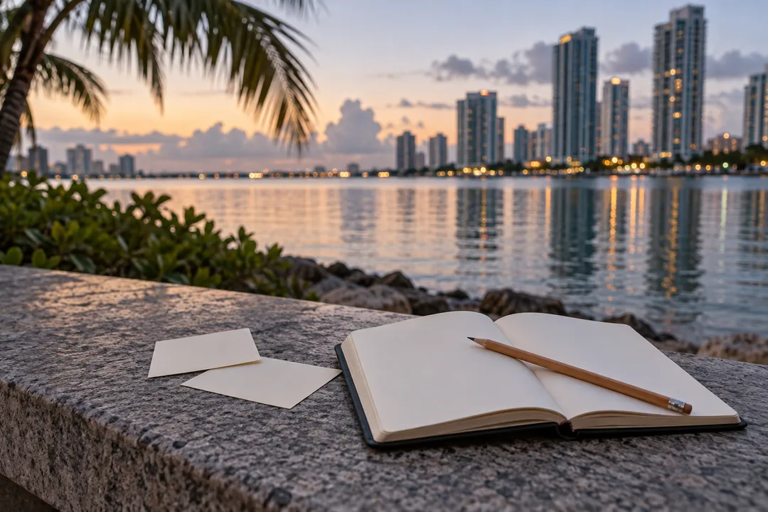
At the public approach you have selected on your map, first identify the relationship between the river and the surrounding built environment. Draw the direction of the water and the edges of the space visible from your position. Add the bridge or towers only as present-day orientation cues. Do not use them to reconstruct an earlier coastline or settlement layout. The current surface can help you understand location, but it cannot show the complete environment in which archaeological features were created or used.
Now fill the second card with a literal present-tense description. Include what interrupts the view as well as what frames it. A barrier, planted surface or change in level tells you something about the limits of your viewpoint. It does not give permission to move beyond that limit. Stay within the public route and treat any marked boundary as the edge of this exercise. There is no need to approach the ground more closely, handle material or look for a souvenir to make the observation feel more archaeological.
Keep the distinction visible in photographs. A wide view can show an urban setting near water. It does not document the subsurface pattern described in a report. A close photograph of contemporary paving is also not an image of ancient worked limestone simply because it was taken nearby. Write the subject plainly when saving an image. A truthful, ordinary caption often preserves more useful information than an evocative title that makes the picture appear to prove a claim it cannot support.
Read a report illustration without relocating it
If you study a plan or excavation photograph later, retain its original caption and orientation. Ask what it records, when it was made and which area it depicts. An image can be authentic while still being unsuitable for answering your particular question. A detail photograph may explain a worked feature but offer little help in finding the public approach. A general site plan may locate a pattern without showing the street scene as it exists now. Different scales provide different kinds of evidence.
Compare the report’s language with your two cards. Which statement can the present view support independently? Which statement depends entirely on the archaeological account? The discovery year, for example, is not something you can observe from a lawn or a skyline. It belongs with the source. The relationship between your standing position and the river is a current observation. Separating them allows you to talk about both confidently, without making the walk carry more evidential weight than it can bear.
The new generated photographs in this article illustrate a contemporary riverfront setting and a blank note-taking exercise. They do not portray exposed archaeological features, reproduce a research illustration or identify an exact site boundary. They also do not depict Tequesta people or reconstruct their buildings. That restraint is deliberate. The article’s useful action is learning how to connect a place with an attributed record. An invented reconstruction would add visual certainty precisely where the method asks you to preserve the difference between evidence and interpretation.
A family conversation that avoids treasure hunting
With children or companions new to archaeology, ask each person to name one thing they can see and one thing they know only because someone investigated it. Keep the examples concrete: the river in front of you belongs to observation, while a statement about an excavated pattern comes from the agency’s record. This is not a test of who knows the most dates. It is an exercise in recognizing how knowledge is acquired, and why careful work can reveal something that an attractive surface view cannot.
Skip a search for objects or markings on the ground. It encourages the wrong expectation and can distract from boundaries and ordinary pedestrian movement. The alternative is a drawing that uses different line styles for different kinds of information. Draw the visible setting with a solid line, and write the archaeological statement separately with its source. Do not place a speculative structure on the landscape as if you knew its exact form. A page that preserves an unanswered question is a better outcome than a confident fictional reconstruction.
Practical Notes for the river-mouth comparison
Choose the actual start, finish and crossings on a current street map, keeping the walking portion compact. This is an interpretive exercise rather than a continuous riverwalk itinerary or a promise of access along every waterfront edge. If a public approach is obstructed, choose another lawful viewpoint or finish the source reading elsewhere. Carry water and allow a quiet pause for writing. Avoid making a bridge crossing or a second neighborhood obligatory simply to stretch a small comparison into a longer sightseeing route.
Karpo APP can be a discovery entry point for a Miami history outing, including ideas that fit an interest in archaeology and a short walk. Keep the two cards yourself and use the responsible agencies for historical interpretation. Sources: Florida’s site description, https://dos.fl.gov/historical/archaeology/projects/miami-circle/ , and the NPS study introduction, https://parkplanning.nps.gov/document.cfm?documentID=21625 . End by stating one supported finding and one limit of your observation. Those two sentences give the route a clear result without claiming that an app or a present-day photograph has reconstructed the past.
Ask Karpo for more information.
Keep reading
- Brickell Tailor Alteration Shop Finder: First Work Suit Fit
 Coconut Grove Tailor Alteration Shop Finder: Heat-Proof Fits
 Little Havana Tailor Alteration Shop Finder: Guayabera Fits