 Brickell Tailor Alteration Shop Finder: First Work Suit Fit
Neighborhood Guides
Heritage Historic District Miami: 2 Buena Vista Readings
Buena Vista East in Miami links village history with boom-era homes. Read porches and parapets from public sidewalks, keeping private gardens outside the visit.
Buena Vista East can be read as two overlapping stories: the earlier village and the boom-era residential subdivisions that followed. This Miami heritage historic district visit keeps both in view. The city's history places the village's origins in the nineteenth century and connects later house building with Miami's rapid growth. For a visitor, the interesting task is to connect that change of scale with the architecture visible from the street. A shaded porch and a shaped parapet offer different ways to begin, without turning a private home into a public attraction.
First reading: a village becoming part of the city
The present historic district is not a complete map of every place ever called Buena Vista. The designation report focuses on Biltmore and Shadowlawn, two subdivisions within a larger community story. Remembering that distinction helps explain why a neighborhood name and a preservation boundary do not always line up. The walk proposed here stays with the mapped district. Its broader village context provides a historical introduction, rather than an excuse to label every nearby old-looking building as protected.
Miami's official overview describes Buena Vista as a small village in the 1890s whose growth accompanied the city's development. Think about what changes when land moves from a village setting into a residential subdivision. Streets and lots make individual buildings part of a more coordinated pattern. The transition is not necessarily visible in one doorway. It becomes easier to understand when you compare a map's repeated parcels with the variety of buildings that occupy them.
Use a simple notebook page with two columns: community history and visible architecture. Put the village narrative in the first column. Reserve the second for things you can actually see on the walk, such as a projecting roof or a recessed opening. A feature does not need to be a surviving piece of the nineteenth-century village to matter. Later architecture can tell the story of growth just as clearly, provided you do not assign it an earlier date because the neighborhood itself is old.
Second reading: the boom-era house as a statement
The city connects Buena Vista East's houses with the land boom and with people whose business success found expression in their homes. That is a historical interpretation of the neighborhood's development, not a license to guess the occupation or income of today's residents. Keep the distinction explicit in your notes. You can discuss how a facade presents itself to the street without trying to turn every architectural choice into a biography of the household behind it.
One frontage may emphasize a broad sheltering roof, another the shape of the wall above the entrance. These are two different forms of public presentation. The first can make the transition from street to room feel gradual. The second can concentrate attention on a silhouette. Compare what is actually visible rather than deciding which house is more prestigious. A historical walk becomes more revealing when it asks how a design works, instead of ranking properties by apparent expense.
The official style list includes Mediterranean Revival, Mission, Craftsman and Art Deco residences. That range gives the district its value as a comparison exercise. It also makes a one-label description inadequate. You need not identify every style correctly to notice that roof projection, wall outline and opening proportions change along a street. Begin with those features. The names can help organize the account afterward, when you have enough visual evidence to explain why a particular comparison interested you.
The porch makes a threshold visible
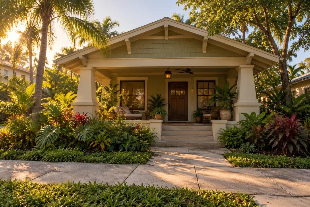
A porch is a useful subject because it gives depth to the space in front of a house. Look for the relationship between its roof and the wall behind it. Is the support easy to distinguish, or does planting obscure it? Does the recess create a broad dark band, or a smaller patch beside the entrance? These questions concern the exterior view. They do not require approaching the steps, inspecting furniture, or photographing people using a private outdoor room.
For a drawing, reduce the porch to three elements: roof, supports and the shaded space behind them. You may find that the shadow is the strongest part of the composition. That does not tell you how cool the interior is or whether the porch remains in its original form. It tells you how the building meets the street visually. A small diagram can preserve that relationship more clearly than a photograph in which leaves and parked vehicles dominate the foreground.
If your companion notices a different feature, keep both accounts. One visitor might remember the horizontal eave while another remembers the vertical supports. Together they describe the same threshold from different priorities. This is a useful way to make an architectural outing social without requiring specialist knowledge. The discussion stays grounded in a particular visible arrangement, and nobody needs to invent a family story or a date to make the conversation interesting.
The parapet changes the question
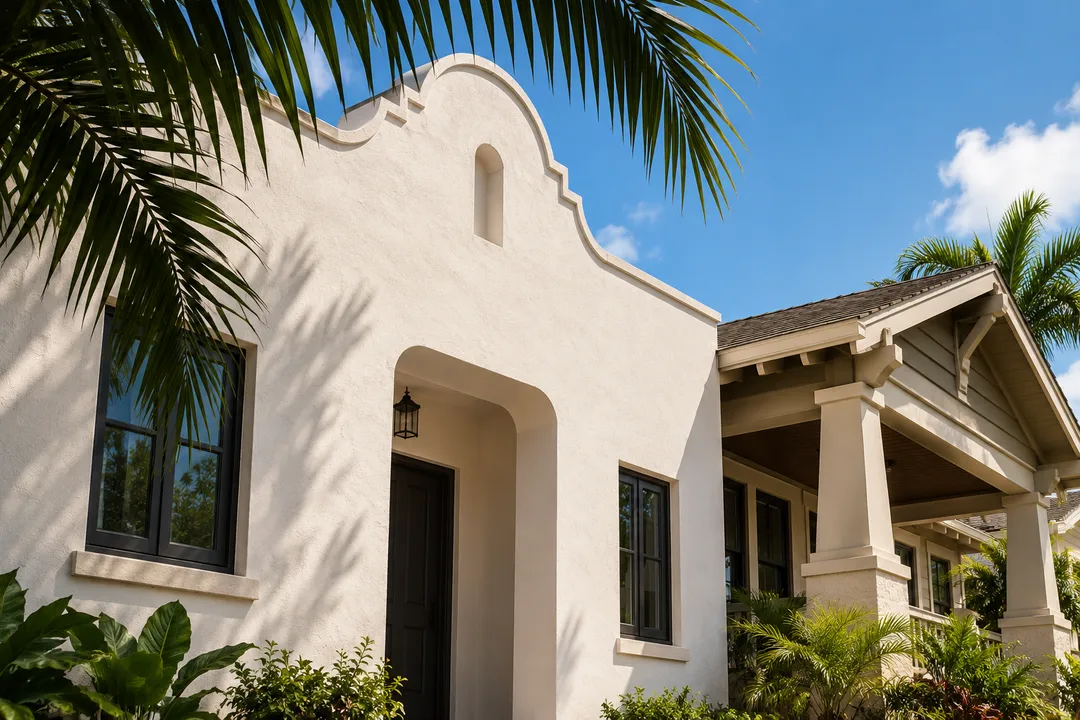
A parapet asks you to look at the wall's upper edge rather than the depth of a porch. A curved or shaped outline can make that edge a distinct architectural event. Study how it relates to the openings below. Does it align with an entrance, or create an emphasis elsewhere? Use the Mission reference in the city's account as context, while remembering that a curving parapet alone cannot establish the complete history or style of a building.
Try recording the frontage as a flat silhouette, then compare that drawing with your porch diagram. One note is primarily about depth and shelter. The other is about outline and alignment. The value lies in the difference between the two drawings. You have found two ways that houses participate in the public street, even if the properties are close together and share a general scale. That is a more useful result than a list of style names detached from any observable feature.
Practical Notes: keep Buena Vista East specific
For broad orientation, the city places the district between NE 2nd Avenue and North Miami Avenue, around NE 42nd through NE 48th Streets. Use its preservation map to choose a manageable section rather than treating that summary as a precise legal boundary. An exterior walk requires space for residents to come and go. Stay on public sidewalks, leave entrances clear, and let a screened house remain screened. The district does not need to surrender its privacy to explain its architecture.
If you want a separate food or neighborhood stop afterward, begin another search in Karpo APP rather than assuming a residential frontage offers visitor services. This article promises no interior tours, prices or opening schedule. Its images are AI-generated architectural composites, illustrating a porch and a parapet rather than documenting identified Buena Vista East houses. End the walk by comparing your two readings: a village absorbed into a growing city, and the later facades through which that growth became visible.
Ask Karpo for more information.
Keep reading
- Brickell Tailor Alteration Shop Finder: First Work Suit Fit
 Coconut Grove Tailor Alteration Shop Finder: Heat-Proof Fits
 Little Havana Tailor Alteration Shop Finder: Guayabera Fits