 Brickell Tailor Alteration Shop Finder: First Work Suit Fit
Neighborhood Guides
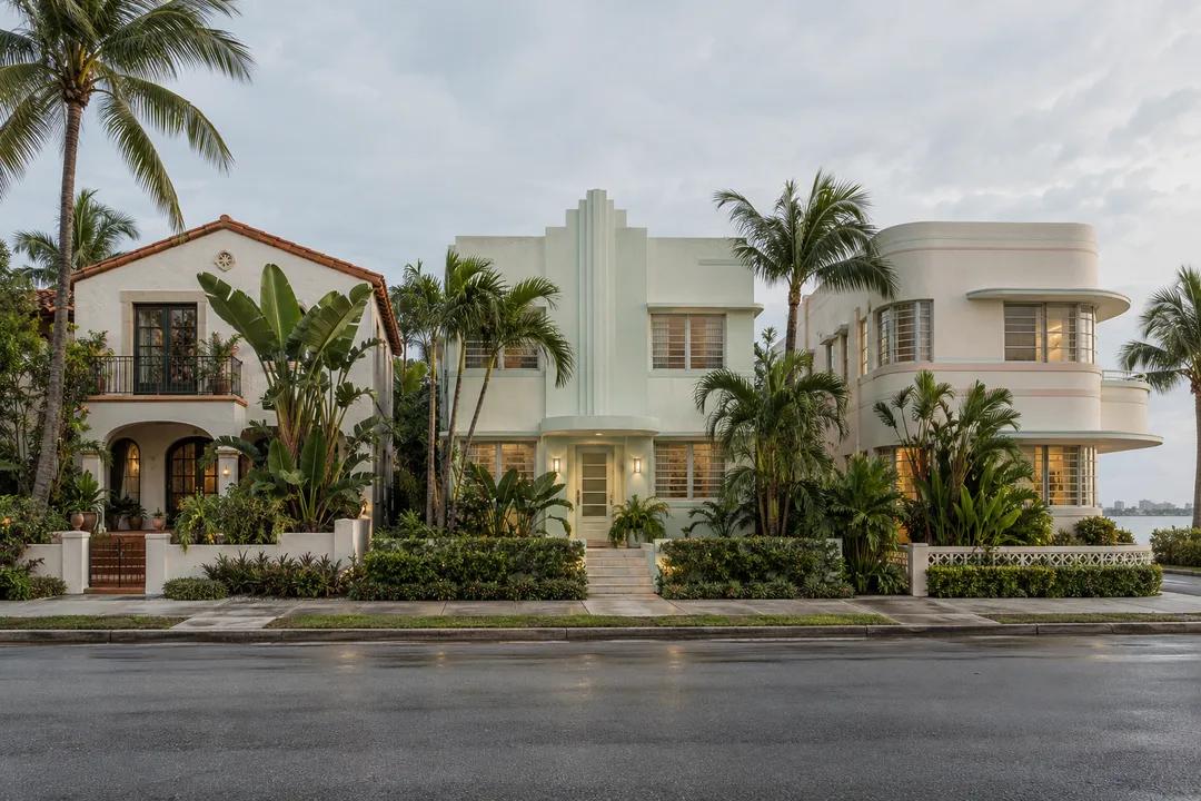
Heritage Historic District Miami: Read Bayside in 4 Parts
Bayside in Miami combines four historic subdivisions. Compare roof shapes, curved walls and the gaps between houses on a public-route architecture walk.
Bayside is an appealing place to resist the idea that historic Miami has one signature look. The residential district combines buildings from several phases of development, and the city's account identifies four separate subdivisions behind the present neighborhood. A heritage historic district visit here can be organized around that layered origin. Study how a frame house, a tiled roof and a rounded masonry frontage can belong to the same broader streetscape. The purpose is to understand coexistence, with all observations made from public routes and no assumption of entry into homes or waterfront land.
Four subdivision names explain the mixture
Elmira, Acadia, Baywood and Washington Place appear in the city's designation report as the subdivisions that became Bayside. Their plats date from different points between 1909 and 1925. Those names offer a better historical starting point than a single architectural slogan. A district assembled over time can contain an assortment of street forms, building shapes and frontage treatments without being a failed version of a uniform plan. Its variety is part of what the preservation account is trying to explain.
Keep a distinction between the date a subdivision was platted and the date a house was built. A line on a map prepared land for development, but buildings could follow later. This matters particularly when reading a neighborhood with several waves of construction. You cannot assign a house's age just by locating it inside the earliest plat. For the walk, use the subdivision history as context and let the visible buildings supply questions rather than exact dates.
The municipal overview situates Bayside generally east of Biscayne Boulevard, between NE 68th and NE 72nd Streets toward the bay. It is the residential historic district, not Bayside Marketplace downtown. Put the full district name in your planning notes to prevent that confusion. Choose one small area within the official mapped boundary. Attempting to cover every former subdivision in one continuous outing would make the history harder to follow, especially if the walk becomes dominated by navigation.
Start a comparison with an outline
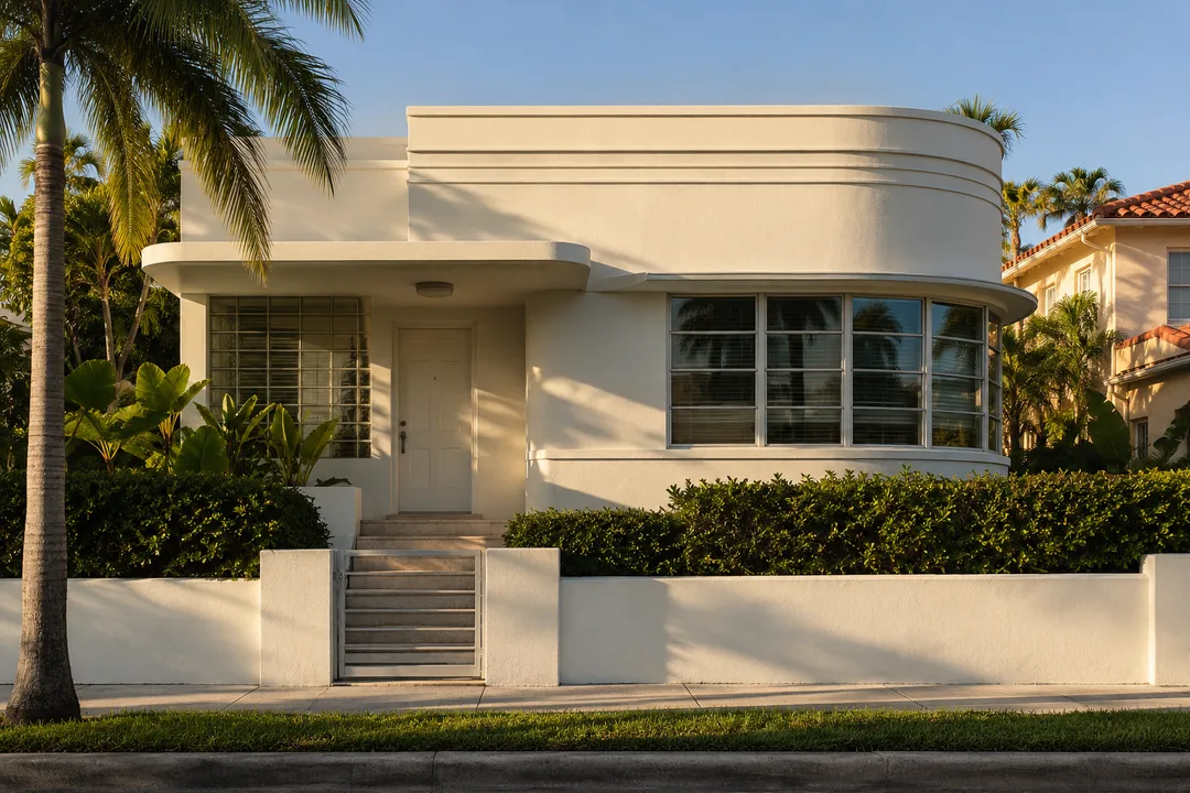
For the first building, ignore ornament and trace the upper edge. A sloping roof creates a different silhouette from a wall that continues upward into a parapet. The city identifies Mediterranean Revival, Art Deco and Streamline Moderne among Bayside's styles. Those labels are useful after you have described the outline in ordinary language. A pitched shape, a stepped edge or a rounded corner gives you something concrete to compare without pretending that a single element establishes a complete stylistic diagnosis.
Next, consider where the building seems to meet the ground. Does the main wall sit behind a visible porch, or does the front read as a more continuous surface? Planting may hide the answer. Treat that interruption as a limit of the view and move on to another visible characteristic. A comparison should not turn into a reason to approach a private entrance. Bayside's residential fabric remains meaningful even when much of an individual property is screened.
Choose a second frontage that changes the first question. If the first outline was strongly vertical, a low horizontal composition can make a productive partner. Describe the contrast in a short sentence that contains both subjects: the roof rises sharply, while the neighboring facade stretches across the lot. This kind of paired description is more useful than two separate compliments. It shows what the walk taught you about the relationship between buildings, rather than simply recording that each looked attractive.
A curve can redirect the whole facade
A rounded corner encourages the eye to travel around a volume. Horizontal bands can reinforce that movement, while a vertical central feature can interrupt it. Use those possibilities as a way to examine a Streamline Moderne reference in the city's style list. They are observation prompts, not a guarantee that the next house you encounter has a particular feature. If the view offers only straight-edged forms, that is the material for your comparison that day.
Stand where the public route lets you see the corner and the front together. The image changes as one plane becomes foreshortened. A curve that seemed dominant from one direction can become barely visible from another. That is why a sequence of small sketches often communicates more than one wide photograph. Mark the direction from which you looked. Without that note, two views of the same frontage can seem like evidence of two quite different buildings.
A tile roof introduces another kind of movement: repeated units across a sloping surface. Compare that texture with a broad, smooth-looking wall. The difference is visual, not a claim about original materials or construction quality. Repeated curves in tiles and a single curved corner operate at different scales. Noticing both provides a satisfying architectural subject even for a visitor who does not want a lesson in the full vocabulary of twentieth-century residential design.
Read the gap as carefully as the house
The interval between two frontages can reveal why varied architecture still feels like a neighborhood. You may notice similar apparent setbacks, comparable heights, or planting that connects otherwise different compositions. Another pair may show a sharper break. Avoid making uniformity the test of success. Bayside's historical importance includes successive phases of development, so a visible change can be just as interesting as a repeated feature. Give the gap its own line in your notes.
This is also a useful moment to separate an old report from a present-day condition. The designation document records the neighborhood at the time of its preparation. It should not be used as proof that a particular tree, fence, roof covering or access arrangement remains unchanged. Keep any observation of today's streetscape tied to the actual view. Historical context and current appearance belong in the same account, but they answer different questions and should not silently substitute for each other.
Practical Notes: a district study without a shoreline promise
Bayside's name describes its setting, but it does not make every waterside parcel public. This itinerary ends wherever your selected public route ends. Do not extend it through a garden, driveway or private waterfront to obtain a more complete circuit. Use the official district map for the study area and keep a separate ordinary route for returning to your starting point. A short visit with two strong comparisons is enough to understand the central idea.
Bring a notebook if the subdivision history interests you, and label the page Bayside Historic District, Miami. Use Karpo APP for a separate nearby search if you want to continue your day elsewhere. The accompanying pictures are AI architectural composites illustrating contrasting residential forms, not documentary images of named Bayside houses. Your own account should end with the actual difference you noticed: perhaps the meeting of a curve and a tile roof, or the unexpected visual link between two unlike frontages.
Ask Karpo for more information.
Keep reading
- Brickell Tailor Alteration Shop Finder: First Work Suit Fit
 Coconut Grove Tailor Alteration Shop Finder: Heat-Proof Fits
 Little Havana Tailor Alteration Shop Finder: Guayabera Fits