 Places To Eat Near Me in Williamsburg: Smorgasburg's Open-Air Vendors
Weekend Plans
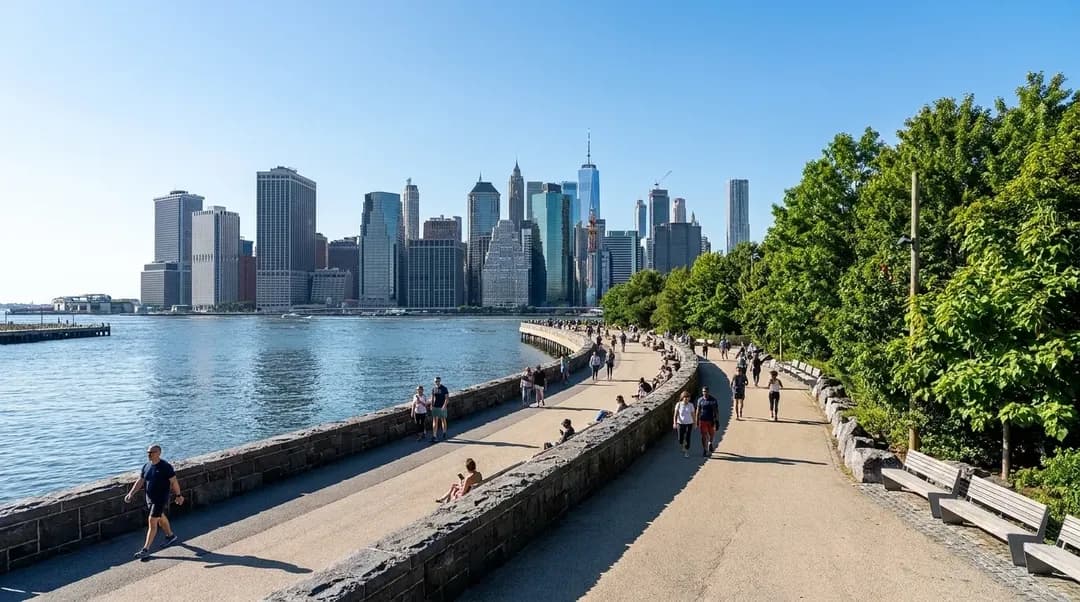
What to Know Before Choosing a Waterfront Plan Based on the Walk Back to Transit
The stretch between the water's edge and your subway station shapes everything from timing to comfort, yet most weekend plans skip this crucial piece of logistics until it's too late.
Picking a waterfront destination in New York City usually starts with the view, the park, or the food. But the experience often hinges on a detail most people don't consider until they're already tired: the walk back to the subway. That final stretch—whether it's a breezy ten-minute stroll or a shadeless thirty-minute trudge—shapes your energy, your schedule, and whether you'll actually want to return. According to the NYC Waterfront Public Access Study, about 80% of New Yorkers can reach at least one waterfront open space within 30 minutes by public transportation, and 99% within 60 minutes. Yet proximity to a station entrance doesn't tell the whole story. The terrain, the weather exposure, the availability of rest stops, and the presence of alternative routes all matter when you're heading home at the end of a long afternoon.
Text Karpo at (332) 334-2042 for a custom waterfront itinerary that factors in your transit line, your stamina, and the forecast.
Why the Return Trip Deserves Its Own Planning
Most waterfront outings follow a predictable arc: you arrive fresh, explore the park or promenade, eat, linger, and then face the return journey when your legs are tired and the sun has shifted. The walk back to transit is rarely the same experience as the walk in. Morning shade becomes afternoon glare. A gentle breeze turns into a headwind. The same route that felt scenic on the way out can feel punishing on the way back, especially if you've been on your feet for hours. The NYC Comprehensive Waterfront Plan emphasizes accessible, pedestrian-friendly streets and bicycle-friendly infrastructure to encourage healthy activity, but not every waterfront zone has achieved that standard yet. Some stretches still lack continuous shade, seating, or clear wayfinding, and those gaps become obvious when you're navigating them in reverse.
The distance itself is only part of the equation. A half-mile walk on a tree-lined street with benches every few blocks feels manageable. The same distance on an exposed industrial corridor with no place to rest can feel twice as long. The study notes that Southeast Queens faces the largest gaps in transit service and waterfront access, but even well-connected neighborhoods can present challenges depending on the specific route. Before committing to a waterfront plan, pull up a map and trace the path from the water back to your subway entrance. Check for parks, cafes, or shaded blocks where you can pause. Look for alternate routes if the direct path lacks infrastructure. If you're traveling with kids, older adults, or anyone with mobility considerations, this step moves from helpful to essential.
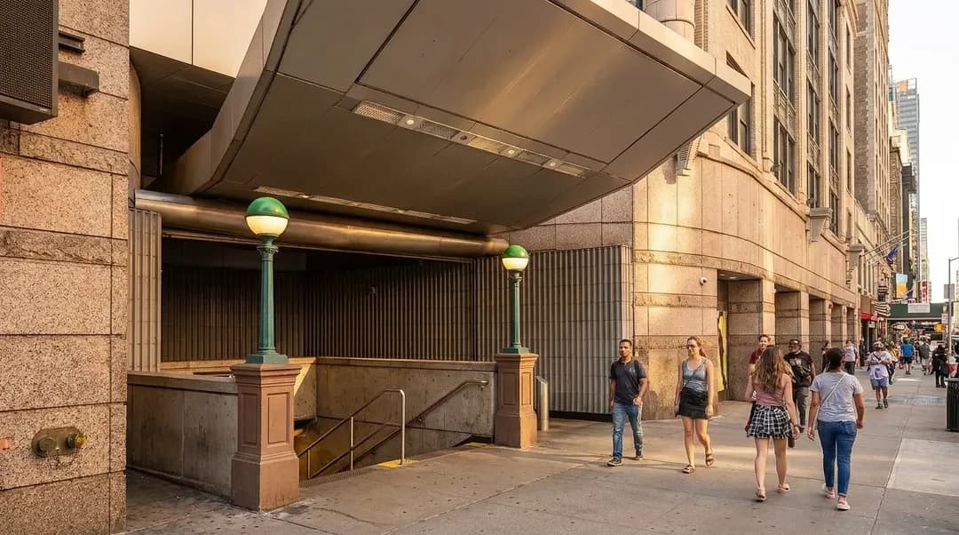
Evaluating Transit Proximity and Terrain
Not all waterfront-to-transit walks are created equal. A station might be a half-mile away on paper, but the route could involve crossing a highway, navigating construction zones, or climbing a steep grade. The Waterfront Public Access Study measured access within a half-mile walk and 30- or 60-minute transit trips, but those metrics don't capture the quality of the walking experience. A flat, well-maintained sidewalk with regular crosswalks is a different proposition than a route with broken pavement, long signal waits, or stretches where pedestrians share space with heavy truck traffic. Before you go, use street view to preview the route. Look for sidewalk width, crosswalk frequency, and the presence of barriers like fences or railyards that force detours.
Elevation matters more than most people expect. Waterfront parks are often at or near sea level, and the walk back to transit can involve a steady climb, especially in neighborhoods like Brooklyn Heights or parts of Astoria. A gentle uphill grade is manageable when you're fresh but can feel steep after a few hours in the sun. If you're planning a long waterfront day, consider whether the return route offers any elevation relief—a bus line that covers part of the climb, for example, or a different subway entrance that shortens the uphill stretch. The MTA's Transit-Oriented Development group promotes mixed-use development around stations to improve access, but until those improvements reach every waterfront corridor, you'll need to do your own reconnaissance.

Weather, Timing, and Contingency Routes
Weather transforms a waterfront walk. A route that feels pleasant at 70 degrees can become unbearable at 90, especially if there's no shade or water access along the way. The Comprehensive Waterfront Plan highlights that waterfront open spaces can bring heat relief, but that relief often ends at the park boundary. The walk back to transit may cross asphalt, concrete, and reflective surfaces that amplify heat. If you're planning a summer outing, check the forecast and the route's shade coverage. A 20-minute walk in full sun at 3 p.m. is a different experience than the same walk at 10 a.m. or 6 p.m. If the forecast shows high heat or humidity, consider shifting your schedule to arrive later or leave earlier, or choose a waterfront destination with a shorter, shadier return path.
Wind is another variable that often gets overlooked. Waterfront breezes feel refreshing when you're stationary, but they can slow your pace and drain your energy on the walk back, especially if you're heading into the wind. Rain changes the equation entirely: a route that's pleasant in dry conditions may lack covered segments or adequate drainage, turning a simple walk into a slog through puddles. Always identify a contingency route before you leave home. Is there a bus line that runs parallel to your walking path? A different subway entrance that's slightly farther but offers more shelter? A cafe or library where you can wait out a sudden downpour? The Waterfront Revitalization Program coordinates activities across waterfront locations, but individual route planning remains your responsibility.
Matching Waterfront Destinations to Your Transit Line and Stamina
The best waterfront choice depends on where you're starting and how much walking you're prepared to do. If you're coming from Manhattan and taking the 1 train, Riverside Park offers multiple access points with relatively short walks back to stations. If you're on the G train, the India Street or Greenpoint Avenue stops put you within a manageable walk of the Greenpoint waterfront, though the return route crosses industrial blocks with limited amenities. The F train to York Street connects to Brooklyn Bridge Park, but the walk back involves navigating tourist-heavy streets and a climb up to the station entrance. Each of these routes has trade-offs, and the right choice depends on your tolerance for crowds, hills, and exposure.
Stamina matters more as the day wears on. A morning visit might pair well with a longer walk because you'll have energy to spare. An afternoon outing after brunch and a few hours in the sun calls for a shorter, easier return route. If you're planning multiple stops—waterfront park, then lunch, then another park—map the cumulative walking distance and the transit connections between each segment. The Comprehensive Waterfront Plan envisions a 520-mile waterfront that's healthy, equitable, and resilient, but until every stretch meets that standard, you'll need to choose destinations that match your physical capacity and schedule. Don't let optimism about your energy level override practical route assessment. A waterfront day that ends with a exhausting slog back to the train is less likely to be repeated, no matter how beautiful the park was.
Practical Notes
- Preview the return route using street view before committing to a waterfront destination; check for shade, seating, and sidewalk quality.
- Identify a contingency route or nearby bus line in case weather, fatigue, or crowds make the primary path less appealing.
- Check elevation profiles if your waterfront destination is significantly below street level; a steady climb back to transit adds time and effort.
- Plan summer outings for early morning or late afternoon to avoid peak heat on exposed return routes; carry water regardless.
- If traveling with kids or older adults, choose waterfront spots with shorter, flatter walks back to transit and multiple rest options along the way.
- Save the address of a cafe, library, or covered space near your transit stop as a fallback if you need to pause or wait out weather.
- Test the route on a weekday if possible; weekend crowds, street fairs, or construction can alter walking times and available paths.
The waterfront itself is only half the experience. The walk back to transit determines whether you arrive home energized or depleted, whether you'll recommend the spot to friends or quietly cross it off your list. By treating the return route as a core part of your planning—checking terrain, weather, and contingencies before you leave—you turn a potential slog into a manageable close to a good day. The city's waterfront is expanding and improving, but until every corridor offers seamless pedestrian infrastructure, the responsibility for route intelligence falls on you. Choose destinations that match your transit line, your stamina, and the day's conditions, and you'll spend less time regretting the walk and more time enjoying the water.
Tags: #nycwaterfront #transitplanning #weekendplans #nycparks #walkablecity #waterfrontaccess #nycsubway #urbanplanning #nycsummer #pedestrianinfrastructure #transitoriented #nycoutdoors
All trademarks are the property of their respective owners.
Ask Karpo for more information.
Keep reading
- Places To Eat Near Me in Williamsburg: Smorgasburg's Open-Air Vendors
 Dinner Near Me in the West Village: Buvette's Tiny French Plates
 Best Restaurants Near Me in Midtown: Le Bernardin Holds Three Stars