Search waterfalls near me from San Francisco and you get Marin, Yosemite, or the one ornamental cascade in Golden Gate Park that every list has already written about. What does not get written about is that the city still has real running water in it — a creek that falls roughly 350 feet over about a mile through a canyon in the middle of a residential neighbourhood, spring-fed lakes, and seasonal seeps on the coastal bluffs. All of it is rain-fed, which is the fact the listicles leave out.
These are rain-fed, which means the difference between a canyon full of water and a dry gully is last week's weather. Ask Karpo whether the creeks are actually running before you drive out, and which trailhead to use given how much time you have.
Glen Canyon: the real one, in the middle of the city
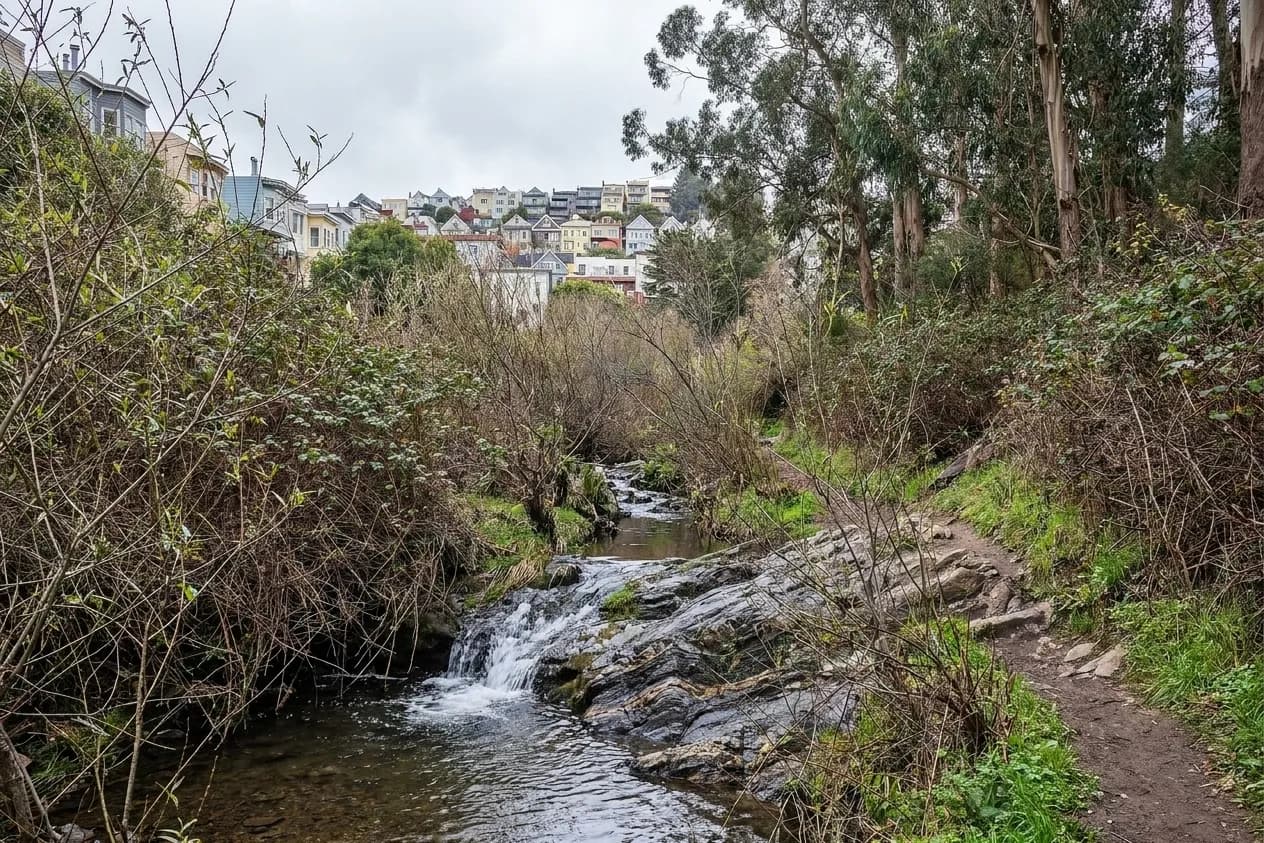
Glen Canyon Park is around seventy acres of canyon between Glen Park, Diamond Heights and Miraloma, and a branch of Islais Creek rises in it. That creek is the largest remaining creek in San Francisco with public access — most of the city's original watercourses were culverted a century ago — and it drops through willow thickets and chert outcrops on its way down the canyon floor. The rock walls are Franciscan chert, banded and folded, and considerably older than the city they sit under.
The canyon has had several previous lives that explain its shape: it was Adolph Sutro's Gum Tree Ranch, the site of the Giant Powder Company's dynamite works in the late 1860s, and an amusement park from 1889 until the early 1920s, before the city acquired the land and the WPA built the recreation centre in 1937. There are three practical ways in — from Bosworth Street at the southeast corner, up the wooden stairway at the end of Sussex Street, or from the Diamond Heights shopping centre at the top.
The honest caveat: when there is actually water
This is the part that gets omitted. San Francisco's rain falls almost entirely between November and April. From roughly August through October the creek in Glen Canyon is a trickle or dry, the coastal seeps are gone, and a trip planned around them is a walk in a dry gully. The best window is a few days after a decent winter storm, which is also when the canyon is greenest and the fewest people are in it. Go in February, not in September.
The coastal seeps at the northwest corner
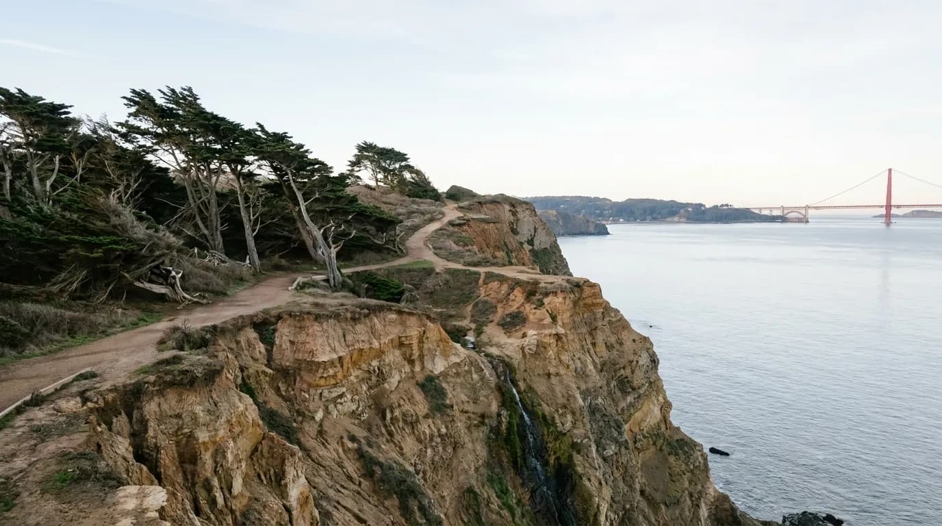
The bluffs between Lands End and the Sutro Baths ruins carry seasonal water after rain: small falls and seeps that appear on the cliff face and run straight to the ocean, then vanish for eight months. The Lands End trail along the top is one of the best coastal walks in any American city regardless of whether the water is running, with the shipwreck at low tide, the Sutro Baths foundations and the Golden Gate framed the whole way. Stay on the trail — these cliffs are actively eroding and the informal paths down them are genuinely dangerous.
Stern Grove and the last natural lake
Pine Lake, at the western end of Stern Grove, is one of the last natural lakes left in San Francisco, fed by an underground spring rather than by a pipe. The grove itself sits in a wind-sheltered hollow of eucalyptus and redwood that is fifteen degrees calmer than the streets above it, which is why the summer concert series has been held there since the 1930s. It is a twenty-minute walk from end to end and the most reliable green space on the western half of the city.
Practical notes
Go after rain, ideally two to four days later, when the creeks are running but the trails have drained. Wear real shoes: the canyon floor in Glen Canyon is mud and loose chert in winter. Dogs are allowed on much of Glen Canyon's trail network but the rules differ between the city park and the federal land at Lands End. There is street parking at the Bosworth entrance and around Diamond Heights; the Glen Park BART station is a ten-minute walk from the southeast trailhead, which is the easiest way in without a car. And check for trail closures after storms — sections of the Lands End bluff path close when the cliff moves.
The creeks that are still under the streets
Most of San Francisco's original watercourses were culverted between the 1860s and the 1930s and now run through the sewer system, which is why the city seems so dry. Traces remain if you know where to look: the low ground along Islais Creek's old course through Glen Park and the Mission, the springs that still feed Pine Lake and Mountain Lake, and the seasonal seeps that appear on the coastal bluffs after heavy rain.
A number of restoration projects have daylighted short stretches of buried creek elsewhere in the Bay Area, and there is a long-running local interest in doing more of it here. It makes a walk through Glen Canyon feel different once you know it is one of the last pieces of the original drainage still open to the sky.
Tags: #SanFrancisco #GlenCanyon #IslaisCreek #LandsEnd #SternGrove #SFHikes #HiddenSF #WaterfallsNearMe #SFOutdoors #UrbanNature #BayArea #WinterInSF #SFParks #WeekendInSF
Sources consulted: sfrecpark.org · nps.gov · sfwater.org
All trademarks are the property of their respective owners.
Ask Karpo first
Whether there is water in these canyons depends entirely on the last storm, and trail closures after rain are common. Ask Karpo if the creeks are running this week, which trailhead makes sense for the time you have, and what else is worth stopping for on the way back.