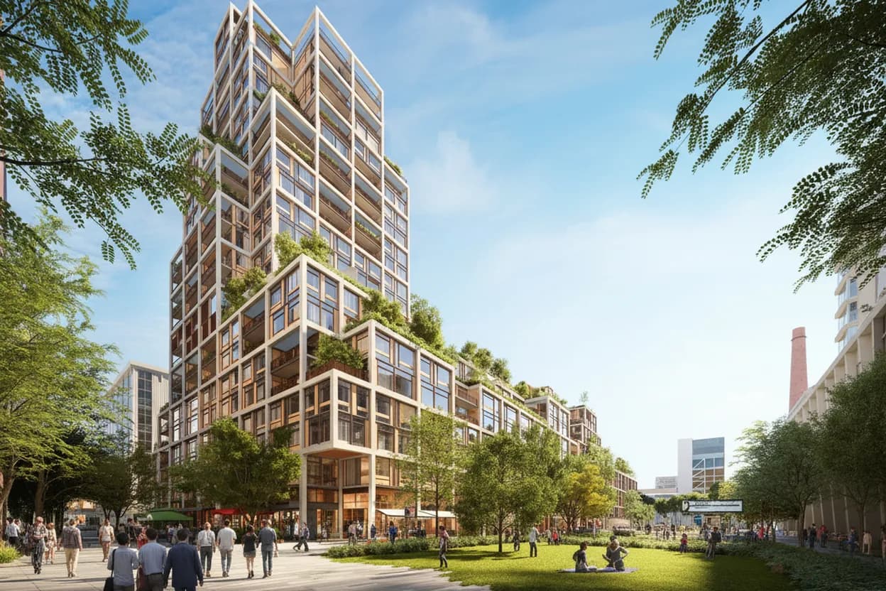
The elon musk terafab construction plan is not a San Francisco construction project: current reporting places the proposed SpaceX and Tesla semiconductor facility in Grimes County, Texas, near College Station. For SF readers, the useful local question is different. What does a mega-factory headline teach you about the city’s own smaller, denser innovation geography? Dogpatch, Pier 70, Mission Bay, and the Central Waterfront show the tradeoff clearly: research, life sciences, maker spaces, housing, transit, and old industrial land all competing on a few waterfront blocks. Use this guide for a curious solo daytime route, not a trespass hunt or rumor chase.
Want a tighter Dogpatch route before you leave? Text Karpo for current stops, transit checks, and backup indoor ideas around Pier 70, UCSF, and 22nd Street.

Dogpatch on 22nd Street Sets the Scale
Start on 22nd Street because it keeps the trend grounded. San Francisco’s own General Plan describes 22nd Street as Dogpatch’s neighborhood commercial heart, with Third Street linking the area to transit and waterfront industry. That matters when big factory news makes every city sound like a blank slate. Dogpatch is not empty land waiting for a headline. It is a small-scale residential, maker, retail, and production district where large projects have to fit around existing life.
This stop suits a solo reader who wants context more than spectacle. Walk during the day, keep to public sidewalks, and treat active driveways, loading doors, construction gates, and lab buildings as working sites. The main failure mode is expecting a tourable tech campus and finding normal city fabric instead. That is the point: San Francisco’s innovation landscape is legible through zoning edges, storefronts, transit stops, and adaptive reuse, not through a single giant facility.
Pier 70 Waterfront Shows the Industrial-to-Lab Tradeoff
Pier 70 is the clearest local comparison to a factory-scale story, because it began as heavy industrial waterfront and is being remade with housing, open space, maker uses, offices, labs, and historic buildings. The Port of San Francisco has described the 28-acre site as a former shipyard district with new waterfront parks, artist and manufacturing space, housing, and rehabilitated structures. Current project materials also emphasize public access to the Bay after more than a century of restricted waterfront edges.
Plan Pier 70 as an exterior-first stop unless you have confirmed a public event or open venue. Construction phases, leasing, and access points can change, and private project websites are not a substitute for posted conditions on site. The payoff is spatial: you can see why land-use fights around advanced manufacturing are never only about technology. They are also about public benefits, shoreline access, sea-level adaptation, job types, and how much city life can share the same parcel.
UCSF Life Sciences Building Site Adds a Real Lab Anchor
For a verified current development rather than a rumor, look at UCSF’s Life Sciences Building in Dogpatch at the historic Power Station site. UCSF Real Estate says construction started in September 2025, with expected completion in 2028, and describes a 300,000-gross-square-foot facility including proton therapy, multi-specialty clinics, and life sciences incubator space. That is a concrete San Francisco innovation project, not a recycled tech headline mapped onto the wrong city.
The practical move is to view the area as a perimeter read, not a destination lobby. Medical construction sites have safety boundaries, patient-care sensitivities, and changing pedestrian routes. If sidewalks are narrowed or blocked, use the posted detour without lingering at gates. The audience fit is strong for readers comparing Texas-style industrial scale with SF’s research-clinic-startup blend. The limitation is visibility: much of the important story is inside institutional planning, not visible from the curb.
T Third Street Keeps the Route Car-Light
Use Muni’s T Third Street line as the default transit spine for this guide. It is the corridor that makes Dogpatch, Mission Bay, Chase Center edges, Pier 70 approaches, and the Central Waterfront easier to connect without hunting for parking around construction zones. Check SFMTA before departure because schedules, alerts, platform conditions, and service changes are live operations, not evergreen facts. If the T is delayed, nearby bus, bike, rideshare, or walking segments may be more reliable.
Accessibility depends on the weakest link of the day: station elevators, curb ramps, construction fencing, crowding, and sidewalk conditions. Build a route with short hops rather than one long forced march, especially if you use a mobility device or need predictable seating. A good backup is to reduce the route to 22nd Street plus one waterfront edge. Missing one stop is better than pushing through an inaccessible detour or an industrial block with poor shade and few services.
Dogpatch Hub Works as the Human-Scale Backup
Dogpatch Hub at 1278 Minnesota Street is a useful reality check because it is a community gathering place, not a tech attraction. Its public materials list drop-in hours Tuesday through Saturday, 11:00 a.m. to 6:00 p.m., with summer Wednesdays open until 7:00 p.m.; still verify the same day before relying on it. In a route about innovation districts, a community room can be the most practical stop for pacing, rest, and local context.
Use the Hub as a backup if weather, construction, or transit makes the waterfront feel too effortful. It is best for solo visitors who want a lower-stakes pause, local notices, or a nearby public-facing anchor before returning to 22nd Street. Do not treat it as an office tour or guaranteed workspace. Check its calendar, respect program use, and have a second indoor option in Mission Bay or Potrero if a private event changes access.
Mission Bay Helps Separate Research From Rumor
Mission Bay is the broader research context behind the Dogpatch story. UCSF’s location materials identify Mission Bay as one of its San Francisco locations, and the Central Waterfront plan explicitly notes the area’s proximity to UCSF research and hospital facilities when discussing life-science uses nearby. That makes Mission Bay a better interpretive pair with Dogpatch than downtown office towers: it shows how clinical care, wet labs, biotech startups, housing, and transit can cluster without becoming a single-company megaproject.
The tradeoff is that Mission Bay can feel polished and institution-heavy compared with Dogpatch’s mixed industrial grain. If your goal is street-level discovery, keep Mission Bay brief and return south. If your goal is understanding how science facilities shape land use, spend more time there and less time searching for hidden labs. The failure mode is assuming every modern building is publicly accessible. Many are hospitals, research buildings, or private offices with security and patient privacy obligations.
Same-Day Verification at Pier 70 or SFMTA Decides the Trip
Before you go, make one final verification action: check SFMTA service alerts for the T Third Street and check the current Pier 70 or Dogpatch Hub pages for public access or events. This is not caution for its own sake. On a route shaped by construction, labs, waterfront redevelopment, and active transit, the conditions that affect your day are often operational rather than editorial: a platform change, sidewalk closure, private event, or weather shift.
If any key fact is unclear, downgrade the plan instead of forcing it. Choose a public sidewalk route along 22nd Street, view Pier 70 from open areas only, and skip anything that depends on a gate, lobby, or unconfirmed event. The best outcome is not seeing every innovation space. It is leaving with a sharper local answer: San Francisco’s tech future is negotiated block by block, not announced as one giant factory.
Tags: #SanFrancisco #Dogpatch #Pier70 #MissionBay #UCSF #CentralWaterfront #TechNews #UrbanPlanning #HiddenGems #TransitGuide #SoloDay #InnovationDistrict #AskKarpo #BeforeYouGo
Sources consulted: Source 1: houstonchronicle.com · Source 2: generalplan.sfplanning.org · Source 3: sfmta.com · Source 4: realestate.ucsf.edu · Source 5: sfport.com · Source 6: dogpatchhub.org
All trademarks are the property of their respective owners.
Ask Karpo first
Tell Karpo your date, group size, budget, and starting point. We’ll check current access, timing, transit, and the cleanest San Francisco plan for Dogpatch neighborhood innovation labs before you head out.


