 El Sereno Urban Staircase Walk Planner for a Study Break
Free Things to Do
West Hollywood Scenic City Skyline Viewpoint Walks
Walk a West Hollywood scenic city skyline viewpoint route from Sunset Strip terraces to San Vicente plazas using Karpo APP to plan hill stops.
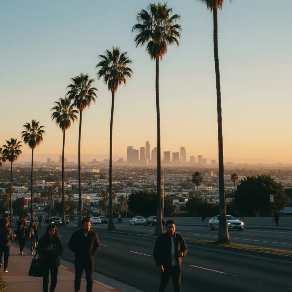
Pausing at the top of the La Cienega Boulevard slope where it meets Sunset Boulevard, the ground drops sharply southward beneath rows of tall Washingtonia palms to reveal the entire flat carpet of the Los Angeles basin stretching from the high-rise clusters of Century City to the distant towers of Wilshire Boulevard and Downtown. Finding a free scenic city skyline viewpoint in West Hollywood means taking advantage of this natural geological shelf where the Santa Monica Mountains and Hollywood Hills meet the coastal plain. Incorporated as an independent city in 1984, West Hollywood pairs high foothill boulevards along the Sunset Strip with modern terraced civic parks along San Vicente Boulevard. Using the Karpo APP to sequence upper boulevard overlooks and lower park plazas helps you capture both southward basin horizons and northward hillside profiles in one afternoon.
Sunset Plaza Sidewalk Balconies And The La Cienega Southward Axis
Between Crescent Heights Boulevard and Doheny Drive, Sunset Boulevard winds along a natural foothill bench several hundred feet above the flat grid of Melrose Avenue and Beverly Boulevard below. Around Sunset Plaza, first developed in the 1920s and 1930s with white Georgian Revival storefronts and open brick sidewalk terraces, the southern curb acts as a continuous public balcony over the Westside. Standing on the public sidewalk between Sunset Plaza Drive and Queens Road lets you look out across miles of low-rise Spanish Revival roofs toward the gleaming twin triangular towers and glass high-rises of Century City to the southwest.
Walking east along the southern sidewalk of Sunset Boulevard to the crest of La Cienega Boulevard and Alta Loma Road shifts your view straight down one of the most dramatic north-south street slopes in the city. From this upper corner, the straight ribbon of La Cienega Boulevard points south toward the Baldwin Hills while the Miracle Mile and Downtown Los Angeles towers line the eastern horizon. Saving the Sunset Plaza and La Cienega intersections inside the Karpo APP ensures you position yourself along the southern sidewalk before golden hour begins.
Holloway Drive Overlooks And Queens Road Foothill Lanes
Just east of La Cienega Boulevard, where Holloway Drive branches diagonally down from Sunset Boulevard toward Santa Monica Boulevard, the terraced hillside grade creates wide diagonal sightlines toward the eastern skyline. Walking a short block up the public sidewalks of Queens Road or Kings Road just north of Sunset Boulevard lifts your eye level above the boulevard billboards and tree canopies without requiring a long mountain hike. Historic stucco courtyard apartments and lush hillside retaining walls frame the descending road geometry below.

From these quiet lower-foothill residential corners, architectural walkers can frame the mid-rise Art Deco and Streamline Moderne apartment towers built along Fountain Avenue and Harper Avenue in the 1930s against the distant skyscrapers of the Wilshire corridor. Dog walkers, music historians exploring the classic rock landmarks of the Strip, and portrait photographers use the late-afternoon shade of the hillside retaining walls to study the changing light over the basin. Keeping these short side-street spurs saved in the Karpo APP gives you quieter viewing angles steps away from the main boulevard.
West Hollywood Park Elevated Terraces And Pacific Design Center Views
Descending south down San Vicente Boulevard between Santa Monica Boulevard and Melrose Avenue brings you to West Hollywood Park, comprehensively rebuilt between 2011 and 2022 with sweeping grand staircases, elevated public deck terraces, and open lawns beside the West Hollywood Library. Climbing the exterior public stairs to the upper plaza levels gives you a striking architectural viewpoint looking west toward the monumental glass volumes of the Pacific Design Center, whose blue building designed by Cesar Pelli opened in 1975, and looking north toward the steep green ridge of the Hollywood Hills.
Unlike the southward basin vistas from the Sunset Strip, the elevated park terraces on San Vicente Boulevard let you look back up at the terraced villas and palm silhouettes crowning the Sunset hillside. Neighbors reading outside the library, lap swimmers heading to the aquatic center, and families gathering on the lawn give the civic plaza an inviting community rhythm. Pairing the upper Sunset Strip balcony with the lower West Hollywood Park terraces inside the Karpo APP creates a downhill walking route that covers both perspectives.
Afternoon Traffic Glare To Skip And Bus Corridor Backups
Skip walking along the narrowest northern curb cuts of Sunset Boulevard west of Sanborn Avenue during weekday evening rush hour if you want a calm pedestrian environment, as commuter traffic moving toward Beverly Hills fills the western lanes. Stay on the wide brick-paved southern sidewalks around Sunset Plaza and La Cienega Boulevard instead. You should also skip shooting directly southwest into the blinding mid-afternoon sun between two and four o'clock when marine haze obscures the Century City towers, waiting until the final hour before sunset when warm side-light defines the skyline.
Whenever evening temperatures drop or rare winter rain showers pass through the basin, step directly onto Metro Bus Line 2 along Sunset Boulevard, Metro Bus Line 4 along Santa Monica Boulevard, or Metro Bus Line 105 along La Cienega Boulevard. The covered public walkways outside the West Hollywood Library on San Vicente Boulevard, opened in 2011, provide convenient shelter near the bus stops while you check your saved transit notes in the Karpo APP.
Pacing A Downhill Sunset Walk From Sunset Plaza To San Vicente
An effortless ninety-minute West Hollywood skyline walk starts on the upper southern sidewalk of Sunset Plaza two hours before sunset, strolling east along Sunset Boulevard past Queens Road to the crest of La Cienega Boulevard. Working from west to east along the hillside shelf lets you watch the late-afternoon light gradually warm the eastern Miracle Mile and Downtown Los Angeles towers while keeping the steep terrain behind you.
Forty minutes before sunset, pause at the corner of Sunset Boulevard and La Cienega Boulevard or Alta Loma Road as the sun sinks over Santa Monica Bay and turns the Century City high-rises gold, then walk south down the gentle slope of San Vicente Boulevard to finish on the elevated terraces of West Hollywood Park at twilight. Reviewing this downhill progression in the Karpo APP before you start guarantees you never have to climb the steep La Cienega grade at the end of your outing.
Ask Karpo for more information.
Keep reading
- El Sereno Urban Staircase Walk Planner for a Study Break
 Santa Monica Urban Staircase Walk Planner Before Meetings
 Mount Washington Urban Staircase Walk Planner: Hike Prep