 El Sereno Urban Staircase Walk Planner for a Study Break
Free Things to Do
Pasadena LA Scenic City Skyline Viewpoint Walk Guide
Walk a Pasadena LA scenic city skyline viewpoint route from Civic Center axes to Colorado Street Bridge using Karpo APP to plan canyon stops.
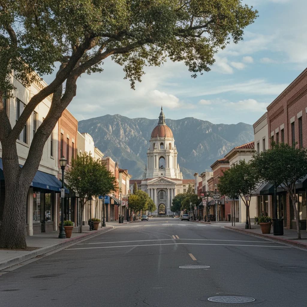
Looking east down the brick-lined corridor of Holly Street from the edge of Memorial Park, the two-hundred-six-foot Spanish Baroque dome of Pasadena City Hall rises directly in front of the rugged five-thousand-foot wall of the San Gabriel Mountains. Planning a scenic city skyline viewpoint walk in Pasadena brings together two monumental facets of Southern California civic design. In the eastern heart of Old Pasadena, axial Beaux-Arts boulevards frame historic tiled domes and mid-rise towers against Alpine mountain peaks, while at the western rim of the neighborhood, the soaring arches of the Colorado Street Bridge suspend walkers one hundred fifty feet above the Arroyo Seco canyon. Using the Karpo APP to connect the Civic Center axis with the western canyon rim lets you experience both architectural vistas in one afternoon.
Holly Street Axial Corridor And Centennial Square Dome Sightlines
Laid out under the 1923 Bennett Plan to give Pasadena a grand European-style civic core, the intersection of Holly Street and Garfield Avenue creates a dramatic east-west visual corridor. Standing near the western end of Holly Street by the Memorial Park Metro A Line station, your view funnels past historic brick commercial facades straight to the tiered cupola and red-tiled dome of Pasadena City Hall, designed by Bakewell and Brown and completed in 1927. Behind the classical stone rotunda, the steep granite ridges of Mount Wilson and the San Gabriel range tower over the city.
Walking east into Centennial Square in front of the courtyard arcade gives photographers a wide plaza foreground where cast-iron lampposts, olive trees, and stone fountains frame the civic skyline. Because Pasadena preserves strict sightline protections around its historic core, modern commercial buildings step back along Walnut Street and Colorado Boulevard so the 1927 dome remains the undisputed crown of the horizon. Saving the Holly Street and Garfield Avenue axis inside the Karpo APP ensures you capture the western facade when late-afternoon sunlight turns the stucco and stone warm gold.
Colorado Street Bridge Pedestrian Alcoves Above The Arroyo Seco
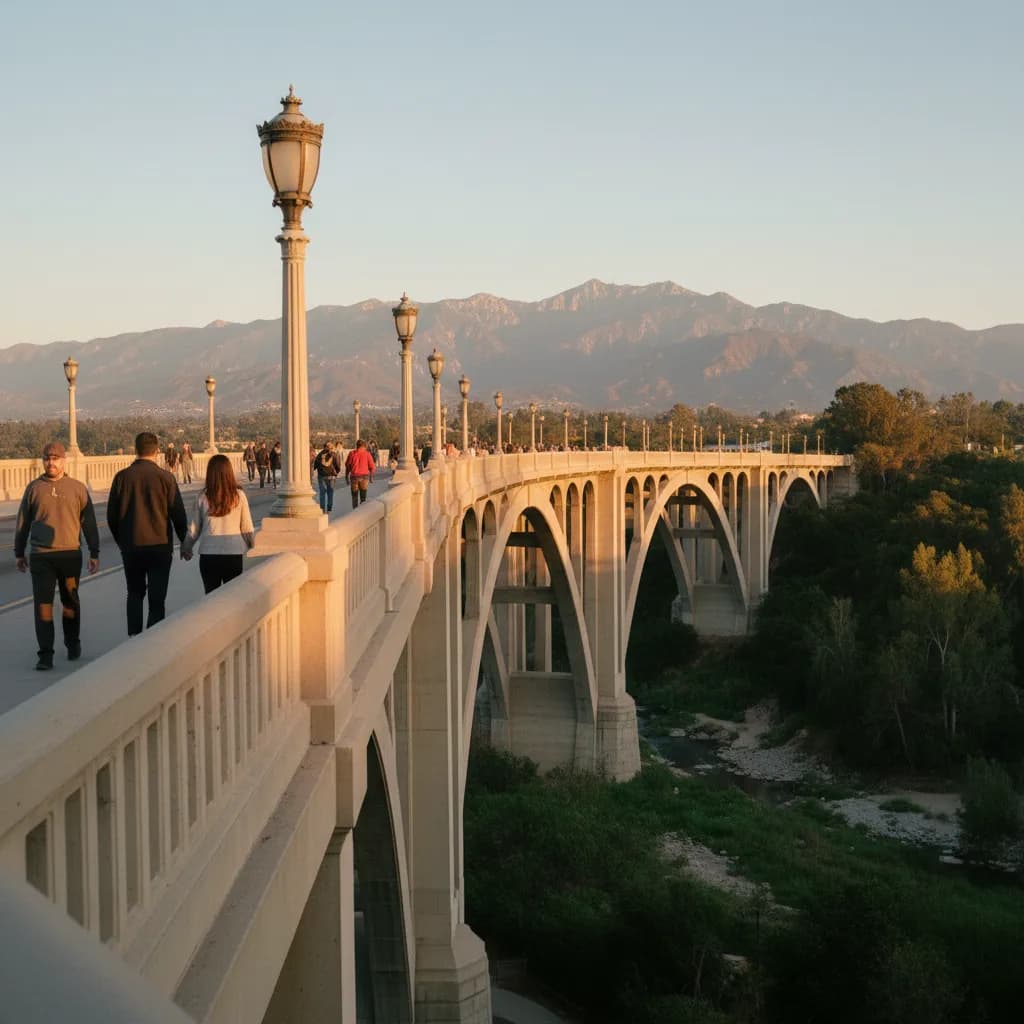
From Old Pasadena, following Colorado Boulevard or Green Street west across Orange Grove Boulevard leads to the eastern approach of the Colorado Street Bridge, a Beaux-Arts masterpiece completed in 1913 and listed on the National Register of Historic Places in 1981. Spanning nearly fifteen hundred feet in a graceful fifty-degree curve across the deep gorge of the Arroyo Seco, the bridge rises one hundred fifty feet above the canyon stream bed on nine open-spandrel concrete arches.
Protected pedestrian sidewalks and semicircular viewing alcoves project above each concrete pier along the span, allowing walkers to pause safely away from the two-lane roadway. Looking north from the mid-span alcoves reveals the parallel steel-and-concrete arches of the 1953 Pioneer Bridge, the oak-shaded floor of the Arroyo Seco, and the full sweep of the San Gabriel Mountains rising behind West Pasadena. Turning west and south looks over the wooded ridges of the San Rafael Hills toward the Highland Park valley. Keeping the eastern bridge approach at Defender's Parkway saved in the Karpo APP anchors the western half of your walk.
Orange Grove Boulevard Rim And Defender's Parkway Overlooks
Before stepping onto the bridge deck itself, the parkway lawns at the intersection of Orange Grove Boulevard and Colorado Boulevard around Defender's Parkway offer an elevated rim vantage point where you can view the entire curved profile of the 1913 concrete arches from the side. Walking a short block south along Grand Avenue or Arroyo Terrace along the eastern bluff of the Arroyo Seco places you among historic Craftsman residences built during the early twentieth century by architects Charles and Henry Greene.
Open breaks along the canyon rim near Vista del Arroyo and the western end of Green Street let you look across the gorge at the sweeping concrete viaduct arches glowing in the late-afternoon sun while the Pasadena skyline rises to the east. Local architectural historians, plein-air watercolorists, and evening strollers use these shaded rim sidewalks because the mature camphor and oak trees keep the walk cool even on warm autumn afternoons. Recording the Orange Grove Boulevard and Green Street junction in the Karpo APP links the residential bluff seamlessly to the bridge walkway.
Midday Canyon Glare To Skip And Metro A Line Transit Backups
Skip walking the exposed span of the Colorado Street Bridge at midday during August and September heat spikes, when temperatures in the San Gabriel Valley climb and overhead sunlight flattens the relief shadows on both the concrete bridge arches and the mountain ridges. Schedule your walk during the final ninety minutes before sunset when pink and purple alpenglow washes across the San Gabriel peaks and the vintage bridge globes flick on. You should also skip crossing the busy traffic lanes of Orange Grove Boulevard outside marked crosswalks, using only the signalized intersections at Colorado Boulevard and Green Street.
Whenever mountain breezes cool the canyon after dusk or winter rain showers develop, catch Pasadena Transit Route 10 along Colorado Boulevard and Green Street back to Old Pasadena, or walk directly to the Memorial Park station or Del Mar station on the Metro A Line light rail. The arched stone colonnades inside the 1927 Pasadena City Hall courtyard and the covered historic brick alleys of One Colorado off Fair Oaks Avenue provide dry shelter while you review your saved transit connections in the Karpo APP.
Sequencing An Afternoon Walk From The Arroyo Rim To City Hall
For the best lighting on both the canyon bridge and the civic skyline, ride Pasadena Transit Route 10 west to Orange Grove Boulevard two hours before sunset and begin at Defender's Parkway on the eastern rim of the Arroyo Seco. Walk out across the curved pedestrian alcoves of the Colorado Street Bridge while afternoon sunlight illuminates the canyon floor and the 1953 Pioneer Bridge to the north.
One hour before sunset, stroll back east along tree-shaded Green Street or Colorado Boulevard through Old Pasadena, turning north on Raymond Avenue to Holly Street so you approach Centennial Square thirty minutes before dusk. Watching the final golden rays and pink mountain alpenglow illuminate the 1927 Pasadena City Hall dome against the San Gabriel peaks gives you a dramatic finale just one block from the Memorial Park Metro A Line station. Checking this west-to-east route in the Karpo APP keeps your afternoon walk perfectly timed.
Ask Karpo for more information.
Keep reading
- El Sereno Urban Staircase Walk Planner for a Study Break
 Santa Monica Urban Staircase Walk Planner Before Meetings
 Mount Washington Urban Staircase Walk Planner: Hike Prep