 El Sereno Urban Staircase Walk Planner for a Study Break
Free Things to Do

Pasadena Scenic City Overlook Trail Along the Arroyo Seco
Follow a free Pasadena scenic city overlook trail from Old Pasadena across the 1913 Colorado Street Bridge, down into the Arroyo Seco and around the Rose Bowl.
Pasadena's best scenic city overlook trail follows a canyon rather than a summit. The Arroyo Seco cuts along the western side of the city, and the walk from Old Pasadena to its edge rewards you with a sweeping view of the Colorado Street Bridge, the San Gabriel Mountains and a green valley floor that feels far from the freeway. Drop down to the trails along the stream bed, then circle the Rose Bowl for the mountain view. Every stop is public and free, and the route works well for a slow weekend morning.
Setting Off From Old Pasadena
Old Pasadena's brick commercial blocks along Colorado Boulevard date largely from the late nineteenth and early twentieth centuries, and they make an easy starting point with plenty of coffee and breakfast choices. Walk west on Colorado Boulevard past the Norton Simon Museum, whose sculpture garden is visible from the sidewalk. Within twenty minutes the land begins to fall away to the west, and the arroyo opens in front of you.
The Colorado Street Bridge
The Colorado Street Bridge opened in 1913 and carried traffic on the old route toward Los Angeles. Its long curve of concrete arches, built to follow solid ground across the canyon, became one of the most photographed structures in Southern California and is listed on the National Register of Historic Places. Walk across on the sidewalk to feel the height, and notice the ornate lamp posts and railings. Taller safety barriers were added in recent years, so expect some fencing in your photos. The best angle of the whole bridge is from below.
Looking Across From the Courthouse Grounds
On the eastern lip of the canyon stands the grand former Vista del Arroyo Hotel, built in the 1920s and now home to a federal appeals court. Its terraced gardens and the streets around it offer some of the classic views of the bridge, especially in late afternoon when the arches turn gold. This is a working court building, so stay on public sidewalks and follow posted access signs. The view sweeps south down the arroyo and north toward the mountains.
Down Into the Lower Arroyo
From the end of the bridge, paths lead down into Lower Arroyo Seco Park, a long strip of oak and sycamore woodland along the stream bed. Walk south on the trail and the bridge rises dramatically overhead before you pass under it. Further along you will find the casting pond, where members of a fly casting club practice in an open pool, and quiet benches beside the trees. The trail is mostly level and shaded, a welcome change after the busy boulevard above.
Circling the Rose Bowl
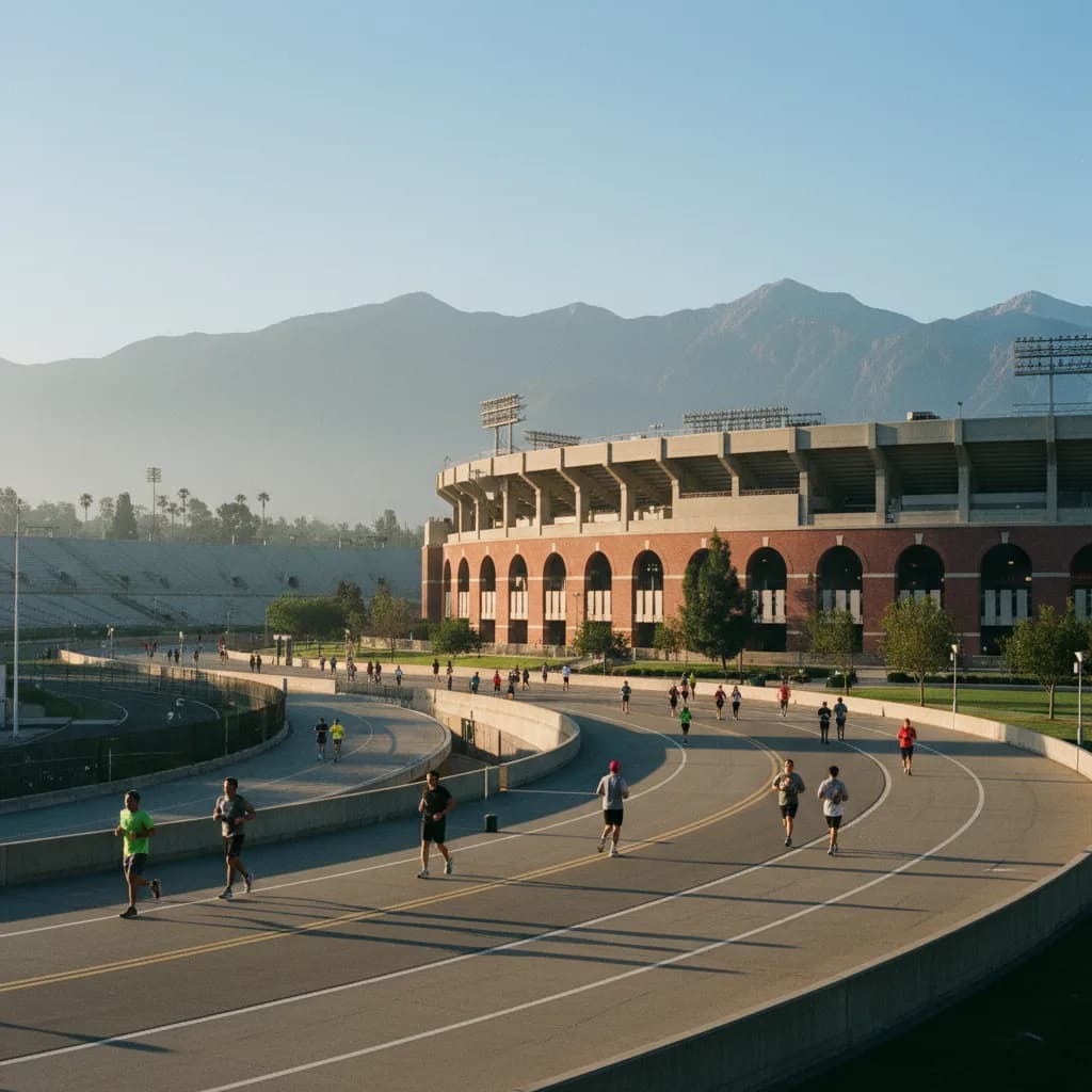
Head north through the arroyo to Brookside Park and the Rose Bowl stadium, which opened in 1922 and hosts the famous New Year's Day game. A paved loop of roughly three miles circles the stadium and the neighboring golf course, and it is one of the most popular walking and running routes in the region. The northern side of the loop faces the San Gabriel Mountains head on, and after winter storms you may see snow on the higher peaks. Bike and pedestrian lanes are separated, so keep to the correct side.

The Wildlife You May Spot
Even in the middle of a busy city, the arroyo shelters a surprising amount of wildlife. Red-tailed hawks circle over the canyon, ravens patrol the bridge railings, and herons sometimes wade in the shallow pools of the stream. Lizards sun themselves on warm rocks beside the trail. In the cooler hours you may hear woodpeckers in the oaks and sycamores. Bring binoculars if you have them, keep dogs leashed near the water, and give any animals plenty of space. Local naturalist groups lead occasional bird walks here, and their notes are a good way to learn what is seasonal.
A Civic Finish at City Hall
Return east toward downtown and end at Pasadena City Hall, completed in 1927 with a domed tower and a fountain courtyard that is open to visitors. The courtyard is a peaceful spot to rest, with arcades framing the dome above. From the steps you look east down the civic axis of tree-lined streets. It is not a high viewpoint, but it closes the walk with one of the city's best-loved buildings.
A Note on the Foothills
Many hikers associate Pasadena with trails up the San Gabriel foothills above Altadena. The January 2025 Eaton Fire burned large parts of that area, and several trailheads and facilities were damaged or closed for recovery. This route stays in the arroyo and city streets on purpose. If you plan to add a foothill hike, read the latest notices from the city and county park agencies before you go, and respect any fences or closures.
Timing Your Walk
Mornings are cool and the Rose Bowl loop fills with runners, cyclists and families. Late afternoon gives the warmest light on the bridge. Summer heat in the arroyo can be intense, so bring water. Major events at the Rose Bowl, including the monthly flea market and football games, can close parts of the loop and fill nearby streets, so look at the stadium calendar before choosing a date.
Plan It With Karpo
Tell Karpo in the Karpo APP that you want breakfast in Old Pasadena, the bridge, the arroyo trail and the Rose Bowl loop within half a day. Karpo can suggest an order for these stops and nearby places to eat or rest. It does not track event closures or weather in real time, so read the stadium calendar and forecast ahead of time.
Practical Notes
Wear comfortable walking shoes, because the arroyo paths are dirt and can be uneven near the stream. Public restrooms are available at Brookside Park and around the Rose Bowl. The Metro A Line serves Memorial Park and Del Mar stations near Old Pasadena, making it easy to arrive without a car. Plan on three to four hours for the full route, or skip the Rose Bowl loop for a shorter two hour version.
Ask Karpo for more information.
Keep reading
- El Sereno Urban Staircase Walk Planner for a Study Break
 Santa Monica Urban Staircase Walk Planner Before Meetings
 Mount Washington Urban Staircase Walk Planner: Hike Prep