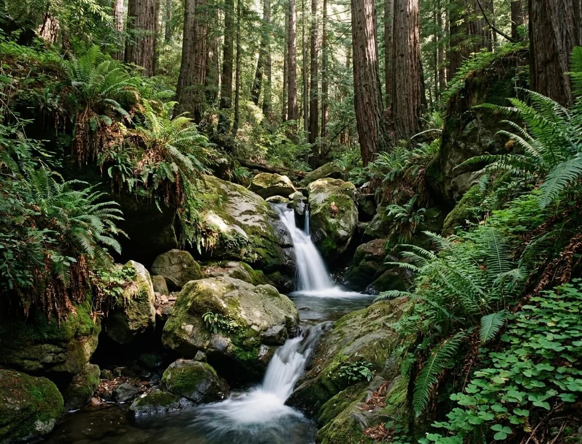
The most common mistake with waterfalls and nature near San Francisco is treating the falls as a fixed feature. They are not. Most of the ones worth seeing in this region are rain-fed and seasonal, running hard from December through April and reducing to a damp streak or nothing at all by late summer. The trail is open year-round. The waterfall is a winter and spring phenomenon, and planning a September trip around one is how people end up standing in front of a wet rock.
Flow depends entirely on recent rain and varies week to week. Ask Karpo whether the falls near you are actually running before you drive out.
The seasonal rule, stated plainly
Rain in this region falls between roughly November and April. Creek flow peaks a few days after a decent storm and tails off over the following weeks. That gives you a good window from late December to early April for the rain-fed falls, a marginal one in November and May, and effectively nothing from June to October unless the fall is spring-fed.
Spring-fed is the exception worth knowing. A small number of falls in the Bay Area run from underground sources and flow year-round at a reduced rate. Those are the ones to aim for in autumn, and they are the reason it is worth asking what feeds a waterfall rather than just where it is.
Mount Tamalpais, the reliable one
The Cataract Falls trail on the flank of Mount Tam is the classic Bay Area waterfall hike and the one most worth doing. From the trailhead at Alpine Lake it climbs steeply beside the creek through redwoods and mossy oaks, passing a whole sequence of cascades rather than a single drop. The round trip to Laurel Dell is a little over three miles, and the wider trail network on the mountain lets you extend it into a full day if you want.

It is genuinely spectacular after rain and genuinely underwhelming in September, when the creek is often dry. It is also steep and the steps are uneven and slick when wet, which is exactly when people go. Proper footwear matters here more than on most Bay Area trails.
Point Reyes, and the long one
Alamere Falls is the region's most photographed waterfall for a good reason: it drops over a sandstone cliff directly onto the beach and into the Pacific, which is a rare formation anywhere in the world. It is also a serious undertaking — the standard round trip runs close to fourteen miles, mostly flat, through Douglas fir forest and past a chain of freshwater lakes before reaching the coast.
Treat it as a full day rather than an afternoon. Start early, carry water, and check the access route before you go, because the final descent to the falls has been the subject of closures and rerouting over the years. It is best in winter and spring, like everything else here.
The shorter, easier options
Not every trip needs to be a fourteen-mile day. There are short waterfall walks in the redwood parks of the East Bay and the Santa Cruz Mountains that run one to three miles round trip and are entirely manageable with children or without much fitness. These are the right choice for a half day, and several of them keep at least a trickle later into the year than the Marin creeks do.
The trade-off is crowds. Short, accessible, well-signposted trails near a large city are busy on any pleasant weekend, and the parking at the popular ones fills before ten. Going on a weekday, or arriving at eight, changes the experience completely.
Practical notes that save the day
Check for closures before you leave. Bay Area canyon trails close regularly after storms, fires and landslides, and a park being open does not mean every trail in it is. The relevant park authority's own page is the only reliable source; third-party trail apps lag by weeks.
Mobile signal is absent in most of these canyons, so download the map before you set off. Bring more water than the distance suggests, because the climbs are steeper than the mileage implies. And go early — not for the light, but because the parking areas at the trailheads are small and the alternative is a long roadside walk before the hike even starts.
If it has not rained
Getting there without a car
Most of these trailheads are genuinely hard to reach on public transport, and pretending otherwise wastes people's Saturdays. The realistic car-free options are the East Bay regional parks, which several transit lines reach directly, and the redwood parks north of the bridge served by the Marin bus network at weekends. Mount Tam is reachable by a combination of ferry and bus with patience; Point Reyes effectively is not.
If you are hiring a car for the day, share it — trailhead parking is the binding constraint on every popular Bay Area hike, and four people in one car is both cheaper and considerably more likely to find a space than two cars carrying two people each.
If it has not rained
Go anyway, but go for the forest rather than the falls. The redwood canyons on Mount Tam and in the East Bay parks are worth the trip in their own right, and a dry creek bed in October is a perfectly good walk if that is what you came for. The disappointment is entirely a function of expectation, and adjusting it in advance costs nothing.
Tags: #SanFrancisco #BayAreaHikes #Waterfalls #MountTam #PointReyes #CataractFalls #AlamereFalls #DayTrip #NatureNearSF #HiddenGems #Outdoors #BayArea #WeekendHike
All trademarks are the property of their respective owners.
Ask Karpo first
Ask Karpo which waterfall hikes near you are flowing right now, how long the drive is, and whether the trail is currently open.