 Chinatown New in Town Weekend Planner: Errands and Temples
Weekend Plans
Clarke Quay Scenic Waterfront Trail: 3km River Loop Route
Take this 3km Clarke Quay scenic waterfront trail in Singapore for free. Follow historic quayside bridges with cool evening breezes and open paths.
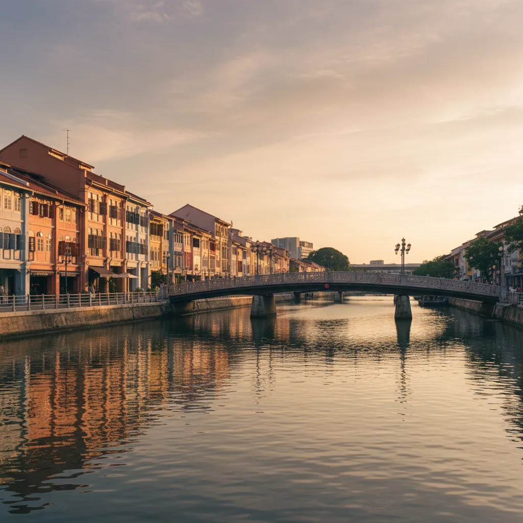
Discovering a scenic waterfront trail near me along the Singapore River offers an unforgettable blend of tranquil waterway breezes and colonial maritime heritage. Extending approximately three kilometers between Clarke Quay and Robertson Quay, this pedestrian-only riverfront circuit follows paved embankments, historic iron bridges, and leafy quayside corridors. Completely free of traffic lights and street crossings, the route invites walkers to experience the living artery of historic Singapore where century-old warehouse architecture meets modern waterside leisure under the shade of mature riverside trees. The entire path remains open to the public free of charge throughout the day and evening.
Departing from Clarke Quay Central Promenade
Setting off from Clarke Quay MRT station Exit G places you directly on the southern promenade of the Singapore River. Unlike open coastal paths exposed to maritime chop, the river water here flows gently between historic masonry embankments constructed during the nineteenth-century colonial shipping boom. Restored pastel-colored godowns and shophouses face the water, creating an intimate urban corridor where wide stone footpaths keep walkers securely isolated from vehicle roads. Late afternoon brings long cooling shadows cast by surrounding colonial civic structures, making the initial stretch along Merchant Court remarkably comfortable before evening sets in. The path is paved with durable granite setts that offer dependable grip in any weather. Looking across the water reveals the historic riverside warehouses that once held gambier, nutmeg, and pepper brought by merchant lighters.
Crossing the Landmark Read Bridge
Stepping onto Read Bridge brings you across a central pedestrian landmark completed in 1889, historically nicknamed the Malacca Bridge by early river lighters. Named after prominent nineteenth-century merchant William Henry Read, the crossing was reconstructed into its current beam structure in 1889. The wide concrete and steel deck spans fifty meters without roadway traffic, functioning as a vibrant public gathering place where cool air funnels naturally along the river channel. Looking downriver reveals traditional wooden bumboats cruising silently toward Marina Bay, while looking upriver frames the quiet, residential tree-lined reaches of Robertson Quay. The bridge abutments feature wide bronze plaques detailing the maritime labor history of coolies and lightermen who unloaded spices along these very steps. It offers a generous vantage point for watching the water catch the early evening glow.
Robertson Quay Shaded Upriver Reaches
Continuing westward past Clemenceau Bridge guides you into the distinctly relaxed environment of Robertson Quay. Here the commercial nightlife of Clarke Quay gives way to residential tranquillity, framed by mature rain trees and broad timber boardwalks hugging the water edge. River breezes feel noticeably cooler along this reach as the channel curves gently beneath residential terraces and leafy public plazas. Wide stone steps lead directly down to the waterline at regular intervals, providing peaceful vantage points for watching night herons and kingfishers perching on mooring posts. The continuous path remains free of steps, making it ideal for continuous uninterrupted walking without having to dodge vehicular traffic.
Alkaff Bridge and Artful Riverside Crossing
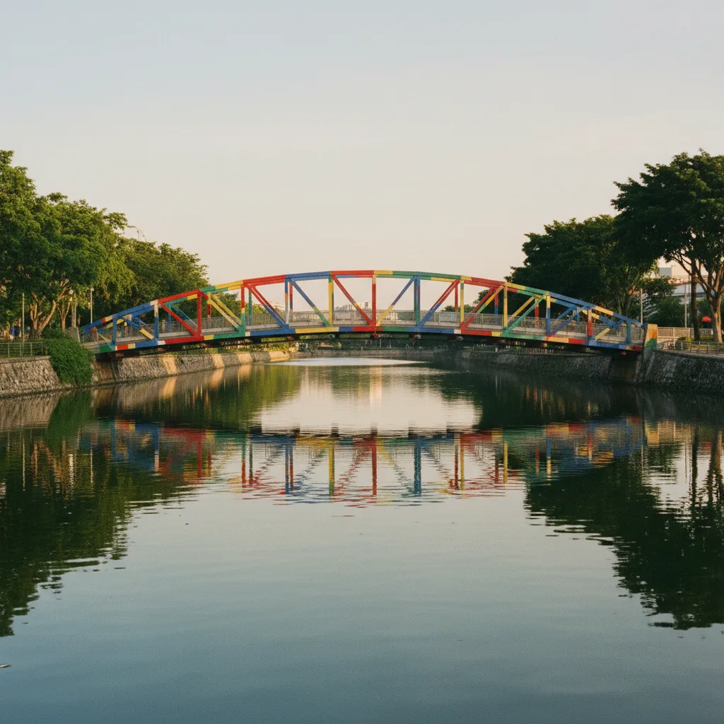
Reaching Alkaff Bridge marks the western turnaround of the scenic waterfront circuit. Resembling an elongated traditional tongkang river lighter, this pedestrian crossing was transformed into an open-air artwork in 2004 by Philippine artist Pacita Abad, adorned with vibrant multi-colored geometric patterns. Walking across the steel deck provides an unhindered perspective looking back down the length of the Singapore River toward the central skyline. The crossing connects seamlessly to the north bank park connector, allowing you to begin your return journey along an entirely fresh set of riverside perspectives without retracing your steps on the same shore. The bridge deck is sheltered with an overhead steel truss, offering welcome protection from passing drizzles.
North Bank Heritage Bridges and Riverside Steps
Following the northern riverbank eastward leads past Ord Bridge and Coleman Bridge, both showcasing intricate ironwork detailing from Singapore's nineteenth-century municipal engineering history. The underpasses beneath major roadway bridges are generously proportioned, well-lit, and fitted with artistic historical murals that depict the river's transformation from a crowded commercial port into a clean urban reservoir. Walking beneath these arches provides complete shelter from occasional tropical drizzles, while continuous public railings prevent accidental slips along the water edge. The northern walkway is noticeably quieter than the south shore, offering an uninterrupted walking rhythm with views of the bustling quayside cafes opposite.
Managing Sunlight and Tropical Humidity Along the River
Navigating Singapore's tropical river environment requires strategic timing to maximize comfort and avoid energy-sapping humidity. Midday walking between 11:30 AM and 4:00 PM is taxing due to direct overhead sunlight penetrating between buildings. The most rewarding hours occur between 5:30 PM and 7:30 PM, when the sun dips behind the Fort Canning ridge and cool air moves along the river surface. Alternatively, early mornings between 6:30 AM and 8:00 AM offer absolute serenity, dew-fresh air, and virtually empty promenades shared only with early morning joggers and municipal cleaners. The tall trees along Robertson Quay provide natural sun filtering during late afternoons.
Public Transit Accessibility and Practical Amenities
The Clarke Quay river trail requires zero admission charges, permits, or ticketing, maintaining twenty-four-hour public accessibility year-round. Multiple transit lines connect directly to the trail: Clarke Quay station on the North East Line sits at the center, Fort Canning station on the Downtown Line lies three minutes to the north, and Raffles Place station borders the eastern river mouth. Public restrooms and water refilling stations are situated near central quayside pavilions and public transit concourses. The entire route is level and barrier-free, accommodating all mobility levels with ease. Public benches with timber slats are placed every few hundred meters along the bank.
Planning Your River Walk with Karpo APP
Using Karpo APP allows you to bookmark this 3-kilometer Clarke Quay river trail to your personal Singapore walking itinerary before setting out. The saved scenario card outlines the historic bridge crossings connecting Clarke Quay, Robertson Quay, and Fort Canning, alongside practical arrival options via Fort Canning and Clarke Quay MRT stations. If you wish to extend your journey eastward toward Boat Quay, the route card highlights convenient public promenade links across the downtown core. It serves as a reliable static digital reference for exploring Singapore's heritage waterways at your own leisure, without live tracking or automated navigation features.
Ask Karpo for more information.
Keep reading
- Chinatown New in Town Weekend Planner: Errands and Temples
 Kampong Glam New in Town Weekend Planner: Mosque to Murtabak
 Holland Village New in Town Weekend Planner: Meet People