 Marina Bay Food Market Grazing Route After a Conference Day
Neighborhood Guides
Singapore Riverside Promenade Loop: Tiong Bahru River Walk
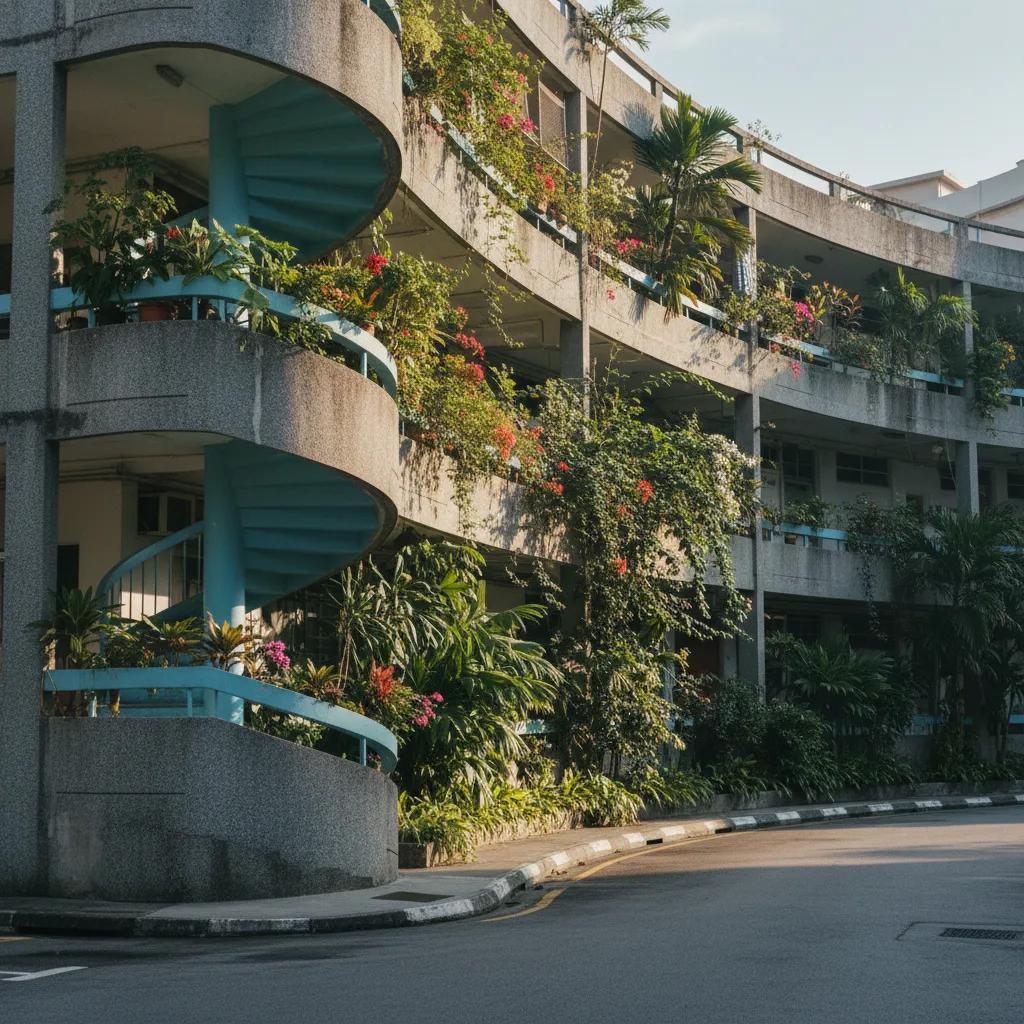
Walk a delightful urban loop combining the curved modernist architecture of Tiong Bahru with the scenic waterside park connector along the Singapore River.
Combining the distinctive pre-war Streamline Moderne architecture of Singapore's oldest public housing estate with the continuous green waterways of the Singapore River park connector, this riverside promenade loop delivers an idyllic neighborhood walking circuit. Walkers begin amidst the aerodynamic curved balconies, horseshoe courtyards, and external spiral staircases of Tiong Bahru before following the Alexandra Canal Linear Park greenway toward the river. The route transitions smoothly into the tree-lined pedestrian boardwalks of Robertson Quay, blending architectural exploration with peaceful waterside recreation.
Exploring the Aerodynamic Modernist Architecture of Tiong Bahru
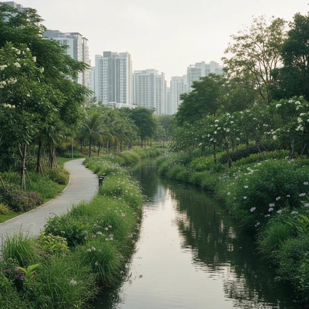
The journey sets out from Seng Poh Road and Eng Hoon Street, the historic heart of the Tiong Bahru estate built in the 1930s by the Singapore Improvement Trust. The neighborhood's architectural aesthetic was heavily influenced by the International Style and Streamline Moderne, mimicking the aerodynamic curves of contemporary ocean liners and aircraft.
Walking through Yong Siak Street and Guan Chuan Street, pedestrians admire unique rounded corners, recessed balconies, and distinctive brickwork with curved concrete cantilever roofs. External spiral staircases coil elegantly behind shophouses, providing timeless architectural viewpoints framed by flowering bougainvillea.
The neighborhood five-foot-ways house independent bookshops, artisan bakeries, and heritage provision stores that maintain an unhurried, neighborly cadence. The absence of high-rise commercial developments preserves a human scale that makes walking exceptionally pleasant.
Strolling along Chay Yan Street reveals classic porthole openings and streamlined parapets, where residents cultivate lush potted ferns and orchids along ground-floor verandahs.
Historic air-raid shelters integrated beneath the residential blocks recall the civilian preparations during the Second World War, adding a somber historical depth to the otherwise cheerful modernist aesthetic.
Heading northward through the shaded residential lanes of Moh Guan Terrace, the trail crosses past Tiong Bahru Market and approaches Kim Pong Road. Gentle pedestrian walkways lined with mature angsana trees guide walkers out toward the tranquil waters of the Alexandra Canal corridor.
Joining the Alexandra Canal Linear Park to the River Basin
Stepping onto the Alexandra Canal Linear Park near Zion Road, the urban streetscape opens up into a lush, dedicated park connector. Built directly above covered waterways and alongside flowing urban channels, this greenway provides a continuous, motor-free pedestrian artery.
The linear park features smooth asphalt paths flanked by verdant bioswales, rain gardens, and native wetland planting designed to naturally filter rainwater. Fragrant flowering frangipani and yellow flame trees form a cooling green canopy overhead, welcoming morning joggers and neighborhood strollers.
Walking eastward along the water, the canal gradually widens as it approaches Kim Seng Bridge, marking the official upper boundary of the historic Singapore River. Here, historical interpretive boards recount the river's transformation from a working trading basin into a clean, recreational freshwater corridor.
Passing under the low bridges via dedicated pedestrian underpasses allows walkers to avoid road crossings entirely, maintaining an uninterrupted walking momentum as the canal transitions seamlessly into the broad stone promenades of Robertson Quay.
Educational markers along the waterway highlight the native biodiversity that has returned to the revitalized canal, including freshwater terrapins, monitor lizards, and blue-eared kingfishers.
Continuous timber guardrails and tactile paving along the water's edge ensure safety for families with young children and elderly neighborhood residents out for morning exercise.
Winding Through the Shaded Boardwalks of Robertson Quay
Entering Robertson Quay, the walking experience shifts into a cosmopolitan riverfront promenade. Timber boardwalks hug the water's edge, bordered by restored colonial godowns with pitched terracotta roofs and expansive arched windows that echo the maritime trading era.
Walkers follow the southern bank downstream past Alkaff Bridge, admiring the playful, multicolored geometric patterns that cover its steel arches. Strolling across this pedestrian suspension span offers picturesque vistas across both banks, where leafy residential quaysides mirror peacefully in the still water.
Generous wooden benches and public viewing platforms under shady pergolas invite walkers to pause and enjoy the calm river rhythm. Electric bumboats glide softly past, their gentle ripples spreading across the wide river channel.
Looping across Jiak Kim Bridge—a modern pedestrian footbridge named after prominent nineteenth-century merchant Tan Jiak Kim—walkers can cross to the northern riverbank. Tracing the riverside path back westward past Grand Copthorne Waterfront completes the river portion of the circuit before heading back toward the canal.
The riverfront boardwalks feature low-level ambient lighting embedded along the timber curbs, creating a soft, reflective illumination after sundown without causing harsh glare.
Sunlight Transitions, Breezes, and Comfortable Walking Hours
The dense mature tree canopies along Tiong Bahru's residential avenues and the continuous foliage of the Alexandra Canal Linear Park provide exceptional natural shade, keeping the route surprisingly comfortable even as midday approaches.
The optimal walking window occurs in the early morning between 7:00 AM and 8:30 AM, when cool morning air rests over the water and neighborhood residents gather for morning tai chi or relaxed walks with pets.
Late afternoons starting around 5:30 PM offer another delightful period, as long shadows stretch across the river boardwalks and golden evening light illuminates the curved white facades of Tiong Bahru's Art Deco residential blocks.
Reliable sheltered five-foot-ways throughout Tiong Bahru and covered bridge underpasses along the canal ensure that brief tropical downpours rarely interrupt the walking experience.
Circuit Directions, Distance, and Practical Tips
This circular promenade trail covers approximately 4.6 kilometers and typically takes between 75 and 90 minutes at an unhurried pace. The walk is conveniently accessible from Tiong Bahru MRT Station (East-West Line) or Havelock MRT Station on the Thomson-East Coast Line.
The path is entirely level, well-paved, and wheelchair- and stroller-accessible, making it ideal for walkers of all fitness levels. Light, breathable clothing and comfortable walking shoes or supportive sneakers are well-suited for the paved boardwalks and stone sidewalks.
Public restrooms, water fountains, and outdoor seating are available at Tiong Bahru Market, the Alexandra Canal Linear Park rest plazas, and throughout Robertson Quay.
Walkers should remain observant of recreational cyclists on shared park connector segments and practice courteous path sharing. This circuit provides an exceptional journey through Singapore's urban design achievements, linking modernist architecture seamlessly with tranquil riverside nature.
Exploring this route offers an inspiring showcase of Singapore urban planning, demonstrating how residential heritage precincts and naturalized riverbank corridors can unite into a seamless pedestrian journey.
Ask Karpo for more information.
Keep reading
- Marina Bay Food Market Grazing Route After a Conference Day
 River Valley Food Market Grazing Route With Young Kids
 Serangoon Food Market Grazing Route for a Homecoming Weekend