 Chinatown New in Town Weekend Planner: Errands and Temples
Weekend Plans
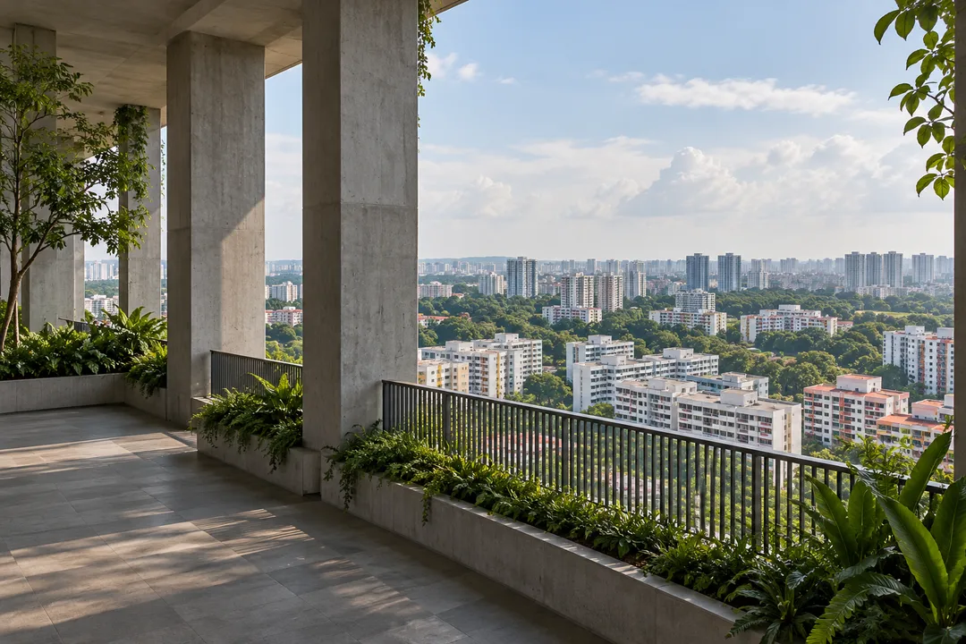
Dawson Panoramic City Lookout: Read Singapore Roof Patterns
SkyVille at Dawson offers a setting for reading Singapore roof patterns, using a small spatial diagram to separate visible blocks from imagined connections.
SkyVille at Dawson invites a different way to read Singapore from a panoramic city lookout: make a diagram of roofs and the gaps between them. WOHA's account of the housing project describes communal terraces, sky gardens and a rooftop park. The setting brings a distant city view into the context of everyday housing. Instead of collecting a spectacular skyline photograph, use a few simple shapes to explore how much of the neighbourhood you can understand from above, and where your understanding stops.
What belongs on a diagram of a lived-in city?
Start with an ordinary rectangle on a small sheet of paper. Let it stand for one roof shape that you can clearly distinguish from your position. Add a second rectangle only when you can see how it sits in relation to the first. You are making a record of visible relationships, not a map of the estate. The paper needs neither street names nor precise measurements. It needs a distinction between a building you can observe and a connection you have merely assumed.
Choose a small group of forms rather than attempting the entire outlook. A broad view offers more detail than a pocket diagram can use, and trying to include everything often turns the page into a texture of boxes. Give your first shape room. If a second roof seems to sit behind it, show that overlap. If a patch of greenery interrupts the pair, leave a space. The decisions about omission are what make the diagram useful.
There is a particular responsibility in using housing as a visual subject. Keep your attention on collective forms, planted spaces and the arrangement of roofs. Do not turn the exercise into a study of individual windows, balconies or people at home. The scale of the drawing should reinforce that boundary. A block can remain one shape even when your eyes can resolve smaller details. You are exploring the city as a shared landscape while respecting the private lives within it.
A worked example with three shapes and an unanswered gap
Imagine that you can distinguish a broad pale roof, a narrower shape behind it and a band of trees between them. These are hypothetical marks for the exercise, not a promise of a particular arrangement at Dawson. Draw the broad form first, then place the narrow one behind its upper edge. Represent the trees with a loose patch rather than individual symbols. The diagram now contains enough information to raise a question: does the green band separate the buildings, or does it simply hide what lies between them?
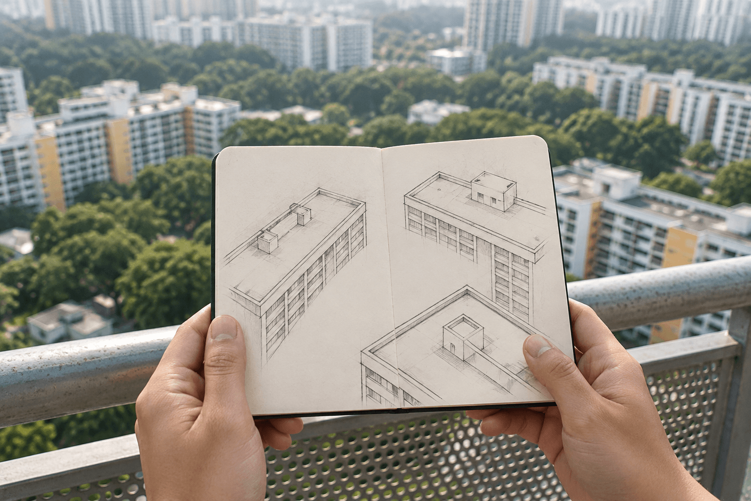
Leave that question open. From an elevated view, a connection can disappear behind a roof or beneath vegetation. Drawing a neat linking line would make the page look resolved, but it would also insert information you do not have. Use a broken mark at the uncertain part, or leave the paper blank there. Either approach records the limit of the view. The absence becomes a useful part of the diagram instead of a mistake to fill.
Now compare the sizes of the three marks. A roof closer to you may occupy much more of your field of vision than a large structure farther away. Your diagram can preserve that appearance without claiming to measure the buildings. Write a short note such as “large in this view” beside the most prominent shape if it helps. Keep the note personal. It describes what caught your eye, rather than ranking the importance or physical size of the places below.
A second visitor might draw the same cluster very differently. They might make the trees the main mass and reduce the roofs to interruptions. Put the two pages beside each other and identify the point where your interpretations diverge. This is more revealing than asking whose drawing is correct. Both can be faithful to the view while selecting different relationships. The disagreement tells you something about attention, and it gives the next observation a specific purpose.
The sky garden changes the meaning of the distance
Look back towards the space around you before adding more distant forms. WOHA describes community space as central to SkyVille's design, including terraces and sky gardens. That architectural context matters because the viewpoint is part of a housing environment. An impressive outlook is only one element of a place used in ordinary life. Keep your group compact and avoid staging a prolonged drawing session across circulation space. The visit should fit around the place rather than rearranging it around your activity.
Consider how you might represent your position on the page. A small edge, an unfilled corner or a narrow strip of nearby planting can be sufficient. Do not draw a detailed floor plan from an incomplete impression. The point is simply to acknowledge that the diagram was made from a particular place, at a particular angle. Without that cue, the page can seem to float above the city as if it were an authoritative overhead survey.
Then select one distant relationship to compare with something nearby. The repeated vertical lines of a built surface might contrast with an irregular tree mass, or a close planted edge might echo a larger green patch below. Use whichever relationship is actually visible. You are not required to find symmetry. A mismatch can be more informative, particularly when it helps explain why the city seems orderly at one scale and complicated at another.
Practical Notes: keep the uncertainty when you leave
Before putting the notebook away, distinguish three kinds of marks. Some represent forms you could see clearly. Others simplify a much more complicated mass. The rest indicate something hidden or uncertain. You can use solid lines, loose shading and an empty gap to separate those roles without inventing a formal legend. The result will be easier to revisit later, when memory tends to smooth the unresolved parts into a more confident story.
Carry only materials you can manage in your hands, and keep the exercise away from residential doorways or private spaces. Follow the on-site boundaries around the communal areas. There is no need to explore corridors in search of a better angle or to photograph residents as a way of adding atmosphere. The architecture and the distant roof forms provide enough material. A small, respectful study has more integrity than a larger one made by intruding.
If this way of looking appeals to you, ask Karpo APP for an outing idea centred on housing architecture or urban greenery. Describe the interest rather than requesting access to a particular residential space. For this visit, keep the diagram's unfinished gap intact. It is the most useful souvenir: a reminder that a wide city view can reveal patterns while still leaving the life between the buildings beyond your sight.
Ask Karpo for more information.
Keep reading
- Chinatown New in Town Weekend Planner: Errands and Temples
 Kampong Glam New in Town Weekend Planner: Mosque to Murtabak
 Holland Village New in Town Weekend Planner: Meet People