 Chinatown New in Town Weekend Planner: Errands and Temples
Weekend Plans
Rochor Historic Canal Towpath Walk? Trace Timber Routes
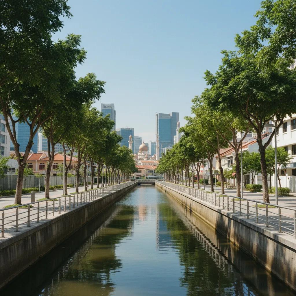
Rochor Canal offers modern waterside promenades tracing early colonial timber routes, drainage engineering, and historic Kampong Glam heritage bridges.
The Rochor Historic Canal Towpath Walk invites you to trace the essential arteries of colonial Singapore. While Singapore's waterways primarily served as colonial trade, timber, and arterial drainage canals rather than horse-drawn towpaths, modern paved pedestrian promenades now allow walkers to explore this rich water engineering heritage on foot. Excavated in 1836 under colonial surveyor George Coleman, the canal was vital for draining mangrove swamps and transporting crucial building materials. Bumboats and tongkangs once plied these waters, ferrying timber from Johore and bricks and tiles from nearby Rochor kilns down to the bustling harbour, a stark contrast to today's serene public spaces.
Colonial Engineering and Modern Transformation
The Rochor Canal's origins as a crucial drainage and transport route underscore Singapore's rapid development in the 19th century. George Coleman's engineering vision transformed a swampy landscape into a functional channel, enabling the efficient movement of goods essential for the burgeoning colonial settlement. The canal's strategic location facilitated the import of timber and the distribution of locally produced building materials, connecting inland industries with the international port. This historical role highlights the pragmatic approach to urban planning during the British colonial era, prioritizing utility and logistical efficiency over recreational aesthetics.
Today, the Rochor Canal has been thoughtfully transformed under the ABC Waters Programme, showcasing a harmonious blend of historical preservation and contemporary urban design. Wide public walking promenades now line both banks, offering expansive spaces for pedestrians and cyclists. New pedestrian bridges enhance connectivity across the waterway, linking various precincts and creating a cohesive urban experience. Heritage markers strategically placed along the route provide insightful glimpses into the canal's past, educating visitors about its significance and evolution, and fostering a deeper appreciation for Singapore's water engineering legacy.
Embarking on the Rochor Canal walk offers a unique perspective on Singapore's urban landscape, allowing walkers to observe the interplay between historical infrastructure and modern amenities. Begin your exploration near Jalan Besar, a vibrant area known for its architectural heritage and bustling streets. As you proceed, pay attention to the subtle changes in the promenade's design and the varying architectural styles of the buildings lining the canal. The walk provides a tranquil escape from the city's hustle, even as it runs through central areas, and visual observation details enhance the journey's richness.
Bridges, Precincts, and Historic Crossings
The Victoria Bridge stands as a prominent landmark along the Rochor Canal, its sturdy structure a testament to enduring colonial engineering. This historic bridge facilitated vital crossings over the canal, connecting different parts of the burgeoning town and serving as a key arterial link for both pedestrian and vehicular traffic. Its design reflects the functional yet robust architectural style prevalent during its construction period, and it continues to be a significant crossing point today. Understanding its original purpose helps contextualize the canal's historical importance within the urban fabric.
The canal route offers seamless access to the vibrant Kampong Glam heritage precinct, a cultural enclave rich with history and unique architecture. From the Arab Street pedestrian crossings, walkers can easily divert into this charming neighborhood, exploring its colorful shophouses, traditional eateries, and the majestic Sultan Mosque. This proximity highlights the canal's historical role in connecting different communities and commercial centers, facilitating trade and cultural exchange among early settlers. The integration of the canal walk with such significant cultural sites enriches the overall pedestrian experience and provides diverse exploration opportunities.
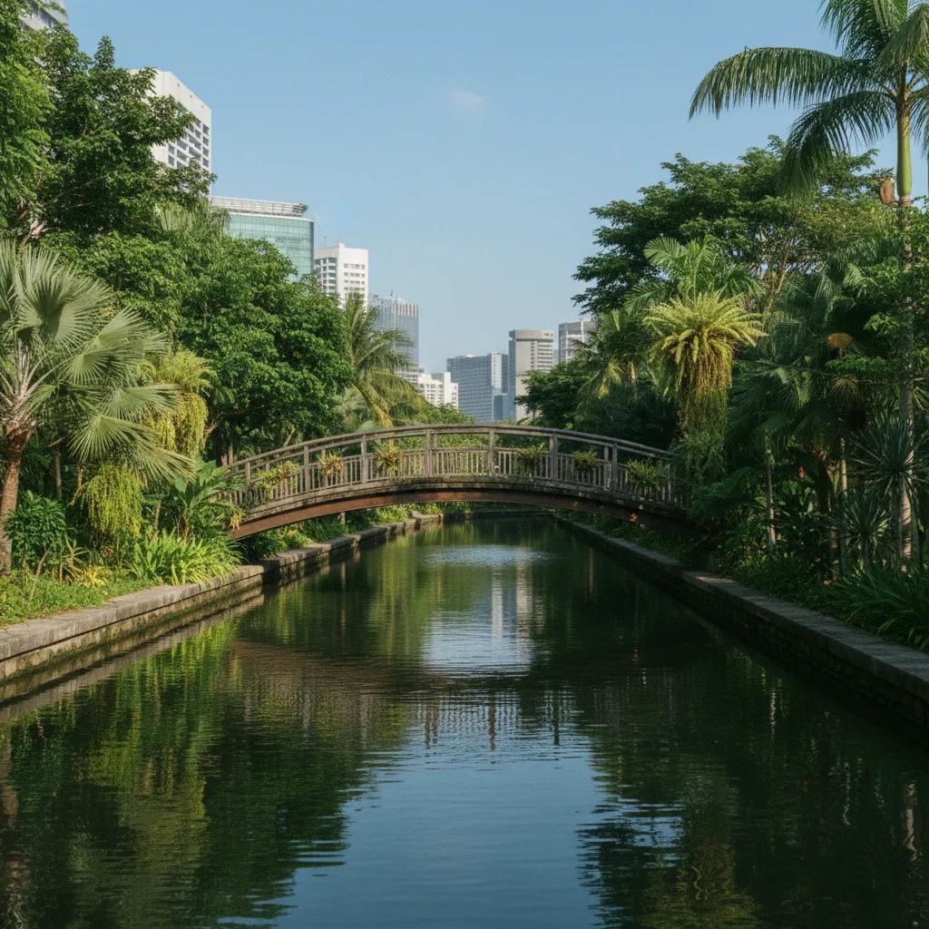
Continuing your walk towards Victoria Street, the journey reveals additional noteworthy features, including the Sim Lim bridge footpaths. These modern pedestrian bridges and pathways offer convenient and safe passage across the canal, ensuring uninterrupted access for walkers and cyclists. The waterside scenery gradually transitions from the more urbanized sections near Jalan Besar to slightly quieter stretches, offering varied visual experiences. Observe the flow of pedestrians, a mix of locals and tourists, enjoying the accessible public spaces, and consider the visual connections between the water, the urban landscape, and the surrounding historic areas.
Waterfront Paths and Urban Greenery
The Rochor Canal promenades feature wide, smooth paved surfaces, ideal for comfortable walking and cycling, providing an accessible urban recreational space. Strategically planted trees line sections of the canal, offering welcome shade and enhancing the aesthetic appeal of the waterside environment. The carefully chosen foliage contributes to a cooler microclimate, creating a pleasant experience even on sunny days. Observe how the surrounding buildings, a mix of historical shophouses and modern developments, reflect the canal's journey through time and the city's ongoing evolution, blending old and new elements.
The modern design of the Rochor Canal's public spaces skillfully integrates contemporary urban planning with the preservation of its water heritage. Interpretive panels along the route provide educational insights into the canal's historical function as a vital transport and drainage artery. These panels also explain the ecological enhancements undertaken as part of the ABC Waters Programme, showcasing efforts to improve water quality and biodiversity. This thoughtful approach ensures that the canal remains not only a functional waterway but also a valuable educational resource and a green corridor within the city, connecting past to present.
Choosing which sections of the Rochor Canal walk to explore allows for a customizable experience, whether you seek a brisk stroll or a leisurely exploration. Consider starting near Jalan Besar for a deep dive into the canal's historical context and urban integration. For picturesque views and photo opportunities, particularly around the Kampong Glam area, focus on the stretches that offer clear lines of sight to iconic landmarks like the Sultan Mosque. The various bridges along the route also serve as excellent vantage points for capturing the canal's winding path and the surrounding cityscape, creating memorable visual records.
From Bumboats to Pedestrian Promenades
Historically, the Rochor Canal bustled with bumboats and tongkangs, navigating the waterways to transport timber, bricks, and other essential building materials. This vital maritime traffic was crucial for Singapore's early development, connecting industrial kilns with the bustling harbour. Today, the canal has transformed from a working waterway into a serene urban promenade, providing dedicated pedestrian and cycling access along its banks. This shift reflects a deliberate urban planning decision to repurpose historical infrastructure for modern recreational and environmental benefits, allowing citizens to enjoy the water heritage on foot.
Beyond the Victoria Bridge, the canal path continues its journey, passing by other significant structures that underscore its historical importance and the evolving urban landscape. These structures, ranging from traditional shophouses to newer developments, tell a story of architectural adaptation and continuous city growth. Observing their varied styles and functions offers a visual narrative of Singapore's urban development, with the canal serving as a constant, albeit transformed, presence. Each bend in the canal reveals new perspectives on the city's architectural tapestry and its enduring connection to this vital waterway.
The editorial illustrations accompanying this article are AI-generated, designed to visually enhance your understanding of the Rochor Canal's historical context and modern transformation. These visuals depict scenes of past bumboats navigating the waters, contrasting with contemporary images of pedestrians enjoying the wide promenades. The illustrations also highlight key landmarks and the harmonious integration of greenery within the urban canal environment. They serve as a complementary visual guide, enriching the narrative and offering a glimpse into both the canal's vibrant history and its peaceful present as a recreational artery for the city.
Practical Notes: Plan Your Route Along the Water
The Rochor Canal walk is easily accessible via public transport, with several MRT stations and bus stops conveniently located near various points along the route. Wear comfortable walking shoes, as the paved promenades offer a smooth but extended walking surface. Carry water, especially on warmer days, and consider bringing a hat and sunscreen for protection from the sun. Public restrooms are available at various points in nearby precincts, and clear signage generally guides walkers along the designated paths. Respect other users of the promenade, maintaining a pleasant flow for pedestrians and cyclists, and always adhere to local regulations regarding public spaces. The route is generally flat, making it suitable for all fitness levels. In the Karpo APP, ask for a waterside walking route in Singapore focusing on Rochor Canal history and your preferred walking distance. Tracing this path from Kampong Glam to Victoria Street provides a direct appreciation of how early canal networks shaped local urban development.
Ask Karpo for more information.
Keep reading
- Chinatown New in Town Weekend Planner: Errands and Temples
 Kampong Glam New in Town Weekend Planner: Mosque to Murtabak
 Holland Village New in Town Weekend Planner: Meet People