 Chinatown New in Town Weekend Planner: Errands and Temples
Weekend Plans

Geylang Historic Canal Towpath Walk? Trace Drainage Paths
Geylang Canal features wide pedestrian bank paths tracing early settlement drainage schemes, historic bridges, and connections to scenic Kallang Basin waters.
The Geylang Historic Canal Towpath Walk invites exploration of Singapore's urban waterways, offering a distinctive perspective on its engineering heritage. While Singapore's canals primarily served as arterial drainage and colonial trade routes for timber and other cargo, rather than traditional horse-drawn towpaths, modern paved promenades now provide excellent pedestrian access. These continuous pathways allow walkers to trace the evolution of Sungei Geylang from an estuarine river into a vital canalized system. This walk reveals the diligent work undertaken to reclaim land and manage water in the early-to-mid twentieth century, transforming the landscape of Geylang Serai.
Dunman Road Bridge Beginnings
Sungei Geylang, once an estuarine river, progressively transformed through extensive canalization during the early-to-mid twentieth century. This ambitious engineering project aimed to effectively drain vast low-lying coconut plantations, expansive rubber estates, and nascent Malay settlements in the Geylang Serai area. The river's original meandering course was straightened and deepened, fundamentally altering the local hydrology and facilitating urban development. Historical records indicate the considerable investment in labor and resources dedicated to this vital drainage infrastructure, underscoring its importance for the burgeoning colonial economy.
The Geylang Park Connector now offers a continuous pedestrian route, beginning near the Dunman Road bridge and extending towards the Kallang Basin. This modern pathway allows walkers to experience the naturalized sections of the canal, where stone riprap lines the banks, creating a more ecological interface with the water. The design incorporates green spaces and thoughtful landscaping, enhancing biodiversity and providing recreational opportunities for residents. The transition from concrete embankments to naturalized edges represents a contemporary approach to urban waterway management, balancing functionality with environmental aesthetics.
Start your walk near the Dunman Road bridge, observing the initial stretch of the canal. Note the varying architectural styles of the buildings flanking the waterway, reflecting different eras of urban expansion. The path here is generally wide and well-maintained, suitable for a leisurely stroll. Pay attention to the subtle changes in the canal's character as you proceed, from more enclosed sections to those opening up into broader parklands. The interplay of sunlight and shadow on the water creates dynamic visual interest, inviting contemplation and photography.
Guillemard Road Crossing Echoes
The crossing at Guillemard Road provides an interesting vantage point to observe the canal's integration within the urban fabric. This location highlights the intersection of modern traffic infrastructure and the historic waterway, a testament to the canal's enduring role in city planning. The bridge structure itself, while contemporary, stands over a waterway that has seen generations of transport and development. Its design facilitates smooth pedestrian and vehicular flow, seamlessly connecting different parts of the Geylang district and providing vital access across the canal.
Historically, cargo lighters and bumboats once plied these waters, ferrying timber from sawmills situated near Tanjong Rhu into the river's upper reaches. This commercial activity was central to the colonial economy, supporting the construction industry and other burgeoning sectors. The canal served as a crucial logistical artery, demonstrating the early engineers' foresight in leveraging natural waterways for economic gain. Traces of this industrious past, though largely unseen, resonate with the canal's present-day function as a recreational and drainage corridor.
As you navigate the Guillemard Road crossing, observe the careful management of pedestrian and vehicular traffic. The park connector thoughtfully guides walkers through this busier intersection, ensuring safety and continuity of the route. Look for the distinct architectural characteristics of the residential and commercial buildings adjacent to the canal, many of which subtly acknowledge the waterway's presence. The waterside scenery here transitions from purely functional to more visually engaging, offering varied perspectives of the surrounding cityscape and the water's surface.
Park Connector's Green Embrace
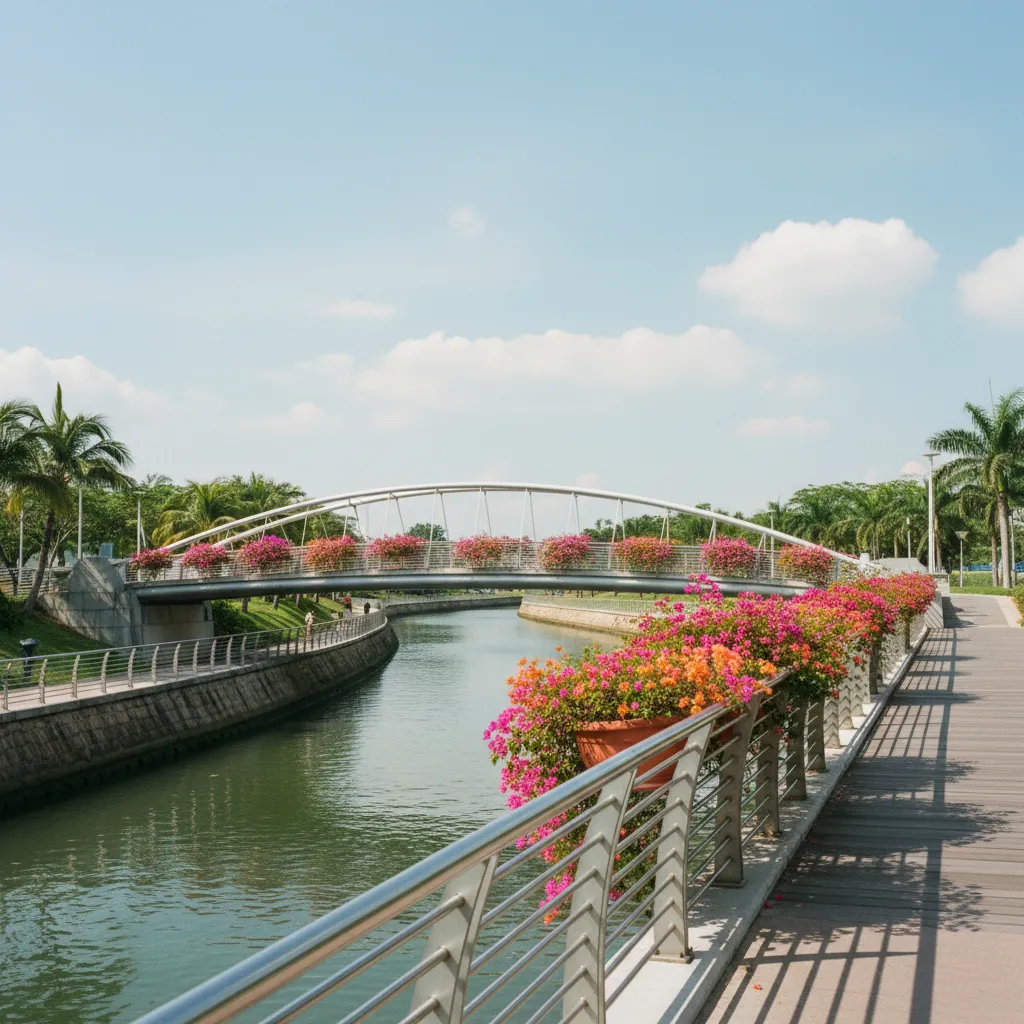
The Geylang Park Connector offers an excellent pathway experience with its smooth surfaces, typically comprising asphalt or paved interlocking blocks, ensuring comfortable walking conditions. Mature trees, such as rain trees and various palms, line sections of the route, providing welcome shade and enhancing the green corridor's appeal. The surrounding landscape features a mix of manicured lawns and naturalized planting, creating a pleasant environment for recreation and relaxation. This well-planned green space significantly contributes to the urban biodiversity and air quality.
Modern ABC Waters initiatives have actively naturalized parts of the Geylang Canal, transforming utilitarian concrete channels into more ecologically sensitive waterways. Stone riprap now shores up banks, promoting vegetation growth and providing habitats for local fauna. This approach demonstrates a commitment to preserving the water engineering heritage while simultaneously embracing contemporary ecological principles. The integration of these naturalized sections with the continuous park connector path reflects a holistic strategy for urban waterway management and public engagement.
When choosing your route sections, consider the different environments offered by the park connector, from bustling urban stretches to quieter, greener oases. Excellent photo viewpoints often emerge where the canal opens up or where distinctive bridges provide architectural interest. Observe the interplay of light and shadow on the water, particularly during the golden hours of early morning or late afternoon, for captivating photographic opportunities. The varied planting and waterside features also offer a chance for birdwatching and observing aquatic life.
Tanjong Rhu Confluence Narratives
The historical navigation of Sungei Geylang by cargo lighters stands in stark contrast to the present-day accessibility for walkers. While commercial vessels once traversed these waters for trade, modern park connectors provide dedicated pedestrian routes, allowing for recreational and educational exploration. This evolution from a working river to a recreational linear park illustrates Singapore's ongoing transformation and commitment to enhancing public spaces. The smooth transition from historical function to contemporary leisure use underscores careful urban planning and adaptation.
Approaching the Tanjong Rhu confluence, where Geylang Canal meets the larger Kallang Basin, walkers witness a significant landmark. This area was historically crucial for timber trade and shipbuilding activities. Although the sawmills are long gone, the scale of the waterway at this junction still hints at its industrial past. The confluence marks the point where freshwater drainage met the estuarine environment, a vital interface for both natural processes and human activity. The modern landscape design respects this history while providing accessible public space.
Please note that the editorial illustrations accompanying this article are AI-generated, designed to visually complement the narrative and evoke the atmosphere of the Geylang Canal. These artistic renderings offer a creative interpretation of the historical and contemporary elements discussed, enhancing the reader's engagement with the route. They provide visual context without being direct photographic representations, allowing for a broader imaginative appreciation of the canal's journey through time and its present-day form.
Practical Notes: Plan Your Route Along the Water
Embarking on the Geylang Canal walk requires comfortable walking shoes and adequate hydration, especially during warmer periods. The paths are generally flat and well-maintained, suitable for most fitness levels, and accessible for strollers and wheelchairs in many sections. Public restrooms are available at various points along the broader park connector network, but planning your stops is advisable. While the route does not feature commercial shops directly along the canal banks, amenities can be found in adjacent neighborhoods a short walk away. Public path etiquette includes keeping left, being mindful of cyclists and other pedestrians, and disposing of litter responsibly to maintain the cleanliness and beauty of the environment. Respect private property boundaries and noise levels, especially when passing residential areas. In the Karpo APP, ask for a waterside walking route in Singapore focusing on Geylang Canal history and your preferred walking distance. Exploring the banks from Dunman Road towards Kallang Basin reveals how nineteenth-century plantation drainage evolved into today's naturalized river promenades.
Ask Karpo for more information.
Keep reading
- Chinatown New in Town Weekend Planner: Errands and Temples
 Kampong Glam New in Town Weekend Planner: Mosque to Murtabak
 Holland Village New in Town Weekend Planner: Meet People