 Twin Peaks Hilltop Staircase Walk Planner for City Lights
Free Things to Do

North Beach Scenic City Skyline Viewpoint Walk Guide
Follow a North Beach scenic city skyline viewpoint route from Washington Square to Telegraph Hill using Karpo APP to sequence public overlooks.
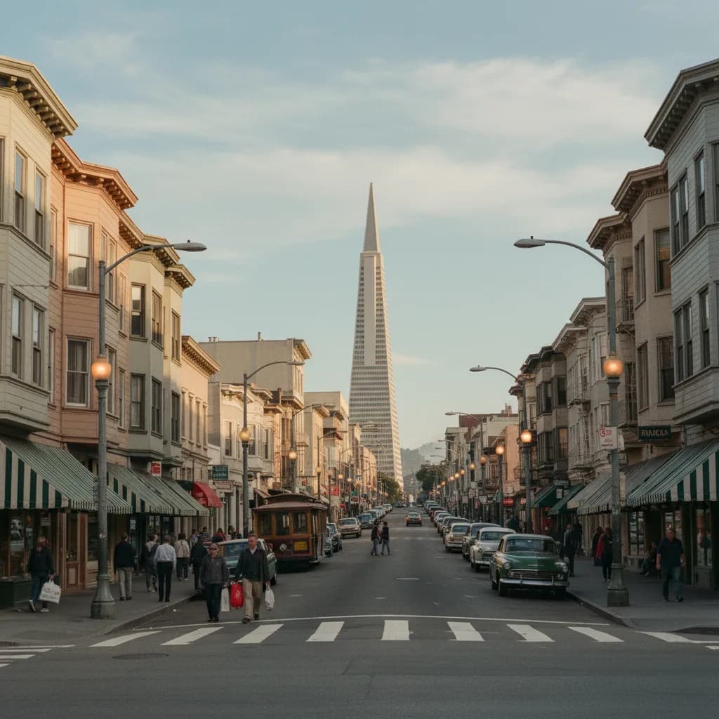
Glancing southeast down the diagonal slice of Columbus Avenue from the edge of Washington Square Park, the white quartz pyramid of the Transamerica building rises directly above three-story Italian bakeries, neon trattoria signs, and string-lit sidewalk tables. Experiencing a classic scenic city skyline viewpoint in North Beach combines that dramatic street-level corridor with the steep limestone and sandstone ledges of Telegraph Hill immediately to the east. Because Pioneer Park has crowned the summit of Telegraph Hill since 1876, walkers can climb from the bustling cafe corners of Grant Avenue and Union Street to a free panoramic stone terrace without needing an observation elevator ticket. Organizing your stairway ascents and plaza stops inside the Karpo APP helps you link low-angle neighborhood avenues with high bay vistas in a single afternoon.
Columbus Avenue Diagonal Corridor And Washington Square Sightlines
Laid out in the nineteenth century as Montgomery Avenue to slice diagonally across the rigid North Beach street grid, Columbus Avenue creates an unbroken visual channel connecting the northern waterfront toward the Financial District. When you stand on the southern sidewalk of Washington Square Park, established as a public green in 1847 opposite the twin spires of Saints Peter and Paul Church completed in 1924, the diagonal avenue points straight at the 1972 Transamerica Pyramid and the surrounding Montgomery Street high-rises.
Morning and late-afternoon walkers pausing at the triangular intersection of Columbus Avenue, Grant Avenue, and Vallejo Street can capture the stark contrast between low-rise Edwardian masonry built after the 1906 earthquake and the glass and aluminum curtain walls of the financial core just six blocks south. Accordion players, retirees reading morning newspapers on park benches, and servers setting up outdoor tables give the foreground a lively neighborhood pulse. Saving key diagonal corners along Columbus Avenue in the Karpo APP lets you frame clean architectural shots before climbing the hill.
Pioneer Park Stone Parapets Around Coit Tower On Telegraph Hill
Ascending East Union Street and turning onto Telegraph Hill Boulevard leads into Pioneer Park, gifted to the city in 1876 and topped by the fluted Art Deco concrete column of Coit Tower, completed in 1933. Even without entering the paid tower elevator, the free outdoor circular promenade and low stone parapet walls wrapping around the summit plaza deliver some of the most commanding skyline and harbor views in Northern California. From the southern stone ledge, the Financial District towers and Salesforce Tower rise immediately beyond the cascading rooftops of Jackson Square and Chinatown.
Walking around the northern and western perimeter walls of Pioneer Park shifts your horizon toward the red suspension towers of the 1937 Golden Gate Bridge, Alcatraz Island, and the steep residential crest of Russian Hill across Mason Street. Wild cherry-headed conure parrots frequently chatter in the Monterey cypress branches overhead while cargo ships pass beneath the 1936 San Francisco–Oakland Bay Bridge to the east. Keeping Pioneer Park anchored in your Karpo APP walking plan ensures you allow twenty minutes to circle every side of the summit parapet.
Filbert Street Wooden Steps And Jack Early Pocket Overlook
East of the Pioneer Park summit, the Filbert Street Steps and the parallel Greenwich Street Steps drop down the sheer eastern cliff of Telegraph Hill through lush public cottage gardens tended by neighborhood volunteers for decades. Pausing on the upper wooden landings of the Filbert Street stairway reveals intimate framed angles of the Bay Bridge western span, Treasure Island, and the northern Embarcadero piers shining between roses, nasturtiums, and towering eucalyptus trunks. Mid-century wooden cottages with unpainted redwood shingles and Carpenter Gothic residences built in the 1870s cling to the hillside along Napier Lane right beside the boardwalk.
Back on the northern slope of the hill off Grant Avenue and Chestnut Street, a short cul-de-sac called Pfeiffer Street leads to a hidden wooden staircase ascending into Jack Early Park. Opened in 1962 as one of the smallest public pocket overlooks in the city, this quiet timber deck perches above the hillside rooftops with a concentrated view toward Pier 39, Angel Island, and the northern bay channel. Recording this tucked-away Pfeiffer Street stairway inside the Karpo APP helps you find a tranquil alternative whenever the main Coit Tower plaza grows busy.
Traffic Bottlenecks To Skip And Transit Fallbacks Down The Hill
Skip walking up the narrow concrete sidewalk beside the single-lane roadway of Telegraph Hill Boulevard on weekend afternoons when long lines of tourist cars idle bumper to bumper waiting for summit parking spaces. Climb the pedestrian-only Greenwich Street steps from Grant Avenue or the Filbert Street steps instead so you stay away from vehicle exhaust and congestion. You should also skip the exposed northern parapet of Pioneer Park during summer afternoon gale warnings when cold wind blasts straight through the Golden Gate strait.
If thick bay fog or winter rain rolls across Telegraph Hill, descend via Grant Avenue or Stockton Street to Washington Square and Columbus Avenue, where the 30 Stockton and 45 Union–Stockton Muni trolleybuses and the Powell-Mason cable car line provide direct transit connections, and the Chinatown–Rose Pak Muni Metro station sits a brief walk south along Stockton Street. The North Beach Branch Library plaza on Mason Street and the historic City Lights Bookstore alley corner at Jack Kerouac Alley offer sheltered inland landmarks while you check your saved transit notes in the Karpo APP.
Timing A Cafe-Corridor To Hilltop Sunset Sequence
For an ideal ninety-minute North Beach skyline route, start at the intersection of Broadway and Columbus Avenue near Jack Kerouac Alley two hours before sunset, walking northwest up Columbus Avenue toward Washington Square Park while looking back frequently at the Transamerica Pyramid glowing in the afternoon sun. Cross Washington Square and follow Union Street and Grant Avenue east to climb the shaded pedestrian stairs up to Pioneer Park.
Spend thirty minutes circling the stone parapets around Coit Tower as golden hour illuminates the Financial District skyscrapers to the south and the Bay Bridge towers to the east, then descend a short segment of the upper Filbert Street garden steps before returning down Grant Avenue at dusk. By keeping your stairway entrances and bus stops organized in the Karpo APP, you can transition smoothly from hilltop twilight views back to the warm glow of Grant Avenue and Columbus Avenue.
Ask Karpo for more information.
Keep reading
- Twin Peaks Hilltop Staircase Walk Planner for City Lights
 Inner Sunset Hilltop Staircase Walk Planner for Trekkers
 Bernal Heights Hilltop Staircase Walk Planner With Kids