 Twin Peaks Hilltop Staircase Walk Planner for City Lights
Free Things to Do

Hayes Valley Scenic City Overlook Trail: Two Free Hills
Yes, it's free: from Patricia's Green in Hayes Valley, walk Hayes Street up to Alamo Square, then south to Buena Vista Park for a two-summit city view loop.
Hayes Valley sits in a bowl, which is exactly why it makes a good base for a scenic city overlook trail: two free hilltop parks rise within walking distance of Patricia's Green, and neither asks for a ticket. Walk west on Hayes Street to the grassy crown of Alamo Square, then continue south to the oak-shaded summit of Buena Vista Park. Plan on roughly two to three hours, a pair of real climbs, and very little traffic noise once you reach the top.

Patricia's Green Is Where the Story Starts
Before you climb, spend five minutes on the strip of lawn between the two lanes of Octavia Boulevard. Patricia's Green exists because the elevated Central Freeway that once cut through here was damaged in the 1989 Loma Prieta earthquake and later torn down. The neighborhood fought for a park instead of a rebuilt ramp, and named it after local activist Patricia Walkup. Large sculptures rotate through the lawn, so the centerpiece changes from one visit to the next. It is a flat, friendly warm-up, and a reminder that this view-heavy walk begins on land that used to sit under concrete.
Climbing Hayes Street to Alamo Square
Head west on Hayes past Laguna, Buchanan, Webster and Fillmore. The grade sharpens after Fillmore, and by Steiner your calves will know it. The 21 Hayes bus runs the same corridor if anyone in your group would rather ride the hill and meet you at the top. Enter the park on the Steiner side and keep climbing to the central ridge instead of stopping at the first bench. The ridge is where the lawn levels out and the skyline opens behind the rooftops, which is the payoff you came for.
What You Actually See From the Alamo Square Ridge
Facing east, the famous row of Victorian houses on Steiner Street sits in the foreground, with the downtown towers stacked behind them. On a clear day the Transamerica Pyramid and Salesforce Tower are easy to pick out. Turn around and the western half of the city rolls toward Sutro Tower. The park reopened in 2017 after a renovation that reworked paths and irrigation, so the grass is usually in good shape. Expect tour vans along Steiner at midday; the photographers cluster there, while the north end of the lawn stays calmer.
Dropping South Toward Buena Vista Park
From Alamo Square, follow Steiner or Pierce south through quiet residential blocks, cross Oak and Fell at the signals beside the Panhandle, and keep going to Haight Street. The walk is a little under a mile and mostly downhill before the second climb begins. Buena Vista Park's main entrance faces Haight near Lyon Street. This stretch has almost no shops, so fill water bottles before leaving Hayes Valley. If you skipped the bus earlier, this is the leg where a tired companion can peel off and wait in the Lower Haight instead.
The Wooded Summit Most Visitors Skip
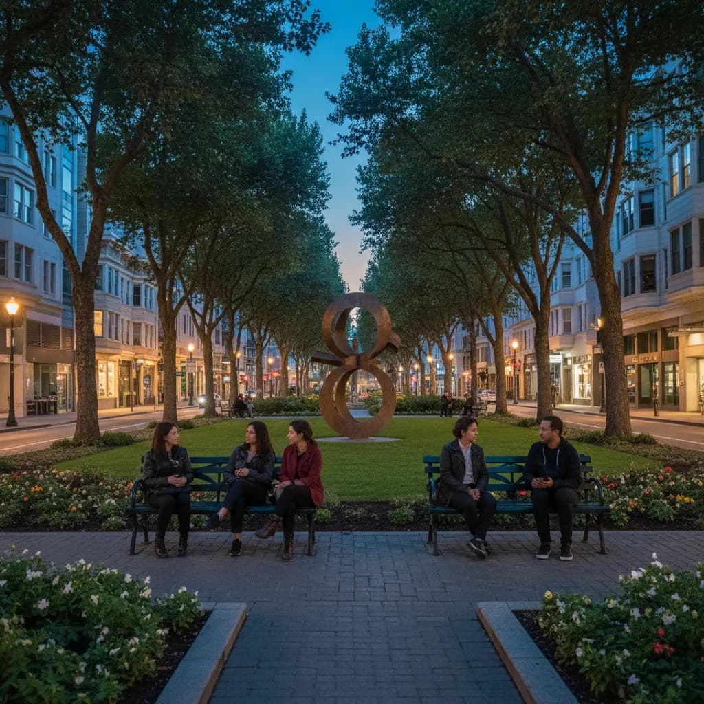
Buena Vista Park was set aside in 1867, which makes it the oldest official park in San Francisco, and it feels nothing like Alamo Square. Steep switchbacks climb through coast live oaks and cypress, and the trees open only in a few spots near the top, at roughly 570 feet. Look down at the gutters along some paths: workers in the 1930s lined them with fragments of old marble grave markers taken from cleared city cemeteries, and you can still read stray letters. The view here comes in narrow windows rather than one grand panorama, which is part of its charm.
When the Fog Decides for You
San Francisco summer fog often swallows these hills by late afternoon, especially from June through August. September and October tend to bring the clearest skies, and winter mornings after rain can be sharp enough to see the bay bridges. A practical rule: if Sutro Tower is hidden when you leave Patricia's Green, do Alamo Square first and treat Buena Vista as optional, since its tree cover limits the view anyway. Golden hour from the Alamo Square ridge is the strongest single reason to time this walk carefully.
An Honest Take on the Order
Some guides send you up Buena Vista first. Skip that sequence unless you love steep starts; the switchbacks are harder on fresh legs going down than coming up, and the reward is smaller. Alamo Square gives you the classic skyline early, so even if energy fades you have the shot that matters. Buena Vista then works as a quiet bonus for people who like woods, birdsong and a little history underfoot. Families with strollers should stop after Alamo Square; Buena Vista's paths include stairs and loose dirt.
Who You Meet Along the Way
On weekend mornings, Alamo Square fills with dog owners who know each other by their dogs' names, picnickers staking out blankets near the ridge, and visitors lining up the classic postcard frame on the Steiner side. Buena Vista draws a different crowd: runners doing hill repeats, birders listening for warblers in the oaks, and neighbors who treat the summit as a daily constitutional. The unspoken etiquette in both parks is simple: keep voices low near the residential edges and pack out everything you bring.
Using Karpo to Shape the Loop
Open the Karpo APP and describe the walk you want, for example two hills, under three hours, ending somewhere to eat in the Lower Haight. Karpo can suggest a sensible order for these stops and point you toward places nearby for food or coffee when you finish. It does not watch the weather or crowds in real time, so glance at the sky yourself before committing to the second climb. Treat Karpo as a planning partner for the route and the meal, and let the fog have the final word.
Practical Notes for This Walk
Both parks are free and open to the public, with no reservation or permit needed for a walk. Wear shoes with grip, because Buena Vista's dirt paths get slick after rain. Bring a layer even on sunny days; wind on the Alamo Square ridge can drop the temperature quickly. Restrooms are limited, so plan a stop before you leave Hayes Valley. Dogs are common on both hills, and some areas are off-leash. Total distance from Patricia's Green to the Buena Vista summit and back to Haight Street runs about two and a half to three miles.
Ask Karpo for more information.
Keep reading
- Twin Peaks Hilltop Staircase Walk Planner for City Lights
 Inner Sunset Hilltop Staircase Walk Planner for Trekkers
 Bernal Heights Hilltop Staircase Walk Planner With Kids