 Twin Peaks Hilltop Staircase Walk Planner for City Lights
Free Things to Do
Mission District Historic Quarry Nature Walk: 4 Free Tips
Plan historic quarry nature walk excursions from the Mission District. Discover Bernal Heights rock faces and Dolores Park chert outcrops in Karpo APP.
Starting your journey at the Sixteenth Street Mission BART station immerses you in the vibrant cultural heart of San Francisco, where historic Victorian streets slope upward toward prominent coastal ridges. While the Mission is widely recognized for dynamic community murals and celebrated taquerias, undertaking a historic quarry nature walk reveals that the surrounding hills contain ancient geological formations quarried during the nineteenth century to pave city streets and construct sea walls. Karpo APP provides an intuitive digital guide that charts pedestrian routes from bustling neighborhood avenues to scenic hilltop rock bluffs, offering an inspiring synthesis of urban exploration and Earth science.
Climb Toward Dolores Park and Bernal Heights
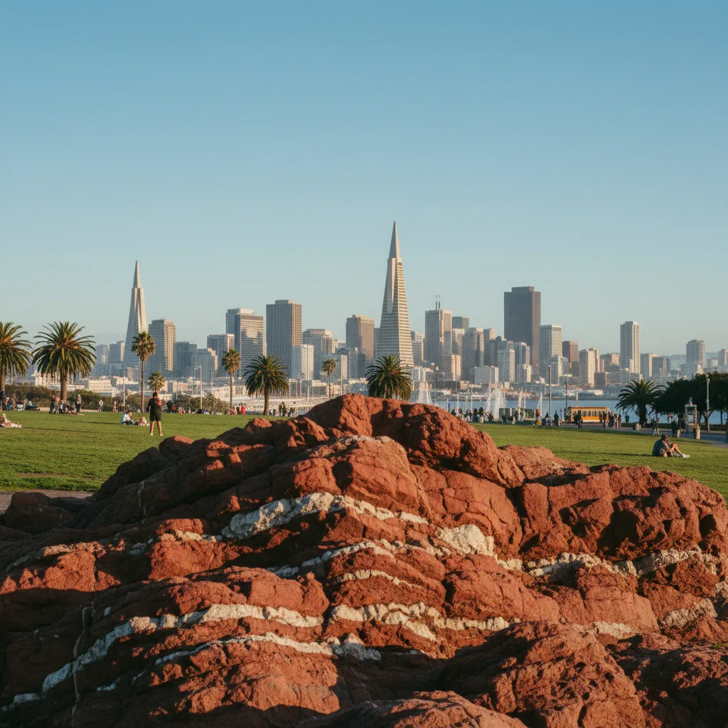
Head westward along Eighteenth Street as the roadway climbs steadily toward Mission Dolores Park, one of the city's premier outdoor gathering spaces. Entering the park at its northeastern corner reveals undulating green lawns framed by mature palm trees and dramatic rock outcroppings of Franciscan chert. These deep reddish-brown sedimentary formations were deposited on ancient deep-sea floors millions of years ago, later compressed, folded, and uplifted by intense tectonic movement along the Pacific plate boundary. Walking past the children's playground toward the southern hillside brings you directly alongside exposed rock faces showcasing thin, folded ribbon bedding.
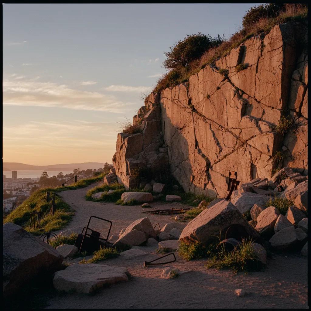
For walkers seeking a deeper geological ascent, continuing south along Dolores Street toward Bernal Heights Park opens up an extraordinary former quarry site. The northern bluffs of Bernal Hill were actively quarried during the late 1800s and early 1900s, providing millions of tons of hard chert aggregate used in local road paving and concrete foundation mixes. Ascending the paved access road and natural dirt singletrack trails delivers you directly beneath sheer rock cliffs that preserve drill holes and vertical split faces from historic quarrying operations. Reaching the summit meadow provides a breathtaking panoramic sweep of the downtown skyline, San Francisco Bay, and the Pacific Ocean.
Study Ancient Radiolarian Chert and Quarry Faces
Studying the exposed rock surfaces along Bernal Hill and Dolores Park reveals the intricate beauty of radiolarian chert. The rock consists of microscopic silica shells of marine plankton, with rich red and ochre hues derived from iron oxide minerals. Notice how the strata curve in acute synclines and anticlines, recording millions of years of crustal compression. Native grasses, drought-hardy coastal scrub, and wild lupines thrive in the mineral-rich soil pockets between rock crevices, creating valuable urban wildlife habitat for butterflies and foraging raptors hovering in the coastal updrafts.
Circling the summit trail around Bernal Heights allows you to observe how nineteenth-century quarrying shaped the hill's modern topography, creating sheltered natural benches and dramatic viewing perches. From this elevated vantage point, walkers can trace San Francisco's dramatic terrain, observing how ancient rock ridges dictate neighborhood boundaries, street alignments, and greenway corridors. The constant breeze sweeping off the Pacific provides refreshing cool air as you take in the uninterrupted 360-degree vista of the Bay Area.
Choose Crisp Morning Hours for Hilltop Views
Timing your Mission and Bernal Heights trek during morning hours between eight and eleven o'clock guarantees the clearest viewing conditions and comfortable temperatures. Morning sun warms the eastern rock slopes while city streets below gradually awaken, providing peaceful trail conditions before afternoon breezes strengthen across the hilltop. Midweek visits offer quiet summits with few fellow hikers, allowing for uninterrupted nature contemplation and crisp photography.
Preparing for San Francisco's steep topography requires appropriate footwear and clothing. Wear hiking shoes or running sneakers with aggressive tread patterns, as transitioning between paved asphalt, loose gravel trails, and uneven rock steps demands dependable grip. Dressing in lightweight, moisture-wicking layers topped with a windproof jacket ensures you stay comfortable as you heat up during hill climbs and cool down on windy summits. Bringing a water bottle and sunglasses completes your outdoor gear kit.
Maintain Safe Footing on Steep Geological Slopes
Trail safety and ecological stewardship are paramount when walking hillside rock formations. Remain strictly on established trails and avoid scrambling up loose talus slopes or vertical quarry cuts, where crumbly chert fragments can slide underfoot. Stay within marked public trails and avoid trampling native coastal prairie grasses that stabilize the thin topsoil. Following these basic stewardship practices protects fragile hillside ecosystems and ensures safe recreation for everyone.
After completing your hilltop circuit, descending back into the Mission District along Mission Street or Valencia Street offers a welcoming return to urban amenities. Vibrant neighborhood cafes, fruit markets, and community bakeries provide pleasant settings to rest your legs, enjoy a refreshing drink, and review your trail photos. Combining vigorous natural hillside hiking with colorful neighborhood culture makes for an unforgettable half-day excursion. Having a well-mapped route ensures a seamless transition between park and city.
Streamline Hillside Traverses With Karpo APP
Karpo APP simplifies navigating San Francisco's hilly terrain by providing elevation-aware pedestrian routing that connects transit stations, neighborhood stairways, and park entries. The app helps you avoid excessively steep dead-ends and guides you toward scenic pedestrian stairs and paved park ramps. Instead of struggling with confusing topographic maps, you have a reliable digital compass that responds smoothly to your walking pace.
The platform also allows users to drop custom pins on fascinating geological formations, scenic bench perches, and historic stone staircases throughout the Mission and Bernal Heights. Saving and sharing custom walking itineraries with friends makes it easy to organize community walks and celebrate local natural history. With Karpo APP handling navigation logistics, you can immerse yourself completely in the panoramic beauty of San Francisco's rocky summits.
Practical Gear Advice for San Francisco Climbs
A few practical pointers will help you make the most of your Mission District geological walk. The complete circuit from Sixteenth Street BART through Dolores Park to the Bernal Heights summit and back spans approximately three and a half miles, requiring two to two and a half hours at a comfortable pace. Public restrooms are available within Mission Dolores Park near the central field house. Always stay aware of traffic when crossing wide thoroughfares like Cesar Chavez Street on your way toward Bernal Hill.
Exploring the rugged rock outcroppings of the Mission District and Bernal Heights offers an invigorating window into San Francisco's dramatic geological heritage. From delicate radiolarian chert ribbons in Dolores Park to the monumental quarried rock faces of Bernal Hill, this walking trail celebrates the ancient earth forces that built California's coast. With proper preparation, thoughtful trail etiquette, and the navigational support of Karpo APP, urban hikers can enjoy a thrilling natural adventure high above the city streets.
Ask Karpo for more information.
Keep reading
- Twin Peaks Hilltop Staircase Walk Planner for City Lights
 Inner Sunset Hilltop Staircase Walk Planner for Trekkers
 Bernal Heights Hilltop Staircase Walk Planner With Kids