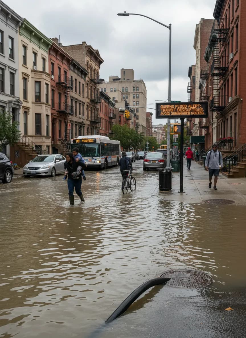
Flash floods can turn a typical Queens commute into a serious challenge. When heavy rainfall overwhelms the city's drainage systems, certain subway lines, bus routes, and even major roadways become particularly vulnerable to disruption. This guide is your practical companion for understanding which transit options are most likely to be affected during a flash flood warning in Queens, helping you make informed decisions to stay safe and keep moving. We'll break down the areas and routes that historically experience the most severe impacts, offering clear alternatives and advice for checking live conditions.
Don't get caught off guard. Sign up for NYC Emergency Management alerts and check MTA's official service advisories before you travel. Your safety is paramount.

Understanding Queens' Flood Vulnerability by Neighborhood
Queens is a diverse borough with varying topographies, which means flood risks aren't uniform. Low-lying areas, especially those near waterfronts or with older infrastructure, are typically more susceptible. Neighborhoods like Flushing, Bayside, and parts of the Rockaways often experience significant street flooding that can quickly impact bus routes and local traffic. Areas with dense street networks and limited green space, such as parts of Long Island City and Astoria, can also see rapid accumulation of water. Keeping these geographical realities in mind is the first step in planning your transit strategy during a flood alert. Always consult official city advisories for specific neighborhood warnings.
Subway Lines to Monitor During Heavy Rain
While the subway system is largely underground, certain lines and stations in Queens are known for their susceptibility to flooding. Water can seep into tunnels, overwhelm station pumps, and cause significant delays or service suspensions. The 7 train, particularly its Flushing-bound sections, can be impacted by street flooding in Flushing and Corona. The E, F, M, and R lines, as they run through low-lying areas or older tunnels, may also experience disruptions. Stations with street-level entrances that are prone to pooling water can become inaccessible. Always check the MTA's official website or app for real-time service changes and advisories. They provide the most accurate and up-to-the-minute information on which lines are affected.
Bus Routes: A Flood-Prone Network

Bus routes are often the first transit option to be directly impacted by street-level flooding. When major thoroughfares become impassable, buses are forced to detour or cease service entirely. In Queens, routes serving areas like Northern Boulevard, Roosevelt Avenue, and sections of Woodhaven Boulevard are particularly vulnerable. Buses that travel through underpasses or along low-lying coastal roads, especially in the Rockaways, can also face significant delays or cancellations. If a flash flood warning is issued, assume that your usual bus route may be altered. Prioritize checking the MTA's bus status updates, as well as local news for street closure information, before heading to a bus stop.
Major Roadways and Intersections to Avoid
For those driving or using ride-shares, certain Queens roadways and intersections become highly problematic during flash floods. The Long Island Expressway (LIE) and Grand Central Parkway are notorious for lane closures and severe slowdowns due to water accumulation, especially in underpasses or dips. Major intersections in Flushing, Corona, and Elmhurst can quickly become inundated, making them impassable. Consider avoiding arterial roads like Northern Boulevard, Roosevelt Avenue, and Astoria Boulevard if flooding is reported. Always check real-time traffic apps and official NYC Department of Transportation advisories for current road conditions and closures. Never attempt to drive through flooded streets, as water depth can be deceptive and dangerous.
Your Flood-Ready Transit Checklist
- Sign up for Notify NYC alerts: These direct notifications from the city provide real-time updates on weather emergencies and street closures.
- Download the official MTA app: Essential for live subway and bus service changes, delays, and advisories.
- Check weather radar frequently: Use reliable weather apps to track the intensity and movement of storms over Queens.
- Have a backup route in mind: Identify alternative subway lines, bus routes, or even walking paths for your regular commute.
- Consider walking or biking for short distances: If conditions allow and it's safe, these can be viable alternatives to stalled transit.
- Charge your phone: Ensure your device is fully charged to stay informed and connected during potential travel disruptions.
- Pack essentials: If you must travel, carry an umbrella, waterproof shoes, and any necessary medications.
- Prioritize safety: If you encounter flooded conditions, do not proceed. Seek higher ground and wait for official clearance.
Staying informed and prepared is your best defense against transit disruptions during flash flood warnings in Queens. By understanding the vulnerabilities of different routes and utilizing official information sources, you can navigate challenging weather with greater confidence and safety. Always put your well-being first and avoid unnecessary travel when conditions are severe.
Tags: #weather_utility #nyc #local_guide
Sources consulted: NYC official website · MTA · NYC Tourism · Reference photo: File:Test of Flood-Resistant 'Flex Gate' Over NYC Subway Stairway (49805896128).jpg by Metropolitan Transportation Authority of the State of New York from United States of America, CC BY 2.0
All trademarks are the property of their respective owners.


