
If you searched “pleasanton fire” before a Bay Area trip from NYC, the incident to track is the Little Fire in Alameda County, south of Pleasanton near Sunol. CAL FIRE’s latest posted incident page listed the fire at 1,007 acres and 10% contained, with a July 21, 2026, 11:29 p.m. PDT update, a cause under investigation, and evacuation orders in zones PLS-081 and PLS-103. That does not automatically mean San Francisco, Oakland, or San José airports are closed, but it does mean East Bay plans deserve a real-time check before you leave New York, especially if your itinerary includes Pleasanton, Livermore, Dublin, Sunol, I-680, or Highway 84.
Text Karpo your Bay Area dates, airport, hotel neighborhood, and whether you plan to drive, and we’ll help you build a calmer route-check list. Ask Karpo before you change flights or cancel plans so you can separate airline delays from local fire access issues.
What CAL FIRE Has Confirmed About the Little Fire
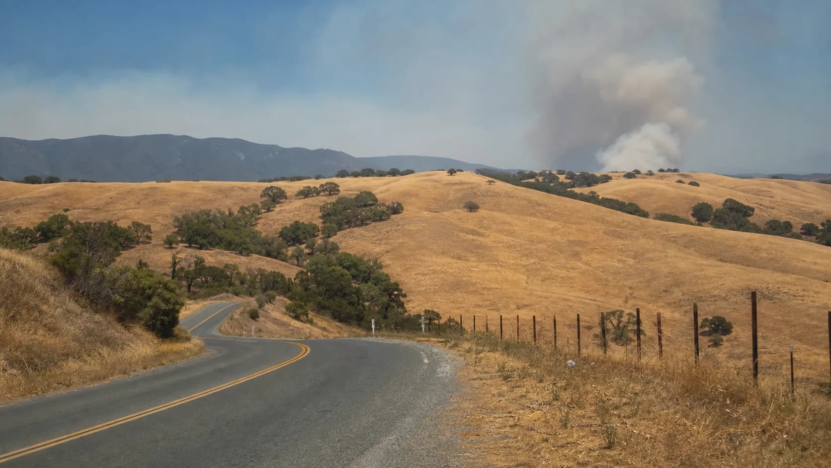
CAL FIRE identifies the incident as the Little Fire, a wildfire that started July 21, 2026, at 3:39 p.m. near Vallecitos Road and Little Valley Road in Sunol, Alameda County. The agency says the fire is under unified command with CAL FIRE’s Santa Clara Unit and Alameda County Fire Department. Its updates describe grass and brush fuels, difficult access, threats to structures and powerlines, and firefighting from the ground and air. One firefighter injury was listed on the CAL FIRE page; no broader damage totals should be assumed unless officials update them.
For travelers, the most useful details are not the dramatic smoke photos circulating online but the official evacuation layer and timestamps. CAL FIRE’s page showed evacuation orders for PLS-081 and PLS-103 at the last update reviewed. Earlier incident updates included additional zones and warnings, which is a reminder that wildfire boundaries and orders can change quickly. If your hotel, short-term rental, family visit, golf reservation, winery stop, or corporate meeting is in the Tri-Valley, compare the exact address with the official evacuation map before traveling.

Why This Matters for New Yorkers Flying West
Most NYC-to-Bay Area travelers will land at SFO, OAK, or SJC, then drive or take rail east. Pleasanton is not beside the terminals, but it is close enough to major East Bay routes that a fire near Sunol can affect ground plans more than flights. A meeting in Pleasanton, a stay in Dublin, or a drive through the I-680 corridor is a different risk calculation from a weekend in downtown San Francisco or coastal Marin.
The best move is to separate three questions: Is your flight operating? Is the air quality acceptable for your plans? Is your destination or route affected by an evacuation order, warning, smoke, traffic, or utility issue? A flight may be on time while the final 35 miles are slow, smoky, or inaccessible. Build your plan around official sources, not a single social post from someone who may be seeing smoke from another part of the Bay Area.
Airports: Check SFO, OAK, and SJC Before Leaving NYC
San Francisco International Airport’s current travel alerts already warn of delays tied to FAA reduced arrival rates and runway construction, with SFO saying at least 30-minute delays are expected on roughly 30% of arriving flights and that the runway is expected to reopen in early October 2026. The FAA’s July 21 daily air traffic report also flagged low clouds expected in San Francisco. Those are airport and weather constraints separate from the Pleasanton-area fire, but they can compound a tight itinerary from JFK, LaGuardia, or Newark.
For OAK and SJC, use the airports’ flight-status pages plus your airline app, because airport boards and airline operations can update faster than national summaries. San José Mineta says its flight status view covers flights eight hours ahead and one hour back in Pacific time and advises passengers to confirm with their airline. If you are choosing between airports, SFO may be best for San Francisco, OAK for much of the East Bay, and SJC for the South Bay, but fire-driven road changes can temporarily change that logic.
Airline Waivers Are Not the Same as Wildfire Access
As of the latest official airline advisories reviewed, Delta listed several current advisories, including New York City thunderstorms and Northeast U.S. inclement weather, while Alaska Airlines posted an East Coast travel advisory covering cities including JFK and Newark for July 21-22 travel. Those policies relate to weather and airline rebooking rules, not necessarily to the Little Fire. We did not verify a Bay Area wildfire-specific blanket waiver from those airline pages.
That distinction matters if you are deciding whether to fly. Airlines may let you change a ticket because of storms at New York airports while still operating your Bay Area flight. Conversely, your ticket may have no waiver even if your local destination has smoke or an evacuation concern. Before canceling, screenshot official fire maps, keep hotel and event messages, and contact the airline or booking platform directly for the policy attached to your ticket.
BART, Rail, and Car Routes Into the Tri-Valley
BART is the main rail link many NYC visitors use after landing at SFO or OAK, with Dublin/Pleasanton serving as the East Bay endpoint for many Tri-Valley trips. BART’s advisories page did not present a Little Fire-specific closure in the page reviewed, but it did list planned service impacts, including weekend bus bridges between Union City and Warm Springs/South Fremont and recurring late-night delays near Millbrae and SFO tied to train-control work. Those could matter if your itinerary connects airport rail, BART, and rideshare pickup.
Drivers should verify routes on Caltrans QuickMap or 511 before using I-680, Highway 84, Vallecitos Road, Pleasanton-Sunol Road, or rural connectors near Sunol. Caltrans already had a separate State Route 84 overnight closure project in the Sunol area this summer, which can complicate detours even when it is not fire-related. Do not route yourself through an evacuation area to save a few minutes; closed zones are public-safety orders, and firefighting equipment needs the road space.
Smoke, Heat, and Outdoor Plans
Smoke can travel differently from the fire perimeter. Dublin posted that smoke from the blaze was visible over the city while also saying there was no immediate threat to Dublin residents or businesses at the time of that July 21 notice. That is exactly the kind of nuance travelers need: visible smoke does not always mean you are in an evacuation zone, but it can affect outdoor dining, hiking, golf, cycling, vineyard visits, and long walks from transit stops.
Use AirNow’s Fire and Smoke Map for the official U.S. Air Quality Index and nearby sensors, then decide whether outdoor plans still make sense. Pleasanton’s emergency-preparedness guidance also emphasizes heat safety, hydration, N95 masks during wildfire smoke, and following emergency alerts. If you are bringing children, older relatives, or anyone sensitive to smoke, plan indoor alternatives near your hotel before arrival rather than improvising after a long flight from New York.
Where to Get Local Alerts Once You Land
Pleasanton directs residents and visitors to AC Alert, Nixle, Genasys Protect evacuation resources, and city emergency information. Travelers often skip local alert signups because they are not residents, but the city specifically notes that additional addresses can be entered and that optional city notifications are available for places you visit for work, school, or other reasons. That is useful if you are staying in a Pleasanton hotel, visiting family in Ruby Hill, or attending a business event in Livermore.
Keep notifications practical. Add your hotel, meeting site, or family address; save the CAL FIRE Little Fire page; and check the Alameda County Sheriff or local emergency channels linked from official pages. If an evacuation order covers your zone, leave immediately and do not wait for a hotel desk, host, or rideshare driver to interpret it. If your zone is only under warning, use that time to relocate early if you would need extra time, luggage help, or a pet-friendly ride.
Practical notes
Practical notes for NYC travelers: check your flight in your airline app before leaving for JFK, LGA, or EWR, then check SFO, OAK, or SJC again after boarding because Bay Area arrival conditions can shift. Pack a high-quality mask if smoke may affect your plans, and keep medications, chargers, glasses, IDs, and one change of clothes in your carry-on. If you are driving, download offline maps but rely on Caltrans, 511, and official evacuation maps for closures. Avoid rural sightseeing near Sunol, Vallecitos Road, Little Valley Road, or evacuation-zone edges until officials say it is safe. If your destination is Pleasanton, Dublin, Livermore, or nearby wine country, call the hotel or host for local conditions, but treat public-safety orders as the final authority.
Tags: #pleasantonfire #LittleFire #NYCTravel #BayAreaTravel #CaliforniaWildfire #CALFIRE #SFO #OAKAirport #SJC #BART #EastBay #PleasantonCA #WeekendPlans #TravelAlerts
Sources consulted: CAL FIRE Little Fire incident page · City of Dublin notice on smoke visible from brush fire near Pleasanton · City of Pleasanton emergency preparedness and wildfire guidance · Livermore-Pleasanton Fire Department fire danger level · SFO current travel alerts · FAA daily air traffic report · San José Mineta International Airport flight status · BART alerts and advisories · Delta Air Lines current advisories · Alaska Airlines travel advisories · AirNow Fire and Smoke Map information · Caltrans State Route 84 Sunol closure notice
All trademarks are the property of their respective owners.
Ask Karpo first
Ask Karpo can turn this into a day-by-day travel checklist for your exact NYC-to-Bay Area itinerary, including which official pages to refresh, what to ask your hotel, and how to compare SFO, OAK, and SJC arrivals if your plans are flexible.