 Crown Heights Rainy Day Kids Activity Finder for Toddlers
Weekend Plans
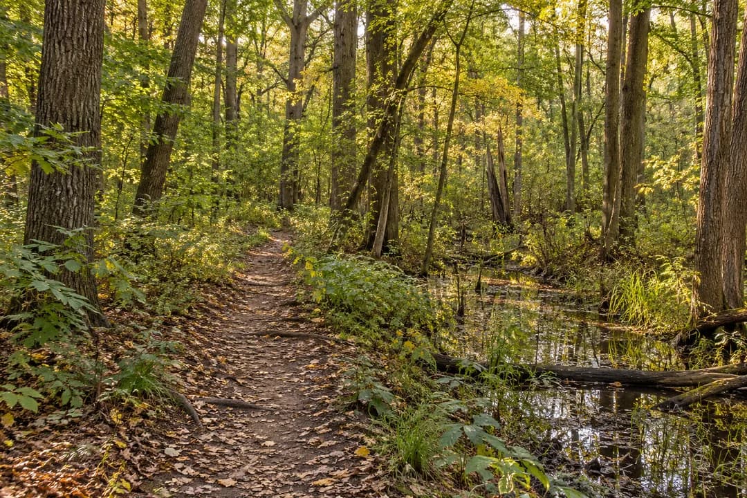
NYC Urban Wildlife Sanctuary: North Mt Loretto Forest Walk
North Mt Loretto State Forest offers Staten Island woodland and seasonal wetland habitats, with a thoughtful approach to amphibians and shared forest paths.
North Mt Loretto State Forest pairs mature woods with wetland habitat on Staten Island, giving an NYC urban wildlife sanctuary visit a different character from the coastal Mount Loretto landscape nearby. DEC describes seasonal ponds and flooded channels among the trees. Make the forest your subject: how water occupies hollows, how tree cover changes a view and how much of a habitat stays hidden. This is a good outing for curiosity about woodland amphibians, provided curiosity stops at looking rather than searching under their cover.
North is a different landscape from the shore
The similar names can obscure the distinction. North Mt Loretto State Forest and Mount Loretto Unique Area are neighboring properties, not interchangeable descriptions of one walk. The forest's story is inland woodland and wet ground. Start with the correct DEC map so that the route you choose matches that setting. Expecting the coastal area's open views would give the visit the wrong objective before you have even looked between the trees.
A forest walk does not have to compete with a shoreline outing. If your group likes enclosed spaces, branching trunks and glimpses of water, keep this visit focused on them. Leave a coastal comparison for another trip rather than trying to connect every nearby green space in one afternoon. Choosing one landscape allows you to notice its structure. It also leaves more energy for the slow work of distinguishing shadows, leaves and water along a woodland path.
A pond can be interesting even when it is absent
DEC's use of seasonal ponds is a useful clue about what to look for. Water is not necessarily the same visible feature on every visit. From the trail, notice hollows, leaf patterns and the way vegetation surrounds lower ground. You do not need to diagnose how recently an area held water. The question is how the land is arranged, and which parts look different from the firmer ground supporting the path beneath your feet.
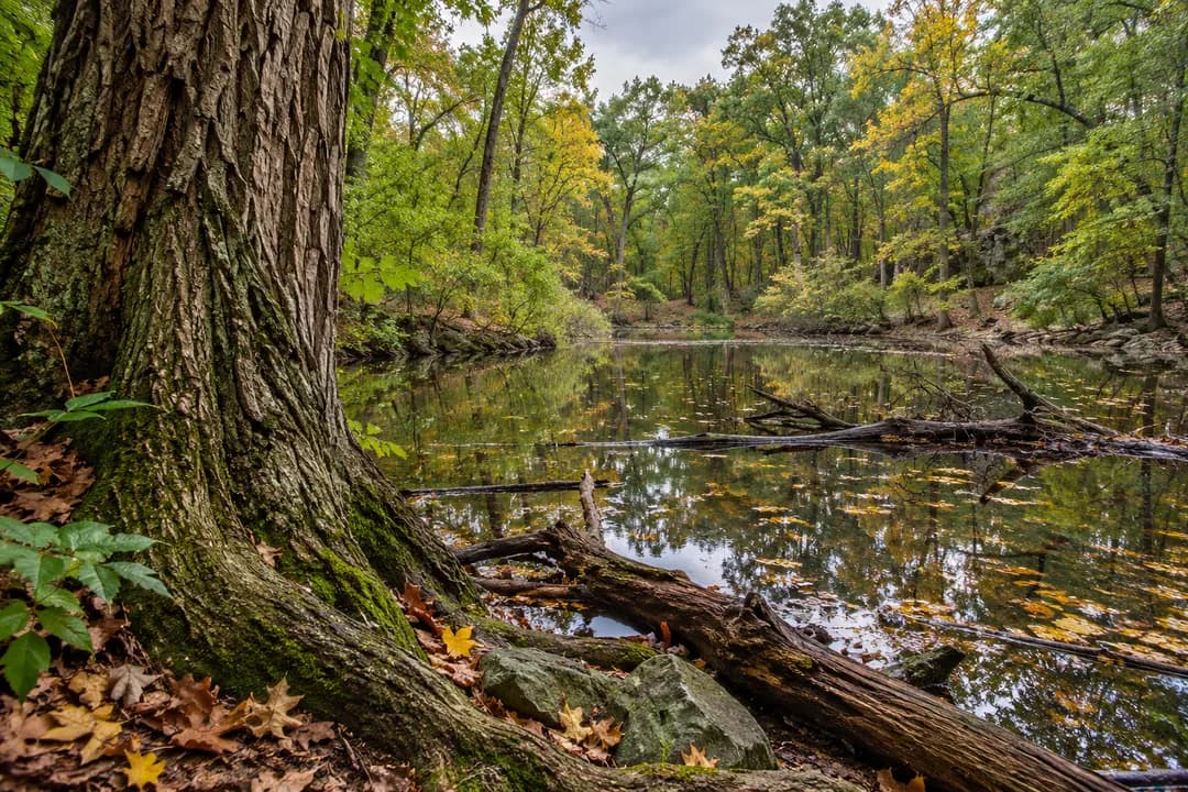
If you return, choose a recognizable tree or turn in the route as a reference point. Compare what you can actually see, without assuming a wet or dry appearance means something has gone wrong. Keep observations separate from explanations. Saying that a hollow looked dry on one visit and reflective on another is a useful record. Claiming a cause would need more information. This distinction lets a beginner learn from repeated walks without pretending to be a hydrologist.
Let amphibians keep their hiding places
Salamanders and frogs appear in DEC's description of the forest's wildlife habitat. Their presence in that account does not make them a guaranteed feature of your afternoon. Skip the temptation to lift wood, move stones or part thick vegetation. A hiding place remains valuable even when it prevents a visitor from getting a closer look. The same restraint makes the visit easier to share with children: the goal is understanding the setting, rather than bringing an animal into view.
Give a child a visible task instead. Ask where a small creature might find cover, then discuss the answer without approaching that spot. A shaded tangle, water edge or fallen limb can start the conversation. Make it clear that a possible shelter is not proof of an occupant. If you do happen to see movement from the path, watch quietly and allow it to end. A fleeting view can be a complete experience without touching, pursuing or photographing the animal.
Five trails need a decision before a destination
DEC describes a network of five trails in the forest. A network creates choices, but a useful plan does not require taking all of them. Decide whether you want a straightforward walk, a series of pauses or an outing centered on an accessible route. Those are different tasks. Use the map to choose accordingly and keep your turning points understandable to everyone in the group. Distance covered is a poor measure of a visit built around looking closely.
There is also shared use to consider. DEC describes single-track routes used by hikers and cyclists. Stay aware of other visitors while you study the surroundings, and choose stopping positions that keep the route clear. Avoid suddenly stepping backward for a photograph. If the group wants a longer discussion, gather where there is room before beginning it. The woodland will still be there once another trail user has passed, and attention is easier when nobody has to squeeze around you.
Read the forest from ground to canopy
Try a change of scale that does not depend on wildlife. Look first at the ground visible from the path, then the lower trunks and finally the canopy. At each level, find one feature you can describe precisely: overlapping leaves, a fork in a tree or a gap of sky. The sequence helps you see the woods as layers rather than a green wall. Repeat it in another permitted spot and notice which layer is most prominent there.
For photography, choose either the larger arrangement or one textural detail. A close image of bark and a broader view of trees around wet ground can work together, but neither needs a dramatic sunset. Be honest about the light available. If the woodland is dim, accept a softer picture or put the camera away. There is no benefit in leaving the route to recover a brighter angle when the real subject is the place as you encountered it.
The forest's preservation is part of the visit
DEC records that North Mt Loretto entered its stewardship in 2008 through collaboration with conservation partners. That history gives the walk another question: what does keeping woodland within a city make possible? You do not need to answer with a total species count. Begin with what the forest preserves in front of you: tree cover, wetland space and a connected setting where wildlife can remain partly unseen. An urban nature outing can be about that continuity.
A neighborhood finish should keep the same manageable scale. Leave by the established route, then decide whether you want a separate street walk or somewhere to sit. Avoid interpreting a gap in the woods as a convenient exit. If you use the Karpo APP for the next idea, describe your preferences plainly, such as a quiet indoor stop after a shaded walk. The forest portion can end well before everyone is tired enough to stop noticing it.
Practical Notes
Bring water, a comfortable layer and footwear for woodland walking. Keep snacks packed away while observing and take packaging out with you. DEC's guidance includes carrying litter out, avoiding new trail construction and keeping pets controlled around other users. Follow local signs and choose a shorter return if footing becomes uncomfortable. A map is helpful for understanding the network, while the decision to turn around belongs to the people actually on the path.
Finish with a question worth bringing back rather than a species tally. Perhaps you want to see the same hollow in a different season or understand why one part of the canopy admits more light. That gives the next visit a purpose without requiring a new attraction. North Mt Loretto rewards a patient relationship with woodland: one recognizable viewpoint, a small change and the possibility that much of its life will continue out of sight.
Ask Karpo for more information.
Keep reading
- Crown Heights Rainy Day Kids Activity Finder for Toddlers
 Jackson Heights Rainy Day Kids Activity Finder for Siblings
 Lower East Side Rainy Day Kids Activity Finder by Stroller