 Fort Greene Holiday Market Browsing Guide for Young Shoppers
Weekend Plans
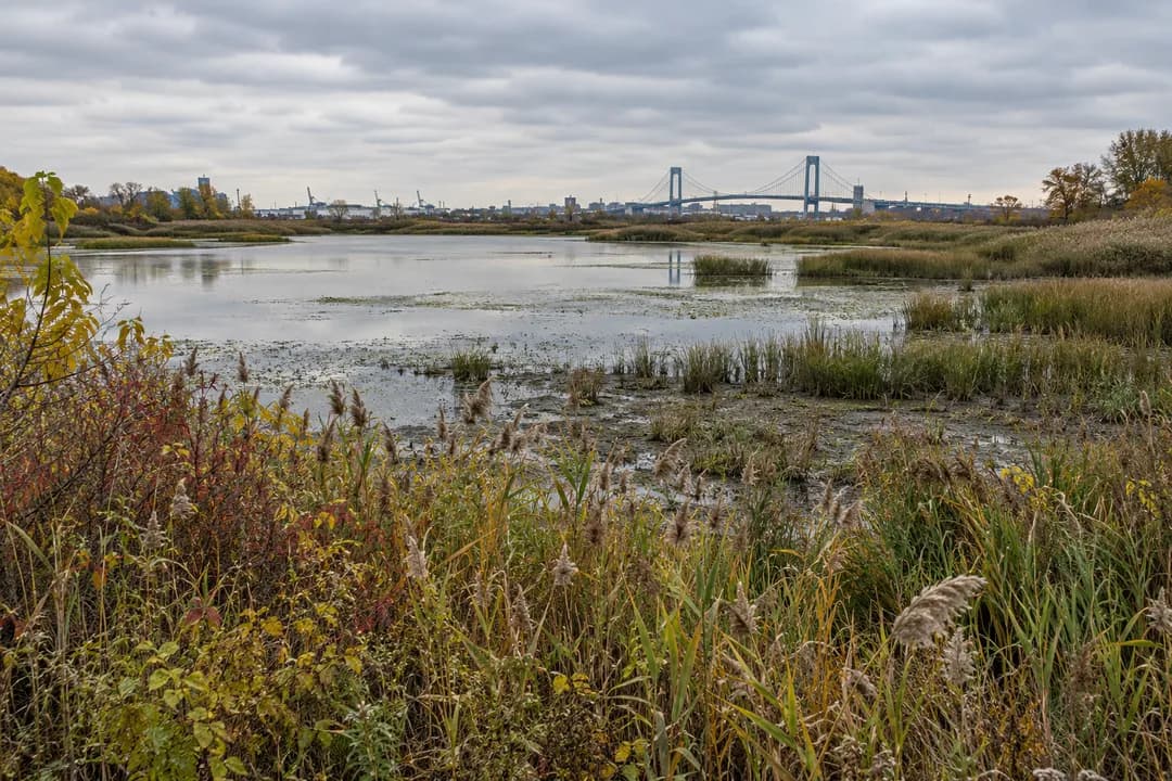
NYC Urban Wildlife Sanctuary: Read Goethals Pond Shallows
Goethals Pond offers shallow-water bird observation in Staten Island, with an industrial backdrop and wetland edges that reward looking from established paths.
Goethals Pond brings an NYC urban wildlife sanctuary outing into view beside Staten Island's transport landscape. DEC describes shallow water, marshes and wet woodland supporting birds within a heavily altered setting. The pond's history includes drainage changes associated with roads and rail crossings. That makes it an interesting place to look without pretending the city has disappeared. Start with the water and its edges, then consider the infrastructure around them. This visit is about learning to see habitat where the backdrop might otherwise make you overlook it.
Begin with a question about the water's edge
A pond is easier to read when you stop treating its entire surface as one subject. From an established viewing place, choose a visible margin between water and vegetation. Notice whether the boundary is a clear line, an uneven series of gaps or a screen of reeds. You do not need to step closer to understand the contrast. A broad view gives you a chance to see how the edge changes along the pond.
Then look farther out. Is the surface visibly broken by vegetation, reflections or movement? Which part can you actually see clearly? These are useful questions before opening a bird guide. They remind you that a missing sighting may simply reflect the limits of your viewpoint. A pond can contain more activity than a visitor can see, and the screen of plants is part of what makes it habitat rather than a display.
A changed pond inside an engineered city
DEC describes Goethals Pond as a former tidal salt marsh whose drainage changed when nearby infrastructure restricted water movement. Its account then describes a mixture of fresh and salt water supporting wildlife. Keep the history at that level rather than trying to determine salinity by eye. The landscape offers a way to think about connections between roads, crossings and water, but a casual walk cannot supply measurements or explain every process occurring beneath the surface.
The surrounding urban context is worth leaving in your mental picture. A bridge or industrial backdrop does not erase the wetland in front of it. Equally, the existence of bird habitat does not make every surrounding piece of land an appropriate place to explore. Keep the distinction clear: observe the natural area from established visitor routes, and leave neighboring infrastructure to its own purposes. A tempting gap beside a commercial property is not a substitute for a mapped approach.
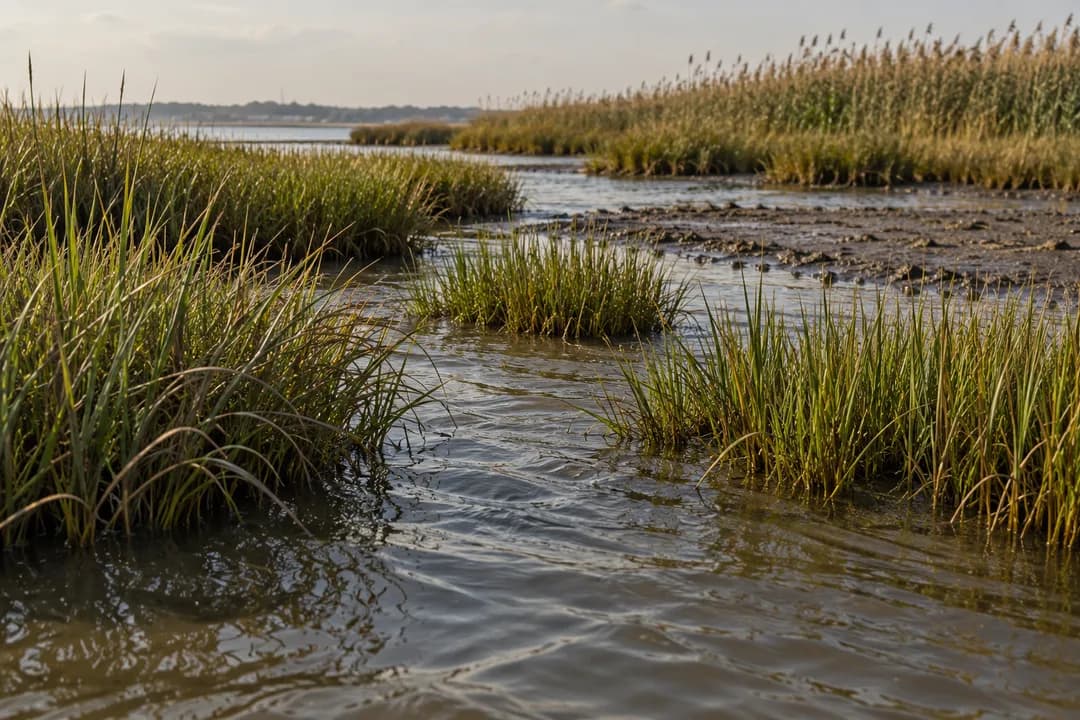
For a photograph, try keeping a modest amount of that wider context in the frame. An image that includes wetland vegetation and a distant urban shape can explain why this place is interesting. Cropping away every sign of the city may create a prettier scene but tell a less complete story. You can also make a second, closer image of water and grass to show the texture that disappears in the wider view.
Watch feeding behavior before reaching for a name
DEC's wildlife description includes wading birds and migratory birds using the shallow-water habitat. If a bird is visible, begin with behavior: standing, moving, dipping or crossing between patches. Distinguish what you can see from what you infer. A lowered head may be an observation, while a claim about the exact prey requires more evidence. Watching this way gives beginners something concrete to do even when the bird is distant or difficult to identify.
Share a sighting with a companion using fixed features of the landscape. A gap in reeds or a distinctive clump of vegetation gives another person a chance to find the same spot. Avoid rushing them through an identification. Once you both have the subject, compare descriptions and see which details agree. This makes a quiet conversation possible without turning the pond edge into a contest over who can name the most birds.
When the view ends, let it end. A bird disappearing behind reeds is not a reason to approach the screen or push into the marsh. Do not use food, sounds or objects to bring it back. Keep your group within the space already available and select a different visible patch if you want to continue. The pond's value lies partly in the cover it provides, including cover that works against a visitor's desire for an unobstructed photograph.
Three names do not mean one continuous walk
The Goethals Pond Complex includes Goethals Pond, Goethals Field and Bridge Creek in DEC's description. Those names help explain a broader habitat setting, but they should not be read as a promise of an easy connected circuit. Use the state's map to distinguish the locations. A first visit can concentrate on the pond and its viewing opportunity rather than attempting to link each part through whatever roads or openings look convenient.
This is especially useful for people arriving with different expectations. Someone interested in waterbirds may want a long stationary pause, while a companion might prefer a continuous walk. Agree on which activity takes priority. If you need a more extensive walking route, choose it deliberately as a separate plan. Making the pond visit serve every purpose risks losing the patient observation that makes the site worth seeking in the first place.
Use the viewing place without claiming the whole scene
DEC describes a short trail to an accessible viewing platform. Treat the platform as a shared vantage point rather than a private photography station. Keep tripods, bags and companions from blocking passage, and allow others to use the view. If your preferred angle is occupied, wait or look elsewhere on the visible water. A small shift in attention often reveals something different without requiring a change of position at all.
An accessible feature is a specific facility, not a description of every surrounding route. Plan with the relevant map and your own needs in mind. The outing can be short and still have a clear purpose: compare two sections of pond edge or spend time on one visible behavior. That is more useful than promising a complete circuit to companions before understanding how the different parts of the complex relate to one another.
Practical Notes for a patient pond stop
Bring binoculars if you enjoy using them, but keep the visit possible without specialist equipment. Water, a comfortable layer and a manageable bag matter during stationary observation. Follow posted instructions and take litter out. DEC's visitor guidance prohibits unauthorized trail building and asks people to control pets around other users. Leave reeds, branches and other vegetation as part of the habitat, even when moving them would improve your view.
Finish by describing the pond to someone who has not visited: shallow water, a screened edge and a city backdrop that belongs in the account. A neighborhood stop afterward can be chosen separately once you have left by the established route. The Karpo APP can be a place to ask for ideas for a relaxed next stop, using your group's preferences. Let the pond remain the main experience rather than treating it as a quick photograph between destinations.
Ask Karpo for more information.
Keep reading
- Fort Greene Holiday Market Browsing Guide for Young Shoppers
 DUMBO Holiday Market Browsing Guide for Gifts to Mail Home
 Midtown East Holiday Market Browsing Guide for Commuters