 Flatiron Holiday Window Walk Planner for Remote Teams
Free Things to Do
Williamsburg Scenic City Skyline Viewpoint: Free Walks
Explore a Williamsburg scenic city skyline viewpoint walk from Domino Park to Marsha P. Johnson State Park using Karpo APP to organize riverfront stops.
Standing on the elevated steel catwalk of Domino Park while East River ferry boats glide past the brick smokestack of the 1882 Domino Sugar Refinery, the entire eastern flank of Manhattan stretches from the Financial District spires to the Art Deco crown of the Chrysler Building. Choosing a scenic city skyline viewpoint in Williamsburg gives walkers a front-row amphitheater across the water where industrial Brooklyn heritage meets uninterrupted metropolitan horizons. Since the public reopening of the River Street shoreline in 2018, a continuous chain of waterfront parks, pier aprons, and historic ferry landings has made it possible to trace the shoreline from Broadway north to Bushwick Inlet without paying admission. Organizing these shoreline stops inside the Karpo APP lets you align each vantage point with shifting afternoon light and nearby subway or ferry connections.
Domino Park Elevated Catwalks And Gantry Crane Frames
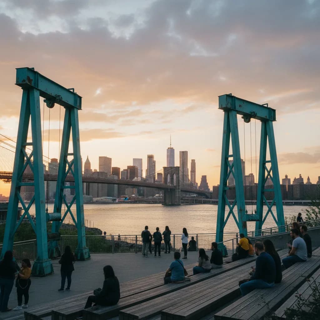
Between Grand Street and South Fifth Street along River Street, Domino Park occupies five acres of former sugar-refining wharf transformed into a multi-level public promenade in 2018. Its centerpiece for skyline watchers is the Artifact Walk, an elevated pedestrian walkway rising above the lawn and framed by four salvaged raw-sugar syrup tanks and eighty-foot turquoise gantry cranes. Climbing the stairs to the upper walkway lifts your line of sight above the riverside railings, placing the massive steel towers of the 1903 Williamsburg Bridge immediately to your south while the Empire State Building rises across the river to the northwest.
Below the catwalk, tiered wooden stadium seating near South Fourth Street faces directly west toward the water, where neighborhood runners, families with strollers, and sunset sketchers gather during the final hour of daylight. Because the park curves slightly outward into the East River channel, you can pivot from a tight architectural frame through the bridge cables to a wide midtown horizon simply by walking two hundred yards north toward Grand Street. Recording your preferred seating tiers and walkway angles in the Karpo APP helps you return to the exact spot that suits your camera lens.
Grand Ferry Park And The North Fifth Street Pier Apron
Immediately north of Domino Park at the western foot of Grand Street lies Grand Ferry Park, a quiet pocket waterfront that preserves the nineteenth-century landing where steam ferries once carried farm produce and commuters between Brooklyn and Grand Street in Manhattan. Bordered by weathered stone blocks and native trees, this compact inlet sits closer to the water surface than the surrounding esplanades, offering an intimate low-angle perspective of tugboats and barges passing beneath the Midtown towers.
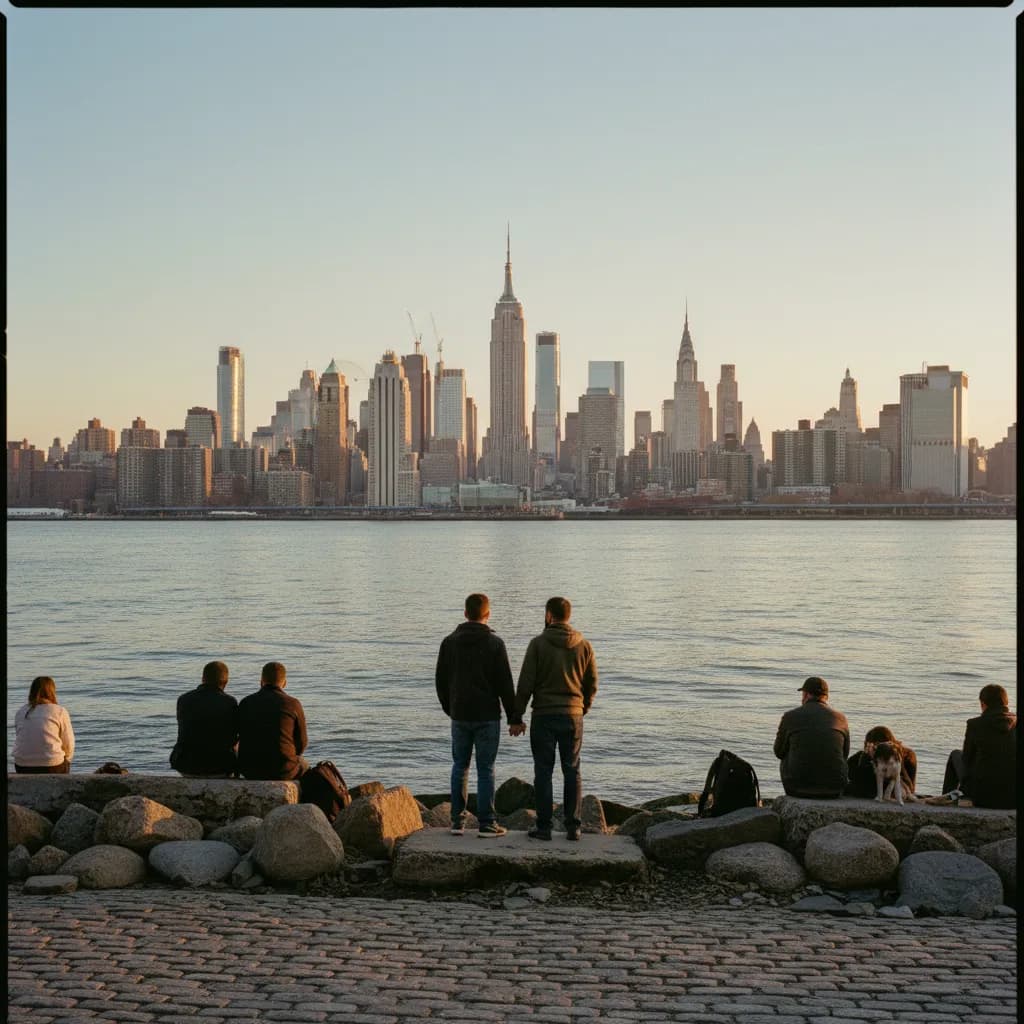
Continuing north along Kent Avenue brings you to the North Fifth Street Pier and Park, where two long concrete and timber piers extend far into the East River current beside the North Williamsburg ferry slip. Walking out to the western tip of the recreational pier places you nearly in the center of the river bend, eliminating foreground obstructions so you can see both One World Trade Center downstream and the United Nations headquarters upstream in one continuous sweep. Keeping both the low-key Grand Ferry cove and the extended North Fifth Street pier in your Karpo APP walking plan gives you contrast between sheltered shoreline seating and open over-water sightlines.
Marsha P. Johnson State Park And Midtown Axis Sightlines
At Kent Avenue between North Seventh Street and North Twelfth Street, Marsha P. Johnson State Park spans eleven acres of open meadow, concrete wharf slabs, and a rare natural cobblestone beach along the East River. Established as a state park in 2007 and renamed in 2020 to honor the pioneering transgender rights activist, the park occupies a former nineteenth-century freight rail terminal where barges once transferred boxcars across the harbor. From the water's edge near the preserved steel transfer bridge girders, your sightline aligns dead-center with Midtown Manhattan, placing the Empire State Building, One Vanderbilt, and the Chrysler Building in a balanced triad.
Unlike elevated concrete decks, the sloped pebble beach at the northern edge of the park lets you stand just inches above the lapping river tide, creating foreground water reflections when the breeze settles at dusk. Weekend picnic groups fill the central grass lawns during warm afternoons, but the northern shoreline path near North Eleventh Street remains spacious enough for unhurried viewing. Using the Karpo APP to note the walking time between the state park gates and the Bedford Avenue subway entrance makes your post-sunset departure smooth.
High-Traffic Times To Skip And Windy-Day Inland Backups
Skip the central wooden bleachers of Domino Park and the narrow boarding gangway area at North Fifth Street Pier on warm Saturday evenings during the twenty minutes immediately before sunset, when dense crowds gather along the front railings and block low-angle camera views. You should also skip the exposed western tip of the North Fifth Street recreational pier during winter nor'easters or summer thunderstorms, as gusts funneling down the East River channel make standing at the outer railing uncomfortable. Tuesday through Thursday afternoons offer far quieter boardwalk access across the entire Kent Avenue corridor.
When cold harbor winds or sudden downpours cut your shoreline walk short, head two blocks inland along Bedford Avenue, Berry Street, or Wythe Avenue, where historic brick factory lofts break the wind while still leaving western cross-street sightlines open down North Sixth Street and Metropolitan Avenue. From Bedford Avenue at North Seventh Street, you can board the L train directly back to Manhattan, or walk south to the Marcy Avenue station for the J, M, and Z elevated lines. Saving these transit exits and sheltered brick side streets inside the Karpo APP ensures you always have a reliable backup route.
Pacing A South-To-North East River Sunset Walk
For a cohesive ninety-minute skyline walk, exit the Marcy Avenue station on the elevated J, M, and Z line and walk west down Broadway to enter the southern end of Domino Park near the Williamsburg Bridge footings. Beginning at the bridge end allows you to study the monumental steel suspension towers in crisp late-afternoon sunlight before walking north along the Artifact Walk and past Grand Ferry Park.
As the sun drops behind the Manhattan skyscrapers, continue north up Kent Avenue to reach the North Fifth Street Pier and Marsha P. Johnson State Park in time for twilight, when thousands of office windows ignite across Midtown and reflect over the dark river tide. Ending your route at North Eighth Street leaves you a five-minute walk up North Seventh Street to the Bedford Avenue L train station. Reviewing this south-to-north progression in the Karpo APP before setting out guarantees you hit the widest Midtown sightline at the peak of blue hour.
Ask Karpo for more information.
Keep reading
- Flatiron Holiday Window Walk Planner for Remote Teams
 SoHo Holiday Window Walk Planner for a Sketchbook Afternoon
 Upper East Side Holiday Window Walk Planner After a Museum