 Upper West Side Free Indoor Weekend Plan Finder for Music
Free Things to Do
Lower East Side Scenic City Skyline Viewpoint Guide
Plan a Lower East Side scenic city skyline viewpoint walk from Pier 35 EcoPark to the Williamsburg Bridge path using Karpo APP to organize public stops.
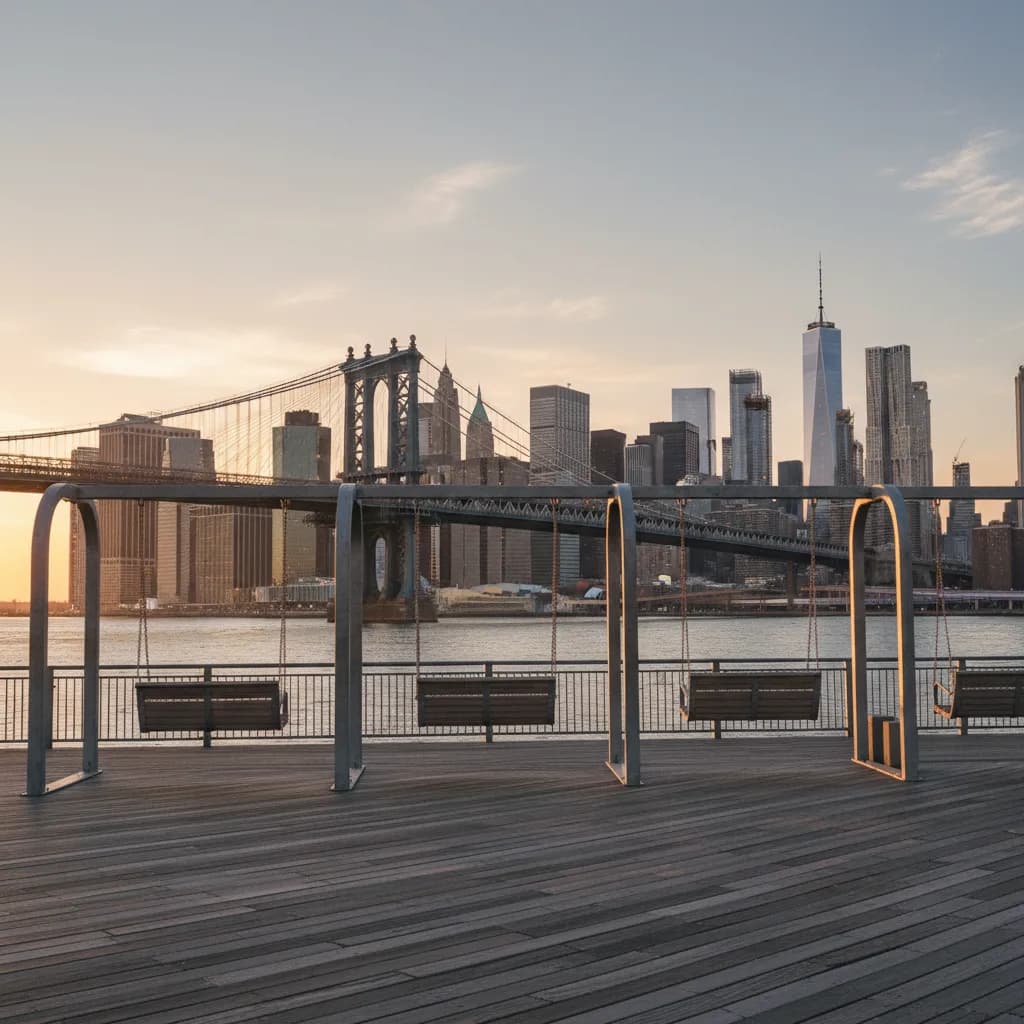
Stepping onto the timber deck of Pier 35 EcoPark just south of Jefferson Street, you hear the rhythmic hum of subway cars crossing the steel lower level of the Manhattan Bridge while the afternoon sun catches the glass spires of the Financial District downstream. Finding a rewarding scenic city skyline viewpoint in the Lower East Side does not require paying for a crowded observation elevator or waiting behind velvet ropes at a commercial rooftop lounge. Because the neighborhood wraps around the curve of the East River and sits between two monumental suspension spans, public parks and bridge approaches give walkers unobstructed angles toward both Midtown and Lower Manhattan. Using the Karpo APP to group waterfront piers, bridge ramps, and wide boulevard sightlines into a single afternoon sequence helps you match each stop to the shifting angle of the sun.
Pier 35 EcoPark And The Two-Bridge Waterfront Horizon
Along South Street below Cherry Street, Pier 35 EcoPark transforms an industrial riverfront edge into a tiered wooden landscape facing southwest across the East River. Four oversized metal porch swings hang beneath a white steel canopy near the western end of the pier, where locals with takeout coffee and amateur photographers carrying compact rangefinders watch commuter ferries carve white wakes between Brooklyn Bridge Park and Wall Street. Looking downstream from the upper lawn terrace, the 1909 steel latticework of the Manhattan Bridge stands directly in the foreground, while the granite towers of the 1883 Brooklyn Bridge frame One World Trade Center and the clustered stone peaks of the Financial District behind it. On clear autumn and winter afternoons, low southern light reflects off the water and illuminates the underside of both bridge decks without blinding glare.
Walkers who want a quieter angle away from the swings can climb the sloped timber boardwalk on the eastern side of Pier 35, where native coastal grasses and mussel-habitat EcoWalls border the water. Because the deck rises several yards above the South Street bikeway, freight trucks and passing cyclists drop out of your camera frame, leaving only river currents, tugboats, and the layered Downtown skyline. Organizing your stop order in the Karpo APP lets you pair this low-angle riverfront perspective with an elevated bridge climb later in the afternoon so you experience two distinct visual compositions within a thirty-minute stroll.
Ascending The Williamsburg Bridge Pedestrian Footpath From Clinton Street
For an elevated vantage point that rivals paid viewing decks, head north to the pedestrian ramp of the Williamsburg Bridge near the intersection of Delancey Street and Clinton Street. Opened in 1903 as the longest suspension span on earth at the time, the bridge features a dedicated northern pedestrian walkway separated from the southern bicycle lanes after the Manhattan approach towers. As you walk up the steady incline past the brick tenement cornices and cast-iron water tanks of Pitt Street and Ridge Street, the neighborhood roofs fall away beneath your feet and a sweeping north-south panorama opens across the island.
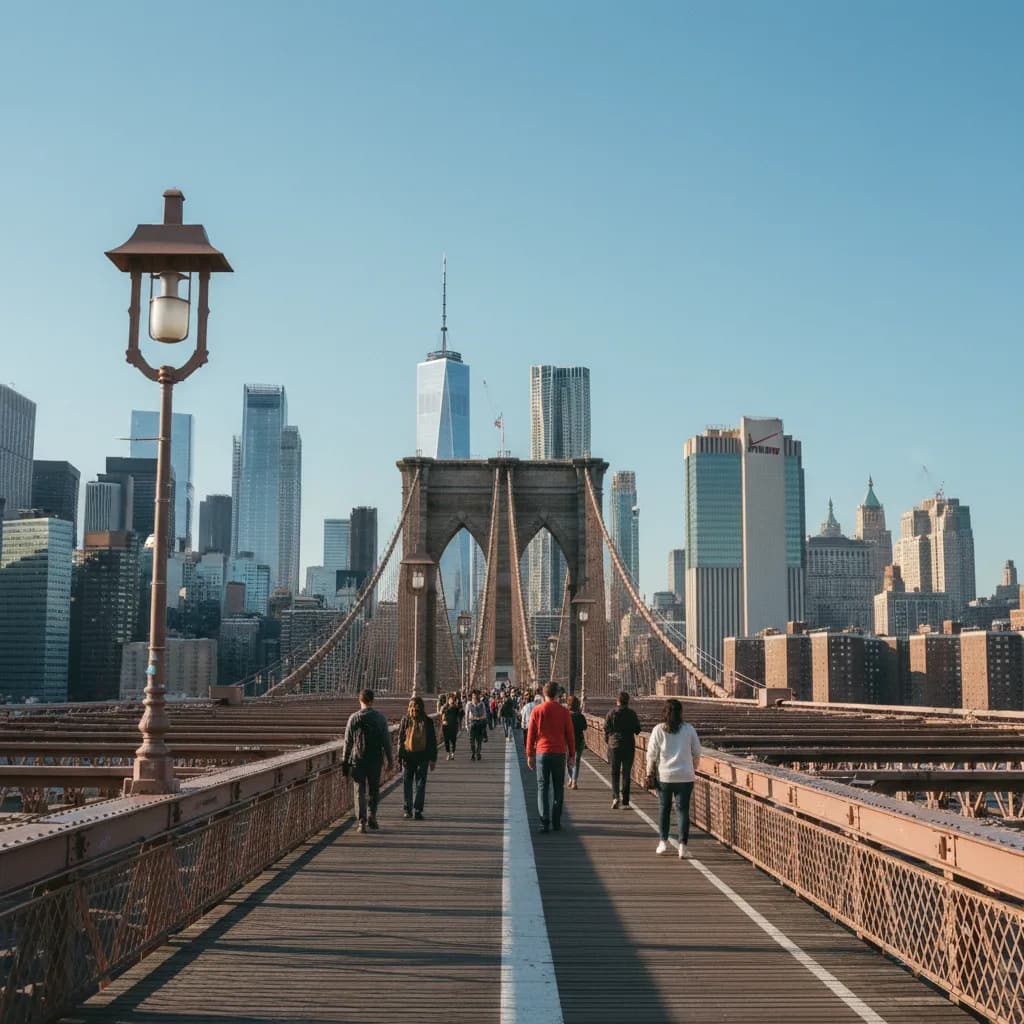
Halfway up the Manhattan approach span, pause at one of the flared steel railing alcoves to look north toward the Empire State Building, Chrysler Building, and One Vanderbilt rising above the low-rise residential blocks of the East Village and Stuyvesant Town. Turning south from the same railing reveals the East River bending around Corlears Hook Park toward the Manhattan Bridge and the glass towers of Downtown. The steel lattice trusses act as natural geometric frames for wide-angle and fifty-millimeter lenses alike, and the constant breeze coming off the river keeps the air crisp even on warm afternoons.
Chrystie Street Corridors And Tenement-Framed Canyon Sightlines
Not every memorable skyline angle in the Lower East Side sits on the water. The interior north-south avenues create dramatic architectural contrast between nineteenth-century brick masonry and contemporary supertall towers. Sara D. Roosevelt Park, a linear greenway stretching seven blocks between Canal Street and East Houston Street along Chrystie Street and Forsyth Street, clears a wide open sky channel through the middle of the tenement district. Standing beside the handball courts or the brick fieldhouse near Broome Street and Grand Street, you can watch elderly neighbors playing afternoon chess while the slender glass towers of Midtown stand centered at the northern horizon.
Walking east along Division Street and East Broadway beside Seward Park, which opened in 1903 as the nation's first permanent municipally built playground, offers another classic neighborhood sightline. Here, five-story brick walk-ups with ornate fire escapes and bilingual signboards angle directly toward the southern financial core, creating a stark visual dialogue between historic immigrant street life and modern steel skyscrapers. Keeping a brief list of these interior intersections in the Karpo APP gives you an immediate inland alternative whenever cold river gusts make the open piers uncomfortable.
When To Skip The Riverfront Walk And Practical Weather Backups
Skip the Williamsburg Bridge pedestrian climb during heavy rain, icy winter squalls, or days when sustained gusts exceed twenty-five miles per hour, as the exposed steel grating and elevated ramp offer zero shelter from crosswinds and blowing spray. You should also skip the central swing section of Pier 35 on sunny Saturday evenings within forty minutes of sunset if you need tripod space or uninterrupted railing access, since weekend crowds fill the narrow timber seating tiers quickly. Weekday afternoons between two and four o'clock deliver the calmest balance of warm directional sunlight and open bench space along the water.
When gusty winds or sudden showers make the riverfront piers unpleasant, pivot to an inland transit-adjacent route anchored by the Delancey Street and Essex Street subway transfer hub, served by the F, J, M, and Z trains, or the Grand Street station on the B and D lines. From Essex Street, you can walk under the sheltered masonry arcades of the Essex Crossing blocks and step into the public seating mezzanine inside Essex Market to warm up before catching a clear break in the clouds along Delancey Street. Saving both your primary riverfront loop and your inland backup stops inside the Karpo APP ensures your Lower East Side skyline outing stays effortless in any season.
Structuring A Seamless Golden-Hour Route Across The Neighborhood
The most effective sequence for a free two-hour skyline walk starts at the East Broadway F train station and moves south to Pier 35 EcoPark while the afternoon sun still lights the eastern faces of the Downtown skyscrapers. Spend twenty-five minutes along the waterfront deck and the eastern boardwalk slope, then follow the East River esplanade or Montgomery Street north toward Grand Street and Clinton Street as the light softens into golden hour.
Reaching the Williamsburg Bridge pedestrian entrance at Delancey Street thirty minutes before sunset lets you climb to the first river tower just as the Midtown and Lower Manhattan windows begin glowing amber against the twilight sky. After descending back to Clinton Street, you are only two blocks from the Delancey Street–Essex Street station, making the return trip across the city straightforward. By reviewing your saved sequence in the Karpo APP before you leave the subway platform, you can move smoothly from historic brick blocks to wide river horizons without backtracking.
Ask Karpo for more information.
Keep reading
- Upper West Side Free Indoor Weekend Plan Finder for Music
 Astoria Free Indoor Weekend Plan Finder for Visiting Parents
 Williamsburg Free Indoor Weekend Plan Finder With Kids