 SoHo Tailor Alteration Shop Finder for Sample Sale Finds
Neighborhood Guides
Heritage Historic District NYC: 3 Douglaston Landscape Clues
Douglaston suits an exterior architecture walk focused on houses, terrain and planting, with a district map and no assumption of waterfront or private access.
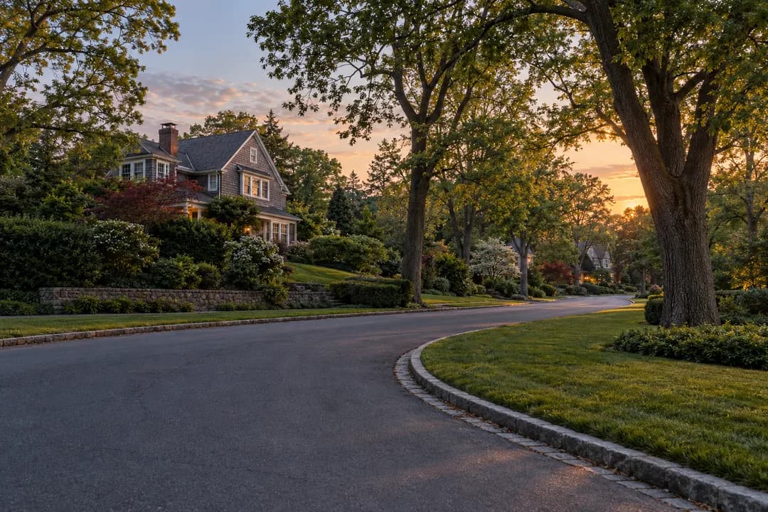
Douglaston offers a different question from a Manhattan rowhouse walk: how much of a historic district's character belongs to the landscape around its houses? The NYC heritage historic district visit proposed here follows that question through the Douglaston district, using the city's master plan as a reading companion. The plan describes a planned suburb adapted to an earlier estate, with varied houses, distinctive terrain and landscaped streets. Choose this outing for that relationship between buildings and setting, rather than expecting a sequence of public interiors or a guaranteed waterfront destination.
Decide which Douglaston you mean
Before making a route, distinguish the Douglaston Historic District from the separately named Douglaston Hill Historic District. The city's master plan used here concerns the former. Similar names are easy to collapse in a search result or a shared message, but they do not make the boundaries interchangeable. Put the full district name in the plan you send to your companion, and keep the corresponding official map beside it. The meeting place can then be selected without silently changing the subject of the walk.
This matters particularly for a visitor choosing between a compact architecture outing and a longer neighborhood exploration. Do not assume that a destination name establishes a manageable walking distance. Start with the district you intend to study and the actual paths between your selected exterior viewpoints. Give the outing an endpoint before adding attractions. The aim is a coherent look at one landscape, not a test of whether you can collect every place with Douglaston in its name.
The house is only part of the picture
The master plan places much of the district's development within the early twentieth-century Douglas Manor project. It discusses several architectural traditions, but its description gives equal importance to the landscaped setting and topography. That is the useful viewing instruction. Leave enough space in your photograph to show how a house sits on its site. A tight crop of a gable might be attractive while concealing the very relationship that distinguishes the place.
Try a simple sequence at one suitable public viewpoint: look at the ground first, the planting second and the building third. Ask where each begins to shape the next. Is a change in level part of the composition you notice? Does a tree obscure the facade or help explain the scale of the plot? Treat these as questions for your own observation, not prewritten answers that every stop must prove. If a detail is hidden, leave it out of your description.
Read the master plan as a visitor
An official preservation document is written for a different purpose from a weekend itinerary. It helps explain why a place has a particular character, but it does not promise visitor facilities or admission to the properties it discusses. Take its architectural description as context for looking. Do not use an alteration rule to infer what an owner must show you, or a listed historic feature to infer a right of entry. A document can establish significance without turning a home into a museum.
For a first reading, separate three categories in a notebook: documented history, things visible during your walk and your interpretation. The history can remain brief. Your visible observations may be more detailed, provided they stay precise. An interpretation such as finding a corner harmonious is your judgment, not a municipal finding. Keeping those categories apart makes conversation more interesting, because a companion can disagree with the interpretation while looking at the same recorded evidence.
Choose variation rather than a greatest-hits list
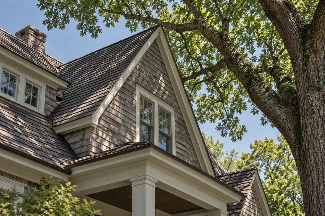
A district with varied houses can tempt a walker to rank them. Replace that competition with comparison. Select a small number of different roof shapes, frontage arrangements or relationships to planting. Let the differences explain the shared setting. A less dramatic house may be more useful to the exercise than an elaborate one if it helps you see how scale, materials or spacing connect the group. There is no need to declare a winning facade.
For photographers, make one image about a building and another about its surroundings. For a drawing visit, sketch the broad outline before adding trim. For a companion interested in planning, discuss how streets and plots shape the view. These are three ways of using the same exterior walk, not three additional routes to complete. Pick the one that gives everybody a reason to pay attention. Skip the rest rather than turning a quiet residential setting into a crowded sequence of assignments.
A bay on the map does not complete the itinerary
The city's description locates the district on a peninsula extending into Little Neck Bay. That geographic fact does not establish public access to every waterside parcel, a continuous shoreline path or somewhere to sit at the water's edge. This outing makes no such promise. If the purpose of your day is specifically waterfront recreation, choose a destination supported by its own public access information instead of assuming the residential district supplies it.
The distinction can prevent a disappointing family plan. A housing landscape walk and a beach or waterside play stop meet different needs. Discuss which one people want before travelling, particularly if a child has been promised a specific activity. Here the interest is how homes and landscape fit together. If that does not sound appealing to the group, change the outing itself. Adding an unsupported shoreline stop would not make the original plan more accurate or more enjoyable.
Give a residential walk room to stay ordinary
A visitor can observe without making a home feel on display. Keep conversations away from occupied entrances, leave driveways clear and do not linger beside windows for a composition. If a resident needs the space where you have paused, move on. These are the conduct choices recommended for this article, not claims about a special local visitor code. The neighborhood does not need to perform a historical scene for the visit to have value.
Weather and group energy should shape how much of the chosen route you attempt. A short observation exercise completed attentively is preferable to a longer walk pursued after somebody wants to stop. Make a practical return plan and allow the route to shrink. Do not present the district's landscape as evidence of universal accessibility. Terrain and a visitor's individual needs require more specific consideration than a description of picturesque streets can provide.
Practical Notes: keep the plan geographically exact
Label your saved route Douglaston Historic District, use the matching official boundary and keep private grounds outside the proposed stops. No house tour, shore access, refreshment service or public restroom is promised in this article. Those would be separate claims requiring separate information. The exterior walk needs only a clear purpose and a route suited to the people taking it. A district designation explains preservation significance, not a package of visitor amenities.
A planning conversation in the Karpo APP can begin with the distinction that matters here: you want a Queens residential landscape outing, with exterior architecture and a definite endpoint, rather than a Manhattan-style list of landmarks. Describe any limits on walking before selecting stops. Keep the official district documentation as the historical reference. Finish with a few observations about how ground, trees and houses work together; that relationship is a more useful memory of Douglaston than a list of houses you could not enter.
Ask Karpo for more information.
Keep reading
- SoHo Tailor Alteration Shop Finder for Sample Sale Finds
 Williamsburg Tailor Alteration Shop Finder for Bike Riders
 Upper West Side Tailor Alteration Shop Finder for Kids