 SoHo Tailor Alteration Shop Finder for Sample Sale Finds
Neighborhood Guides
Williamsburg Art Walk Route Planner: Free East River Loop
Walk from 135 Broadway to Domino Park at 15 River Street, open daily 6 AM to 11 PM for free. Connect South Side brick lofts and waterfront steel cranes.
Domino Park along River Street between Grand and South 5th Streets welcomes walkers free of charge every day from early morning until late evening beside the East River, anchoring a Williamsburg art walk route planner that links nineteenth-century civic stone architecture, repurposed brick factory exhibition rooms, and industrial riverfront sculpture. Beginning inland beneath the steel approach of the Williamsburg Bridge and moving north along Kent, Wythe, and Berry Streets lets you trace how Brooklyn's working shoreline evolved from sugar refining and barrel cooperage into contemporary studio and design spaces. Every leg of this north-bound route stays on flat waterfront blocks with open skyline sightlines toward Manhattan.
Starting Beneath the Mansard Roof at 135 Broadway
Ride the J, M, or Z train across the East River to Marcy Avenue for a $3.00 OMNY subway tap and walk four blocks west along Broadway toward Bedford Avenue. Rising above the intersection at 135 Broadway is the 1867 Kings County Savings Bank building, a carved Dorchester sandstone French Second Empire landmark designed by architects King and Wilcox. In 1996, artist and philanthropist Yuko Nii established the nonprofit Williamsburg Art and Historical Center inside its grand upstairs banking hall to host multidisciplinary salon exhibitions, print shows, and chamber performances.
Even when your walk falls outside a weekend salon reception, pausing across Bedford Avenue to study 135 Broadway's tiered mansard roof, arched dormer windows, and Corinthian portico explains why painters and sculptors gravitated to South Williamsburg decades before glass towers arrived. Overhead, cyclists and pedestrians climb the pink-painted steel truss ramp of the 1903 Williamsburg Bridge, whose riveted ironwork frames dramatic diagonal shadows across Broadway's brick storefronts throughout the early afternoon.
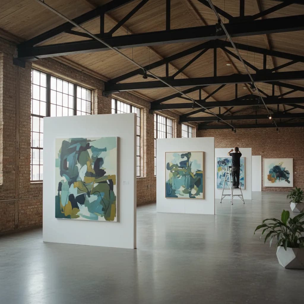
From Bedford Avenue, angle two blocks northwest to 20 South 4th Street, where repurposed 1920s brick warehouse bays near the bridge anchorage host seasonal contemporary painting and sculpture presentations such as the Williamsburg Biannual. Heavy timber ceiling joists, wide freight doors, and poured concrete floors preserve the muscular scale of Brooklyn's interwar light-manufacturing district. Viewers here tend to be working Brooklyn ceramicists, Pratt Institute MFA painters, and neighborhood collectors who prefer unhurried warehouse rooms over velvet-roped Manhattan openings.
As you walk these southern blocks between Wythe Avenue and Kent Avenue, look up at the faded hand-painted ghost signs still legible across sunlit brick party walls from early twentieth-century ironworks, spice mills, and rope lofts. Ground-floor loading docks along South 2nd and South 3rd Streets frequently leave steel roll-up gates ajar during mild afternoons while framing shops, woodworkers, and print studios stretch canvas or crate sculptures inside.
Climbing the Elevated Artifact Walk at 15 River Street
Continue one block west to the water's edge at 15 River Street to enter Domino Park, inaugurated in June 2018 on the eleven-acre footprint of the 1882 Havemeyer and Elder sugar refinery. Landscape studio James Corner Field Operations salvaged more than thirty large-scale industrial relics from the former plant and arranged them into an outdoor sculptural sequence stretching a quarter mile beside the East River.
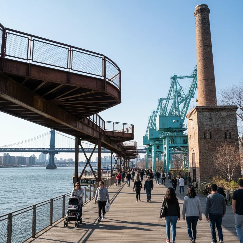
Because the waterfront esplanade welcomes the public daily from 6:00 AM to 11:00 PM, you can take the ramp at South 5th Street up onto the elevated steel Artifact Walk in either crisp morning sun or golden dusk light. Walking twenty feet above the lawn brings you eye-to-eye with four thirty-six-foot-tall cylindrical raw syrup tanks, cast-iron screw conveyors, mooring bollards, and the towering brick smokestack of the Barrel Vaulted Refinery building. At the northern end of the catwalk, two eighty-foot turquoise gantry cranes once used to unload Caribbean cane barges stand against the river tide like kinetic minimalist monuments.
Photographers and plein-air watercolorists gather along the western rail of the catwalk roughly ninety minutes before sunset, when low light bounces off the East River chop and turns the weathered red brick of the refinery facade deep copper. Unspoken waterfront etiquette keeps tripods tucked clear of the narrow elevated deck passings so families, joggers, and sketchers can share the overlook without bottlenecks.
Pause directly opposite the restored 1882 Refinery landmark at the center of the park to study how architects inserted a setback glass curtain wall inside the original load-bearing Romanesque Revival brick shell. Leaving an open air gap between the nineteenth-century arched masonry openings and the interior structure lets daylight reveal the thickness of the historic kiln-fired walls, turning industrial preservation itself into an architectural study along your walk.
Using Berry Street to Reach Marsha P. Johnson State Park
Once you descend near Grand Street, skip cutting inland to Bedford Avenue between North 4th and North 7th Streets on weekend afternoons. Sidewalk congestion outside chain boutiques and brunch patios along those three blocks slows walking pace to a crawl and offers almost no studio architecture. Instead, step one block east of Wythe Avenue onto Berry Street, where New York City's Open Streets design calms through-vehicles and lets walkers and cyclists move past converted brick lofts, screen-printing windows, and painted mural walls at an easy stride.
Turn back west at North 8th Street to finish at Marsha P. Johnson State Park along Kent Avenue, seven waterfront acres dedicated in 2020 to the pioneering LGBTQ rights activist and Greenwich Village and Brooklyn cultural figure. Old concrete rail-float transfer slabs from the nineteenth-century Brooklyn Eastern District Terminal still jut into the river beside native wildflower meadows and vibrant public ground murals. Open daily from dawn into the evening at no charge, the park's pebbled shoreline looks straight across the water toward Midtown and Lower Manhattan.
Ending at the North Williamsburg NYC Ferry pier at the foot of North 6th Street gives you a scenic river exit back to East 34th Street or Wall Street Pier 11 without retracing a single block underground. Total distance from 135 Broadway through South 4th Street, Domino Park, Berry Street, and Marsha P. Johnson State Park covers roughly one and a half flat miles, comfortably paced across two unhurried hours with plenty of daylight left on the harbor.
If brisk East River wind or sudden rain rolls across the harbor mid-route, pivot two blocks inland to Wythe Avenue or Berry Street, or hop the L train at Bedford Avenue and North 7th Street back to Manhattan in one stop. When you wrap up near North 8th Street and want to compare relaxed coffee roasters, natural wine bars, or nearby evening exhibitions without wandering block by block, open the Karpo APP and ask for neighborhood recommendations around Wythe Avenue or Grand Street.
Ask Karpo for more information.
Keep reading
- SoHo Tailor Alteration Shop Finder for Sample Sale Finds
 Williamsburg Tailor Alteration Shop Finder for Bike Riders
 Upper West Side Tailor Alteration Shop Finder for Kids