 SoHo Stationery Shop Gift Picker for a New Job Desk
Hidden Gems & Odd Finds

Williamsburg Antique Print Map Shop Route Notes
Scout Williamsburg vintage map dealers and archival print studios near Bedford Avenue. Learn authentic plate identification and plan your Brooklyn walk.
Williamsburg combines its rich industrial history with a thriving contemporary arts community, creating an exciting destination for discovering an antique print map shop and rare maritime cartography. Arriving via the Bedford Avenue subway station or the North Williamsburg ferry landing brings you directly into a dynamic landscape of converted brick warehouses, independent galleries, and specialized print studios. Karpo APP organizes your Brooklyn exploration into a clear, connected walking route, helping you discover hidden flat-file collections, evaluate original lithographs, and experience the creative vitality of the East River waterfront.
Scout Converted Warehouse Studios Near Grand Street
The streets flanking Grand Street, Wythe Avenue, and Kent Avenue showcase the architectural transition of North Brooklyn from manufacturing powerhouse to creative haven. Within spacious high-ceilinged lofts featuring exposed post-and-beam timbers, specialized print dealers and vintage collectors maintain extensive flat-file archives. These expansive studio spaces allow for the proper display of large-format nautical surveys, coastal charts, and detailed 19th-century regional maps that require wide viewing tables.
Exploring these Williamsburg studios offers a distinct contrast to the compact basement shops of Lower Manhattan. The open layouts and abundant natural light flooding through factory-style industrial windows create ideal viewing conditions for scrutinizing paper tone and fine engraved detail. Dealers here often focus on coastal cartography, industrial patent drawings, and early American lithographs, providing a fresh and varied selection that appeals to maritime historians and design enthusiasts alike.
Identify Authentic Lithographic Stones and Steel Engravings
Understanding the technical processes used to produce 19th-century prints is key to making confident acquisitions. Chromolithography, developed extensively in the mid-to-late 1800s, used separate polished limestone blocks to print each individual color layer. Authentic stone lithographs exhibit soft crayon-like grain patterns and rich opaque ink layers that blend seamlessly across the paper surface, without the harsh dot matrix patterns visible in modern four-color digital scans.
In contrast, steel engravings from the Victorian era are renowned for extraordinary micro-detail and razor-sharp linework. Steel plates allowed engravers to produce thousands of crisp impressions for commercial atlases and gazetteers without noticeable plate wear. Examine the lettering in map titles and cartouches under a hand lens; authentic period steel engravings demonstrate unmatched typographic precision and uniform ink deposit that reflect the master craftsmanship of historical printing houses.
Uncover Brooklyn Waterfront and Navy Yard Coastal Charts
Collectors exploring Williamsburg have a prime opportunity to focus on regional maritime maps that document the storied waterways of the East River and New York Harbor. Historical coastal survey charts produced by the United States Coast Survey in the mid-19th century remain among the most accurate and beautiful examples of scientific engraving. These maps record hydrographic soundings, navigation buoys, tidal currents, and early dock structures along Wallabout Bay and the Brooklyn Navy Yard.
Studying these coastal surveys reveals the vital role that maritime commerce played in shaping Brooklyn's urban geography. You can trace early shipping piers, ferry terminals that predated the East River bridges, and the extensive network of rail yards that once lined the waterfront. Displaying an authentic Brooklyn harbor chart provides a compelling connection to the maritime heritage that continues to define the character of the surrounding borough.
Finding these maritime prints in Williamsburg also connects you to the historical craftspeople who originally drafted and printed them. During the 19th century, New York was the primary center for nautical chart publishing in North America, with skilled engravers working closely with ship captains and naval cartographers to produce indispensable tools for ocean navigation.
Transport and Conservation for Oversized Antique Charts
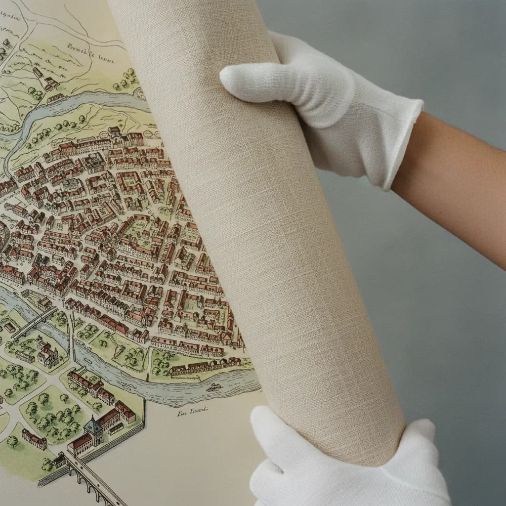
Because maritime charts and commercial wall maps were frequently produced in large formats, transport and framing require specialized handling techniques. Many historical coastal maps were originally mounted on sturdy linen or cotton backing to endure rough shipboard handling. When inspecting linen-backed maps, ensure that the cloth remains supple and free of active mold, and check that the paper has not started lifting or peeling from the textile base.
Never attempt to roll an oversized antique chart into a narrow mailing tube, as aged linen can snap and brittle paper can split along ancient fold lines. Instead, carry a wide portfolio folder with rigid corner reinforcements when shopping in Williamsburg. When preparing to frame an oversized map, select lightweight acrylic glazing with ultraviolet filtration to protect the large paper surface against sun exposure while keeping the framed piece safe to hang on your wall.
Waterfront Walk and Neighborhood Pause Points
Pairing your print expedition with a stroll along the Brooklyn waterfront makes for a thoroughly enjoyable day out. After browsing studio collections near Kent Avenue, head toward Domino Park or the East River State Park promenade. The expansive waterfront lawns and reclaimed industrial sugar refinery structures offer sweeping panoramic views of the Lower Manhattan skyline across the water, providing a dramatic visual contrast to the historical maps in your portfolio.
The surrounding side streets along Berry and Bedford avenues are home to celebrated artisanal bakeries, specialty coffee shops, and independent vintage retailers. Pausing at an outdoor table allows you to carefully review your purchases, compare cartographic features with fellow collectors, and plan your next destination. This seamless mix of waterfront leisure, historical discovery, and neighborhood dining makes Williamsburg a standout cultural destination.
Streamline Your Brooklyn Day With Karpo APP
Karpo APP simplifies your Brooklyn outing by connecting studio locations, ferry schedules, and subway access into an intuitive, custom walking route. Rather than jumping between navigation tabs and transit schedules, you have a reliable neighborhood guide that guides you effortlessly from one antiquarian destination to the next. The app ensures you maximize your walking time while discovering hidden artistic gems along the way.
You can also use Karpo APP to bookmark framing ateliers, save notes on print dimensions, and record dealer recommendations for future visits across the borough. Whether you are expanding an established cartography collection or searching for a unique focal art piece for your home, Karpo APP gives you the clarity and organization needed to make the most of Williamsburg's creative landscape.
Maritime cartographers working along the East River in 1854 produced coastal navigation charts that proved essential for navigating turbulent harbor channels. Following the landmark opening of the Brooklyn Bridge in 1883, regional mapmakers updated harbor triangulations to reflect rapid dockside expansion and shifting ferry routes along the Williamsburg waterfront.
Preserving these historic maritime charts requires attention to textile conservation, as many 19th-century pocket maps were backed with cotton muslin or fine Irish linen. Consulting experienced paper conservators ensures that aged adhesive layers are stabilized with reversible wheat starch paste, keeping original chart impressions flexible and structurally sound.
Ask Karpo for more information.
Keep reading
- SoHo Stationery Shop Gift Picker for a New Job Desk
 SoHo Consignment Shop Crawl Planner: Designer Handbag Checks
 Williamsburg Stationery Shop Gift Picker for Office Swaps