 Chelsea Consignment Shop Crawl Planner for Your First Studio
Hidden Gems & Odd Finds
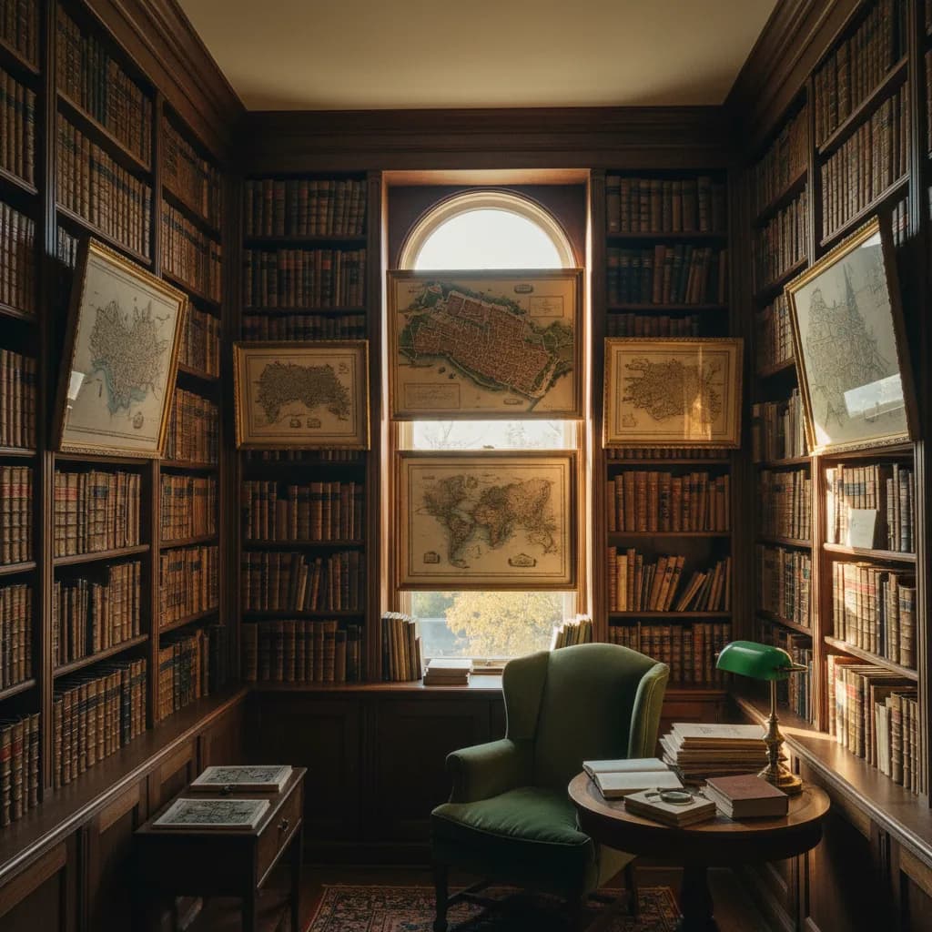
Upper West Side Antique Print Map Shop Route
Track Upper West Side antiquarian print dealers and map collections near Amsterdam Avenue with paper conservation tips, transit stops, and walking routes.
The Upper West Side offers a refined, scholarly atmosphere for exploring an antique print map shop, surrounded by historic residential brownstones, quiet tree-lined avenues, and world-class cultural institutions. Arriving at the 72nd Street or 81st Street subway stations brings you within easy walking distance of specialized antiquarian booksellers and paper dealers who cater to historians, curators, and devoted collectors. Karpo APP coordinates your uptown journey into an organized, leisurely walking route, helping you discover rare 19th-century American city plans, examine authentic paper watermarks, and enjoy the timeless appeal of this historic neighborhood.

Stroll Along Amsterdam and Columbus Antiquarian Corridors
The avenues stretching along Amsterdam, Columbus, and Broadway host a distinguished collection of independent antiquarian bookdealers and print specialists. Nestled beneath the high brownstone stoops of residential side streets or occupying classic storefronts along the avenues, these shops maintain deep inventories of historical American cartography, natural history lithographs, and vintage topographical surveys. The quiet, unhurried pace of the Upper West Side makes it an ideal setting for thorough, thoughtful browsing.
Proprietors in this neighborhood frequently work in close association with nearby academic institutions and historical societies. Their flat-file portfolios are systematically organized by geographical state, county, and historical epoch, making it easy to locate specific regional maps and vintage town plans. Engaging with these knowledgeable dealers offers a masterclass in American printing history, as they gladly share the provenance stories behind individual acquisitions and highlight rare cartographic states.
Study 19th-Century Bird's-Eye Views and County Atlases
Among the most popular cartographic works available on the Upper West Side are 19th-century perspective bird's-eye views of American cities. Popularized after the Civil War by talented artists and lithographers like Albert Ruger and Thaddeus Mortimer Fowler, these panoramic prints captured expanding harbor towns, railroad depots, and growing civic centers from an imaginary elevated perspective. Examining these prints reveals incredible architectural details, including individual storefront signage, horse-drawn carriages, and sailing vessels in harbor docks.
Historical county atlases, produced in abundance during the late 19th century by publishers such as Beers and Everts, represent another rewarding collecting category. These regional volumes mapped rural townships down to individual farmsteads, complete with owner names, acreage counts, schoolhouses, and former millponds. Framing an original county map sheet provides a charming, tangible record of ancestral roots and early American rural life that adds historical warmth to any interior space.
Master Provenance Verification and Engraver Imprints
Evaluating the authenticity and historical significance of an American map requires careful reading of the publication cartouche and margin imprints. Authentic period maps display the names of the original surveyor, draftsman, engraver, and publishing house, typically engraved in fine italic script along the lower margin. Prominent 19th-century cartographic publishers based in New York, such as J.H. Colton, S. Augustus Mitchell, and Alvin J. Johnson, established rigorous standards for geographic accuracy and decorative border engraving.
Verify that the copyright date stamped on the plate corresponds accurately with the geographic boundaries depicted on the map sheet. Historical publishers often updated printing plates across successive years to record newly admitted states, emerging railroad lines, and updated territorial borders. Tracking these geographical modifications allows collectors to identify the precise historical state of an impression and trace the dynamic westward expansion of the United States.
Care and Climate Control for Vintage Paper Collections
Maintaining an antiquarian paper collection in a private home requires ongoing attention to environmental climate controls. Paper fibers expand in high humidity and contract in dry winter air, which can cause cockling and surface waviness over time. Aim to maintain a stable relative humidity between forty and fifty percent in rooms where valuable historical maps are displayed, and keep framed works away from exterior walls that experience dramatic temperature fluctuations.
When moving newly acquired prints from the Upper West Side back to your home, protect them from accidental handling damage by using rigid portfolio folders lined with acid-free tissue paper. Never store historical paper inside plastic storage containers that can trap residual moisture, and inspect your collection periodically for signs of dust buildup or humidity stress. Diligent care ensures that antique works on paper remain vibrant and intact for decades to come.
Central Park Strolls and Cultural Neighboring Stops
A collecting visit to the Upper West Side naturally harmonizes with the surrounding cultural and natural landmarks. After browsing print archives along Columbus Avenue, take a peaceful stroll eastward into Central Park. Entering through the historic gates at 72nd Street brings you to Strawberry Fields and the quiet paths surrounding the Lake, offering a serene outdoor setting to reflect on your historical discoveries and enjoy the park's tranquil natural scenery.
Enhance your outing by visiting nearby cultural landmarks such as the New-York Historical Society on Central Park West, where exceptional exhibitions showcase rare historical cartography and early American manuscripts. Relaxing at a neighborhood sidewalk cafe along Amsterdam Avenue for afternoon tea or coffee rounds out your day with classic uptown elegance, creating a perfect balance between scholarly pursuit and urban leisure.
Organize Your Uptown Promenade With Karpo APP
Karpo APP enhances your Upper West Side antiquarian walk by organizing store stops, providing clear pedestrian directions, and syncing your schedule with nearby subway lines and park entrances. Instead of flipping between digital maps and scattered notes, you have a cohesive neighborhood itinerary that keeps your day enjoyable and effortless. The app allows you to pace your walk and explore quiet residential streets with complete confidence.
You can also use Karpo APP to record dealer observations, save precise map dimensions for future framing projects, and bookmark favorite cultural stops for future weekend outings. Whether you are building an extensive historical map archive or simply seeking a distinguished print of early Manhattan, Karpo APP serves as your reliable guide to exploring the Upper West Side's rich antiquarian landscape.
Antiquarian map publishing in New York reached an artistic peak in 1855, when J.H. Colton released landmark American atlases featuring hand-engraved decorative borders and delicate original watercolor tinting. Later in 1868 and 1879, prominent cartographers like Beers and Fowler documented the dramatic transformation of the Upper West Side from rural estates into grand residential boulevards.
Studying these late-19th-century property atlases allows collectors to trace the development of Central Park West and Amsterdam Avenue before the arrival of the subway. Engaging with neighborhood print specialists provides deep historical context, as they explain how regional cartographic revisions captured the steady growth of Manhattan's classic residential landscape.
Ask Karpo for more information.
Keep reading
- Chelsea Consignment Shop Crawl Planner for Your First Studio
 East Village Consignment Shop Crawl Planner: Leather Jackets
 Harlem Consignment Shop Crawl Planner for a Jazz Night Look