 MiMo District Free Indoor Weekend Plan Finder for Retro Fans
Free Things to Do
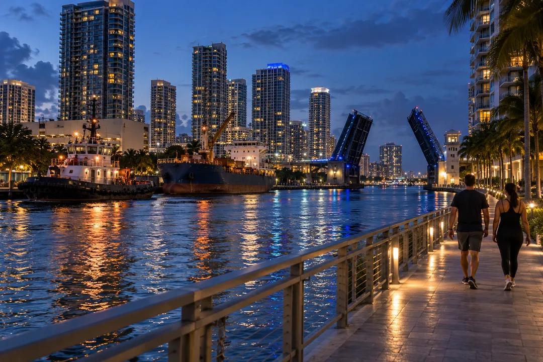
Scenic Walking Trail Near Me: Downtown Miami Riverwalk and Baywalk Loop
The Miami Riverwalk is a free waterfront promenade along the Miami River in Downtown and Brickell, overlapping the Baywalk, with each path nearly five miles long.
The Miami Riverwalk is free, has no gate and follows the working Miami River from Biscayne Bay into the heart of Downtown. The Miami Downtown Development Authority describes it and the Baywalk as two overlapping waterfront paths, each nearly five miles long, that form a single corridor for walking and biking. If scenic walking trail near me brought you here from a Brickell or Downtown hotel, this is the walk where tugboats, drawbridges and 2,000-year-old history share the same railing.
A 1979 Ordinance Built This Path One Tower at a Time
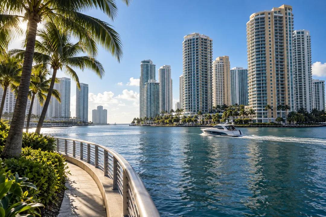
Nobody built the Riverwalk in one go. In 1979 an ordinance championed by Miami attorney Dan Paul required new buildings to be set back 50 feet from the water's edge and their owners to build and maintain a 25-foot public pedestrian promenade. Every time a tower went up along the river or the bay, another piece of public waterfront came with it, which is why the path changes paving, railing and lighting every few hundred feet.
That piecemeal history is still unfolding. The DDA lists recent openings such as a 200-foot segment at 609 Brickell Avenue in June 2023, a 500-foot stretch at the Aston Martin Residences at 300 Biscayne Boulevard Way in April 2024, and a 200-foot piece at Casa Neos, 40 SW North River Drive, in July 2024. By the DDA's own count the 5-mile Baywalk is 89% complete, while the 10-mile Riverwalk and on-road Greenway together are 68% complete.
What 68 Percent Complete Means on Foot
The honest truth about this trail is that it has gaps. You will walk a polished promenade under palms, then hit a fence, a parking garage or a construction wall and have to step out to the street for a block before the path picks up again. The Miami River Commission's 2026 river map marks existing and proposed Riverwalk sections and the on-road Greenway links between them, and it is worth pulling up on your phone before you start so the detours do not feel like dead ends.
The reward for putting up with the gaps is a river that still works. Small cargo freighters tie up along the banks, tugboats nudge them around the bends, and the drawbridges at Brickell Avenue and Miami Avenue swing up while traffic waits. It is a rare thing to watch a working port from a condo-lined promenade, and it is the part of the walk visitors remember.
A Walk From the Bay to the River's First Bend
Start where the river meets the bay, at the Miami Circle at 465 Brickell Avenue. The ring of holes cut into the limestone there is believed to be almost 2,000 years old, the work of the Tequesta people who lived at the river mouth. From the circle you look straight across the water to the Brickell Key towers, and the path heads west under the Brickell Avenue bridge toward the first Downtown segments.
Follow the north bank west, detouring where you must, toward Lummus Park at 404 NW 3rd Street, the City of Miami park on the river's edge. Two of the oldest buildings in Miami stand there: Fort Dallas, a stone structure tied to the Seminole Wars era, and the Wagner Homestead, a pioneer house from the 1850s. Both were moved to the park to save them, and the Miami River Commission map lists them among the river's historic sites.
Extending the Walk to Brickell Key and Jose Marti Park
For a longer loop, cross to Brickell Key, the small island just off the river mouth. Brickell Key Park at 500 Brickell Key Drive sits at the island's tip, and the DDA calls it a place to admire the Downtown Miami skyline. The walk around the island's edge stays close to the water for most of its length, and it makes a good final lap when your legs still have something left after the river.
Heading upriver instead, Jose Marti Park at 362 SW 4th Street sits at the edge of Little Havana on the south bank, but it is not a riverside finish line for now. The City of Miami began the first phase of its adaptive redesign there in September 2026, and the northern section along the water is fenced off while crews build a new seawall, baywalk and drainage, with the whole project due in August 2028. The rest of the park stays open, so you can still cut through it toward Little Havana for a cafecito before the walk back toward the towers.
Using the Free Metromover Around the Gaps
The Metromover is the walker's best friend on this route. It is free, it runs from 5:30 am to 10:00 pm seven days a week, and its Riverwalk station sits a short walk from the north bank, while Metrorail stops at Brickell station a few blocks south. Ride it to skip an awkward gap, or to get back to your starting point once you have walked one way along the river.
Check the service notices on the county Metromover page before you plan around it this week. Miami-Dade Transit says all Metromover stations will be closed until 2:00 pm on Saturday, October 24, and the Financial District station will close for five weeks from that same day. A separate alert from March 2026 noted that the Miami Avenue station was closed under a modified Inner Loop, so do not count on that stop either.
When to Go and What to Skip
Late afternoon into dusk is the best time on the river. The light drops behind the Downtown towers, the water turns bronze, and if you are lucky a bridge goes up while a freighter slides through. Midday in summer is the time to skip, because many segments have little shade, and the reflected heat off the glass towers is relentless. Evening walks feel lively near the hotels and quiet near the older industrial stretches upriver.
Cyclists share the path, since the DDA designs the corridor for both walking and biking, so stay to one side on the narrower segments. If you only have an hour, skip the upriver section entirely and walk the bay side between the Miami Circle and the Brickell Key bridge, where the path is most complete and the views are widest. Save the full river walk, with its detours and history, for a cooler morning.
Practical Notes
Route: Miami Riverwalk along both banks of the Miami River, overlapping the Downtown Baywalk at the river mouth. Length: each path nearly five miles, with gaps. Cost: free. Good starting point: Miami Circle, 465 Brickell Avenue, Miami, FL 33131. Turnaround: Lummus Park, 404 NW 3rd Street. The Jose Marti Park riverfront is closed for seawall work until August 2028. Transit: free Metromover, Riverwalk station, 5:30 am to 10:00 pm daily, with station closures from October 24, 2026. Shared with bicycles.
Ask Karpo for more information.
Keep reading
- MiMo District Free Indoor Weekend Plan Finder for Retro Fans
 Coral Gables Free Indoor Weekend Plan Finder for Book Lovers
 South Beach Free Indoor Weekend Plan Finder for Rainy Days