 MiMo District Free Indoor Weekend Plan Finder for Retro Fans
Free Things to Do
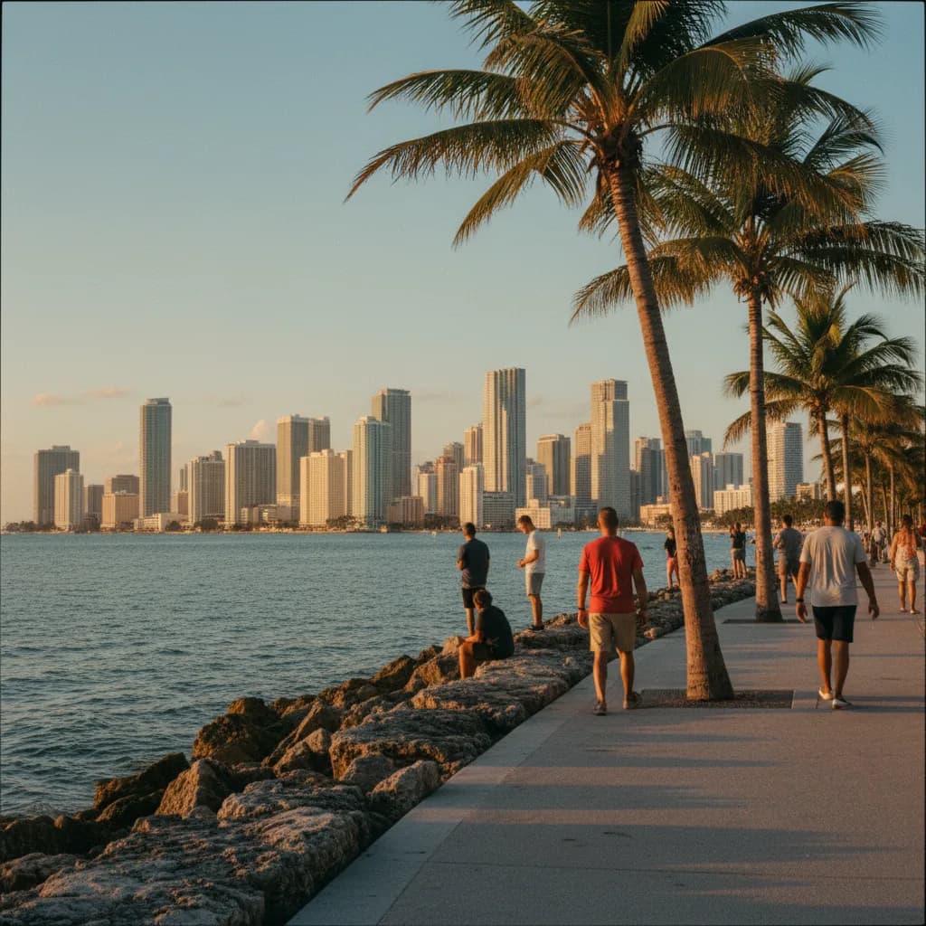
South Beach Miami Scenic City Skyline Viewpoint Guide
Walk a South Beach Miami scenic city skyline viewpoint route from South Pointe Park to bayfront piers using Karpo APP to organize sunset stops.
Climbing the serpentine grassy mound of South Pointe Park at the southern tip of Miami Beach while outgoing vessels glide down the Government Cut shipping channel, your view sweeps from the Atlantic surf in the east all the way across Biscayne Bay to the glittering glass wall of Downtown Miami and Brickell in the west. Choosing a scenic city skyline viewpoint in South Beach takes advantage of the barrier island's western shoreline, which acts as a natural front-row viewing platform facing the mainland skyscrapers three miles across the water. Since the seventeen-acre park was reimagined in 2009 and extended by the public pier in 2014, walkers can follow a continuous waterfront promenade from the ocean dunes to the bay marina. Saving these waterfront segments in the Karpo APP helps you move from eastern beach light to western bay sunsets in one effortless walk.
South Pointe Park Serpentine Hill And Government Cut Seawall
Occupying the southernmost seventeen acres of Miami Beach below Biscayne Street, South Pointe Park was originally created as a municipal park in 1985 after the demolition of early twentieth-century industrial docks and was comprehensively redesigned by landscape architects Hargreaves Associates in 2009. Two grassy observation ridges rise twenty feet above the surrounding coral-stone walkways, linked by a wide elevated serpentine footpath lined with sea grape trees and silver buttonwood. Standing atop the western ridge gives you an elevated panorama over the mouth of Biscayne Bay, with the supertall towers of Brickell, Downtown Miami, and PortMiami stacked across the western horizon.
Below the grassy hill, a twenty-foot-wide cut-stone promenade traces the northern edge of the Government Cut shipping channel, where pilot boats, sailing yachts, and ocean liners pass within yards of the seawall. Evening runners, local dog walkers, and landscape photographers rest on the custom canted benches as the setting sun drops directly behind the mainland skyline. Recording the Washington Avenue entrance to South Pointe Park in the Karpo APP sets up the southern anchor of your waterfront loop.
South Pointe Pier Over-Water Deck And Oceanfront Sightlines
At the southeastern corner of the park where the Government Cut rock jetty meets the Atlantic Ocean, the South Pointe Pier extends four hundred fifty feet over the emerald surf. Opened to the public in 2014 with turtle-friendly amber deck lighting, shaded steel canopies, and viewing stations, the pier allows walkers to step well east of the shoreline dunes. Looking north from the outer end of the pier reveals the entire coastal arc of South Beach, where the historic 1930s pastel facades of the Miami Beach Architectural District, listed on the National Register of Historic Places in 1979, sit tucked beneath modern oceanfront towers.

Turning west from the same pier railing aligns your view straight down the length of Government Cut toward Fisher Island and the distant silhouettes of the Brickell financial core. Pelicans diving along the rock jetty and wave patterns beneath the concrete pilings add lively foreground movement to wide-angle skyline compositions. Adding twenty minutes on the South Pointe Pier deck to your Karpo APP walking plan lets you capture the eastern ocean horizon before walking west along the channel for sunset.
Miami Beach Marina Baywalk And The Venetian Causeway Approach
Following the western shoreline of South Pointe Park north past First Street and Alton Road leads onto the public baywalk bordering the Miami Beach Marina up to Fifth Street. Here, a calm timber and concrete boardwalk weaves beside moored sailboats and catamarans while facing directly west across the calm waters of Biscayne Bay toward the MacArthur Causeway and the museum park towers of Downtown Miami. Because the marina breakwater calms the harbor chop, evening reflections of the illuminated downtown towers dance smoothly across the water beside the docks.
Walkers who want an even closer over-water perspective of the northern downtown and Edgewater high-rises can continue north along Alton Road or Purdy Avenue to the eastern pedestrian sidewalk of the Venetian Causeway in Sunset Harbour. Opened in 1926 as a chain of low-level bascule bridges linking Miami Beach to the mainland across six artificial islands, the causeway sidewalk places you just feet above the bay tide with a panoramic view of the mainland skyline. Keeping both the marina baywalk and the Venetian Causeway approach saved inside the Karpo APP lets you choose a shorter or longer bayfront walk.
Midday Channel Heat To Skip And Free Trolley Transit Backups
Skip walking the unshaded concrete deck of South Pointe Pier and the exposed southern seawall between noon and three in the afternoon during summer months, when intense tropical UV radiation and salt glare reflect off the water with very little shade canopy. Visit during the final hour before sunset when Atlantic sea breezes cool the point and the sun drops behind Downtown Miami across the bay. You should also skip summer afternoon lightning warnings along the open jetty and pier, retreating immediately when thunderclouds build over the mainland.
Whenever a passing tropical shower or gusty evening squall interrupts your shoreline walk, step inland to Washington Avenue or Alton Road to board the free air-conditioned South Beach Trolley, which operates continuous loops across the neighborhood, or catch Metrobus Route 100 and Route 20 connecting directly across the MacArthur Causeway to Downtown Miami. The historic Art Deco porticoes along Ocean Drive and Washington Avenue provide dry sidewalk cover while you review your saved trolley stops in the Karpo APP.
Sequencing An Ocean-Pier To Bay-Seawall Sunset Walk
Start a ninety-minute South Beach skyline walk at the southern end of Lummus Park near Fifth Street and Ocean Drive two hours before sunset, strolling south along the coastal dune boardwalk to step out onto the 2014 South Pointe Pier while afternoon sunlight illuminates the turquoise Atlantic water and the northern Miami Beach coastline.
Forty-five minutes before sunset, walk west along the Government Cut stone promenade and climb the serpentine grassy observation ridge of South Pointe Park, then continue north along the Miami Beach Marina baywalk toward Fifth Street and Alton Road. Watching the sun sink directly behind the Downtown Miami and Brickell skyscrapers while their reflections shimmer across Biscayne Bay delivers the signature skyline view of South Florida. Reviewing this east-to-west loop in the Karpo APP ensures you finish steps away from the Alton Road and Fifth Street transit stops.
Ask Karpo for more information.
Keep reading
- MiMo District Free Indoor Weekend Plan Finder for Retro Fans
 Coral Gables Free Indoor Weekend Plan Finder for Book Lovers
 South Beach Free Indoor Weekend Plan Finder for Rainy Days