 MiMo District Free Indoor Weekend Plan Finder for Retro Fans
Free Things to Do
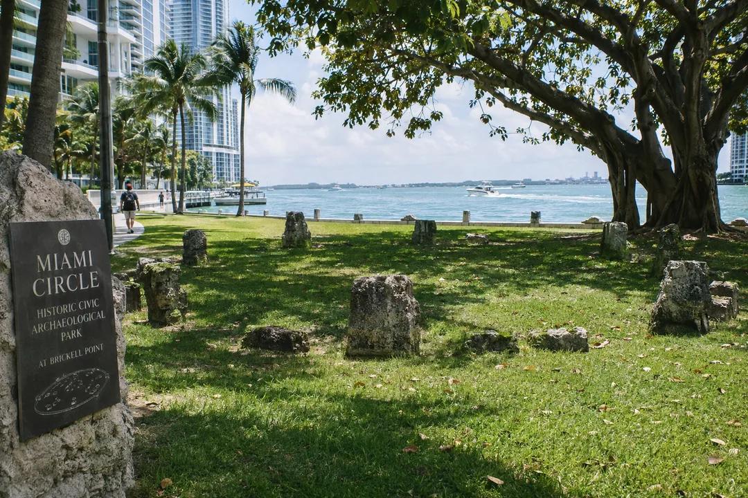
Brickell Historic Civic Square Promenade Walking Guide
Explore Brickell historic civic waterfront promenades along a scenic walking route connecting Miami Circle at Brickell Point to coastal paths.
While Brickell is recognized globally as the financial capital of South Florida, the district also holds ancient archaeological origins and dramatic public waterfront promenades. This historic civic square promenade invites pedestrians to experience the convergence of prehistoric native settlement, early twentieth-century estate planning, and modern waterfront access. Walking from the sacred limestone foundation of the Miami Circle to the shaded esplanades of Brickell Key and Simpson Park, visitors discover an extraordinary civic landscape at the mouth of the Miami River.
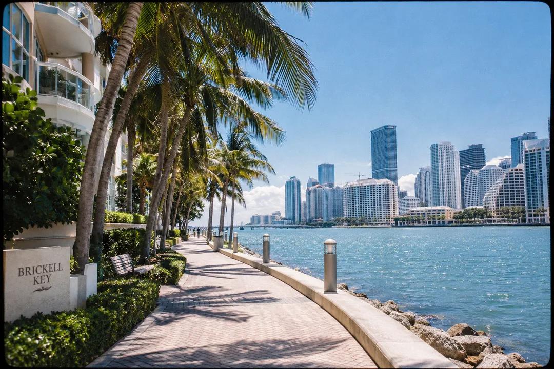
Miami Circle at Brickell Point Heritage
Situated at the southern mouth of the Miami River overlooking Biscayne Bay, the Miami Circle at Brickell Point was discovered in 1998 during archaeological pre-construction excavations. The landmark site preserves a thirty-eight-foot circular formation carved into the oolitic limestone bedrock by the Tequesta people over two thousand years ago, representing one of the most significant prehistoric civic and ceremonial structures in eastern North America. In 2002, the site was permanently saved through public acquisition as a protected state historic park.
Today, the site operates as a peaceful waterfront civic green, where manicured lawns and native coastal plantings surround the subterranean archaeological formation. Paved stone pathways border the riverbank, offering panoramic vistas of downtown Miami, passing cruise ships, and historic bridge crossings. Benches positioned along the seawall provide contemplative seating where visitors can reflect on thousands of years of human gathering at this exact geographical threshold.
Interpretive historical markers along the promenade explain Tequesta architecture, trade networks, and early colonial contact, anchoring the modern financial district in deep archaeological time. The soothing sound of river currents meeting bay waters creates a tranquil natural acoustic that insulates the park from surrounding urban skyscrapers, offering a rare sanctuary of open space.
Walking the Brickell Key Waterfront Promenade
Crossing the landscaped pedestrian bridge onto Brickell Key leads walkers to a continuous one-point-one-mile paved seaside promenade that encircles the entire triangular island. Originally created in the late nineteenth century by pioneering Miami settler Henry Flagler, the island was thoughtfully master-planned to prioritize public waterfront access along its perimeter.
The wide asphalt and brick promenade is lined with towering coconut palms, royal poincianas, and flowering bougainvillea hedges that frame unobstructed views across Biscayne Bay toward Key Biscayne and Fisher Island. Sea breezes sweep constantly across the pathway, making it one of the most refreshing walking trails in urban Miami. Public benches and stone resting ledges placed along the shoreline wall invite walkers to pause and watch dolphins playing in the clear coastal waters.
The walking loop is completely separated from vehicle roadways, creating a peaceful pedestrian environment enjoyed by local residents, joggers, and casual walkers. Modern public art sculptures, including bronze dolphins and abstract stone monuments, punctuate the trail, reinforcing the island's dedication to scenic public recreation under open skies.
Simpson Park and the Historic Tropical Hammock
Heading westward toward South Miami Avenue brings the promenade into Simpson Park, an eight-acre preserved old-growth tropical hardwood hammock established as a public park in 1913. The park preserves a pristine remnant of the native coastal forest that once covered the entire Brickell ridge prior to modern urban development, featuring endangered trees such as red stopper, wild cinnamon, and century-old live oaks draped in Spanish moss.
Paved and wooden boardwalk pathways meander beneath a dense green canopy that drops ambient temperatures by several degrees, providing immediate natural relief from Florida humidity. A historic stone community lodge built during the 1930s by the Works Progress Administration anchors the park's central plaza, serving as an educational nature center. Benches tucked along shaded limestone outcroppings offer tranquil resting spots filled with the songs of resident songbirds.
The park's nature trails feature native butterfly gardens and natural stone water features where rare zebra longwing butterflies flutter among wild coffee plants. Botanical markers identify indigenous medicinal herbs and hardwood specimens that sustained native communities for generations. The peaceful atmosphere provides an authentic botanical sanctuary completely shielded from city clamor.
Walking the shaded trails of Simpson Park offers a striking contrast to the gleaming glass towers of the financial district just two blocks away. The preservation of this ancient forest underscores Miami's early conservation achievements, demonstrating how civic foresight protected natural heritage for future generations. Concluding your walk here leaves visitors with a profound appreciation for South Florida's native ecology.
Seamless Navigation With the Karpo APP
Organizing your walking itinerary along Brickell's diverse waterfront paths and historic reserves is made remarkably straightforward with the Karpo APP. Rather than getting confused by dense skyscraper corridors, Karpo helps you identify direct pedestrian connectors between Miami Circle, Brickell Key, and Simpson Park, locate shaded rest stops, and bookmark scenic bay viewpoints along the route. The app delivers a clean visual overview of open public spaces, allowing you to adapt your walk to your personal pacing.
Whether you are planning a historical archaeological study, an early morning sunrise jog, or an evening stroll along the bay, Karpo keeps your saved spots neatly organized. You can easily mark accessible Metromover stations, track walking distances along the island loop, and coordinate meeting points near well-known civic monuments. The application's clean design lets you focus entirely on the coastal grandeur and historic beauty of Brickell.
Navigating the Brickell financial district with the Karpo APP reveals quiet archaeological greens and breezeswept coastal seawalls hidden behind gleaming towers. Karpo keeps your island walking distance and Metromover boarding coordinates clearly visible as you explore ancient Tequesta gathering grounds.
Practical Guidance for Brickell Walkers
Early mornings offer extraordinary sunrise views over Biscayne Bay from Brickell Key, along with calm, cool conditions across Miami Circle before the tropical sun climbs high. Late afternoons bring pleasant shade along the riverfront esplanades and refreshing breezes off the bay. Public transit access is exceptionally convenient, with the free Metromover Brickell Loop serving Fifth Street, Financial District, and Riverwalk stations directly adjacent to the promenade.
The walking route follows smooth, level concrete sidewalks, wooden boardwalks, and paved seaside promenades equipped with modern ADA-compliant ramps at all street crossings for total accessibility. Public restrooms are located at the Brickell Metromover station and within Simpson Park nature center during regular operating hours. Wearing supportive walking sneakers, sunglasses, and sun protection ensures a comfortable and pleasant walking experience.
Ask Karpo for more information.
Keep reading
- MiMo District Free Indoor Weekend Plan Finder for Retro Fans
 Coral Gables Free Indoor Weekend Plan Finder for Book Lovers
 South Beach Free Indoor Weekend Plan Finder for Rainy Days