 Richmond Park Sunset Viewing Planner: Deer Meadow Horizons
Weekend Plans
London Scenic Pedestrian Bridge Route With a Clear Exit
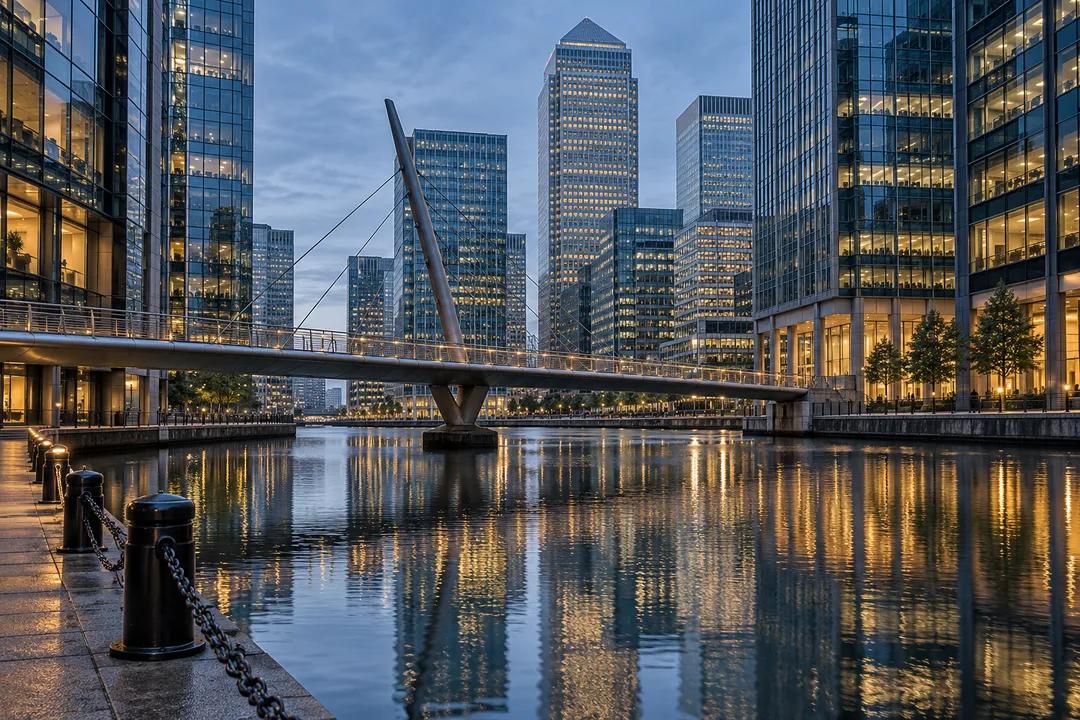
Plan a London scenic pedestrian bridge route at Canary Wharf around a dock crossing, a fixed departure point and a small wayfinding exercise by the water.
A London scenic pedestrian bridge route at Canary Wharf works better when the exit is part of the attraction. Docks, pedestrian crossings and several transport destinations can make a short walk look simpler on a skyline photograph than it feels at ground level. Use one dock crossing as a wayfinding exercise: arrive with a chosen departure point, identify which water space you are crossing, and practise explaining the route to a companion. The result is a small urban walk that leaves everyone understanding where they are, rather than following the person holding a map.
The map-reading task begins beside the water
Open the official Canary Wharf map before selecting a bridge. Look for the outline of the dock, the pedestrian connection across it and the streets that reach the water. Read the names as a group. A stretch of water beside an office building is not enough information to distinguish one route from another. The official map identifies North Dock Footbridge, giving you a named feature to work with. Use its exact position on the map instead of guessing from a general photograph of Canary Wharf.
Then decide which side should contain the end of the outing. The departure point might be a transport entrance or a place where your group will separate. Choose the actual named point, not simply the words Canary Wharf station, because the estate map distinguishes different transport locations. This article does not provide a transfer time between them. It asks you to make the distinction early, when changing the walking plan is still easy and nobody has started following a route based on a different destination.
Give three people three different jobs
For a small group, divide the navigation rather than appointing a permanent leader. One person locates the departure point on the map. Another identifies the chosen crossing and the water it spans. A third watches for the land-side turn where the riverside or dockside section ends. With two people, combine the first and third roles. The exercise works because each role has something specific to notice. Asking everyone to help navigate without defining a task usually leaves one person making every decision anyway.
Begin by having each person explain their part in ordinary language. A useful explanation refers to the dock, a mapped crossing and an actual turning decision. Avoid instructions based only on a glass building or the nearest tall tower, since those features can resemble one another from different angles. You can use the skyline as a scenic subject while relying on names and map relationships for navigation. Keeping those roles separate makes it easier to enjoy reflections and architecture without mistaking a visual impression for a direction.
Cross one line, then reorient
After the selected crossing, pause in a suitable public position on land and turn the map to match the surroundings. Locate the bank you have just left. This simple action helps a companion understand the crossing as a connection between two sides rather than an isolated photo stop. If the view looks different from the picture you had in mind, use the dock outline and the mapped path to regain orientation. Do not keep walking merely because the first section seemed obvious.
Now ask the person who did not lead the approach to describe the next move. Their explanation should include where the dockside part finishes. If they cannot explain it, reduce the route before adding more waterfront. This is particularly useful for a group which plans to split afterwards. Everyone should know how to leave the outing independently. You are not testing anyone's map skills or memory. You are finding the parts of the plan that were clear only to the person who originally assembled it.

Let reflections supply the scenic pause
For the visual part of the walk, look at how building lines and the bridge sit against the dock water. Reflections can turn vertical architecture into a pattern, while the edge of a span gives the photograph a different scale. Choose a position on the public path that does not obstruct movement. The scene may be still, windy, bright or flat when you arrive. Treat the actual surface of the water as your subject instead of waiting indefinitely for a reflection copied from somebody else's image.
A group can make this a brief comparison exercise. One person describes the view through the bridge structure, another describes the same setting from farther along the bank. Which position makes the dock easier to read? Which makes the surrounding buildings seem larger? The questions produce a reason to look without requiring multiple crossings or specialist equipment. Do not add a second bridge simply because the first photograph felt ordinary. A small observation can serve the outing without turning it into an architectural photography assignment.
Keep a land-side alternative in the same area
When you choose the crossing on the map, also identify a public land-side version of the walk. It should preserve your departure point and keep the dock as the visual subject. This is useful if an approach is restricted or if someone decides they would prefer not to cross. The alternative must be a route you can identify, not a vague promise to find a way around. Never treat a line drawn across water as evidence that access is available on the day.
For people who need a step-free journey, use the estate's accessibility information for the complete route and match it to the transport leg. A bridge photograph does not establish the accessibility of its approaches. This article supplies a planning exercise and does not certify an access route. If you are unable to establish a suitable connection, choose the land-side outing instead. Making the route smaller is more useful than silently substituting steps or an uncertain entrance into a plan that somebody expected to be accessible.
Use Karpo to make the brief easier to explain
A specific Karpo APP request could ask for help organising a Canary Wharf dockside walk with one crossing and a named departure point. Add that everyone in the group should be able to describe the exit. Ask for a concise brief that separates the scenic pause from the onward journey. The output you need is a route discussion you can use with a map, rather than a claim of live bridge access, a transport guarantee or a tour booking.
Read the proposed brief aloud before setting off. Remove any extra stop that makes the exit less clear. If the route begins to depend on a shop, restaurant or indoor shortcut, decide whether that is necessary to the task and establish its conditions separately. The dock walk can stand on its own. Keep a simple record of the arrival, crossing and departure names, together with the land-side alternative. Those names give a companion something concrete to refer to if the group becomes separated.
Practical Notes for a shared navigation exercise
The official estate map and its accessibility map are the reference documents for locating the dock and pedestrian crossings. Use the map version supplied by the estate when organising the walk. Follow any on-site routing and keep stops away from entrances and the main walking line. No shop opening hours, prices or telephone numbers are included here. Newly generated editorial images illustrate the dockside setting. They are not exact wayfinding diagrams and cannot establish the state of a crossing or access point.
End with a handover rather than another stop. Ask each person which direction they are taking after the group finishes, then let them point out the relevant part of the map. If everyone can explain the departure, the navigation exercise has worked. You have combined a scenic crossing with a practical understanding of the district at walking level. The useful souvenir is not simply a photograph of a bridge between towers, but the confidence to find the water, cross intentionally and leave by the route you chose.
Ask Karpo for more information.
Keep reading
- Richmond Park Sunset Viewing Planner: Deer Meadow Horizons
 South Bank Sunset Viewing Planner: Thames Riverside Walks
 Parliament Hill Sunset Viewing Planner: London Heath Vistas