 Brixton Vintage Thrift Shop Finder: South London Retro Gems
Hidden Gems & Odd Finds
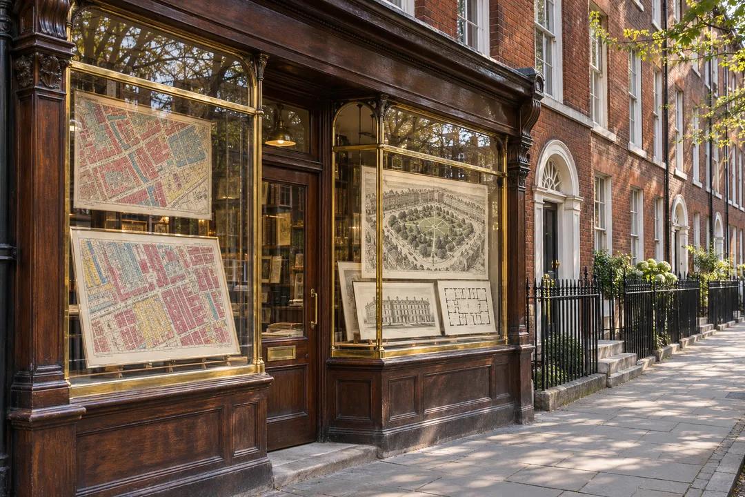
Bloomsbury Map Print Shop Browsing Guide: Parish Surveys
Visit Bloomsbury map and print dealers near Museum Street and Russell Square with free browsing. Trace social inquiry charts and historic squares on foot.
After a morning session in an archive near Great Russell Street, two social history postgraduates cross into Museum Street looking for a visual record of the alleys they have been reading about all term. Following a map print shop browsing guide through Bloomsbury suits readers and researchers who care as much about the marginal legends, surveyor notes, and parish boundaries as they do about wall decoration. Between the British Museum forecourt and the leafy railings of Bloomsbury Square, specialist print rooms stock everything from colour-coded Victorian poverty surveys and coaching road strips to Ordnance Survey town sheets that capture every vanished court, brewery yard, and timber-yard passage.
Searching Catalogue Dividers by Parish, Theme, and Printing Technique
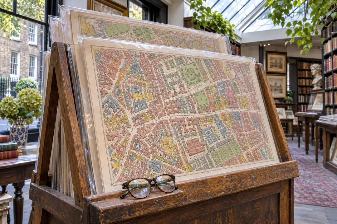
Bloomsbury dealers organize their wooden floor cradles for quick scholarly cross-referencing rather than purely decorative browsing. Instead of grouping prints by frame size, the tabbed dividers usually separate sheets into St Giles and Holborn parishes, railway and underground proposals, medical or cholera topography, and bird's-eye panoramic views. Checking the handwritten index card taped to the front of each cradle tells you how the sleeves are ordered before you begin flipping through the stack.
Use both hands when turning sleeved prints in an A-frame stand, lifting from the upper corners of the backing board rather than pinching the top middle edge where the antique sheet sits closest to the opening. Once you spot a sheet worth studying, ask the assistant behind the counter to move it to the flat reading table rather than leaning on the angled stack in the cradle. Many Bloomsbury rooms keep heavy brass or leather-covered beanbag weights on the table so curl-prone sheets can lie open safely without anyone pressing a thumb onto the margin.
Tell the bookseller or print specialist if you are tracking a specific vanished landmark—such as the old Rookery lanes around New Oxford Street, the Foundling Hospital fields, or the early university colleges along Gower Street. Dealers who spend their days cataloguing local plates often know which nineteenth-century surveyor drew the clearest footprint of a demolished hospital, workhouse infirmary, or coaching inn, and they can pull unframed sheets from the back room that have not yet reached the floor cradles.
Distinguishing Chromolithograph Survey Sheets from Steel Engravings
Because Bloomsbury attracts collectors of nineteenth-century social and scientific cartography, you will encounter three distinct printing methods in the same rack: early copperplate, mid-century steel engraving, and late-Victorian chromolithography. Steel plates allowed Victorian mapmakers to pack tiny terrace names, tramway lines, and public house symbols into dense urban blocks without the metal wearing soft, producing a cool silvery grey tone across the sheet that holds up crisply even in small octavo atlas formats.
Chromolithographed thematic maps—famous for colour-coding London streets block by block according to trade, income, or parish boundary—were printed from multiple inked stones rather than painted by hand with a brush. Under a magnifying glass, you can recognize stone-printed colour by its crisp, uniform flat tints and subtle dot stippling where two colours overlap, whereas hand-washed watercolours pool slightly darker along the engraved boundary trenches and vary in saturation from one corner of the parish to the next.
Inspect the paper stock on late-nineteenth-century folding survey sheets before committing to a purchase. Machine-made wood-pulp paper from the late Victorian decades turns more fragile along multiple pocket folds than earlier rag-linen sheets. If you fall in love with a colour-coded social survey printed on thin machine paper, check that a conservator has already lined the reverse with archival tissue so the intersections do not split inside the frame when winter central heating dries out your study.
Checking Accompanying Text Leaves and Legend Keys Before You Choose
Many thematic maps and parliamentary boundary plans sold in Bloomsbury originally appeared alongside an explanatory key leaf or statistical table in a bound report. Always ask the dealer whether the matching legend strip or gazetteer page survived with the plate. Having the original printed key explaining what each colour wash, dotted parish line, or numeral denotes makes the framed map twice as engaging when guests lean in to read it beside a bookcase.
When the legend was printed on a separate sheet from the main cartographic plate, consider asking a framer to cut a double window mat: a wide main aperture for the Bloomsbury street plan and a narrow horizontal slot beneath it for the original title key. That layout preserves the historical context without forcing you to cram an oversized mount onto a narrow study wall, and it keeps the companion text leaf safely sealed inside the same archival enclosure.
Pass over mid-twentieth-century classroom reproductions that have been artificially stained with tea washes to mimic old paper; the halftone dot grid visible under a ten-power lens gives away modern offset printing right away. An authentic Victorian steel-engraved weekly dispatch map or an early twentieth-century pocket plan offers genuine crispness, period typography, and honest historical character. If you want a study piece that rewards close reading every time you stand up from your desk, choose a single-parish sheet with house-by-house plot lines rather than a continent-wide school atlas page.
Tracing the Engraved Grid Live Across Bedford and Russell Squares
Once your print is slipped into a stiff board folder, step out of Museum Street and walk five minutes west into Bedford Square to compare the eighteenth-century estate plan in your hand with the surviving Georgian oval of dark brick townhouses. Standing by the central garden railings lets you see how the uniformity of the Coade stone doorways and fanlights matches the neat geometric hatching drawn by the original surveyors over two centuries ago.
Continue north through Montague Place into Russell Square and Woburn Square, watching how the axial sightlines between the garden enclosures were laid out as a connected sequence of green lungs across the estate. Walking these quiet academic streets with your newly acquired parish sheet turns an afternoon browse into a field walk through London urban planning history, especially when you spot cast-iron parish boundary markers still fixed to brick corner walls between St George Bloomsbury and St Giles-in-the-Fields.
Open the Karpo APP to find quiet Bloomsbury tearooms with wide wooden tables, independent academic bookshops around Torrington Place, or nearby conservation framers who handle archival paper mounts. Planning the rest of your afternoon through the app keeps your route along calm garden squares and pedestrian passages away from the Euston Road crowds, giving you a dry, unhurried corner to review your survey notes and magnifier findings before heading home.
Ask Karpo for more information.
Keep reading
- Brixton Vintage Thrift Shop Finder: South London Retro Gems
 Notting Hill Vintage Thrift Shop Finder: Preloved Rails
 Soho Vintage Thrift Shop Finder: West End Designer Archives