 Richmond Park Sunset Viewing Planner: Deer Meadow Horizons
Weekend Plans
Tottenham Historic Canal Towpath Walk: River Meets Marsh
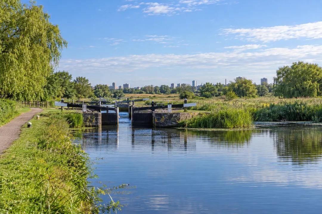
Tottenham’s historic canal towpath walk follows the Lee Navigation by Stonebridge Lock, with a choice between a waterside return and a marshland circuit.
Tottenham's Lee Navigation makes a historic canal towpath walk through a landscape that is also a river valley. Start around Stonebridge Lock and choose either a modest waterside return or Lee Valley Regional Park's published “Walk on the Wild Side” circuit through Tottenham Marshes. The difference matters: one keeps the engineered channel in view, while the other places it within a broader wetland setting. This is a north London outing for understanding the relationship between managed water and open land, with no need to travel out of the city.
Lea or Lee? The spelling explains the view
The Canal & River Trust uses Lea for the natural river and Lee for its canalised navigation. That is a useful distinction to carry on the walk. You are not looking at an entirely artificial canal laid across unrelated ground. The navigation uses a river whose course and flow have been modified, with locks and cuts helping boats move along it. At Stonebridge, the lock setting gives you a visible example of that management within a much larger valley.
The Trust explains that Stonebridge Lock lies on a man-made cut. Water comes from the Lea and its tributaries, while other river and flood-relief channels form part of the surrounding system. Rather than trying to identify every blue line from a distant view, begin with the channel beside you and locate the lock on a map. The distinction between a navigation cut and a neighbouring watercourse becomes easier to grasp when you connect it to a specific place you can actually see.
The full Lee Navigation extends well beyond Tottenham. That broad scale is background to this visit, not a target for the afternoon. A short walk around the lock and marshes can explain a great deal about the waterway without attempting a long linear journey. Avoid setting out with a vague intention to follow the water until you have had enough. Decide how you will return, since moving through a large green corridor can disguise the distance accumulating behind you.
Choose the marsh circuit for a wider picture
Lee Valley Regional Park's “Walk on the Wild Side” route uses Tottenham Marshes and returns by the navigation to Stonebridge Lock. Its sequence includes Marsh Triangle, wetland and wildflower habitats, then Chalk Bridge and the towpath. Use the published route as a whole, rather than joining fragments of different walking descriptions. A circuit is most useful when its crossings and return are clear, especially in a landscape where several parallel channels and paths can look equally plausible.
The official directions approach Chalk Bridge from the marsh side, follow the path down to the towpath and then head south towards Stonebridge Lock. The lock crossing brings walkers back towards the starting area. Notice how this changes the canal's role. On the outward part, open land is the subject. On the return, the navigation becomes the line that gathers the route together. That shift gives the walk a beginning and an ending without needing a separate attraction at either end.
A wetland circuit asks a different kind of attention from a lock visit. Look for changes between open grass, taller plants and the water's edge, rather than expecting a single spectacular viewpoint. Wildlife belongs to those habitats, but the walk cannot promise a particular sighting. If you want a longer pause, choose somewhere that leaves the path clear and observe one area for a while. Moving slowly through fewer places often reveals more than trying to cover every branch path in the marshes.
Stay with the navigation when simplicity matters
For a less complicated outing, use Stonebridge Lock as the focus and keep your walk to a manageable stretch of the public towpath. A return along the same line avoids committing to a marsh circuit. That can suit a companion who wants a straightforward waterside walk, or a visit where conversation is more important than route-finding. Choose your turnaround before fatigue or the journey home makes the decision for you, and keep track of the crossings you have used.
The lock is a good place to compare controlled water with the more open landscape around it. Watch the chamber from a position that leaves working space clear. If boats are moving, observe rather than crowd the people handling them. If the chamber is quiet, look at its relationship to the adjoining channel. You can understand the purpose of a lock without seeing a complete passage, and there is no reason to treat boat crews as a visitor demonstration team.
This is also a shared corridor, used by people making ordinary journeys as well as those spending leisure time beside the water. The Trust gives pedestrians priority on its towpaths. Keep that principle compatible with consideration: stop where others can pass, keep dogs under close control and avoid gathering across a lock approach. A relaxed walk should not require someone else to negotiate a group spread across the route, particularly when attention is directed towards the water.
Make the route legible in your photographs
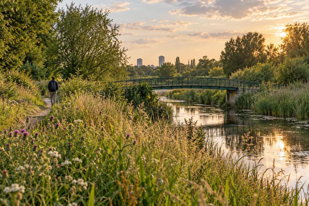
A wide view from a settled position can show the relationship between a lock, the channel and the marshland. That is more informative than a string of close-ups whose location becomes impossible to recognise afterwards. For a second image, turn away from the machinery and look at a path or bridge within the vegetation. The contrast explains why this visit combines navigation history with a larger landscape, rather than merely offering another collection of canal gates.
Avoid using a camera as a reason to cross barriers, stand on equipment or block a bridge. If a photograph would require someone else to squeeze past beside the water, choose another position. Be equally careful about private boats. A vessel can be a home or workplace, so photograph the broader setting without peering into windows or treating personal possessions on a deck as a still life arranged for you. The history is interesting without making residents part of the exhibit.
The illustrations with this article are AI-generated canal and marsh scenes, not photographs of particular people, today’s vegetation or present-day access. Their purpose is to convey the contrasting settings. Use what you encounter on the walk to form your own picture of the place. A changing river landscape is especially poorly served by assuming that an attractive image proves a path, bridge or patch of water will look exactly the same during your visit.
Practical Notes: keep the return unambiguous
For the circuit, carry Lee Valley Regional Park's “Walk on the Wild Side” directions. The authority identifies Northumberland Park as the closest station and buses along Watermead Way. Add the station approach to your plan, since a route beginning in the marshes is not a station-to-station measurement. Wear footwear appropriate to outdoor paths and choose the version of the outing that suits your companions. This article does not promise a step-free route or the availability of facilities at a particular time.
In the Karpo APP, ask for Tottenham Marshes with either a navigation-side return or the published marsh circuit, and say how much walking your group wants. Finish the request with an endpoint, rather than simply asking for a longer route. The value of this outing is the connection it makes visible: a river valley shaped to carry boats, with open land still framing the engineered channel. Leave enough time to understand that relationship before adding another destination.
Ask Karpo for more information.
Keep reading
- Richmond Park Sunset Viewing Planner: Deer Meadow Horizons
 South Bank Sunset Viewing Planner: Thames Riverside Walks
 Parliament Hill Sunset Viewing Planner: London Heath Vistas