 Richmond Park Sunset Viewing Planner: Deer Meadow Horizons
Weekend Plans

Limehouse Historic Canal Towpath Walk: Follow Old Freight
Limehouse Cut is a historic canal towpath walk through east London, linking a broad basin with the Lee Navigation and explaining an old freight shortcut.
Limehouse Cut offers a historic canal towpath walk through east London's freight landscape, with a straight water route linking Limehouse Basin and the Lee Navigation at Bromley-by-Bow. Canal & River Trust calls it London's oldest canal. Its appeal is the contrast between that direct line and the more complicated tidal journey it was built to avoid. Walk it for bridges, waterside industry and the transition from basin to cut, choosing a linear outing or a shorter basin circuit according to the time you have.
A straight line with a reason
The River Lea Act of 1766 authorised the canal's construction. Before that shortcut, vessels travelling between the Lee and Thames had to negotiate the winding tidal Bow Creek. The Cut made the relationship between those waterways more direct. Keep that purpose in mind when you look along its unusually straight course. What might seem visually plain is evidence of an engineering decision: the route was designed to move boats efficiently, rather than create a picturesque promenade for a later visitor.
Canal & River Trust describes the Cut as two miles long. That gives you a useful choice before setting out. Walking its length is different from circling Limehouse Basin, even though the two can appear together in a search for a canal stroll. Choose the full Cut if you want to follow the industrial connection north-east. Choose the basin route if your group wants a contained outing with a return to the same small area. Neither requires you to combine every nearby waterway.
Find the canal leaving the basin
Limehouse Basin is an effective place to understand the difference between a broad gathering space for boats and a channel carrying them onwards. Begin by orienting yourself towards the Cut, rather than simply following whichever waterside path looks attractive. The Trust's basin map separates the Regent's Canal, Limehouse Cut and the Thames entrance. Taking a moment over that geography saves you from accidentally beginning a different canal walk and wondering why the direction does not match your plan.
The modern connection is itself part of the story. In 1968, a new length of canal linked Limehouse Cut with the former Regent's Canal Dock, replacing its earlier Thames exit. That dock is now Limehouse Basin. The landscape you see therefore reflects changes to the transport system as well as later redevelopment. Looking for a single untouched historical scene would miss the point. The interest lies in the successive decisions that kept altering how boats, goods and people moved through the area.
Read the bridges as a sequence
Tower Hamlets' published walk follows the Cut beneath a series of bridges, including Burdett Road, Bow Common Lane and Violet Road. Use those crossings as a rhythm for the outing. Each provides a chance to notice how the canal carries on beneath the street network. You do not have to stop at every structure or memorise its name. Picking a few comparisons makes the walk more engaging than repeatedly taking the same photograph of water disappearing into the distance.
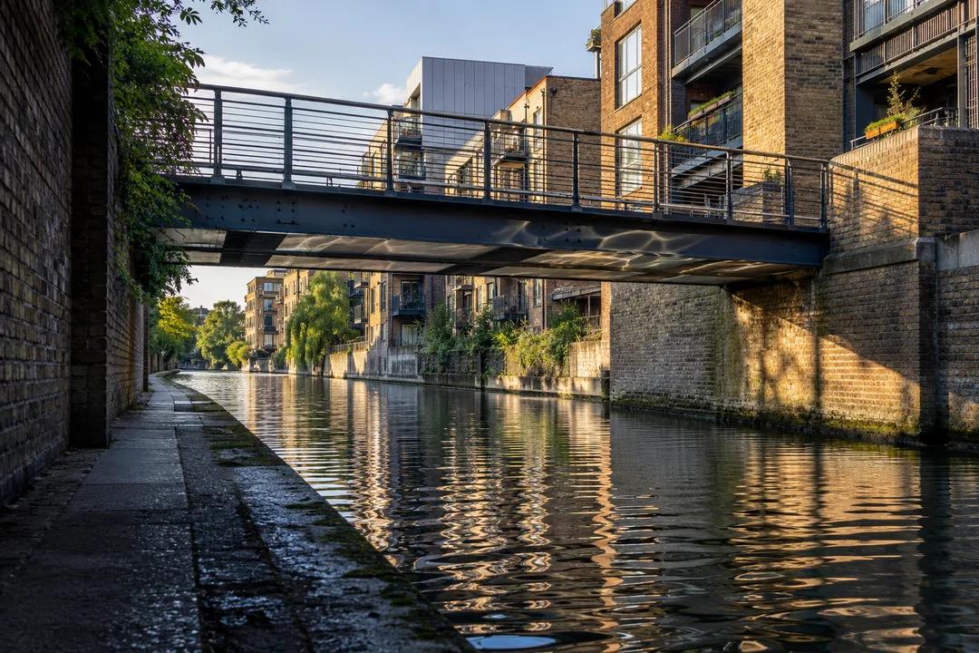
For an architectural photograph, find a position where the bridge helps show the canal's scale. A low crossing, the bank and the opposite frontage can explain the space better than a tightly framed façade. Keep moving traffic and other walkers in mind before stopping. Do not step into a narrow passage just to make the composition symmetrical. On an urban towpath, an image works best when you can take it without turning a shared route into a private photography spot.
Leave room for a short uphill detour
The council's route points out St Anne's Church, designed by Nicholas Hawksmoor, near the early part of the Cut. Treat the church as an optional change of scale and setting, rather than as a promised indoor visit. Looking towards its tower gives you a landmark beyond the canal corridor. If your group prefers to stay beside the water, keep going. A useful walk allows a choice like this without making one person feel they have missed the essential attraction.
That detour also offers a natural moment to discuss what you want from the rest of the outing. Some walkers enjoy a continuous line towards Bow, while others would rather turn back after looking at the canal's first few bridges. Make that decision while everyone is still comfortable. Avoid adding Three Mills or the Olympic Park by default because both appear on nearby-attraction lists. They are separate extensions, and the Cut already has a complete historical subject of its own.
Follow the public edge through a changing neighbourhood
The Trust notes that a floating towpath forms part of the waterside walk. That is a reminder that access beside an old canal can be a modern intervention. The route is not simply a surviving strip of nineteenth-century ground. As you pass newer buildings, look at how the public path is fitted around the water and the surrounding uses. That relationship is a distinctive feature of this walk, and can be more revealing than judging every new frontage against an imagined industrial past.
Take the path's actual line seriously. A canal drawn as a straight line does not guarantee an equally straight, uninterrupted pedestrian route at every point. Use signed access, respect barriers and leave private moorings alone. If a section is closed, return to the last clear public exit rather than trying to make your own waterside bypass. The historical interest is in understanding the canal, not proving that you can remain beside its edge regardless of what is in the way.
The one-mile alternative is its own walk
For a compact visit, the Trust publishes a one-mile circular route around Limehouse Basin, with a suggested walking time of thirty to forty minutes. Its map includes the ship lock, the hydraulic accumulator tower and the canal connections. This is a useful alternative for someone who wants to understand the meeting of waterways without committing to the full Cut. It should be described honestly as the basin circuit, rather than advertised as the entire two-mile canal in miniature.
On that shorter version, give each side of the basin a different purpose. Use one for orientation and the wider view, then use the return to notice the structures associated with handling boats and cargo. A route can feel substantial because you have learned how its parts relate, even when the distance is small. Leave room for sitting or simply watching the water. There is no requirement to fill every minute with another landmark or another piece of historical information.
Practical Notes: pick an endpoint before you leave
Set your plan as either Limehouse Basin to Bromley-by-Bow along the Cut, or the Trust's basin circuit. Add the station approach and the journey home to whichever walking distance you choose. Wear footwear suited to an outdoor waterside route, and keep companions together through constrained sections. A boat passage, wildlife sighting or access to a particular building is not guaranteed by choosing this walk. The reliable subject is the waterway itself and the urban connections visible from the public route.
The accompanying images are AI-generated editorial illustrations of east London canal settings, rather than photographs of conditions today. In the Karpo APP, ask for a Limehouse walk focused on canal history, specifying whether you want a linear finish or a short return. That distinction is more useful than a vague request for somewhere scenic. It gives the afternoon a clear shape while leaving enough room to stop, look and understand why this straight stretch of water exists.
Ask Karpo for more information.
Keep reading
- Richmond Park Sunset Viewing Planner: Deer Meadow Horizons
 South Bank Sunset Viewing Planner: Thames Riverside Walks
 Parliament Hill Sunset Viewing Planner: London Heath Vistas