 Richmond Park Sunset Viewing Planner: Deer Meadow Horizons
Weekend Plans
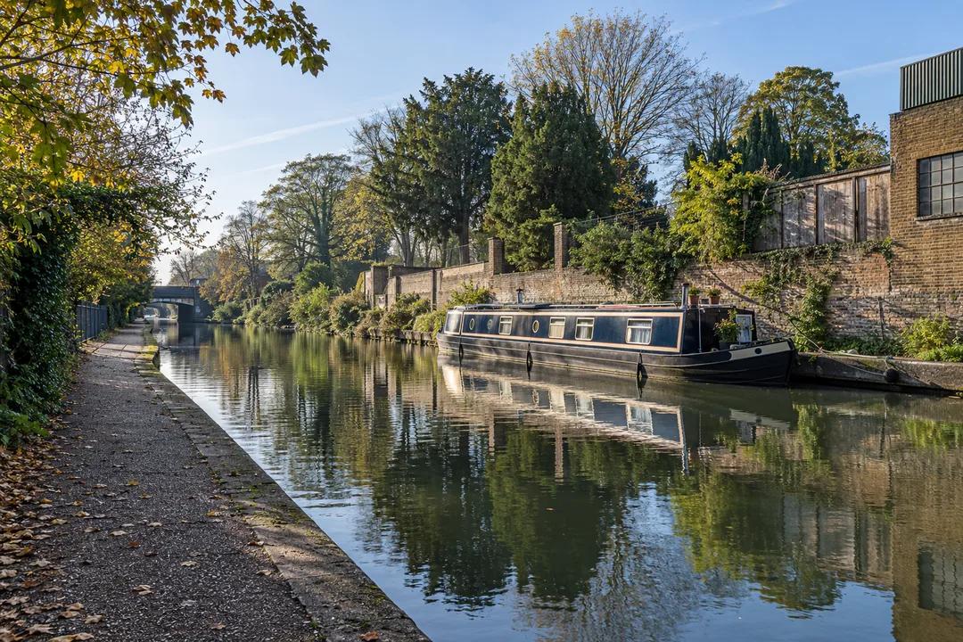
Kensal Historic Canal Towpath Walk: Read the Working Banks
Kensal offers a historic canal towpath walk along the Paddington Arm, where old industrial edges and a cemetery boundary give west London’s waterway context.
The Paddington Arm around Kensal makes a historic canal towpath walk for people interested in how west London worked, rather than a circuit of famous sights. The branch opened in 1801, bringing the inland canal network closer to central London. Along this stretch, the useful subjects are the banks, old industrial edges and the relationship between water and neighbouring land. Start from the public towpath at Ladbroke Grove and choose an outward walk towards Old Oak, keeping your return point within the time and energy you want to spend.
Leave the postcard canal behind
Little Venice is the familiar name on the Paddington Arm, but it need not be the focus of every walk on the branch. Kensal offers a different question: what can the edge of a canal tell you about the work once carried along it? Look across the water as well as ahead. A long wall, a landing place or the orientation of a building can suggest how water served the land beside it, even when its use has changed.
The Trust describes old factories and warehouses among the evidence of the Arm's industrial past. That does not mean every brick building you pass has the same age or purpose. Avoid assigning a confident history to an unlabelled structure just because it looks old. Instead, compare how buildings meet the water: directly at the edge, behind a wall or across a strip of open land. Those are observations you can make without inventing a former trade for each frontage.
Why a branch to Paddington mattered
London Canal Museum explains that the Grand Junction Canal's original route reached the Thames at Brentford. Serving central London from there still involved a long river journey. A branch to Paddington offered a closer connection with the capital, and its basin became a place for wharves, warehousing and markets. Carry that wider geography into a short Kensal walk. You are looking at part of an approach to a city, rather than a decorative water feature that happened to attract buildings.
Historic England's national canal survey describes local industries, particularly brickfields, along the branch and industrial premises towards its eastern end. Keep that account at the scale it supports. It explains why the waterway mattered along its length, but does not identify every present-day building in Kensal. The most rewarding approach is to let the history sharpen your attention, then distinguish the details you can actually see from the uses recorded in the wider canal story.
Give the cemetery boundary a different kind of attention
The Canal & River Trust highlights former landing platforms associated with the cemetery, where coffins once arrived by narrowboat. It is an arresting reminder that canals carried more than familiar industrial cargo. A waterborne connection could serve the rituals and institutions of a growing city too. Read that history with restraint. The point is to understand a transport relationship, not to turn the neighbouring burial ground into a macabre backdrop for a walk.
A canal-side visit does not imply access through a cemetery boundary. If you want a separate cemetery visit, plan to use its public entrance rather than searching for a gate from the water. For this outing, the boundary itself can be enough: compare its quieter planted edge with the harder industrial frontages elsewhere along the canal. That contrast gives Kensal a particular character without requiring you to enter another site or build the afternoon around a list of individual graves.
Choose a section, rather than the whole Arm
The Paddington Arm reaches far beyond this walk, from Paddington towards its junction with the main Grand Union Canal near Hayes. A map of the whole waterway can make a short local outing seem incomplete. Resist that impression. Choose a public access point, a direction and a return decision before setting off. From Ladbroke Grove, walking towards Old Oak keeps the focus on the western bank-side landscape, rather than automatically following every visitor towards the basin and Little Venice.
Set a personal turnaround time if you do not want to plan a linear finish. That is a planning method, not a published route duration. It allows you to spend longer at a detail that interests you without worrying about reaching a particular landmark. Include the time needed to get back to your starting area. On a canal, the existence of another bridge ahead can make it tempting to continue indefinitely, even when your group has already had the walk it wanted.
Look at the towpath as present-day infrastructure
The Trust records completed towpath improvements between Ladbroke Grove and Old Oak Lane as part of its Quietways work. That adds another layer to the route's story. The path supports contemporary walking and cycling as well as providing a way to encounter canal history. It is not an empty viewing terrace. Watch how people move through the space, and choose your stopping places with that everyday use in mind, particularly where the available width is constrained.
The Trust's work on considerate sharing gives pedestrians priority. In practice, a comfortable walk still depends on everyone leaving room for others. If you are discussing a feature across the water, gather where you do not obstruct the path. Keep dogs close when people pass and avoid occupying a bridge approach with a group photograph. These small choices let you spend time looking without making other users negotiate around an outing they did not choose to join.
Photograph the relationship, not just the reflection
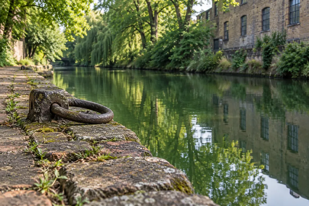
Kensal is a useful place to try a more explanatory style of canal photograph. Frame a bank, a building and a length of water together so the image shows how they relate. A reflection alone may be attractive, but it can hide the reason this stretch is interesting. For a second picture, choose a material detail visible from the path, such as brickwork or a mooring fitting, without stepping onto a boat landing or crossing a private boundary.
Keep any interpretation proportionate to what you know. A worn edge may suggest use, but you cannot date it from its texture. A moored boat may be someone's home, so treat windows and decks as private space. Avoid photographing residents as if they were historical characters provided for visitors. The strongest story here is the changing relationship between a transport corridor and a city, and it does not need an invented encounter or a picturesque boat owner to make it engaging.
Practical Notes for a close-looking walk
Begin with the public canal access at Ladbroke Grove and a map showing the Paddington Arm towards Old Oak. Plan your station approach separately, since the canal's name does not identify the most convenient entrance for every traveller. Choose comfortable footwear and a daylight outing if you intend to spend time examining banks and structures. This article does not promise a particular surface standard or a step-free approach. Stay on signed public paths and leave working waterside spaces clear.
The images accompanying this article are newly generated editorial illustrations inspired by west London canal settings, not photographs establishing a specific building's identity or today's conditions. In the Karpo APP, describe your interest as an industrial-history canal walk around Kensal, with a modest return and no compulsory attraction stop. That request keeps the plan focused. A successful visit here can be a small stretch of water understood more clearly, with enough attention left to notice how the present uses it.
Ask Karpo for more information.
Keep reading
- Richmond Park Sunset Viewing Planner: Deer Meadow Horizons
 South Bank Sunset Viewing Planner: Thames Riverside Walks
 Parliament Hill Sunset Viewing Planner: London Heath Vistas