Switzer Falls sits in a canyon off the Angeles Crest Highway in the San Gabriel Mountains, about an hour from central Los Angeles, and it is one of the closest genuine waterfall hikes to the city. The route runs down the Gabrielino Trail and onto the Bear Canyon Trail for roughly 4.5 miles round trip with about 650 feet of elevation change. The number that matters is not the distance; it is the direction.
You hike down to this one and up on the way back, and the parking lot has been closing without warning. Ask Karpo about current Switzer Falls trail and parking conditions before you drive up.
The climb is at the end
Most hikes go up first and come down tired. This one is the reverse: you descend from the trailhead into the canyon, spend time at the falls, and then climb 650 feet back out with the afternoon sun on you. That is an easy hike on the way in and a meaningfully harder one on the way back, and it catches out people who judged the difficulty during the first twenty minutes.
The practical consequence is water. Carry more than you think you need, especially between May and October, and treat the return as the real hike rather than the walk back to the car.
You need a pass to park
A National Forest Adventure Pass is required to park at this San Gabriel Mountains trailhead, and an America the Beautiful federal recreation pass is accepted in its place. There is no way to pay at the trailhead in the way you might at a state park, so this is something to sort in advance — passes are sold at ranger stations and at various retailers around the foothills.
Arriving without one and hoping is a reliable way to get a citation. It is also the single most common preventable problem at Angeles National Forest trailheads.
Parking has been unreliable
The Switzer picnic area lot is not large, and there have been recent reports of the lower lot being closed outright. When the picnic area lot is full or shut, additional parking is available at the top of the access road, which adds distance to both ends of the hike.
This is a trailhead where checking current conditions genuinely changes the plan. Angeles National Forest has carried a shifting set of closures in recent years following major fires in the range, and while the Bear Canyon route to Switzer Falls has been reported open, closure orders in the forest are revised regularly. Check the Angeles National Forest alerts page before driving up rather than after.
There is also a choice of viewpoints that most people miss. The main route brings you to an overlook above the falls rather than to the base, and continuing down into the gorge to stand at the bottom is a separate, rougher scramble. Knowing which one you are aiming for before the junction saves a confused twenty minutes on the trail.
What the hike is like
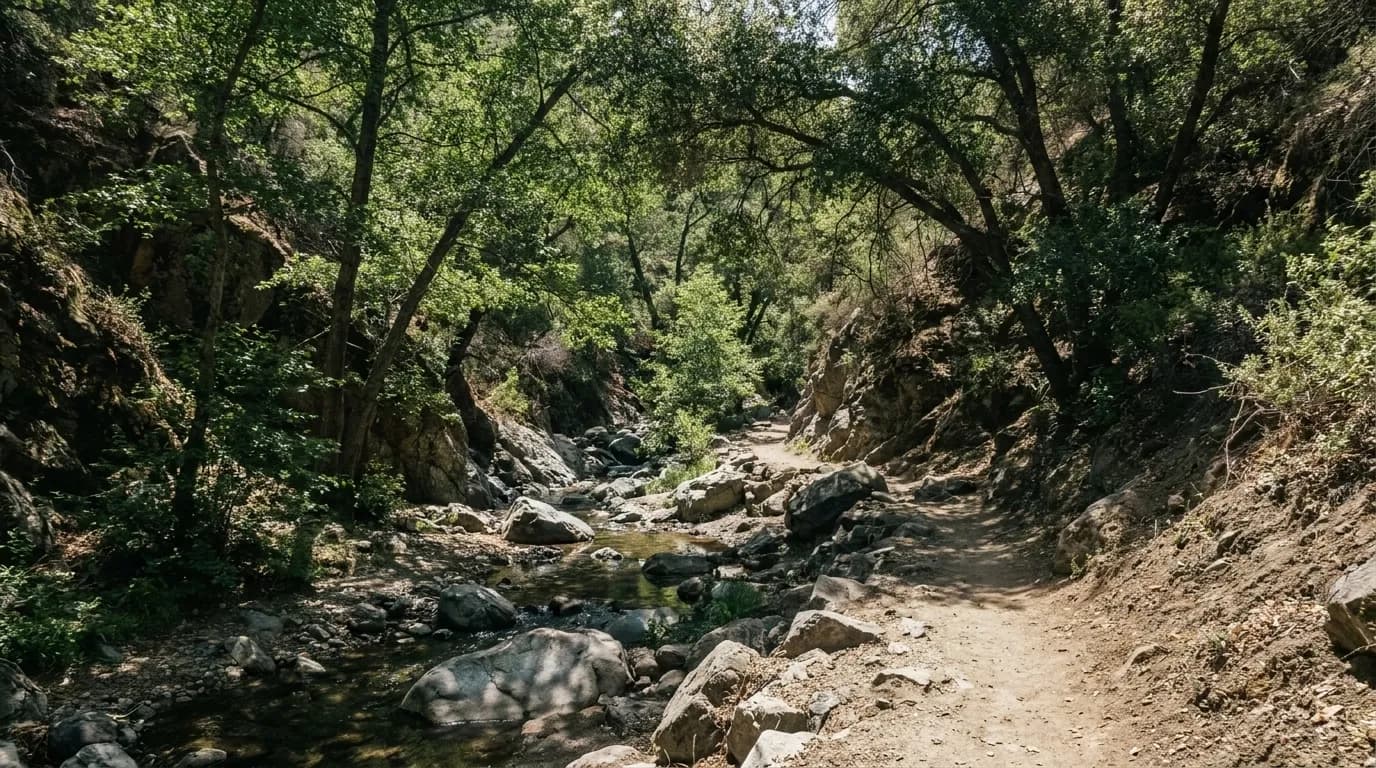
The canyon is shaded and follows the creek, which makes it significantly cooler than the exposed ridges around it and one of the better summer options in the range. There are creek crossings, alders, and the remains of an old resort camp along the route — the canyon has a longer human history than its current wildness suggests.
Dogs are allowed on leash and bikes are permitted on this trail, which is not true everywhere in the forest. Day-use hours run from 6am to 10pm.
Mountain weather is the other thing to respect. The Angeles Crest Highway climbs fast, and conditions at the trailhead can be fifteen degrees cooler than in the basin, with snow on the road in winter and thunderstorms building on summer afternoons. Checking the forecast for the mountains rather than for Los Angeles is the correct habit.
Water levels decide the payoff
As with every Southern California waterfall, the falls are a function of recent rain. Late winter and spring after a wet season is when this is worth the drive; late summer in a dry year can reduce it to a trickle over rock.
That does not necessarily make the trip pointless — the canyon and the creek are the better part of the walk in most conditions — but it is worth adjusting expectations. If the waterfall itself is the entire objective, check recent trip reports rather than photographs, which are almost always taken in March.
Practical notes
Switzer Falls is reached from the Switzer picnic area off the Angeles Crest Highway near La Cañada Flintridge, in the San Gabriel Mountains of Angeles National Forest. The hike runs down the Gabrielino Trail and onto the Bear Canyon Trail, roughly 4.5 miles round trip with about 650 feet of elevation change — downhill on the way in, uphill on the way out. A National Forest Adventure Pass or America the Beautiful pass is required to park, and must be bought in advance. The lower lot is small and has been reported closed at times, with additional parking at the top of the road. Day-use hours are 6am to 10pm; dogs on leash and bikes are allowed. Check the Angeles National Forest alerts page for current closures before driving up. Flow depends on recent rain.
Tags: #WaterfallsNearMe #LosAngelesHikes #SwitzerFalls #AngelesNationalForest #SanGabrielMountains #GabrielinoTrail #Hiking #AdventurePass #LAOutdoors #SportsSocial #ThingsToDoInLA #WaterfallsLA #TrailGuides #Canyons
Sources consulted: hikespeak.com · fs.usda.gov · alltrails.com
All trademarks are the property of their respective owners.
Ask Karpo first
Want to know whether the trailhead lot is open, what the creek is running at, and how hot the climb out will be? Ask Karpo for current Switzer Falls conditions, a start time that avoids the afternoon heat, and a nearby alternative if the road or lot is closed.