 Los Feliz Nail Salon Walk In Finder for Broken Nail Repair
Neighborhood Guides
Pasadena Scenic Pedestrian Stroll Through Old Town Arcades
Plan a Pasadena scenic pedestrian stroll through Old Pasadena alleys, the City Hall courtyard and Colorado Street Bridge, with timing and an easier loop.
Pasadena rewards walkers who like brick, arches and a slower pace. This scenic pedestrian stroll begins in Old Pasadena, the restored commercial core along Colorado Boulevard, threads through its alleys and courtyards, turns north into the arcaded garden of Pasadena City Hall and ends on the Colorado Street Bridge above the Arroyo Seco. It covers roughly three miles on mostly level streets and works best from late morning into golden hour.

Old Pasadena and Its Brick Blocks
Old Pasadena grew up in the late 1800s around Colorado Boulevard and Fair Oaks Avenue, when the city was a winter resort for wealthy visitors from the East and Midwest. By the 1970s many of its buildings were run down and threatened with demolition. Preservationists pushed back, and in 1983 the area was listed on the National Register of Historic Places as a historic district, which helped launch a long restoration.
Today the blocks around Fair Oaks and Colorado are lined with brick and stone facades, decorative cornices and tall shop windows. Look above the ground floor shops for painted ghost signs, cast iron details and the dates that some owners carved into their parapets. A slow first lap here sets the tone, so walk both sides of Colorado before heading into the side streets.
Alleys and Hidden Courtyards
The best part of an Old Pasadena walk is the network of alleys behind the main street. Narrow passages such as Mills Place and the walkways around One Colorado lead into courtyards with string lights, planters and outdoor seating. Some of these lanes were once service alleys for delivery wagons, and the brick walls still show old loading doors and filled in windows.
Walk in from Colorado Boulevard and follow the passages north and south, crossing from one block to the next. The courtyards are quieter than the main street and make good places to sit for a few minutes. Treat them with respect, since many are shared by restaurants, offices and apartments. Weekday mornings are calm here, while weekend evenings bring dinner crowds and music.
Memorial Park and the Playhouse District
Head north on Raymond Avenue to Memorial Park, a small green space with mature trees, a band shell and a war memorial. The Metro A Line stops at the edge of the park, so this is also a convenient place to start or end the walk if you arrive by train. Families, office workers and dog walkers use the lawns throughout the day.
From the park, you can extend east along Colorado Boulevard toward the Playhouse District, named for the Pasadena Playhouse, a Spanish Colonial Revival theater opened in 1925 and later designated the State Theatre of California. Its courtyard and arched entrance are worth a look even if you are not seeing a show. This detour adds about a mile out and back.
Pasadena City Hall and Its Garden Courtyard
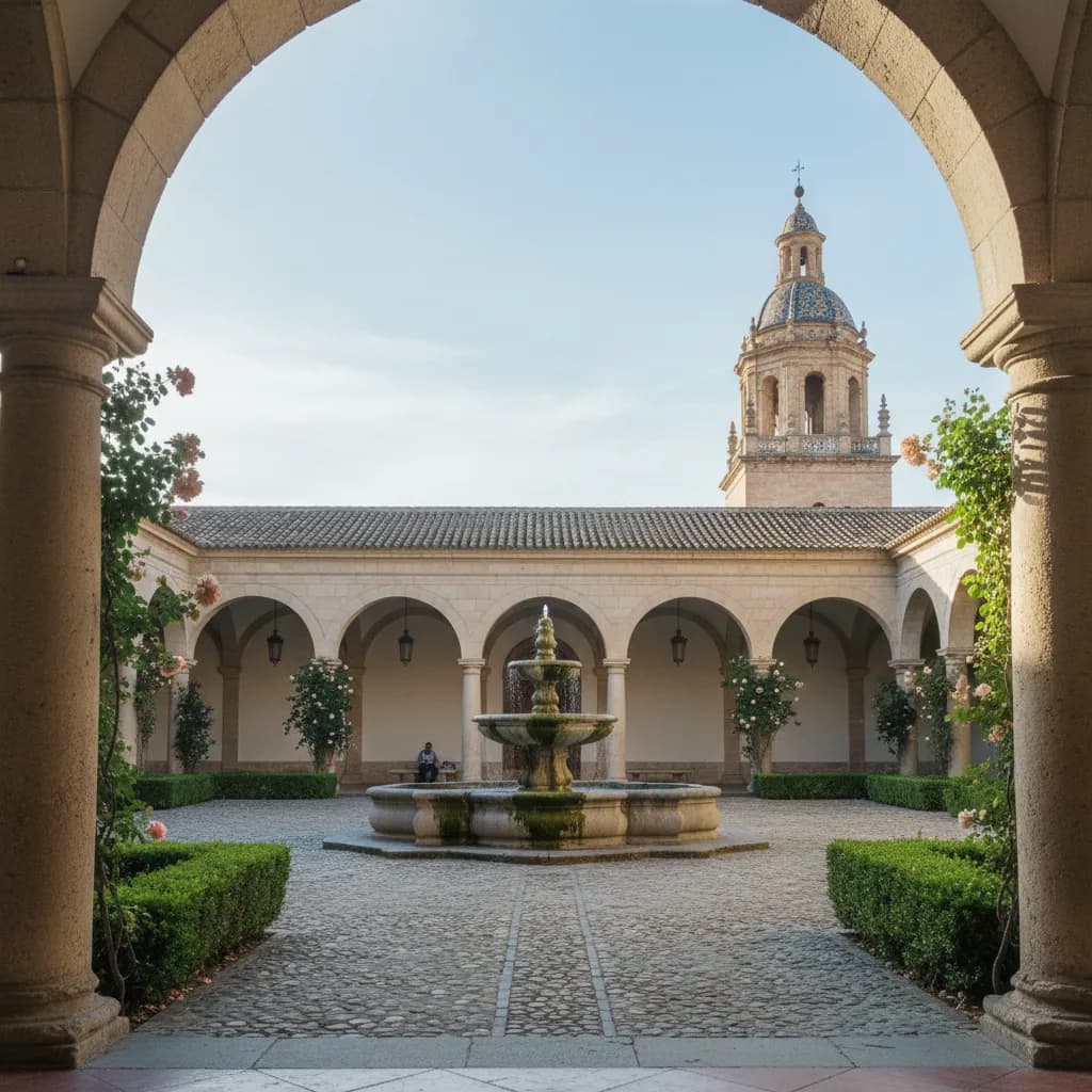
Turn north on Garfield Avenue and the view ends at Pasadena City Hall, completed in 1927 and designed by the San Francisco firm Bakewell and Brown. Its dome and tower rise above a Mediterranean style building with arcades wrapped around a large central courtyard. The courtyard garden, with a tiered fountain, roses and clipped hedges, is one of the most peaceful public spaces in the city.
Walk through the arcades and circle the fountain slowly, looking up at the tower from different corners. The building is a working city hall, so be considerate of staff and visitors and check whether the courtyard is open before you go. Its arches and long shadows are especially photogenic in the morning, when the sun falls across the garden from the east.
Along the Arroyo to the Colorado Street Bridge
From City Hall, head west across Old Pasadena toward the Arroyo Seco, a natural canyon that runs along the western edge of the city. Streets begin to slope gently as you approach, and houses become larger with deep front gardens. The Colorado Street Bridge crosses the arroyo here on a sweep of tall concrete arches, and it opened in 1913 as part of an early route linking Pasadena to Los Angeles.
Walk out onto the bridge on its pedestrian sidewalk and look north toward the San Gabriel Mountains and south along the wooded canyon. The curved deck, ornate light posts and railings make this one of the most elegant structures in Southern California. It is a busy roadway as well, so keep to the sidewalk and take photos from the overlooks rather than leaning out over the rail.
Who Shares the Route and When to Go
Pasadena walkers include students, office workers from nearby campuses, families visiting for the day and residents who use Old Pasadena as their main street. Weekday mornings are calm and ideal for architecture. Weekend afternoons and evenings fill the alleys and courtyards with diners and shoppers. Around New Year, the Rose Parade route along Colorado Boulevard draws huge crowds, so plan around those dates.
The weather is usually warm and dry. Summer middays can be hot on the open boulevards, and the walk to the bridge has limited shade. Winter brings cooler, clearer days and often fine views of the mountains. For the best light, start in Old Pasadena in the late morning, visit City Hall early in the afternoon and reach the bridge in the last hour before sunset.
Planning Your Stroll with Karpo APP
Karpo APP helps you organize a walk like this before you leave home. Ask for a Pasadena stroll that starts at Memorial Park station, includes the Old Pasadena alleys and the City Hall courtyard, and finishes on the Colorado Street Bridge by sunset, and it can put the stops in a sensible order with a rough time for each one.
You can also ask Karpo APP to add the Playhouse District, suggest a midway coffee break or trim the route for younger kids. It is a planning helper rather than a live guide, so rely on your map app for directions and on official city pages for courtyard access and event closures.
Distances, Transit and an Easier Version
The full route from Memorial Park through Old Pasadena, east to City Hall and west to the Colorado Street Bridge is about three miles. Most of it is level, with a gentle slope down toward the arroyo. The Metro A Line serves Memorial Park and Del Mar stations, and several bus lines run on Colorado Boulevard, so it is easy to arrive without a car.
For a shorter outing, stay within Old Pasadena and add the City Hall courtyard, which takes about an hour and a half at an easy pace. If you want the bridge view without the full loop, ride or drive toward the arroyo and walk the bridge from end to end, then return to Old Pasadena for a meal in one of the courtyards.
Ask Karpo for more information.
Keep reading
- Los Feliz Nail Salon Walk In Finder for Broken Nail Repair
 Highland Park Nail Salon Walk In Finder for Retro Manicures
 Koreatown Nail Salon Walk In Finder for K-Beauty Nail Looks