 Los Feliz Nail Salon Walk In Finder for Broken Nail Repair
Neighborhood Guides

Heritage Historic District LA: 3 Whitley Hillside Views
Explore Whitley Heights through hillside sections, retaining walls and changing views, with a short exterior walk that respects private residential space.
Whitley Heights is easier to understand in section than in a flat photograph. The historic Hollywood neighborhood occupies hilly terrain north of Franklin Avenue, and the city's account links its Mediterranean architectural character to developer H.W. Whitley and architect A.S. Barnes. For a heritage historic district outing in LA, use the hillside as the organizing subject. Three views are enough: uphill, across the slope and back along the lane. Each reveals a different relationship between a house and the ground beneath it.
First draw the ground, then the house
Imagine a simple section cut through a hillside frontage. Before adding a roof, draw a line for the public pavement and another for the ground rising behind it. Now place the visible house volume above those lines. The exercise is deliberately rough. It can explain why a building seems taller from one direction without requiring a floor plan or a precise survey. A retaining wall may occupy much of the view even when the house itself sits farther back.
Distinguish a wall supporting a change in level from a garden boundary when the relationship is visible, and leave the distinction unresolved when it is not. A textured surface alone cannot tell you how a wall was built or when it was altered. The important observation is spatial: how much ground appears between the lane and the entrance, and how that changes the view. Keep your sketch beside a written note about where you stood, so the apparent height remains tied to a viewpoint.
The uphill view compresses several levels
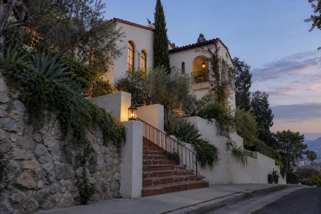
Looking uphill can bring wall, entrance, roof and trees into one narrow frame. Instead of calling the result picturesque, unpack it. Find the lowest visible built edge, the doorway level if visible, and the roofline above. Ask whether the house seems to emerge from the slope or stand clearly in front of it. This is a description of the view, not evidence that the architect intended a particular emotional effect or borrowed from one specific Mediterranean town.
Choose an uphill observation position with enough public pavement to stand comfortably. If the lane is too confined, omit the photograph and make a quick sketch from a safe position. Do not use a private stair as a viewing platform. A residential staircase may look like the most direct continuation of a hillside path while serving only the home behind it. An incomplete view of the doorway is still sufficient for the ground-to-roof comparison.
Across the slope, roofs become neighbors
A view across a slope changes the subject from a single frontage to the way buildings overlap. One roof may sit against another wall, and a lower house can partly disappear beneath the garden of a higher one. Follow the sequence from near to far. Use three pencil tones if you are drawing: dark for the nearest edge, medium for the next building and light for the background. You are recording depth, not trying to reproduce every tile.
This view helps explain why a detached house can appear almost attached to its neighbor in a photograph. Perspective can collapse the gap. Resist turning that appearance into a claim about shared walls, parcel lines or ownership. A slight change in your position may reveal the separation, but only move within the public pedestrian space. When the gap stays hidden, caption the image as an overlapping view rather than asserting a construction relationship you cannot see.
The Mediterranean idea was part of development
City Planning describes Whitley's decision to send Barnes to study Mediterranean architecture and landscape, and identifies Barnes with much of the neighborhood's residential design from 1918 to 1928. That documented story makes the hillside composition a meaningful topic. It does not mean every house was designed by Barnes or that a tiled roof dates to that period. Keep the district-level account separate from any attribution to an individual property, especially when later changes may be visible.
The same restraint improves the visitor experience. You can notice how a wall, planted slope and roof work together without identifying a former celebrity resident. Famous names are not substitutes for understanding a street. Unless you have a reliable property-specific record, skip the imagined scenes of actors arriving home or entertaining on a terrace. The development story already offers a strong contrast with Hollywood below: a residential landscape shaped to suggest another architectural setting.
Look back to find what the climb concealed
Once you have reached a suitable turning point, look back along the public lane. The facade that commanded the uphill view may now be less prominent than a wall or roof edge. Compare the sense of enclosure in the two directions. You might find that a bend blocks the next building, or that vegetation provides more of the visual boundary than architecture. These are observations to make on the day rather than promises that every stretch will produce the same composition.
The city's history also records the Hollywood Freeway's division of the original neighborhood layout. That is a reason to avoid imagining a complete, unchanged village plan. A present-day route can be shorter or differently connected than a historical map suggests. Use an actual pedestrian connection and your own ability to return as the practical test. Do not follow an apparent shortcut through a gate or treat a discontinuity as an invitation to improvise a private passage.
Practical Notes for turning around early
Make the return part of the plan before climbing. This article does not certify a step-free route, stair access or a particular gradient. A visitor who finds the slope uncomfortable can use one safe observation point and compare uphill with across-slope views from there. There is no requirement to reach the highest house. For a mixed-ability group, a short shared study is preferable to splitting up on the assumption that everyone will find the same route down.
Carry a small notebook and reduce the task to three labels: ground, wall, roof. If your photographs make the houses look flatter than the walk felt, add a little section sketch alongside them. You can ask the Karpo APP a general neighborhood-planning question, without assuming live slope assessment or accessible-route verification. The illustrations here are AI-generated architectural composites, not photographs proving the form of a named Whitley Heights property. Leave with three distinct viewpoints and an honest record of what they revealed, rather than a collection of unsupported house histories.
Ask Karpo for more information.
Keep reading
- Los Feliz Nail Salon Walk In Finder for Broken Nail Repair
 Highland Park Nail Salon Walk In Finder for Retro Manicures
 Koreatown Nail Salon Walk In Finder for K-Beauty Nail Looks