 Sawtelle Bowling Group Night Planner for a College Reunion
Sports Social
Santa Monica Cycling Trail Planner: Coastal Route Guide
Plan protected cycling trail routes across Santa Monica from the beach path to Broadway. Master connector intersections and timing rules for coastal rides.
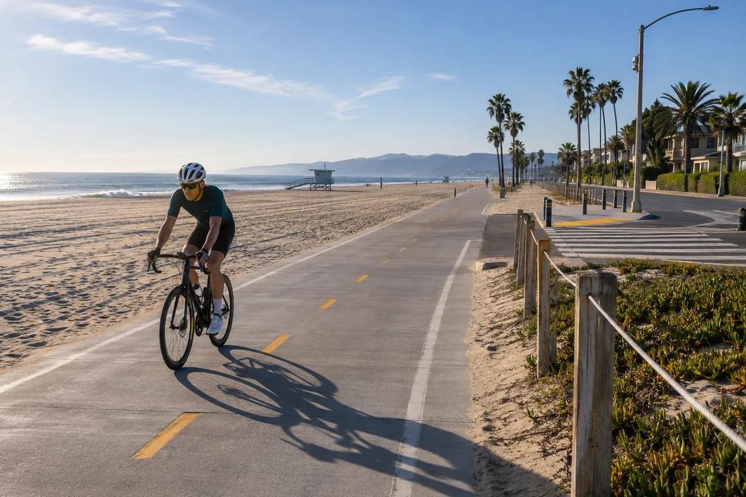
Navigating westside Los Angeles on two wheels demands an intentional cycling trail planner approach rather than casual street cruising. Santa Monica stands out as Southern California's most comprehensively networked coastal biking hub, linking the continuous oceanfront Marvin Braude Bike Trail with robust inland protected bikeways along Broadway, 17th Street, and Ocean Park Boulevard. Choosing the right sequence of dedicated paths transforms an intimidating commute into an invigorating oceanside ride. Ever since regional transportation planners began integrating dedicated coastal bike networks in the 1970s, the city has refined its bikeway master plans into high-capacity active corridors. Karpo APP coordinates these interconnected cycling corridors so you can monitor protected lane transitions, compare gradient profiles, and pace your transit connections without losing track of your coastal route.
Oceanfront Path Versus Inland Protected Corridors
The twenty-two-mile Marvin Braude Bike Trail forms the western spine of Santa Monica cycling, tracing the shoreline sand from Pacific Palisades south through Venice, Marina del Rey, and the South Bay beach communities. While cruising directly along the beach delivers uninterrupted Pacific views, refreshing ocean breezes, and a completely flat grade, afternoon coastal winds and heavy pedestrian foot traffic around the Santa Monica Pier can slow touring speeds significantly. In peak summer months, pedestrian spillover near the carousel building and boardwalk ramps creates bottleneck congestion that requires continuous cadence modulation and defensive steering.
Inland infrastructure provides dedicated, grade-separated bike boulevards that parallel busy vehicular thoroughfares without beachside pedestrian conflict. The 17th Street protected bikeway connects the Metro E Line station directly to Santa Monica College and residential neighborhoods, featuring physical concrete curbs, green conflict paint, and dedicated bicycle signal phases. Broadway functions as an east-west neighborhood greenway, guiding riders between Downtown Santa Monica and mid-city commercial hubs with dramatically reduced traffic volumes, making it an essential connector in your cycling trail planner routine.
Cyclists seeking longer uninterrupted tempo workouts often combine both networks into a versatile coastal circuit. By using the beach path for early morning endurance miles and returning through the shaded residential grid of 4th Street and California Avenue, riders maximize overall speed while avoiding the midday beachside crowds. Understanding when to transition from the ocean path to the city street grid forms the foundation of smart westside cycling.
Optimal Departure Timing and Wind Conditions
Coastal riding conditions vary markedly depending on the hour of day and regional onshore thermal activity. Early morning between 7 am and 10 am offers calm onshore air, crisp pavement conditions, and sparse pedestrian traffic along the boardwalk. Commuters and local cycling clubs capitalize on this tranquil daylight window to complete distance loops before afternoon thermal winds build up off the Santa Monica Bay. Starting early ensures unhindered passage through major junction points like Ocean Avenue, the Colorado Esplanade, and the entrance to the beach underpass near Pico Boulevard.
By mid-afternoon, prevailing westerly winds generate steady head resistance for northbound cyclists heading toward Will Rogers State Beach and Topanga Canyon. When organizing a coastal round trip, seasoned riders recommend pedaling north during the calm morning hours and riding south with tailwind support as the coastal breeze strengthens after 2 pm. Midday weekend hours around the pier area also bring dense crowds of rental cruisers and roller skaters, requiring careful bell communication or an immediate inland detour.
Seasonal shifts also influence coastal riding comfort along the coastline. Spring and early summer frequently bring dense marine fog known locally as May Gray and June Gloom, which dampens road surfaces and cools ambient temperatures until midday clearing. Equipping your bicycle with clear lens eyewear prevents wind fatigue and salt spray irritation, while a packable windbreaker keeps your core warm during brisk coastal morning departures.

Essential Gear and Bike Lock Protocols
Westside coastal salt air and sudden ocean fog require regular equipment vigilance and preventive maintenance. A dependable front daytime running light and a bright red rear flasher ensure high visibility when marine layers roll over coastal bluffs near Palisades Park. Keep tires inflated to recommended pressure ratings, as windblown coastal sand occasionally accumulates in bike lane gutters along Ocean Park Boulevard and Neilson Way, requiring stable traction during turns and rapid stops.
Santa Monica maintains numerous public bike racks, fix-it repair stations, and secure parking corrals near Metro E Line stations and civic centers. Always secure your frame and both wheels with a hardened steel U-lock paired with a secondary braided cable, avoiding lightweight wire cables that invite opportunistic tampering. If stopping for refreshments along Main Street or Montana Avenue, position your bicycle within clear sightlines of outdoor patio seating to ensure continuous peace of mind.
Carrying a compact multi-tool, tire levers, a spare tube, and a mini-pump or CO2 inflator is strongly advised for self-sufficient riding. While mobile bike repair vans and independent retail shops operate throughout Santa Monica and Venice, being able to fix a minor roadside pinch flat preserves your itinerary schedule. Routine chain lubrication with wet or ceramic lube protects drive trains from corrosive salt air exposure.
Scenic Route Connections and Urban Greenways
Connecting coastal stretches with surrounding neighborhoods expands your riding horizons far beyond the immediate beach strip. From Ocean Avenue, riders can climb gentle inclines toward the scenic bluffs of Palisades Park, connecting with San Vicente Boulevard's historic coral-tree-lined center median bike path heading into Brentwood. This corridor offers a classic endurance workout featuring broad pavement and steady climbs away from oceanfront congestion, framed by decades-old canopy trees established in the 1950s.
Southbound riders can exit the beach path at Ocean Park Boulevard to explore the boutique corridors and coffee stops of Main Street before crossing into Venice. The Ocean Park bike lanes provide a direct route eastward to Clover Park and the Santa Monica Airport parklands, presenting shaded rest areas and water refill stations. Integrating these neighborhood greenways ensures a well-rounded itinerary that balances open ocean scenery with relaxed urban discovery.
For those seeking additional vertical gain, climbing north toward the Pacific Palisades bluffs via Channel Road or Entrada Drive opens panoramic vantage points over the entire Santa Monica coastline. These climbing spurs test climbing gearing while rewarding riders with unobstructed views stretching from Malibu down to the Palos Verdes Peninsula on clear afternoons.
Cycling Etiquette and Navigation With Karpo APP
Safety and courtesy maintain harmony on shared beach paths and busy urban lanes. Obey the posted fifteen-mile-per-hour speed limit on the Marvin Braude beach trail, giving audible bell alerts or friendly vocal signals when overtaking slower family groups, runners, and pedestrians. At signalized city intersections, utilize dedicated green bike boxes to position yourself ahead of turning motor vehicle traffic, remaining visible and predictable at all times.
Urban cycling continues to evolve with connected bike lanes and signalized street designs across Los Angeles County. Karpo APP keeps your route planning precise by compiling verified path segments, elevation contours, and neighborhood connectors into an intuitive, real-time interface. Whether mapping a morning workout loop or navigating transit transfers across Santa Monica, having clear pathway data empowers you to ride with confidence along Southern California's finest coastline.
Ask Karpo for more information.
Keep reading
- Sawtelle Bowling Group Night Planner for a College Reunion
 Larchmont Bowling Group Night Planner for Carpool Parents
 Boyle Heights Bowling Group Night Planner for a Quince Court