Dead Horse Bay has the kind of reputation that makes careful walkers pause: old bottles, eroding landfill edges, strange shoreline stories, and a name that sounds borrowed from a city myth. As of July 21, 2026, the practical answer is less romantic. The National Park Service lists the Dead Horse Bay land area in the Jamaica Bay Unit as closed to public use because of potentially hazardous contamination, and its Dead Horse Bay FAQ describes a southern-area closure tied to radiological and chemical concerns. For a Brooklyn walker on a mild, dry weekday with a photography friend, the smart trip is a rules check, a boundary respect exercise, and a backup plan.
Want a quick read on whether an unusual NYC shoreline is actually visitable today? Text Karpo before you go, especially when closures, tides, transit, or park alerts can change the plan.
Dead Horse Bay Access Is a Closure Question First
Treat Dead Horse Bay as a closure question before you treat it as a destination. Gateway’s 2026 Superintendent’s Compendium names the Dead Horse Bay land area, from the Marine Parkway Bridge south to the Marina of the Future boundary, between Flatbush Avenue and the shoreline, as closed to public use. That language matters because it covers casual walking, photography wandering, beachcombing, and curiosity stops, not only organized events or vehicle access.
The failure mode is assuming an old blog, map pin, or social photo proves access is acceptable. It does not. NPS explains that closures can be marked by signs, maps, media notices, barriers, or gates, and park rangers enforce Gateway rules. If the official page, a posted sign, or an on-site barrier says no access, the decision is already made. This is a skip-the-shoreline situation, even on a clear day with good shoes.
Bottle Beach Curiosity Does Not Override NPS Hazard Rules
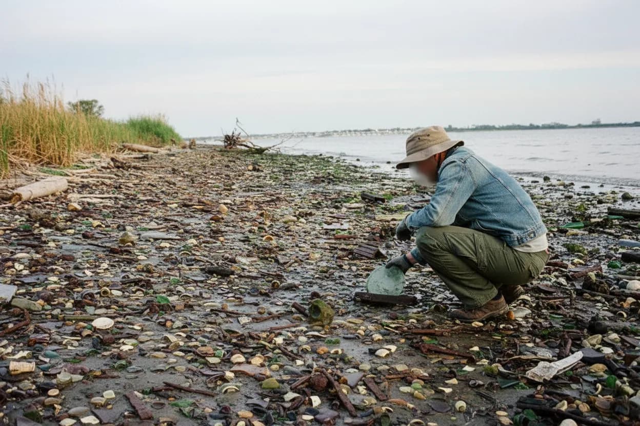
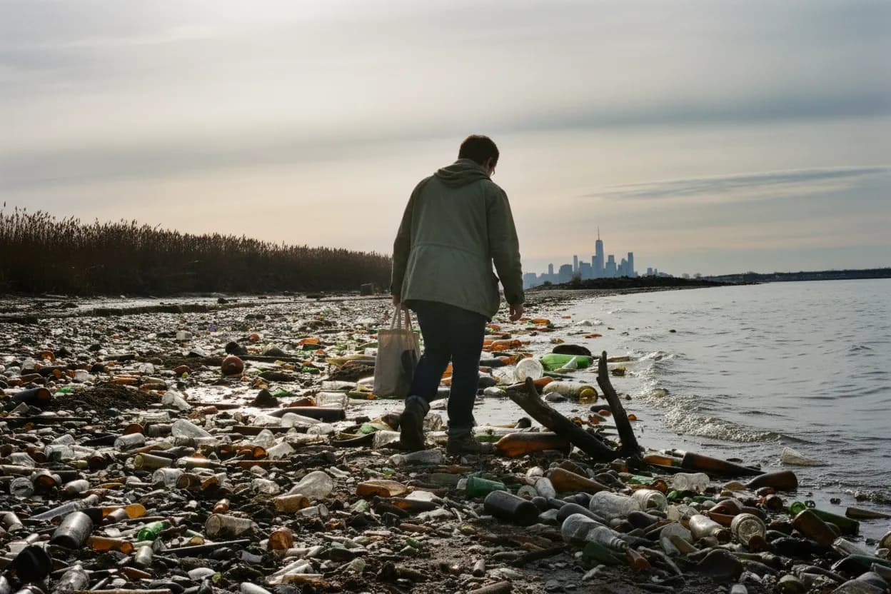
The lure is understandable: NPS’s own media gallery describes Bottle Beach as an eroding former landfill where bottles, ceramics, shoes, metal, and older refuse have appeared along the shoreline. That history is exactly why the site attracts photographers and urban-history walkers. It is also why the current rule should be taken seriously. Interesting visible artifacts are not a public invitation, and removing objects from a national park area can create separate legal and safety problems.
NPS’s Dead Horse Bay FAQ says the southern site closure followed identification and removal of man-made radioluminescent articles buried below the surface. It also names Radium-226 as the primary radiological contaminant identified, with PCBs, pesticides, polycyclic aromatic hydrocarbons, and metals also found in soil while the full extent remained under investigation. For a cautious walker, that means no digging, no collecting, no handling, no stepping around closure lines for a better photograph.

Floyd Bennett Field Is the Safer Nearby Pivot
If the goal is an unusual Brooklyn edge rather than Dead Horse Bay specifically, pivot to Floyd Bennett Field. NPS lists Floyd Bennett Field as open daily from 6 am to 9 pm, with historic aviation context, grasslands, saltmarshes, tidal mudflats, a marina area, bird watching, biking, and the Ryan Visitor Center area. It gives you the same far-south Flatbush Avenue geography without turning the walk into a test of closed-land boundaries.
This pivot works best if you frame the outing as observation, not scavenging. Photograph hangars, broad runways, sky, birds, and marsh edges from open public areas. Avoid unpaved roads and any posted restricted zones, because the Compendium separately closes all unpaved roads within the North Shore District, including Dead Horse Bay and Raptor Point Trail. The tradeoff is losing the bottle-strewn shoreline image, but gaining a legal, daylight-friendly route.
Transit To Flatbush Avenue Needs Extra Time
Public transportation is possible, but it is not frictionless. NPS directions for Floyd Bennett Field say to take the 2 train, or the 5 at rush hour, to Flatbush Avenue-Brooklyn College and transfer to the Q35, then ride to the Floyd Bennett Field entrance. NPS also lists an A train or Rockaway Park Shuttle option to Rockaway Park-Beach 116th Street, with a Q35 transfer back toward the entrance.
For a hard-difficulty outing, build in slack for the last leg and the return. The area is wide, exposed, and less forgiving than a neighborhood park if a bus gap, heat, wind, or phone battery problem appears. If your companion uses a mobility aid, verify current MTA elevator status and stop spacing before leaving. If either person expects a short, casual stroll from the subway, choose a more central waterfront instead.
Daylight Only Changes The Risk Calculation
The dynamic plan here should stay daylight only. Gateway’s Compendium lists Jamaica Bay Unit visiting hours as 6:00 a.m. to 9:00 p.m. for all areas except Canarsie Pier and Jacob Riis Park, but posted local closures still control what you can enter. Daylight helps you see fences, signs, uneven ground, wet edges, and traffic crossings near Flatbush Avenue. It does not convert closed land into open land.
A mild, dry weekday is the best version of this plan because crowds, glare, and weather pressure are lower. Still, bayside conditions can change the feel quickly: wind can make exposed roads unpleasant, rain can turn margins slick, and high tide can reduce visible shoreline elsewhere in Gateway. If the day turns wet, hazy, very hot, or windy, downgrade the trip to Ryan Visitor Center-area photos or another paved, staffed site.
Photography Near Dead Horse Bay Has Legal Boundaries
A photography friend can make the outing better, but only if the subject is the boundary, not a trespass. Use legal vantage points, open park areas, signage, Flatbush Avenue approaches, and Floyd Bennett Field textures. Do not move barriers, climb fencing, follow informal tracks, or step into vegetated wetlands for a cleaner frame. Gateway rules close vegetated wetland areas to visitor access, and the park can restrict access to protect resources or safety.
The practical test is simple: if taking the photo requires ignoring a sign, touching debris, entering a closed land area, or putting a person near unstable shoreline material, skip the shot. Bring a longer lens rather than closer feet. Keep hands off found objects, even if they look harmless or historically interesting. The strongest image from this trip may be the city’s limit line, not the forbidden artifact behind it.
Verify Gateway Alerts Before Leaving Brooklyn
Make the final decision shortly before departure, not the night before. Open the Gateway National Recreation Area alerts page, the 2026 Superintendent’s Compendium, and the Dead Horse Bay FAQ. Check whether NPS has posted a newer access notice, construction warning, weather closure, program change, or contact instruction. Because the cleanup process can take many years and official pages can be revised, an old screenshot or saved map is not enough.
Your go decision should have three parts: Dead Horse Bay shoreline remains off the plan, Floyd Bennett Field or another open Gateway area is the actual destination, and your return route is confirmed. If any official source is unclear, call Gateway contact numbers or choose a different waterfront. For curious but cautious walkers, the win is not getting close to Bottle Beach; it is leaving with good photos and no boundary problem.
Tags: #DeadHorseBay #GatewayNRA #BrooklynWalks #JamaicaBay #FloydBennettField #NYCParks #ShorelineSafety #HiddenGemsOddFinds #UrbanHistoryNYC #BottleBeach #TransitTrip #DaylightOnly #AskKarpo #BeforeYouGo
Sources consulted: Source 1: nps.gov · Source 2: nps.gov · Source 3: home.nps.gov · Source 4: nps.gov
All trademarks are the property of their respective owners.
Ask Karpo first
Tell Karpo your date, group size, budget, and starting neighborhood. We’ll check current access, timing, transit, and the cleanest plan for Dead Horse Bay, Gateway National Recreation Area before you head out.