Mission Reach Paddling Trail Access Point
4.2 (5)attraction
 4.2 (5)
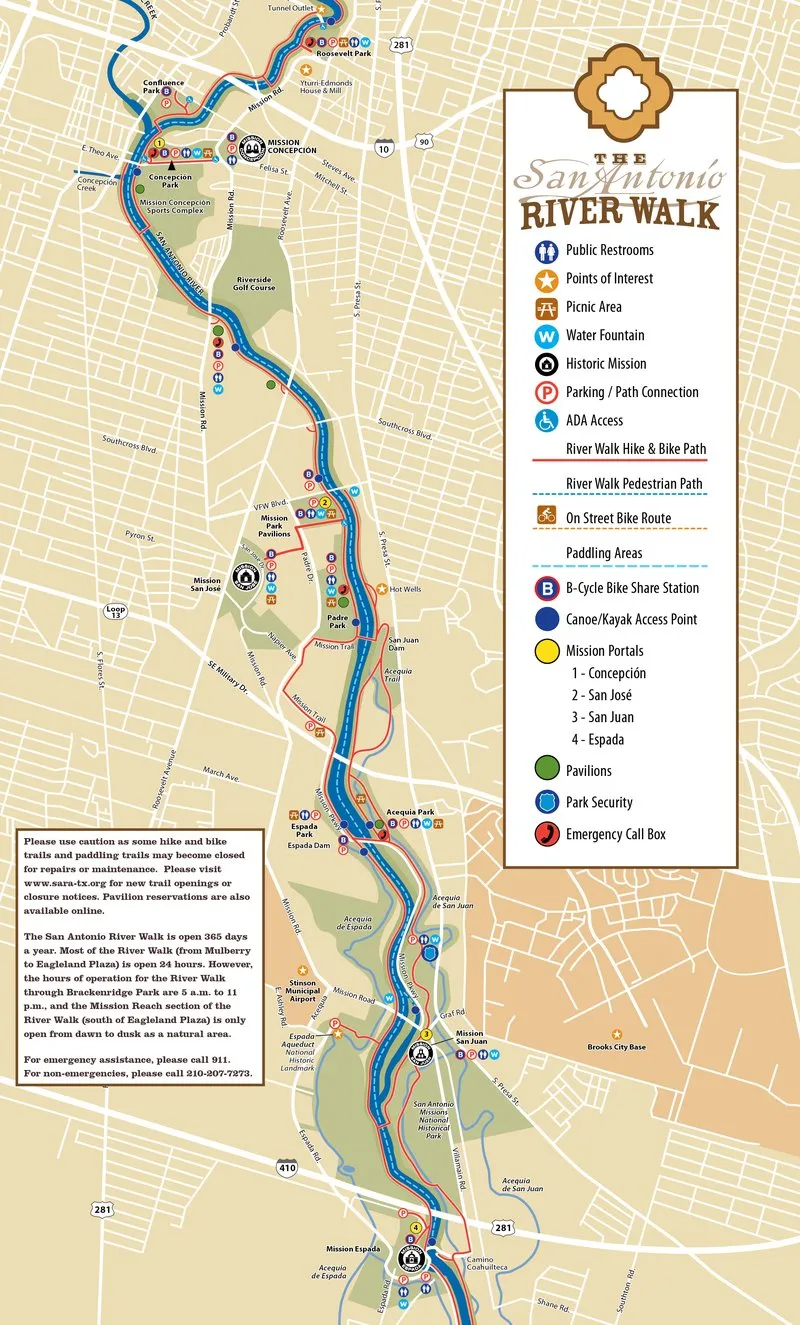
Paddle eight miles down the San Antonio River past historic missions, restored habitats, and dozens of canoe chutes.
Description
Starting just south of Downtown, the route runs downstream from Roosevelt Park to the Camino Coahuilteca takeout by Mission Espada. The water flows through more than 400 acres of restored riparian terrain, bordered by 15 miles of hike and bike trails, municipal parkland, and San Antonio Missions National Historical Park. Over 30 canoe chutes let vessels pass through riffles during low flow, while access points are marked by blue buoys at the water's edge, visible from both the river and the shore.
Good to know
Blue buoys mark access